Welcome to Visit Riverhead, Kent Places
The Walkfo guide to things to do & explore in Riverhead, Kent
 Visit Riverhead, Kent places using Walkfo for free guided tours of the best Riverhead, Kent places to visit. A unique way to experience Riverhead, Kent’s places, Walkfo allows you to explore Riverhead, Kent as you would a museum or art gallery with audio guides.
Visiting Riverhead, Kent Walkfo Preview
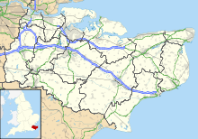
Riverhead is a northern village part of the urban area of Sevenoaks in the district of the same name in Kent. The parish stretches from Chipstead Lake and the River Darent in the north through the hamlet of Dibden and A21 to Mill Bank Wood in the south. When you visit Riverhead, Kent, Walkfo brings Riverhead, Kent places to life as you travel by foot, bike, bus or car with a mobile phone & headphones.
Riverhead, Kent Places Overview: History, Culture & Facts about Riverhead, Kent
Visit Riverhead, Kent – Walkfo’s stats for the places to visit
With 28 audio plaques & Riverhead, Kent places for you to explore in the Riverhead, Kent area, Walkfo is the world’s largest heritage & history digital plaque provider. The AI continually learns & refines facts about the best Riverhead, Kent places to visit from travel & tourism authorities (like Wikipedia), converting history into an interactive audio experience.
Riverhead, Kent history
Riverhead was an early settlement, part of the Codsheath Hundred. The settlement grew in size during Saxon times as traffic on the pilgrim routes between Canterbury and Winchester increased. The economy was based mainly on agriculture, along with some gravel and sand quarrying to the north east of the village that created the lakes around Bradbourne which are now a wildfowl reserve.
Why visit Riverhead, Kent with Walkfo Travel Guide App?
 You can visit Riverhead, Kent places with Walkfo Riverhead, Kent to hear history at Riverhead, Kent’s places whilst walking around using the free digital tour app. Walkfo Riverhead, Kent has 28 places to visit in our interactive Riverhead, Kent map, with amazing history, culture & travel facts you can explore the same way you would at a museum or art gallery with information audio headset. With Walkfo, you can travel by foot, bike or bus throughout Riverhead, Kent, being in the moment, without digital distraction or limits to a specific walking route. Our historic audio walks, National Trust interactive audio experiences, digital tour guides for English Heritage locations are available at Riverhead, Kent places, with a AI tour guide to help you get the best from a visit to Riverhead, Kent & the surrounding areas.
“Curated content for millions of locations across the UK, with 28 audio facts unique to Riverhead, Kent places in an interactive Riverhead, Kent map you can explore.”
Walkfo: Visit Riverhead, Kent Places Map
28 tourist, history, culture & geography spots
Riverhead, Kent historic spots | Riverhead, Kent tourist destinations | Riverhead, Kent plaques | Riverhead, Kent geographic features |
| Walkfo Riverhead, Kent tourism map key: places to see & visit like National Trust sites, Blue Plaques, English Heritage locations & top tourist destinations in Riverhead, Kent | |||
Best Riverhead, Kent places to visit
Riverhead, Kent has places to explore by foot, bike or bus. Below are a selection of the varied Riverhead, Kent’s destinations you can visit with additional content available at the Walkfo Riverhead, Kent’s information audio spots:

Dorton House
Dorton House, formerly known as Wildernesse, is a Grade II listed Georgian mansion house in Seal, Kent, near Sevenoaks . Until 2013 it was used as the headquarters for the Royal London Society for the Blind and as housing for blind and partially sighted children who attended its school .

Vine Cricket Ground
The Vine Cricket Ground is one of the oldest cricket venues in England . It was given to the town of Sevenoaks in Kent in 1773 by the 3rd Duke of Dorset . The land is thought to have possibly been used as a vineyard for the Archbishops of Canterbury .

Montreal Park
Montreal Park was formerly the home of Lord Amherst, Commander-in-Chief of the Forces. It was named after his conquest of Montreal in 1760.

Chatham Vase
The Chatham Vase is a stone sculpture by John Bacon commissioned as a memorial to William Pitt the Elder by his wife, Hester, Countess of Chatham. It was originally erected at their house in Burton Pynsent in 1781, then moved to Stowe House but sold in 1848, then purchased in 1857 by a member of the family and installed at Revesby Abbey.

Sevenoaks Town F.C.
Sevenoaks Town F.C. were established in 1883. They are currently members of the Isthmian League South East Division.

Sundridge, Kent
Sundridge is a village within the civil parish of Sundridge with Ide Hill in the Sevenoaks District of Kent. It lies within the Kent Downs Area of Outstanding Natural Beauty and within London’s Metropolitan Green Belt.
Polhill Anglo-Saxon cemetery
Polhill Anglo-Saxon cemetery is a place of burial that was used in the seventh and eighth centuries CE. It is located close to the hamlet of Polhill, near Sevenoaks in Kent, South-East England. An estimated 180 to 200 graves were placed there, containing between 200 and 220 individuals.
Visit Riverhead, Kent plaques
 1
1
plaques
here Riverhead, Kent has 1 physical plaques in tourist plaque schemes for you to explore via Walkfo Riverhead, Kent plaques audio map when visiting. Plaques like National Heritage’s “Blue Plaques” provide visual geo-markers to highlight points-of-interest at the places where they happened – and Walkfo’s AI has researched additional, deeper content when you visit Riverhead, Kent using the app. Experience the history of a location when Walkfo local tourist guide app triggers audio close to each Riverhead, Kent plaque. Explore Plaques & History has a complete list of Hartlepool’s plaques & Hartlepool history plaque map.


 Trying to encourage visitors to Riverhead, Kent?