Welcome to Visit Sheffield Places
The Walkfo guide to things to do & explore in Sheffield
 Visit Sheffield places using Walkfo for free guided tours of the best Sheffield places to visit. A unique way to experience Sheffield’s places, Walkfo allows you to explore Sheffield as you would a museum or art gallery with audio guides.
Visiting Sheffield Walkfo Preview
Sheffield is a historic part of Yorkshire, although some southern suburbs have been annexed from Derbyshire . It is situated east of Manchester, south of Leeds and north of Nottingham . Sixty-one per cent of Sheffield’s entire area is green space, and a third of the city lies within the Peak District national park . The city’s gross value added (GVA) has increased by 60% since 1997, standing at £11.3 billion in 2015 . When you visit Sheffield, Walkfo brings Sheffield places to life as you travel by foot, bike, bus or car with a mobile phone & headphones.
Sheffield Places Overview: History, Culture & Facts about Sheffield
Visit Sheffield – Walkfo’s stats for the places to visit
With 290 audio plaques & Sheffield places for you to explore in the Sheffield area, Walkfo is the world’s largest heritage & history digital plaque provider. The AI continually learns & refines facts about the best Sheffield places to visit from travel & tourism authorities (like Wikipedia), converting history into an interactive audio experience.
Sheffield history
Early history
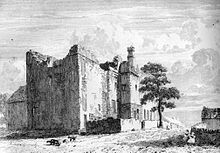
The earliest evidence of human occupation in the Sheffield area was found at Creswell Crags to the east of the city . In the Iron Age the area became the southernmost territory of the Pennine tribe called the Brigantes . The settlements that grew and merged to form Sheffield are of Anglo-Saxon and Danish origin .
Industrial Revolution

During the 1740s, a form of the crucible steel process was discovered that allowed the manufacture of a better quality of steel than had previously been possible . In about the same period, a technique was developed for fusing a thin sheet of silver onto a copper ingot to produce silver plating, which became widely known as Sheffield plate . The resulting poor conditions culminated in a cholera epidemic that killed 402 people in 1832 . The population of the town grew rapidly throughout the 19th century; increasing from 60,095 in 1801 to 451,195 by 1901 .
Blitz
Sheffield’s steel factories were set to work manufacturing weapons and ammunition for the war effort . As a result, the city became a target for bombing raids on the nights of 12 and 15 December 1940, now known as the Sheffield Blitz . More than 660 lives were lost and many buildings were destroyed or damaged .
Post-Second World War
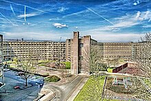
In the 1950s and 1960s, many of the city’s slums were demolished and replaced with housing schemes such as Park Hill flats . The 1980s saw the worst of this run-down of Sheffield’s industries, along with those of many other areas of the UK . Attempts to regenerate the city were kick-started when the city hosted the 1991 World Student Games .
21st century
Sheffield was particularly hard hit during the 2007 United Kingdom floods and the 2010 ‘Big Freeze’ Many landmark buildings such as Meadowhall and the Hillsborough Stadium flooded due to being close to rivers that flow through the city . In 2010, 5,000 properties in Sheffield were identified as still being at risk of flooding . In 2012 the city narrowly escaped another flood, despite extensive work by the Environment Agency to clear local river channels since the 2007 event .
Sheffield economy & business
Heavy industries and metallurgy
The earliest official record of cutlery production is from 1297 when a tax return for ‘Robert the Cutler’ was submitted . The abundance of streams in the area provided water power and the geological formations in the Hope Valley provided grit stones for grinding wheels . Forgemasters, founded in 1805, is the sole remaining independent steel works in the world and dominates the north-east of Sheffield around the Lower Don Valley .
Public sector

Sheffield has a large public sector workforce, numbering 77,500 workers . During the period 1995 – 2008, the number of jobs in the city increased by 22% and 50% were in the public sector . Major public sector employers include the National Health Service, The University of Sheffield, Sheffield Hallam University, and numerous government departments and agencies .
Tourism
Tourism industry in Sheffield was valued at £1.36 billion and supported 15,000 jobs in 2019 . In 2012, Sheffield City Region Enterprise Zone was launched to promote development in the city . In March 2014 additional sites were added to the zone .
Sheffield etymology
The name, Sheffield, has its origins in Old English and derives from the name of a principal river in the city, the River Sheaf. This name, in turn, is a corruption of shed or sheth, which refers to a divide or separation. It is believed that the name refers to an Anglo-Saxon settlement in a clearing.
Sheffield geography / climate

Blake Street, in the S6 postcode area, is the third steepest residential street in England, with a gradient of 16.6°. Sheffield is England’s highest city above sea level; the highest point is 548 metres (1,798 ft) The city lies in a natural amphitheatre created by several hills and the confluence of five rivers: Don, Sheaf, Rivelin, Loxley and Porter. It has more trees per person than any other city in Europe and is considered to be one of the greenest cities in England and the UK.
Climate
Under the Köppen classification, Sheffield has a oceanic climate type (Cfb) Like the rest of the United Kingdom, the climate in Sheffield is generally temperate . The Pennines to the west of the city can create a cool, gloomy and wet environment, but they also provide shelter from the prevailing westerly winds, casting a “rain shadow” across the area . Between 1971 and 2000 Sheffield averaged 824.7 millimetres (32.47 in) of rain per year . The highest temperature ever recorded in the city of Sheffield was 35.6 °C (96.1 °F)
Subdivisions
Sheffield is largely unparished, but Bradfield and Ecclesfield have parish councils, and Stocksbridge has a town council . It is divided into 28 electoral wards, with each ward generally covering 4–6 areas . These electoral wards are grouped into six parliamentary constituencies .
Why visit Sheffield with Walkfo Travel Guide App?
 You can visit Sheffield places with Walkfo Sheffield to hear history at Sheffield’s places whilst walking around using the free digital tour app. Walkfo Sheffield has 290 places to visit in our interactive Sheffield map, with amazing history, culture & travel facts you can explore the same way you would at a museum or art gallery with information audio headset. With Walkfo, you can travel by foot, bike or bus throughout Sheffield, being in the moment, without digital distraction or limits to a specific walking route. Our historic audio walks, National Trust interactive audio experiences, digital tour guides for English Heritage locations are available at Sheffield places, with a AI tour guide to help you get the best from a visit to Sheffield & the surrounding areas.
“Curated content for millions of locations across the UK, with 290 audio facts unique to Sheffield places in an interactive Sheffield map you can explore.”
Walkfo: Visit Sheffield Places Map
290 tourist, history, culture & geography spots
Sheffield historic spots | Sheffield tourist destinations | Sheffield plaques | Sheffield geographic features |
| Walkfo Sheffield tourism map key: places to see & visit like National Trust sites, Blue Plaques, English Heritage locations & top tourist destinations in Sheffield | |||
Best Sheffield places to visit
Sheffield has places to explore by foot, bike or bus. Below are a selection of the varied Sheffield’s destinations you can visit with additional content available at the Walkfo Sheffield’s information audio spots:
 | Canada House, Sheffield Canada House, formerly known as Panache House, is a Grade II listed building in Sheffield, South Yorkshire . It was built as the head offices of the Sheffield United Gas Light Company in 1874 . |
 | Castle Market Castle Market was built on top of the remains of Sheffield Castle . The market closed in 2013 when the Moor Market opened on The Moor, further south in Sheffield city centre, and demolition began in 2015 . |
 | Castle Square, Sheffield Castle Square is the plaza at the intersection of High Street, Angel Street, and Arundel Gate . The name was given to the square in the 1960s to reflect the proximity of the square to the site of Sheffield Castle . |
 | Leader House Leader House is a Georgian townhouse located on Surrey Street in Sheffield . It overlooks the busy Arundel Gate dual carriageway and is a Grade II listed building . |
 | Sheffield Winter Garden Sheffield Winter Garden is one of the largest temperate glasshouses in the UK . It is home to more than 2,000 plants from all around the world . It was officially opened by Queen Elizabeth II on 22 May 2003 . |
 | Millennium Square, Sheffield Millennium Square is a modern city square in Sheffield, England . It was created as part of the Heart of the City project that began in 1998 . It contains fountains in the shape of steel spheres, recalling Sheffield’s past as a centre of the steel industry . |
 | Leopold Square Leopold Square is a mixed-use development in Sheffield’s West End . The development comprises the refurbishment of the former Central Technical School buildings . The redevelopment of the old buildings began in 2004, following years of use as council offices . |
 | Sheaf House Sheaf House was a nine-storey tower building by Sheaf Square, next to Sheffield railway station, in the centre of Sheffield . The building was formerly the Sheffield area headquarters of British Rail . |
 | National Union of Mineworkers headquarters The National Union of Mineworkers headquarters is a building in Sheffield, England which formerly housed the head office of the NUM . The NUM was founded by the National Association of Miners (NUM) |
 | Sir Frederick Mappin Building The Sir Frederick Mappin Building is part of the University of Sheffield . The building and street (formerly Charlotte Street) are named after the so-called Father of Sheffield University . |
Visit Sheffield plaques
 71
71
plaques
here Sheffield has 71 physical plaques in tourist plaque schemes for you to explore via Walkfo Sheffield plaques audio map when visiting. Plaques like National Heritage’s “Blue Plaques” provide visual geo-markers to highlight points-of-interest at the places where they happened – and Walkfo’s AI has researched additional, deeper content when you visit Sheffield using the app. Experience the history of a location when Walkfo local tourist guide app triggers audio close to each Sheffield plaque. Explore Plaques & History has a complete list of Hartlepool’s plaques & Hartlepool history plaque map.


 Trying to encourage visitors to Sheffield?