Welcome to Visit Shropshire Places
The Walkfo guide to things to do & explore in Shropshire
 Visit Shropshire places using Walkfo for free guided tours of the best Shropshire places to visit. A unique way to experience Shropshire’s places, Walkfo allows you to explore Shropshire as you would a museum or art gallery with audio guides.
Visiting Shropshire Walkfo Preview
Shropshire is a landlocked historic county in the West Midlands region of England . It is bordered by Wales, Cheshire, Staffordshire, Worcestershire and Herefordshire . The county’s population and economy is centred on five towns: Shrewsbury, Telford, Oswestry, Bridgnorth, Ludlow and Ludlow . The Wrekin is one of the most famous natural landmarks in the county, though the highest hills are the Clee Hills, Stiperstones and the Long Mynd . When you visit Shropshire, Walkfo brings Shropshire places to life as you travel by foot, bike, bus or car with a mobile phone & headphones.
Shropshire Places Overview: History, Culture & Facts about Shropshire
Visit Shropshire – Walkfo’s stats for the places to visit
With 18 audio plaques & Shropshire places for you to explore in the Shropshire area, Walkfo is the world’s largest heritage & history digital plaque provider. The AI continually learns & refines facts about the best Shropshire places to visit from travel & tourism authorities (like Wikipedia), converting history into an interactive audio experience.
Shropshire history

The area was once part of the lands of the Cornovii, which consisted of the modern day counties of Cheshire, Shropshire, north Staffordshire, north Herefordshire and eastern parts of Powys. It was annexed to the Angle kingdom of Mercia by King Offa in the 8th century. The area suffered repeated Viking incursions, and fortresses were built at Bridgnorth (912) and Chirbury (913) after the Norman conquest in 1066.
Etymology

Shropshire is first recorded in the Anglo-Saxon Chronicle annal for 1006 . The origin of the name is the Old English Scrobbesbyrigscīr, meaning “Shrewsburyshire” It is also used as an alternative name for the county town, Shrewsbury .
County extent
The present day ceremonial county boundary is almost the same as the historic one . The border with Wales was defined in the 16th century – the hundreds of Oswestry and Pimhill (including Wem) and part of Chirbury formed various Lordships in the Welsh Marches .
Shropshire economy & business
Statistics
Regional gross value added for non-metropolitan county (that is, excluding Telford & Wrekin) of Shropshire at current basic prices, with figures in millions of British pounds sterling . With the statistics for the borough of Telford and Wrekins included, the following represents the ceremonial county .
Shropshire geography / climate
Geographically, Shropshire is divisible into two distinct halves – north and south. The county has a highly diverse geology. The West Midlands Green Belt covers an area north from Highley to the east of Bridgnorth.
North Shropshire

The North Shropshire Plain is an extension of the flat and fertile Cheshire Plain . It is here that most of the county’s large towns, and population, are to be found . The River Severn runs through the lower half of this area (from Wales in the west, eastwards), through Shrewsbury and down the Ironbridge Gorge, before heading south to Bridgnorth . The A5 and M54 run from Wolverhampton across to Telford, around Shrew’sbury parallel to the line of Watling Street, an ancient trackway .
South Shropshire

South Shropshire is more rural, with fewer settlements and no large towns . The only substantial towns are Bridgnorth, with a population of around 12,000 people, Ludlow and Church Stretton . The A49 is the main road through the area, running north to south from Shrewsbury to Herefordshire . The Brown Clee Hill, the county’s highest peak at 540 m (1,770 ft) is the highest peak in England .
Natural regions

Natural England recognised the following national character areas that lie wholly or partially within Shropshire . Natural England recognises the following areas that are entirely or partially in the county that lie within the county . The areas include Shropphire Hills, Shripshire Hills and Staffordshire .
Climate
The climate of Shropshire is moderate . Rainfall averages 760 to 1,000 mm (30 to 40 in) influenced by being in the rainshadow of the Cambrian Mountains . The hilly areas in the south and west are much colder in the winter .
Geology

Shropshire has a huge range of different types of rocks stretching from the Precambrian to the Holocene . In the northern part of the county there are examples of Jurassic, Carboniferous, Permian and Triassic rocks . And in the south it is predominantly Silurian and Quaternary .
Statistical
For Eurostat purposes, the county (less the unitary district of Telford and Wrekin) is a NUTS 3 region (code UKG22) The two Shropshire unitary areas (covering all of the ceremonial county), together with the authorities covering the ceremonial . of Staffordshire, together with . the authorities . covering the . ceremonial county of Stafford .
Why visit Shropshire with Walkfo Travel Guide App?
 You can visit Shropshire places with Walkfo Shropshire to hear history at Shropshire’s places whilst walking around using the free digital tour app. Walkfo Shropshire has 18 places to visit in our interactive Shropshire map, with amazing history, culture & travel facts you can explore the same way you would at a museum or art gallery with information audio headset. With Walkfo, you can travel by foot, bike or bus throughout Shropshire, being in the moment, without digital distraction or limits to a specific walking route. Our historic audio walks, National Trust interactive audio experiences, digital tour guides for English Heritage locations are available at Shropshire places, with a AI tour guide to help you get the best from a visit to Shropshire & the surrounding areas.
“Curated content for millions of locations across the UK, with 18 audio facts unique to Shropshire places in an interactive Shropshire map you can explore.”
Walkfo: Visit Shropshire Places Map
18 tourist, history, culture & geography spots
Shropshire historic spots | Shropshire tourist destinations | Shropshire plaques | Shropshire geographic features |
| Walkfo Shropshire tourism map key: places to see & visit like National Trust sites, Blue Plaques, English Heritage locations & top tourist destinations in Shropshire | |||
Best Shropshire places to visit
Shropshire has places to explore by foot, bike or bus. Below are a selection of the varied Shropshire’s destinations you can visit with additional content available at the Walkfo Shropshire’s information audio spots:
 | St Mary’s Church, Acton Burnell St Mary’s Church is in the village of Acton Burnell, Shropshire, England. It is an active Anglican parish church in the deanery of Condover, the archdeaconry of Ludlow and the diocese of Hereford. The church is recorded in the National Heritage List for England as a designated Grade I listed building. |
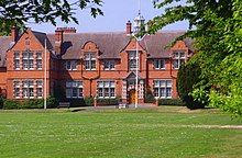
 | Pitchford Hall Pitchford Hall is a large Grade I listed Tudor country house in the village of Pitchford, Shropshire, 6 miles south east of Shrewsbury. It was built c.1560 on the site of a medieval building and has been modified several times since. It is a timber framed two-storey building with rendered red sandstone panels, a stone roof and brick chimneys. |
Visit Shropshire plaques
 0
0
plaques
here Shropshire has 0 physical plaques in tourist plaque schemes for you to explore via Walkfo Shropshire plaques audio map when visiting. Plaques like National Heritage’s “Blue Plaques” provide visual geo-markers to highlight points-of-interest at the places where they happened – and Walkfo’s AI has researched additional, deeper content when you visit Shropshire using the app. Experience the history of a location when Walkfo local tourist guide app triggers audio close to each Shropshire plaque. Currently No Physical Plaques.


 Trying to encourage visitors to Shropshire?