Welcome to Visit Northamptonshire Places
The Walkfo guide to things to do & explore in Northamptonshire
 Visit Northamptonshire places using Walkfo for free guided tours of the best Northamptonshire places to visit. A unique way to experience Northamptonshire’s places, Walkfo allows you to explore Northamptonshire as you would a museum or art gallery with audio guides.
Visiting Northamptonshire Walkfo Preview
Northamptonshire is a historic county in the East Midlands of England . In 2015, it had a population of 723,000 . Covering an area of 2,364 square kilometres (913 sq mi) It is landlocked between eight other counties: Warwickshire to the west, Leicestershire and Rutland to the north . The Soke of Peterborough falls within the historic boundaries of the county, but its area has been part of Cambridgeshire since 1974 . When you visit Northamptonshire, Walkfo brings Northamptonshire places to life as you travel by foot, bike, bus or car with a mobile phone & headphones.
Northamptonshire Places Overview: History, Culture & Facts about Northamptonshire
Visit Northamptonshire – Walkfo’s stats for the places to visit
With 23 audio plaques & Northamptonshire places for you to explore in the Northamptonshire area, Walkfo is the world’s largest heritage & history digital plaque provider. The AI continually learns & refines facts about the best Northamptonshire places to visit from travel & tourism authorities (like Wikipedia), converting history into an interactive audio experience.
Northamptonshire history
Much of Northamptonshire’s countryside appears to have remained somewhat intractable with regards to early human occupation, resulting in an apparently sparse population and relatively few finds from the Palaeolithic, Mesolithic and Neolithic periods. In about 500 BC the Iron Age was introduced into the area by a continental people in the form of the Hallstatt culture, and over the next century a series of hill-forts were constructed at Arbury Camp, Rainsborough camp, Borough Hill, Castle Dykes, Guilsborough, Irthlingborough, and most notably of all, Hunsbury Hill. There are two more possible hill-forts at Arbury Hill (Badby) and Thenford. In the 1st century BC, most of what later became Northamptonshire became part of the territory of the Catuvellauni, a Belgic tribe, the Northamptonshire area forming their most northerly possession. The Catuvellauni were in turn conquered by the Romans in 43 AD. The Roman road of Watling Street passed through the county, and an important Roman settlement, Lactodurum, stood on the site of modern-day Towcester. There were other Roman settlements at Northampton, Kettering and along the Nene Valley near Raunds. A large fort was built at Longthorpe. After the Romans left, the area eventually became part of the Anglo-Saxon kingdom of Mercia, and Northampton functioned as an administrative centre. The Mercians converted to Christianity in 654 AD with the death of the pagan king Penda. From about 889 the area was conquered by the Danes (as at one point almost all of England was, except for Athelney marsh in Somerset) and became part of the Danelaw – with Watling Street serving as the boundary – until being recaptured by the English under the Wessex king Edward the Elder, son of Alfred the Great, in 917. Northamptonshire was conquered again in 940, this time by the Vikings of York, who devastated the area, only for the county to be retaken by the English in 942. Consequently, it is one of the few counties in England to have both Saxon and Danish town-names and settlements. The county was first recorded in the Anglo-Saxon Chronicle (1011), as Hamtunscire: the scire (shire) of Hamtun (the homestead). The “North” was added to distinguish Northampton from the other important Hamtun further south: Southampton – though the origins of the two names are in fact different. Rockingham Castle was built for William the Conqueror and was used as a Royal fortress until Elizabethan times. In 1460, during the Wars of the Roses, the Battle of Northampton took place and King Henry VI was captured. The now-ruined Fotheringhay Castle was used to imprison Mary, Queen of Scots, before her execution. George Washington, the first President of the United States of America, was born into the Washington family who had migrated to America from Northamptonshire in 1656. George Washington’s ancestor, Lawrence Washington, was Mayor of Northampton on several occasions and it was he who bought Sulgrave Manor from Henry VIII in 1539. It was George Washington’s great-grandfather, John Washington, who emigrated in 1656 from Northants to Virginia. Before Washington’s ancestors moved to Sulgrave, they lived in Warton, Lancashire. During the English Civil War, Northamptonshire strongly supported the Parliamentarian cause, and the Royalist forces suffered a crushing defeat at the Battle of Naseby in 1645 in the north of the county. King Charles I was imprisoned at Holdenby House in 1647. In 1823 Northamptonshire was said to “[enjoy] a very pure and wholesome air” because of its dryness and distance from the sea. Its livestock were celebrated: “Horned cattle, and other animals, are fed to extraordinary sizes: and many horses of the large black breed are reared.” Nine years later, the county was described as “a county enjoying the reputation of being one of the healthiest and pleasantest parts of England” although the towns were “of small importance” with the exceptions of Peterborough and Northampton. In summer, the county hosted “a great number of wealthy families… country seats and villas are to be seen at every step.” Northamptonshire is still referred to as the county of “spires and squires” because of the numbers of stately homes and ancient churches. In the 18th and 19th centuries, parts of Northamptonshire and the surrounding area became industrialised. The local specialisation was shoemaking and the leather industry and became one of Britain’s major centres for these crafts by the 19th century. In the north of the county a large ironstone quarrying industry developed from 1850. Prior to 1901 the ancient hundreds were disused. Northamptonshire was administered as four major divisions: Northern, Eastern, Mid, and Southern. During the 1930s, the town of Corby was established as a major centre of the steel industry. Much of Northamptonshire nevertheless remains rural. Corby was designated a new town in 1950 and Northampton followed in 1968. As of 2005 the government is encouraging development in the South Midlands area, including Northamptonshire.
Peterborough
The Soke of Peterborough was historically associated with and considered part of Northamptonshire . However, Peterborough had its own courts of quarter sessions and, later, county council . In 1965 the administration was merged with that of neighbouring Huntingdonshire. Under the Local Government Act 1972 the city became a district of Cambridgeshire .
Northamptonshire culture & places

Jane Austen set her 1814 novel Mansfield Park mostly in Northamptonshire. Rock and pop bands originating in the area have included Bauhaus, Temples, The Departure, New Cassettes, Raging Speedhorn and Defenestration.
Northamptonshire economy & business
Milton Keynes and South Midlands Growth area
Northamptonshire forms part of the Milton Keynes and South Midlands Growth area . Area has been identified as an area which is due to have tens of thousands additional homes built between 2010 and 2020 .
Northamptonshire geography / climate
Northamptonshire is a landlocked county located in the southern part of the East Midlands region. The county contains the watershed between the River Severn and The Wash. The highest point in the county is Arbury Hill at 225 metres (738 ft) There are 16 settlements in Northampton with a town charter.
Climate
Northamptonshire has an oceanic climate (Köppen climate classification) The table below shows the average weather from the Moulton weather station .
Why visit Northamptonshire with Walkfo Travel Guide App?
 You can visit Northamptonshire places with Walkfo Northamptonshire to hear history at Northamptonshire’s places whilst walking around using the free digital tour app. Walkfo Northamptonshire has 23 places to visit in our interactive Northamptonshire map, with amazing history, culture & travel facts you can explore the same way you would at a museum or art gallery with information audio headset. With Walkfo, you can travel by foot, bike or bus throughout Northamptonshire, being in the moment, without digital distraction or limits to a specific walking route. Our historic audio walks, National Trust interactive audio experiences, digital tour guides for English Heritage locations are available at Northamptonshire places, with a AI tour guide to help you get the best from a visit to Northamptonshire & the surrounding areas.
“Curated content for millions of locations across the UK, with 23 audio facts unique to Northamptonshire places in an interactive Northamptonshire map you can explore.”
Walkfo: Visit Northamptonshire Places Map
23 tourist, history, culture & geography spots
Northamptonshire historic spots | Northamptonshire tourist destinations | Northamptonshire plaques | Northamptonshire geographic features |
| Walkfo Northamptonshire tourism map key: places to see & visit like National Trust sites, Blue Plaques, English Heritage locations & top tourist destinations in Northamptonshire | |||
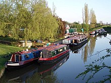
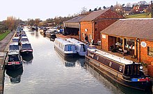
Best Northamptonshire places to visit
Northamptonshire has places to explore by foot, bike or bus. Below are a selection of the varied Northamptonshire’s destinations you can visit with additional content available at the Walkfo Northamptonshire’s information audio spots:
 | List of local nature reserves in Northamptonshire Northamptonshire is a county in the East Midlands of England . It has an area of 236,700 hectares (914 sq mi) and a population estimated in mid-2015 at 723,000 . It is bordered by Warwickshire, Leicestershire, Rutland, Lincolnshire, Cambridgeshire, Bedfordshire and Oxfordshire . |
 | Sywell Country Park Sywell Country Park exists on the site of a former drinking water reservoir. The reservoir was built at the turn of the 20th century to supply water to the Higham Ferrers and Rushden areas. It operated between 1906 and 1979 and is now a country park run by Northamptonshire County Council. |
Visit Northamptonshire plaques
 0
0
plaques
here Northamptonshire has 0 physical plaques in tourist plaque schemes for you to explore via Walkfo Northamptonshire plaques audio map when visiting. Plaques like National Heritage’s “Blue Plaques” provide visual geo-markers to highlight points-of-interest at the places where they happened – and Walkfo’s AI has researched additional, deeper content when you visit Northamptonshire using the app. Experience the history of a location when Walkfo local tourist guide app triggers audio close to each Northamptonshire plaque. Currently No Physical Plaques.


 Trying to encourage visitors to Northamptonshire?