Welcome to Visit Derry Places
The Walkfo guide to things to do & explore in Derry
 Visit Derry places using Walkfo for free guided tours of the best Derry places to visit. A unique way to experience Derry’s places, Walkfo allows you to explore Derry as you would a museum or art gallery with audio guides.
Visiting Derry Walkfo Preview
The name Derry is an anglicisation of the Old Irish name Daire meaning “oak grove” In 1613, the city was granted a royal charter by King James I and gained the “London” prefix to reflect the funding of its construction by the London guilds. The population of Derry, Northern Ireland, was 83,652 at the 2001 Census, while the Derry Urban Area had a population of 90,736. When you visit Derry, Walkfo brings Derry places to life as you travel by foot, bike, bus or car with a mobile phone & headphones.
Derry Places Overview: History, Culture & Facts about Derry
Visit Derry – Walkfo’s stats for the places to visit
With 58 audio plaques & Derry places for you to explore in the Derry area, Walkfo is the world’s largest heritage & history digital plaque provider. The AI continually learns & refines facts about the best Derry places to visit from travel & tourism authorities (like Wikipedia), converting history into an interactive audio experience.
Derry history
Early history
Derry is one of the oldest continuously inhabited places in Ireland. The earliest historical references date to the 6th century when a monastery was founded there by St Columba or Colmcille, a famous saint from what is now County Donegal. The town became strategically more significant during the Tudor conquest of Ireland and came under frequent attack.
Plantation
What became the City of Derry was part of the relatively new County Donegal up until 1610. The west bank of the future city was transferred by the English Crown to The Honourable The Irish Society. The aim was to settle Ulster with a population supportive of the Crown. The city was the first planned city in Ireland: it was begun in 1613, with the walls being completed in 1619.
17th-century upheavals
During the 1640s, the city suffered in the Wars of the Three Kingdoms, which began with the Irish Rebellion of 1641. In 1649 the city and its garrison, which supported the republican Parliament in London, were besieged by Scottish Presbyterian forces loyal to King Charles I. During the Glorious Revolution, only Derry and nearby Enniskillen had a Protestant garrison.
18th and 19th centuries

The city was rebuilt in the 18th century with many of its fine Georgian style houses still surviving. The city’s first bridge across the River Foyle was built in 1790. The port became an important embarkation point for Irish emigrants setting out for North America.
Early 20th century
During World War I the city contributed over 5,000 men to the British Army from Catholic and Protestant families. During the Irish War of Independence, the area was rocked by sectarian violence. In 1921, following the Anglo-Irish Treaty and the Partition of Ireland, it unexpectedly became a ‘border city’, separated from much of its traditional economic hinterland in County Donegal. In World War II, the city played an important part in the Battle of the Atlantic.
Late 20th century
Catholics were discriminated against under Unionist government in Northern Ireland, both politically and economically. The city languished after the second world war, with unemployment and development stagnating. A large campaign, led by the University for Derry Committee, to have Northern Ireland’s second university located in the city, ended in failure.
The Troubles

The conflict which became known as the Troubles is widely regarded as having started in Derry. In the early 1970s the city was heavily militarised and there was widespread civil unrest. Several districts in the city constructed barricades to control access and prevent the state from entering. Violence eased towards the end of the Trouble in the late 1980s and early 1990s.
Derry culture & places

Artists and writers associated with the city and surrounding countryside include the Nobel Prize-winning poet Seamus Heaney. The large political gable-wall murals of Bogside Artists, Free Derry Corner, the Foyle Film Festival and the Derry Walls are popular tourist attractions.
Media
The Derry Journal was founded in 1772 and is Ireland’s second oldest newspaper. The Londonderry Sentinel was formed in 1829 when new owners of the Journal embraced Catholic Emancipation. The largest radio stations based in the city are BBC Radio Foyle and Q102.9.
Night-life
The city’s night-life is mainly focused on the weekends. Several bars and clubs provide “student nights” during the weekdays. Waterloo Street and Strand Road provide the main venues.
Events
Derry became the first city to be designated UK City of Culture in July 2010. The “Banks of the Foyle Hallowe’en Carnival” in Derry are a huge tourism boost for the city. The Siege of Derry is commemorated annually by the fraternal organisation the Apprentice Boys in the Maiden City Festival.
Derry economy & business
History
The economy of the district was based significantly on the textile industry until relatively recently. The history of shirt making in the city dates to 1831, said to have been started by William Scott and his family who first exported shirts to Glasgow. The industry reached its peak in the 1920s employing around 18,000 people.
Inward investment

In the last 15 years there has been a drive to increase inward investment in the city. Economic successes have included call centres and a large investment by Seagate. Raytheon Systems Limited, a software division of the American defence contractor, was set up in Derry in 1999. Critics have noted that the grants offered by the Northern Ireland Industrial Development Board have helped land jobs for the area that only last as long as the funding lasts.
Shopping
The Foyleside Shopping Centre has 45 stores and 1,430 parking spaces. The Richmond Centre has 39 retail units and is the second largest retail park in Northern Ireland. Plans have also been approved for Derry’s first Asda store, which will be located at the retail park sharing a unit with Homebase.
Derry landmarks

Derry is renowned for its architecture, with a collection of late Georgian, Victorian and Edwardian buildings centred on the Diamond. Historic buildings within the city walls include St Augustine’s Church, which sits close to the site of the original monastic settlement. The Townscape Heritage Initiative has funded restoration works to key listed buildings and other older structures.
Derry geography / climate

Derry is characterised by its distinctively hilly topography. The original walled city of Londonderry lies on a hill on the west bank of the River Foyle. The western branch of the river dried up and became a low-lying and boggy district that is now called the Bogside.
Climate
Derry has, like most of Ireland, a temperate maritime climate according to the Köppen climate classification system. The nearest official Met Office Weather Station for which climate data is available is Carmoney, just west of City of Derry Airport and about 5 miles (8 km) north east of the city centre.
Why visit Derry with Walkfo Travel Guide App?
 You can visit Derry places with Walkfo Derry to hear history at Derry’s places whilst walking around using the free digital tour app. Walkfo Derry has 58 places to visit in our interactive Derry map, with amazing history, culture & travel facts you can explore the same way you would at a museum or art gallery with information audio headset. With Walkfo, you can travel by foot, bike or bus throughout Derry, being in the moment, without digital distraction or limits to a specific walking route. Our historic audio walks, National Trust interactive audio experiences, digital tour guides for English Heritage locations are available at Derry places, with a AI tour guide to help you get the best from a visit to Derry & the surrounding areas.
“Curated content for millions of locations across the UK, with 58 audio facts unique to Derry places in an interactive Derry map you can explore.”
Walkfo: Visit Derry Places Map
58 tourist, history, culture & geography spots
Derry historic spots | Derry tourist destinations | Derry plaques | Derry geographic features |
| Walkfo Derry tourism map key: places to see & visit like National Trust sites, Blue Plaques, English Heritage locations & top tourist destinations in Derry | |||
Best Derry places to visit
Derry has places to explore by foot, bike or bus. Below are a selection of the varied Derry’s destinations you can visit with additional content available at the Walkfo Derry’s information audio spots:

Londonderry railway station
Londonderry Railway Station is a railway terminus in the city of Derry in Northern Ireland. It serves the line to Belfast, with its service terminating at Belfast Great Victoria Street. It is operated by Northern Ireland Railways.
![]()
Children in Crossfire
Children in Crossfire aims to eradicate poverty and help children in war zones. Charity has raised funds totaling over £25 million for causes in 10 countries including Malawi, The Gambia, and Ethiopia.

Richmond Centre (Derry)
The Richmond Centre is a large shopping centre in Derry, Northern Ireland of 100,000 sq ft (9,300 m) The centre hosts over 40 retail units, including some major high street names. It was completed in 1984 within the city’s historic walls.
Creggan, Derry
Creggan (Irish: An Creagán; meaning stony place) is a large housing estate in Derry, Northern Ireland, on a hill on the outskirts of the city. The estate is very close to the border with County Donegal in the Republic of Ireland.
BBC Radio Foyle
BBC Radio Foyle (Irish: BBC Raidió Feabhail) is a BBC Northern Ireland local radio station. It broadcasts from 93.1 FM and 792 MW in Derry, County Londonderry. It is an opt-out from BBC Radio’s main Northern Ireland service, BBC Radio Ulster.
Derry Journal
The Derry Journal is a newspaper based in Derry, Northern Ireland, serving Derry as well as County Donegal in the Republic of Ireland. The paper is published on Tuesday and Friday and is a sister paper of the Sunday Journal, the only local newspaper published on a Sunday.
Lenamore
Lenamore is a townland in County Londonderry, Northern Ireland. It is at the foot of the mountain Benbradagh near Dungiven. It was once a village more populous than Drumsurn.
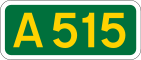
A515 road (Northern Ireland)
The A515 Skeoge Link is part of a larger project to link County Donegal with Belfast. The total construction cost was £5 million. It was designed to complete the route between Foyle Bridge and Donegal.

Boom Hall
A fort was constructed on the site during the English Civil War during the Williamite War in Ireland. A two-storey country house was later built by the Alexander family and named after this boom. During the Second World War, the demesne was used by the Admiralty. It fell into disuse in the 1960s and was almost destroyed by fire in the 1970s. Part of the estate was used for the construction of the Foyle Bridge.

Gransha Hospital
Gransha Hospital was a health facility in Clooney Road, Derry, Northern Ireland. The site is managed by Western Health and Social Care Trust.
Visit Derry plaques
 9
9
plaques
here Derry has 9 physical plaques in tourist plaque schemes for you to explore via Walkfo Derry plaques audio map when visiting. Plaques like National Heritage’s “Blue Plaques” provide visual geo-markers to highlight points-of-interest at the places where they happened – and Walkfo’s AI has researched additional, deeper content when you visit Derry using the app. Experience the history of a location when Walkfo local tourist guide app triggers audio close to each Derry plaque. Explore Plaques & History has a complete list of Hartlepool’s plaques & Hartlepool history plaque map.


 Trying to encourage visitors to Derry?