Welcome to Visit Surrey Places
The Walkfo guide to things to do & explore in Surrey
 Visit Surrey places using Walkfo for free guided tours of the best Surrey places to visit. A unique way to experience Surrey’s places, Walkfo allows you to explore Surrey as you would a museum or art gallery with audio guides.
Visiting Surrey Walkfo Preview
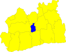
Surrey is the 12th-most populous English county, with 1.2 million people . It is the third most populous home county, after Kent and Essex . Surrey is a relatively affluent county with the highest proportion of woodland in England . Guildford is popularly regarded as the county town . When you visit Surrey, Walkfo brings Surrey places to life as you travel by foot, bike, bus or car with a mobile phone & headphones.
Surrey Places Overview: History, Culture & Facts about Surrey
Visit Surrey – Walkfo’s stats for the places to visit
With 25 audio plaques & Surrey places for you to explore in the Surrey area, Walkfo is the world’s largest heritage & history digital plaque provider. The AI continually learns & refines facts about the best Surrey places to visit from travel & tourism authorities (like Wikipedia), converting history into an interactive audio experience.
Surrey history
Ancient British and Roman periods

Before Roman times the area today known as Surrey was largely occupied by the Atrebates tribe . Eastern parts of the area may have been held by the Cantiaci, based largely in Kent . The only important settlement within the historic area of Surrey was the London suburb of Southwark .
Formation of Surrey
During the 5th and 6th centuries Surrey was conquered and settled by Saxons . The name Surrey is derived from Sūþrīge (or Suthrige), meaning “southern region” Surrey may have formed part of a larger Middle Saxon kingdom or confederacy, also including areas north of the Thames .
West Saxon and English shire

Surrey’s inland position shielded it from coastal raiding, so that it was not normally troubled except by the largest and most ambitious Scandinavian armies . In 851 an exceptionally large invasion force of Danes arrived at the mouth of the Thames in a fleet of about 350 ships, which would have carried over 15,000 men . Two years later the men of Surrey marched into Kent to help their Kentish neighbours fight a raiding force at Thanet, but suffered heavy losses including their ealdorman, Huda . Surrey remained safe from attack for over a century thereafter, due to its location and to the growing power of the West Saxon kingdom . Kingston was the scene for the coronations of Æthelstan in 924 .
Later Medieval Surrey
After the Battle of Hastings, the Norman army advanced through Kent into Surrey, where they defeated an English force which attacked them at Southwark and then burned that suburb. Rather than try to attack London across the river, the Normans continued west through Surrey, crossed the Thames at Wallingford in Berkshire and descended on London from the north-west. As was the case across England, the native ruling class of Surrey was virtually eliminated by Norman seizure of land. Only one significant English landowner, the brother of the last English Abbot of Chertsey, remained by the time the Domesday survey was conducted in 1086. At that time the largest landholding in Surrey, as in many other parts of the country, was the expanded royal estate, while the next largest holding belonged to Richard fitz Gilbert, founder of the de Clare family. In 1088, King William II granted William de Warenne the title of Earl of Surrey as a reward for Warenne’s loyalty during the rebellion that followed the death of William I. When the male line of the Warennes became extinct in the 14th century, the earldom was inherited by the Fitzalan Earls of Arundel. The Fitzalan line of Earls of Surrey died out in 1415, but after other short-lived revivals in the 15th century the title was conferred in 1483 on the Howard family, who still hold it. However, Surrey was not a major focus of any of these families’ interests. Guildford Castle, one of many fortresses originally established by the Normans to help them subdue the country, was rebuilt in stone and developed as a royal palace in the 12th century. Farnham Castle was built during the 12th century as a residence for the Bishop of Winchester, while other stone castles were constructed in the same period at Bletchingley by the de Clares and at Reigate by the Warennes. During King John’s struggle with the barons, Magna Carta was issued in June 1215 at Runnymede near Egham. John’s efforts to reverse this concession reignited the war, and in 1216 the barons invited Prince Louis of France to take the throne. Having landed in Kent and been welcomed in London, he advanced across Surrey to attack John, then at Winchester, occupying Reigate and Guildford castles along the way. Guildford Castle later became one of the favourite residences of King Henry III, who considerably expanded the palace there. During the baronial revolt against Henry, in 1264 the rebel army of Simon de Montfort passed southwards through Surrey on their way to the Battle of Lewes in Sussex. Although the rebels were victorious, soon after the battle royal forces captured and destroyed Bletchingley Castle, whose owner Gilbert de Clare, Earl of Hertford and Gloucester, was de Montfort’s most powerful ally. By the 14th century, castles were of dwindling military importance, but remained a mark of social prestige, leading to the construction of castles at Starborough near Lingfield by Lord Cobham, and at Betchworth by John Fitzalan, whose father had recently inherited the Earldom of Surrey. Though Reigate and Bletchingley remained modest settlements, the role of their castles as local centres for the two leading aristocratic interests in Surrey had enabled them to gain borough status by the early 13th century. As a result, they gained representation in Parliament when it became established towards the end of that century, alongside the more substantial urban settlements of Guildford and Southwark. Surrey’s third sizeable town, Kingston, despite its size, borough status and historical association with the monarchy, did not gain parliamentary representation until 1832. Surrey had little political or economic significance in the Middle Ages. Its agricultural wealth was limited by the infertility of most of its soils, and it was not the main power-base of any important aristocratic family, nor the seat of a bishopric. The London suburb of Southwark was a major urban settlement, and the proximity of the capital boosted the wealth and population of the surrounding area, but urban development elsewhere was sapped by the overshadowing predominance of London and by the lack of direct access to the sea. Population pressure in the 12th and 13th centuries initiated the gradual clearing of the Weald, the forest spanning the borders of Surrey, Sussex and Kent, which had hitherto been left undeveloped due to the difficulty of farming on its heavy clay soil. Surrey’s most significant source of prosperity in the later Middle Ages was the production of woollen cloth, which emerged during that period as England’s main export industry. The county was an early centre of English textile manufacturing, benefiting from the presence of deposits of fuller’s earth, the rare mineral composite important in the process of finishing cloth, around Reigate and Nutfield. The industry in Surrey was focused on Guildford, which gave its name to a variety of cloth, gilforte, which was exported widely across Europe and the Middle East and imitated by manufacturers elsewhere in Europe. However, as the English cloth industry expanded, Surrey was outstripped by other growing regions of production. Though Surrey was not the scene of serious fighting in the various rebellions and civil wars of the period, armies from Kent heading for London via Southwark passed through what were then the extreme north-eastern fringes of Surrey during the Peasants’ Revolt of 1381 and Cade’s Rebellion in 1450, and at various stages of the Wars of the Roses in 1460, 1469 and 1471. The upheaval of 1381 also involved widespread local unrest in Surrey, as was the case all across south-eastern England, and some recruits from Surrey joined the Kentish rebel army. In 1082 a Cluniac abbey was founded at Bermondsey by Alwine, a wealthy English citizen of London. Waverley Abbey near Farnham, founded in 1128, was the first Cistercian monastery in England. Over the next quarter-century monks spread out from here to found new houses, creating a network of twelve monasteries descended from Waverley across southern and central England. The 12th and early 13th centuries also saw the establishment of Augustinian priories at Merton, Newark, Tandridge, Southwark and Reigate. A Dominican friary was established at Guildford by Henry III’s widow Eleanor of Provence, in memory of her grandson who had died at Guildford in 1274. In the 15th century a Carthusian priory was founded by King Henry V at Sheen. These would all perish, along with the still important Benedictine abbey of Chertsey, in the 16th-century Dissolution of the Monasteries. Now fallen into disuse, some English counties had nicknames for those raised there such as a ‘tyke’ from Yorkshire, or a ‘yellowbelly’ from Lincolnshire. In the case of Surrey, the term was a ‘Surrey capon’, from Surrey’s role in the later Middle Ages as the county where chickens were fattened up for the London meat markets.
Early Modern Surrey

Under the early Tudor kings, magnificent royal palaces were constructed in northeastern Surrey, conveniently close to London. At Richmond an existing royal residence was rebuilt on a grand scale under King Henry VII, who also founded a Franciscan friary nearby in 1499. The still more spectacular palace of Nonsuch was later built for Henry VIII near Ewell. The palace at Guildford Castle had fallen out of use long before, but a royal hunting lodge existed outside the town. All these have since been demolished. During the Cornish Rebellion of 1497, the rebels heading for London briefly occupied Guildford and fought a skirmish with a government detachment on Guildown outside the town, before marching on to defeat at Blackheath in Kent. The forces of Wyatt’s Rebellion in 1554 passed through what was then northeastern Surrey on their way from Kent to London, briefly occupying Southwark and then crossing the Thames at Kingston after failing to storm London Bridge. Surrey’s cloth industry declined in the 16th century and collapsed in the 17th, harmed by falling standards and competition from more effective producers in other parts of England. The iron industry in the Weald, whose rich deposits had been exploited since prehistoric times, expanded and spread from its base in Sussex into Kent and Surrey after 1550. New furnace technology stimulated further growth in the early 17th century, but this hastened the extinction of the business as the mines were worked out. However, this period also saw the emergence of important new industries, centred on the valley of the Tillingbourne, south-east of Guildford, which often adapted watermills originally built for the now moribund cloth industry. The production of brass goods and wire in this area was relatively short-lived, falling victim to competitors in the Midlands in the mid-17th century, but the manufacture of paper and gunpowder proved more enduring. For a time in the mid-17th century the Surrey mills were the main producers of gunpowder in England. A glass industry also developed in the mid-16th century on the southwestern borders of Surrey, but had collapsed by 1630, as the wood-fired Surrey glassworks were surpassed by emerging coal-fired works elsewhere in England. The Wey Navigation, opened in 1653, was one of England’s first canal systems. George Abbot, the son of a Guildford clothworker, served as Archbishop of Canterbury in 1611–1633. In 1619 he founded Abbot’s Hospital, an almshouse in Guildford, which is still operating. He also made unsuccessful efforts to revitalise the local cloth industry. One of his brothers, Robert, became Bishop of Salisbury, while another, Maurice, was a founding shareholder of the East India Company who became the company’s Governor and later Lord Mayor of London. Southwark expanded rapidly in this period, and by 1600, if considered as a separate entity, it was the second-largest urban area in England, behind only London itself. Parts of it were outside the jurisdiction of the government of the City of London, and as a result the area of Bankside became London’s principal entertainment district, since the social control exercised there by the local authorities of Surrey was less effective and restrictive than that of the City authorities. Bankside was the scene of the golden age of Elizabethan and Jacobean theatre, with the work of playwrights including William Shakespeare, Christopher Marlowe, Ben Jonson and John Webster performed in its playhouses. The leading actor and impresario Edward Alleyn founded the College of God’s Gift in Dulwich with an endowment including an art collection, which was later expanded and opened to the public in 1817, becoming Britain’s first public art gallery. Surrey almost entirely escaped the direct impact of fighting during the main phase of the English Civil War in 1642–1646. The local Parliamentarian gentry led by Sir Richard Onslow were able to secure the county without difficulty on the outbreak of war. Farnham Castle was briefly occupied by the advancing Royalists in late 1642, but was easily stormed by the Parliamentarians under Sir William Waller. A new Royalist offensive in late 1643 saw skirmishing around Farnham between Waller’s forces and Ralph Hopton’s Royalists, but these brief incursions into the western fringes of Surrey marked the limits of Royalist advances on the county. At the end of 1643 Surrey combined with Kent, Sussex and Hampshire to form the South-Eastern Association, a military federation modelled on Parliament’s existing Eastern Association. In the uneasy peace that followed the Royalists’ defeat, a political crisis in summer 1647 saw Sir Thomas Fairfax’s New Model Army pass through Surrey on their way to occupy London, and subsequent billeting of troops in the county caused considerable discontent. During the brief Second Civil War of 1648, the Earl of Holland entered Surrey in July, hoping to ignite a Royalist revolt. He raised his standard at Kingston and advanced south, but found little support. After confused manoeuvres between Reigate and Dorking as Parliamentary troops closed in, his force of 500 men fled northwards and was overtaken and routed at Kingston. Surrey had a central role in the history of the radical political movements unleashed by the civil war. In October 1647 the first manifesto of the movement that became known as the Levellers, The Case of the Armie Truly Stated, was drafted at Guildford by the elected representatives of army regiments and civilian radicals from London. This document combined specific grievances with wider demands for constitutional change on the basis of popular sovereignty. It formed the template for the more systematic and radical Agreement of the People, drafted by the same men later that month. It also led to the Putney Debates shortly afterwards, in which its signatories met with Oliver Cromwell and other senior officers in the Surrey village of Putney, where the army had established its headquarters, to argue over the future political constitution of England. In 1649 the Diggers, led by Gerrard Winstanley, established their communal settlement at St. George’s Hill near Weybridge to implement egalitarian ideals of common ownership, but were eventually driven out by the local landowners through violence and litigation. A smaller Digger commune was then established near Cobham, but suffered the same fate in 1650.
Modern history
Prior to the Great Reform Act of 1832, Surrey returned fourteen Members of Parliament (MPs), two representing the county and two each from the six boroughs of Bletchingley, Gatton, Guildford, Haslemere, Reigate and Southwark. For two centuries before the Reform Act, the dominant political network in Surrey was that of the Onslows of Clandon Park, a gentry family established in the county from the early 17th century, who were raised to the peerage in 1716. Members of the family won at least one of Surrey’s two county seats in all but three of the 30 general elections between 1628 and 1768, while they took one or both of the seats for their local borough of Guildford in every election from 1660 to 1830, usually representing the Whig Party after its emergence in the late 1670s. Successive heads of the family held the post of Lord Lieutenant of Surrey continuously from 1716 to 1814. One of the principal residences of the British monarchy in the 18th century was Kew Palace in north Surrey, leased by Queen Caroline of Brandenburg-Ansbach in 1728 and inhabited by her son Frederick, Prince of Wales, and later by King George III and Queen Charlotte of Mecklenburg-Strelitz. After the latter’s death at the palace in 1818 it was sold. The White House was demolished about this time, but the Dutch House survives and is now a museum. Until the modern era Surrey, apart from its northeastern corner, was quite sparsely populated in comparison with many parts of southern England, and remained somewhat rustic despite its proximity to the capital. Communications began to improve, and the influence of London to increase, with the development of turnpike roads and a stagecoach system in the 18th century. A far more profound transformation followed with the arrival of the railways, beginning in the late 1830s. The availability of rapid transport enabled prosperous London workers to settle all across Surrey and travel daily to work in the capital. This phenomenon of commuting brought explosive growth to Surrey’s population and wealth, and tied its economy and society inextricably to London. There was rapid expansion in existing towns like Guildford, Farnham, and most spectacularly Croydon, while new towns such as Woking and Redhill emerged beside the railway lines. The huge numbers of incomers to the county and the transformation of rural, farming communities into a “commuter belt” contributed to a decline in the traditional local culture, including the gradual demise of the distinctive Surrey dialect. This may have survived among the “Surrey Men” into the late 19th Century, but is now extinct. Meanwhile, London itself spread swiftly across north-eastern Surrey. In 1800 it extended only to Vauxhall; a century later the city’s growth had reached as far as Putney and Streatham. This expansion was reflected in the creation of the County of London in 1889, detaching the areas subsumed by the city from Surrey. The expansion of London continued in the 20th century, engulfing Croydon, Kingston and many smaller settlements. This led to a further contraction of Surrey in 1965 with the creation of Greater London, under the London Government Act 1963; however, Staines and Sunbury-on-Thames, previously in Middlesex, were transferred to Surrey, extending the county across the Thames. Surrey’s boundaries were altered again in 1974 when Gatwick Airport was transferred to West Sussex. In 1849 Brookwood Cemetery was established near Woking to serve the population of London, connected to the capital by its own railway service. It soon developed into the largest burial ground in the world. Woking was also the site of Britain’s first crematorium, which opened in 1878, and its first mosque, founded in 1889. In 1881 Godalming became the first town in the world with a public electricity supply. The eastern part of Surrey was transferred from the Diocese of Winchester to that of Rochester in 1877. In 1905 this area was separated to form a new Diocese of Southwark. The rest of the county, together with part of eastern Hampshire, was separated from Winchester in 1927 to become the Diocese of Guildford, whose cathedral was consecrated in 1961. During the later 19th century Surrey became important in the development of architecture in Britain and the wider world. Its traditional building forms made a significant contribution to the vernacular revival architecture associated with the Arts and Crafts Movement, and would exert a lasting influence. The prominence of Surrey peaked in the 1890s, when it was the focus for globally important developments in domestic architecture, in particular the early work of Edwin Lutyens, who grew up in the county and was greatly influenced by its traditional styles and materials. The late 19th and early 20th centuries saw the demise of Surrey’s long-standing industries manufacturing paper and gunpowder. Most of the county’s paper mills closed in the years after 1870, and the last survivor shut in 1928. Gunpowder production fell victim to the First World War, which brought about a huge expansion of the British munitions industry, followed by sharp contraction and consolidation when the war ended, leading to the closure of the Surrey powder mills. New industrial developments included the establishment of the vehicle manufacturers Dennis Brothers in Guildford in 1895. Beginning as a maker of bicycles and then of cars, the firm soon shifted into the production of commercial and utility vehicles, becoming internationally important as a manufacturer of fire engines and buses. Though much reduced in size and despite multiple changes of ownership, this business continues to operate in Guildford. Kingston and nearby Ham became a centre of aircraft manufacturing, with the establishment in 1912 of the Sopwith Aviation Company and in 1920 of its successor H.G. Hawker Engineering, which later became Hawker Aviation and then Hawker Siddeley. During the Second World War a section of the GHQ Stop Line, a system of pillboxes, gun emplacements, anti-tank obstacles and other fortifications, was constructed along the North Downs. This line, running from Somerset to Yorkshire, was intended as the principal fixed defence of London and the industrial core of England against the threat of invasion. German invasion plans envisaged that the main thrust of their advance inland would cross the North Downs at the gap in the ridge formed by the Wey valley, thus colliding with the defence line around Guildford. Between the wars Croydon Airport, opened in 1920, served as the main airport for London, but it was superseded after the Second World War by Heathrow, and closed in 1959. Gatwick Airport, where commercial flights began in 1933, expanded greatly in the 1950s and 1960s, but the area occupied by the airport was transferred from Surrey to West Sussex in 1974. In June 1972, British European Airways Flight 548 crashed near Staines just after taking off from Heathrow Airport. This remains the worst air accident in the UK.
Surrey geography / climate

Surrey is divided in two by the chalk ridge of the North Downs, running east–west. The ridge is pierced by the rivers Wey and Mole, tributaries of the Thames, which formed the northern border of the county before modern redrawing of county boundaries. The highest elevation in Surrey is Leith Hill near Dorking, 295 m (968 ft) above sea level.
Surrey rivers
The longest river to enter Surrey is the Thames, which historically formed the boundary between the county and Middlesex . As a result of the 1965 boundary changes, many of the Surrey boroughs on the south bank of the river were transferred to Greater London . The River Wey is the longest tributary of the Thames above London .
Why visit Surrey with Walkfo Travel Guide App?
 You can visit Surrey places with Walkfo Surrey to hear history at Surrey’s places whilst walking around using the free digital tour app. Walkfo Surrey has 25 places to visit in our interactive Surrey map, with amazing history, culture & travel facts you can explore the same way you would at a museum or art gallery with information audio headset. With Walkfo, you can travel by foot, bike or bus throughout Surrey, being in the moment, without digital distraction or limits to a specific walking route. Our historic audio walks, National Trust interactive audio experiences, digital tour guides for English Heritage locations are available at Surrey places, with a AI tour guide to help you get the best from a visit to Surrey & the surrounding areas.
“Curated content for millions of locations across the UK, with 25 audio facts unique to Surrey places in an interactive Surrey map you can explore.”
Walkfo: Visit Surrey Places Map
25 tourist, history, culture & geography spots
Surrey historic spots | Surrey tourist destinations | Surrey plaques | Surrey geographic features |
| Walkfo Surrey tourism map key: places to see & visit like National Trust sites, Blue Plaques, English Heritage locations & top tourist destinations in Surrey | |||
Best Surrey places to visit
Surrey has places to explore by foot, bike or bus. Below are a selection of the varied Surrey’s destinations you can visit with additional content available at the Walkfo Surrey’s information audio spots:

Sheepleas
Sheepleas is a 99.9-hectare (247-acre) biological and geological Site of Special Scientific Interest. It is a Geological Conservation Review site and a Local Nature Reserve.

Upper Common Pits
Upper Common Pits is a 3-hectare (7.4-acre) geological Site of Special Scientific Interest in the north of Gomshall in Surrey. It is a Geological Conservation Review site.

Horsley Towers
The East Horsley estate was later sold to William King-Noel, 1st Earl of Lovelace. The house was designed by Charles Barry for the banker William Currie in the 19th century. The Towers was purchased by Thomas Sopwith, the aviator and businessman, in 1919.

Hatchlands Park
Hatchlands Park is a red-brick country house with surrounding gardens in East Clandon, Surrey, England, covering 170 hectares (430 acres) It is located near Guildford along the A246 between East and West Horsley. The gardens were Grade II listed in 2007.
Effingham Hundred
Effingham Hundred or the Hundred of Effingham was a hundred but often treated as a half-hundred with that of Copthorne (to the east and north-east) and was the smallest in Surrey.
Visit Surrey plaques
 1
1
plaques
here Surrey has 1 physical plaques in tourist plaque schemes for you to explore via Walkfo Surrey plaques audio map when visiting. Plaques like National Heritage’s “Blue Plaques” provide visual geo-markers to highlight points-of-interest at the places where they happened – and Walkfo’s AI has researched additional, deeper content when you visit Surrey using the app. Experience the history of a location when Walkfo local tourist guide app triggers audio close to each Surrey plaque. Explore Plaques & History has a complete list of Hartlepool’s plaques & Hartlepool history plaque map.


 Trying to encourage visitors to Surrey?