Welcome to Visit Derbyshire Places
The Walkfo guide to things to do & explore in Derbyshire
 Visit Derbyshire places using Walkfo for free guided tours of the best Derbyshire places to visit. A unique way to experience Derbyshire’s places, Walkfo allows you to explore Derbyshire as you would a museum or art gallery with audio guides.
Visiting Derbyshire Walkfo Preview
Derbyshire is a non-metropolitan county in the East Midlands of England . It includes much of the Peak District National Park and the southern edge of the Pennine range of hills . Kinder Scout, at 636 metres (2,087 ft), is the highest point in the county . The River Derwent is the longest river at 66 mi (106 km) running north–south . When you visit Derbyshire, Walkfo brings Derbyshire places to life as you travel by foot, bike, bus or car with a mobile phone & headphones.
Derbyshire Places Overview: History, Culture & Facts about Derbyshire
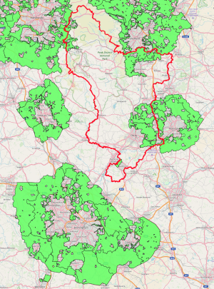
Visit Derbyshire – Walkfo’s stats for the places to visit
With 57 audio plaques & Derbyshire places for you to explore in the Derbyshire area, Walkfo is the world’s largest heritage & history digital plaque provider. The AI continually learns & refines facts about the best Derbyshire places to visit from travel & tourism authorities (like Wikipedia), converting history into an interactive audio experience.
Derbyshire history
The area that is now Derbyshire was first visited, probably briefly, by humans 200,000 years ago during the Aveley interglacial. Mesolithic hunter-gatherers roamed the hilly tundra. Further occupation came with the Upper Paleolithic and Neolithic periods of the Stone Age. Roman invaders were attracted to the county for its lead ore in the limestone hills of the area.
Derbyshire geography / climate

Most of Derbyshire consists of rolling hills and uplands, with the southern Pennines extending from the north of Derby throughout the Peak District and into the north. The main rivers in the county are the River Derwent and the River Dove which both join the River Trent in the south.
Landscape character

Derbyshire contains 11 discrete landscape types, known as National Character Areas . The county has been formed mainly as a consequence of the underlying geology, but also by the way the land has been managed and shaped by human activity . The 11 areas include Dark Peak White Peak, South West Peak and Lower Derwent .
Geology
Derbyshire’s solid geology can be split into two very different halves . The oldest rocks occur in the northern, more upland half of the county, and are mostly of Carboniferous age, comprising limestones, gritstones, sandstones and shales . The southern and more lowland half contains softer rocks, mainly mudstones and sandstones of Permo-Triassic age .
Green belts
There are four green belts within the county, aimed at preserving the landscape surrounding main urban areas . The first three are portions of larger green belts that extend outside the county and surround large conurbations .
Why visit Derbyshire with Walkfo Travel Guide App?
 You can visit Derbyshire places with Walkfo Derbyshire to hear history at Derbyshire’s places whilst walking around using the free digital tour app. Walkfo Derbyshire has 57 places to visit in our interactive Derbyshire map, with amazing history, culture & travel facts you can explore the same way you would at a museum or art gallery with information audio headset. With Walkfo, you can travel by foot, bike or bus throughout Derbyshire, being in the moment, without digital distraction or limits to a specific walking route. Our historic audio walks, National Trust interactive audio experiences, digital tour guides for English Heritage locations are available at Derbyshire places, with a AI tour guide to help you get the best from a visit to Derbyshire & the surrounding areas.
“Curated content for millions of locations across the UK, with 57 audio facts unique to Derbyshire places in an interactive Derbyshire map you can explore.”
Walkfo: Visit Derbyshire Places Map
57 tourist, history, culture & geography spots
Derbyshire historic spots | Derbyshire tourist destinations | Derbyshire plaques | Derbyshire geographic features |
| Walkfo Derbyshire tourism map key: places to see & visit like National Trust sites, Blue Plaques, English Heritage locations & top tourist destinations in Derbyshire | |||
Best Derbyshire places to visit
Derbyshire has places to explore by foot, bike or bus. Below are a selection of the varied Derbyshire’s destinations you can visit with additional content available at the Walkfo Derbyshire’s information audio spots:

St Helen’s Church, Darley Dale
St Helen’s Church, Darley Dale is a Grade II* listed parish church in Derbyshire . It was built in the 1930s and is now a Grade I listed parish .

Old Millclose Mine
Old Millclose Mine was a lead mine near Wensley, Derbyshire, England . The engine house of the mine survives as a ruin; it is a scheduled monument .

St Mary the Virgin’s Church, South Darley
St Mary the Virgin’s Church, South Darley is a Grade II listed parish church in Derbyshire. At the entrance to the churchyard is a memorial to the men from the parish who died in the two world wars.

Via Gellia
Via Gellia is a steep-sided wooded dry valley and road in Derbyshire. It is probably named after Philip Eyre Gell in a mock-Latin style; he was responsible for building the road through the valley. At its lower (eastern) end is the village of Cromford and its Georgian mill, built by inventor Richard Arkwright.

St John the Baptist’s Church, Winster
St John the Baptist’s Church, Winster is a Grade II listed parish church in Winster, Derbyshire. It was built in the 1930s and is now on the marketable site of Winster.

Cromford Mill
Cromford Mill is the world’s first water-powered cotton spinning mill, developed by Richard Arkwright in 1771. The mill structure is classified as a Grade I listed building. It is now the centrepiece of the Derwent Valley Mills UNESCO World Heritage Site.

Willersley Castle
Willersley Castle is a late 18th-century country mansion above the River Derwent at Cromford, Derbyshire. The Classical-style castellated house is three storeys with a seven-bay frontage, the central bay flanked by full-height round towers.

Masson Mill
Masson Mill is situated on the west bank of the River Derwent in Matlock Bath, Derbyshire. It forms part of the Derwent Valley Mills, a World Heritage Site. Nearby is Willersley Castle, the house Richard Arkwright built for himself.

Ivonbrook Grange
Ivonbrook Grange is wholly within the Peak District national park on its southern edge. It shares a border with the parishes of Aldwark, Bonsall, Brassington, Ible as well as Winster. There is one listed structure in the parish.
Visit Derbyshire plaques
 16
16
plaques
here Derbyshire has 16 physical plaques in tourist plaque schemes for you to explore via Walkfo Derbyshire plaques audio map when visiting. Plaques like National Heritage’s “Blue Plaques” provide visual geo-markers to highlight points-of-interest at the places where they happened – and Walkfo’s AI has researched additional, deeper content when you visit Derbyshire using the app. Experience the history of a location when Walkfo local tourist guide app triggers audio close to each Derbyshire plaque. Explore Plaques & History has a complete list of Hartlepool’s plaques & Hartlepool history plaque map.


 Trying to encourage visitors to Derbyshire?