Welcome to Visit West Ham Places
The Walkfo guide to things to do & explore in West Ham
 Visit West Ham places using Walkfo for free guided tours of the best West Ham places to visit. A unique way to experience West Ham’s places, Walkfo allows you to explore West Ham as you would a museum or art gallery with audio guides.
Visiting West Ham Walkfo Preview
West Ham is located 6.1 mi (9.8 km) east of Charing Cross in the west of the modern London Borough of Newham. The area was originally an ancient parish formed to serve parts of the older Manor of Ham. West Ham was an administrative unit, with largely consistent boundaries, from the 12th century to 1965. When you visit West Ham, Walkfo brings West Ham places to life as you travel by foot, bike, bus or car with a mobile phone & headphones.
West Ham Places Overview: History, Culture & Facts about West Ham
Visit West Ham – Walkfo’s stats for the places to visit
With 426 audio plaques & West Ham places for you to explore in the West Ham area, Walkfo is the world’s largest heritage & history digital plaque provider. The AI continually learns & refines facts about the best West Ham places to visit from travel & tourism authorities (like Wikipedia), converting history into an interactive audio experience.
West Ham history
Ham(me): Pre-partition origins & toponymy
The first known written use of the term ‘Hamme’ is in an Anglo-Saxon charter of 958 in which King Edgar granted the land to Ealdorman Athelstan. The place name derives from Old English ‘hamm’ and means ‘a dry area of land between rivers or marshland’
Urbanisation
West Ham underwent rapid growth from 1844 following the Metropolitan Building Act. The Act restricted dangerous and noxious industries from operating in the metropolitan area. Many of these activities were relocated to the other side of the river and to West Ham. West Ham became one of Victorian Britain’s major manufacturing centres for pharmaceuticals, chemicals, and processed foods.
First World War – West Ham Pals
The Mayor and Borough of West Ham raised the 13th (Service) Battalion (West Ham) of the Essex Regiment. The West Ham Pals were assigned to the 6th Infantry Brigade of the 2nd Infantry Division. The disbandment occurred as the British Army was so short of manpower that it could no longer maintain as many units.
Second World War
The Borough of West Ham was one of the areas of London worst affected by bombing during the Second World War. There were officially 1186 civilians killed, but this may have been around 500 higher due to the disputed death toll at South Hallsville School.
Post-war
In March 1976, an IRA terrorist planted a bomb on a Metropolitan Line train, but it exploded prematurely, at West Ham station, injuring seven. The perpetrator shot and injured a member of the public and fled. The train driver, Julius Stevens, gave chase but was shot and killed. The terrorist turned the gun on himself but survived.
West Ham geography / climate
The parish, and coterminous subsequent borough, lay east of the Lea and north of the Thames, with Leyton to the north and East Ham to the east. The area included the twin focuses of All Saints’ Parish Church and West Ham station. Since its urbanisation the area has always been one of the poorest in London.
Transport
West Ham station on Manor Road is served by Jubilee, Hammersmith and City and District tube lines. Plaistow and Stratford stations are also close by.
Why visit West Ham with Walkfo Travel Guide App?
 You can visit West Ham places with Walkfo West Ham to hear history at West Ham’s places whilst walking around using the free digital tour app. Walkfo West Ham has 426 places to visit in our interactive West Ham map, with amazing history, culture & travel facts you can explore the same way you would at a museum or art gallery with information audio headset. With Walkfo, you can travel by foot, bike or bus throughout West Ham, being in the moment, without digital distraction or limits to a specific walking route. Our historic audio walks, National Trust interactive audio experiences, digital tour guides for English Heritage locations are available at West Ham places, with a AI tour guide to help you get the best from a visit to West Ham & the surrounding areas.
“Curated content for millions of locations across the UK, with 426 audio facts unique to West Ham places in an interactive West Ham map you can explore.”
Walkfo: Visit West Ham Places Map
426 tourist, history, culture & geography spots
West Ham historic spots | West Ham tourist destinations | West Ham plaques | West Ham geographic features |
| Walkfo West Ham tourism map key: places to see & visit like National Trust sites, Blue Plaques, English Heritage locations & top tourist destinations in West Ham | |||
Best West Ham places to visit
West Ham has places to explore by foot, bike or bus. Below are a selection of the varied West Ham’s destinations you can visit with additional content available at the Walkfo West Ham’s information audio spots:
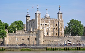 | Tower division The Tower Division was a liberty in the ancient county of Middlesex, England. It took its name from the military obligations owed to the Constable of the Tower of London. In contemporary terms, the Liberty covered inner East London, the area now administered by the eponymous modern London Borough of Tower Hamlets. |
 | Hackney Wick Hackney Wick lies 4.2 miles (6.8 km) northeast of Charing Cross. Adjacent areas of the London Borough of Tower Hamlets are sometimes also described as being part of Hackney. |
 | Bushwood, Leytonstone Bushwood is an area in the north of Leytonstone in East London. The area is popular for its proximity to Wanstead Flats and Wanstead Park. It has many tree-lined streets with Victorian and Edwardian houses. |
 | East Village, London East Village is a housing development in Stratford, East London that was designed and constructed as the Olympic Village of the 2012 Summer Olympics. The area was formerly contaminated waste land and industrial buildings to the north of Stratford town centre. |
| Upton Park, London Upton Park is an area of the East London borough of Newham, centred on Green Street which is the boundary between West Ham and East Ham. West Ham United Football Club formerly played at the Boleyn Ground, commonly known as Upton Park. |
 | St Francis of Assisi Church, Stratford St Francis of Assisi Church is a Roman Catholic parish church in Stratford, London. It was founded from a mission that started in 1770. The Franciscan Order of Friars Minor arrived in 1873 and built a friary next door to the church in 1876. |
Visit West Ham plaques
 64
64
plaques
here West Ham has 64 physical plaques in tourist plaque schemes for you to explore via Walkfo West Ham plaques audio map when visiting. Plaques like National Heritage’s “Blue Plaques” provide visual geo-markers to highlight points-of-interest at the places where they happened – and Walkfo’s AI has researched additional, deeper content when you visit West Ham using the app. Experience the history of a location when Walkfo local tourist guide app triggers audio close to each West Ham plaque. Explore Plaques & History has a complete list of Hartlepool’s plaques & Hartlepool history plaque map.


 Trying to encourage visitors to West Ham?