Welcome to Visit Warlingham Places
The Walkfo guide to things to do & explore in Warlingham
 Visit Warlingham places using Walkfo for free guided tours of the best Warlingham places to visit. A unique way to experience Warlingham’s places, Walkfo allows you to explore Warlingham as you would a museum or art gallery with audio guides.
Visiting Warlingham Walkfo Preview
When you visit Warlingham, Walkfo brings Warlingham places to life as you travel by foot, bike, bus or car with a mobile phone & headphones.
Warlingham Places Overview: History, Culture & Facts about Warlingham
Visit Warlingham – Walkfo’s stats for the places to visit
With 38 audio plaques & Warlingham places for you to explore in the Warlingham area, Walkfo is the world’s largest heritage & history digital plaque provider. The AI continually learns & refines facts about the best Warlingham places to visit from travel & tourism authorities (like Wikipedia), converting history into an interactive audio experience.
Warlingham history
Etymology
The name means the home(stead) (-ham) of the followers (-(l)ing) of Waer(l),a . The letters “ae” here are the implied earlier spelling of any Anglo-Saxon scribes to denote the sound /æ/.
Early history, Dark Ages and Middle Ages
Flint implements are not uncommon, and reputed eoliths have been found in the pebble beds near the village centre . In 1909 several cinerary urns of late Celtic date were found near the road towards Worms Heath . In several places are depressions which may have been pit houses .
Manors
Warlingham, Crewes/Carewes and Westhall owned virtually all of the land . Under manorialism, three manors owned virtually the land: Warledham, . Crewes, . Carewes, and . Westhall .
Post Industrial Revolution
In 1841 Warlingham had 512 inhabitants; a notable resident of the Victorian period was Sir Joseph Swan, inventor of the incandescent light bulb . Sir George Gilbert Scott led the project to renovate and restore All Saints’ Church in 1857 .
Warlingham geography / climate
Warlingham is situated on the scarp slope of the North Downs and parts of the village are 650 feet (200 metres) above sea level. On a clear day all the major skyscrapers (including Canary Wharf, the Gherkin and the NatWest tower) can be seen on the Limpsfield road.
Elevations
Elevations vary from 110m AOD at Woldingham Road, at the southernmost point of the parish, with a gentle increase in height through the village along the main road heading to the southeast, to the highest elevation (199.6m) at Limpsfield Road .
Why visit Warlingham with Walkfo Travel Guide App?
 You can visit Warlingham places with Walkfo Warlingham to hear history at Warlingham’s places whilst walking around using the free digital tour app. Walkfo Warlingham has 38 places to visit in our interactive Warlingham map, with amazing history, culture & travel facts you can explore the same way you would at a museum or art gallery with information audio headset. With Walkfo, you can travel by foot, bike or bus throughout Warlingham, being in the moment, without digital distraction or limits to a specific walking route. Our historic audio walks, National Trust interactive audio experiences, digital tour guides for English Heritage locations are available at Warlingham places, with a AI tour guide to help you get the best from a visit to Warlingham & the surrounding areas.
“Curated content for millions of locations across the UK, with 38 audio facts unique to Warlingham places in an interactive Warlingham map you can explore.”
Walkfo: Visit Warlingham Places Map
38 tourist, history, culture & geography spots
Warlingham historic spots | Warlingham tourist destinations | Warlingham plaques | Warlingham geographic features |
| Walkfo Warlingham tourism map key: places to see & visit like National Trust sites, Blue Plaques, English Heritage locations & top tourist destinations in Warlingham | |||
Best Warlingham places to visit
Warlingham has places to explore by foot, bike or bus. Below are a selection of the varied Warlingham’s destinations you can visit with additional content available at the Walkfo Warlingham’s information audio spots:
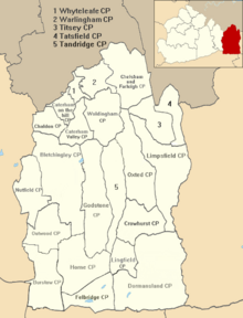
 | Caterham and Warlingham Urban District Caterham and Warlingham was an Urban District of Surrey in England until 1974 . It was the first Urban District to be named after Caterham in Surrey . |
 | Sanderstead Court Sanderstead Court was a country house dating from the 17th century . It was destroyed by fire in 1944, and its ruins are Grade II listed . |
 | Riddlesdown Common Riddlesdown Common is a 43 hectare area of green space in Kenley, towards the northern end of the North Downs . It is owned and maintained by the City of London Corporation, apart from two small areas . An area of 32 hectares is a biological Site of Special Scientific Interest . |
Visit Warlingham plaques
 6
6
plaques
here Warlingham has 6 physical plaques in tourist plaque schemes for you to explore via Walkfo Warlingham plaques audio map when visiting. Plaques like National Heritage’s “Blue Plaques” provide visual geo-markers to highlight points-of-interest at the places where they happened – and Walkfo’s AI has researched additional, deeper content when you visit Warlingham using the app. Experience the history of a location when Walkfo local tourist guide app triggers audio close to each Warlingham plaque. Explore Plaques & History has a complete list of Hartlepool’s plaques & Hartlepool history plaque map.


 Trying to encourage visitors to Warlingham?