Welcome to Visit Tijuana Places
The Walkfo guide to things to do & explore in Tijuana
 Visit Tijuana places using Walkfo for free guided tours of the best Tijuana places to visit. A unique way to experience Tijuana’s places, Walkfo allows you to explore Tijuana as you would a museum or art gallery with audio guides.
Visiting Tijuana Walkfo Preview
Tijuana is located on the Pacific coast of Baja California. It is the 45th largest city in the Americas and is the westernmost city in Mexico. The city was founded on July 11, 1889 as urban development began. The San Ysidro Port of Entry is the fourth busiest land-border crossing in the world. When you visit Tijuana, Walkfo brings Tijuana places to life as you travel by foot, bike, bus or car with a mobile phone & headphones.
Tijuana Places Overview: History, Culture & Facts about Tijuana
Visit Tijuana – Walkfo’s stats for the places to visit
 With 19 audio plaques & Tijuana places for you to explore in the Tijuana area, Walkfo is the world’s largest heritage & history digital plaque provider. The AI continually learns & refines facts about the best Tijuana places to visit from travel & tourism authorities (like Wikipedia), converting history into an interactive audio experience.
Tijuana history
Origins
The land was originally inhabited by the Kumeyaay, a tribe of Yuman-speaking hunter-gatherers. Europeans arrived in 1542, when the explorer Juan Rodríguez Cabrillo toured the coastline of the area. In 1769, Juan Crespí documented more details about the area that was later called the Valley of Tijuana.
1889–1915: Town established
Urban settlement began in 1889, when descendants of Santiago Argüello and Augustín Olvera entered an agreement to begin developing the city of Tijuana. The date of the agreement, July 11, 1889, is recognized as the founding of the city. In 1911, during the Mexican Revolution, revolutionaries claiming loyalty to Ricardo Flores Magón took over the city for shortly over a month.
1916–1935: Gambling and drinking destination
The first professional race track opened in 1916, just south of the border gate. It was almost immediately destroyed by the great “Hatfield rainmaker” flood of 1916. In 1928, the Agua Caliente Touristic Complex was opened, including hotel, spa, dog-track, private airport, golf course and gambling casino.
1935–1965: Tourism broadens
In 1935, President Cárdenas decreed an end to gambling and casinos in Baja California, and the Agua Caliente complex faltered, then closed. In 1939, it was reopened as a junior high school. With increased tourism and a large number of Mexican citizens relocating to Tijuana, the city’s population grew from 21,971 to 65,364.
1965–2001: The city matures
In 1965, the Mexican federal government launched the Border Industrialization Program to attract foreign investment. Manufacturing jobs attracted workers from other parts of Mexico and the city’s population grew from less than half a million in 1980 to almost 1 million in 1985. In 1994, PRI presidential candidate Luis Donaldo Colosio was assassinated in Tijuana.
2001–2011: Violence and decline of US tourism
After 9/11, tighter US border controls resulted in hours-long waits to return to the US. The number of US visitors dropped sharply due to this factor, as well as subsequent drug violence. Thousands of Tijuana’s elite bought houses in and moved to Chula Vista, California to escape violence.
2011–present
In recent years, Tijuana has become an important city of commerce and migration for Mexico and US. In spite of violence and border crossing issues, the city has received a large number of tourists from US, China, Japan and the south of Mexico.
Tijuana economy & business
Manufacturing

Tijuana is a large manufacturing center, and in addition to tourism, it serves as a cornerstone of the city economy. In the past decade alone, Tijuana became the medical device manufacture capital of the North American continent, surpassing previous leader Minneapolis – Saint Paul.
Tourist economy and entertainment
Tijuana relies on tourism for a major part of its revenue. About 300,000 visitors cross by foot or car from the San Ysidro point of entry in the United States every day. The city’s tourist centers include Downtown Tijuana including the nightlife hot spots around La Sexta, Avenida Revolucion and souvenir shopping.
Medical tourism
Tijuana receives 2.5 million medical tourists per year. Tijuana is home to more than 2,000 medical tourists a year. The city has a history of medical tourism.
Culinary
Tijuana, along with the nearby Valle de Guadalupe, has recently become a culinary hotspot. Tijuana is known for its Baja Med cuisine, but also for its tacos, other street food, food trucks and coffee houses.
Tijuana geography / climate

Tijuana is the westernmost city in Mexico and the second largest city of northern Mexico. The city lies in a valley through which flows the channeled Tijuana River. The varied terrain of Tijuana gives the city elevation extremes that range from sea level to 790 meters (2,590 ft)
Cityscape

The Tijuana skyline is the fifth largest skyline in Mexico and is located in the Zona Rio and Playas de Tijuana. Overall, the city maintains 33 completed structures with other proposed and under-construction skyscrapers. Currently the tallest building, and soon to be the largest complex in footage, New City Residential reaches 102 m (335 ft)
Boroughs and neighborhoods
The municipality of Tijuana is divided into eight administrative boroughs, or Delegaciones. The Tijuana metropolitan area occupies all of borough seats. The boroughs are in turn divided into colonias or ejidos.
Climate
Tijuana’s climate is a semi-arid (Köppen climate classification BSh) with about 231 mm (9.09 in) of annual precipitation. It has characteristics of the Mediterranean climate (Csa) found to the immediate north, with most of the annual precipitation falling in the winter. January is the wettest month of the year for the city and during this time a periodic event, similar to June Gloom, is observed created by marine layer.
Why visit Tijuana with Walkfo Travel Guide App?
 You can visit Tijuana places with Walkfo Tijuana to hear history at Tijuana’s places whilst walking around using the free digital tour app. Walkfo Tijuana has 19 places to visit in our interactive Tijuana map, with amazing history, culture & travel facts you can explore the same way you would at a museum or art gallery with information audio headset. With Walkfo, you can travel by foot, bike or bus throughout Tijuana, being in the moment, without digital distraction or limits to a specific walking route. Our historic audio walks, National Trust interactive audio experiences, digital tour guides for English Heritage locations are available at Tijuana places, with a AI tour guide to help you get the best from a visit to Tijuana & the surrounding areas.
“Curated content for millions of locations across the UK, with 19 audio facts unique to Tijuana places in an interactive Tijuana map you can explore.”
Walkfo: Visit Tijuana Places Map
19 tourist, history, culture & geography spots
Tijuana historic spots | Tijuana tourist destinations | Tijuana plaques | Tijuana geographic features |
| Walkfo Tijuana tourism map key: places to see & visit like National Trust sites, Blue Plaques, English Heritage locations & top tourist destinations in Tijuana | |||
Best Tijuana places to visit
Tijuana has places to explore by foot, bike or bus. Below are a selection of the varied Tijuana’s destinations you can visit with additional content available at the Walkfo Tijuana’s information audio spots:
| Tijuana Tijuana is located on the Pacific coast of Baja California. It is the 45th largest city in the Americas and is the westernmost city in Mexico. The city was founded on July 11, 1889 as urban development began. The San Ysidro Port of Entry is the fourth busiest land-border crossing in the world. |
 | Centro (borough) Delegación Centro is the main historical and economic borough of Tijuana. It includes the old downtown, Zona Centro, the new business district (Zona Río), Zona Norte (the red-light district), Agua Caliente, and other adjacent neighborhoods (“zonas”) City Hall is located here as well as most of the tourist areas. |
 | Roman Catholic Archdiocese of Tijuana The Roman Catholic Archdiocese of Tijuana (Latin: Archidioecesis Tigiuanaënsis) is based in Tijuana, Baja California. The province has the suffragan dioceses of Ensenada, La Paz en la Baja. |
| Zona Río Zona Río (English: “River Zone”) is the main business district of Tijuana, Mexico. It is located about 1 mile (1.6 km) from the U.S.-Mexico border and 9 miles (14 km) away from Downtown San Diego. The tallest buildings are the 28-story twin towers that are home for the Plaza Aguacaliente and Grand Hotel Tijuana. |
 | Tijuana Municipality Tijuana Municipality is a municipality in the Mexican state of Baja California. Its municipal seat is located in the city of Tijuana. According to the 2020 census, the municipality had a population of 1,922,523. The municipality comprises the largest part of the Tijuana metropolitan area. |
 | United States Custom House (San Ysidro, California) The United States Custom House (also known as the Old Customs House) is a 1933 Spanish Revival building located 50 feet (15 m) north of the Mexico–United States border at the San Ysidro Port of Entry. It is listed on the National Register of Historic Places with the full historic name U.S. Custom House. |
 | San Ysidro Port of Entry The San Ysidro Port of Entry is one of three ports of entry in the San Diego–Tijuana metropolitan region. It is the fourth-busiest land border crossing in the world with 70,000 northbound vehicles and 20,000 pedestrians crossing each day. It connects Mexican Federal Highway 1 on Mexican side with Interstate 5 on the American side. |
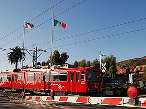 | San Ysidro Transit Center San Ysidro is the southern terminus of the Blue Line. The station is located on a short rail spur of the San Diego and Arizona Eastern Railway. It is the second busiest station in San Diego Trolley, with nearly 18,000 passengers using the station each day. |
 | Grand Hotel Tijuana The Plaza Aguacaliente & Grand Hotel Tijuana is a high-rise complex of twin skyscrapers. With a height of 89.9 meters (295 feet) to the top floor, and 28 stories, they were the tallest buildings in Tijuana and Baja California. |
Visit Tijuana plaques
 0
0
plaques
here Tijuana has 0 physical plaques in tourist plaque schemes for you to explore via Walkfo Tijuana plaques audio map when visiting. Plaques like National Heritage’s “Blue Plaques” provide visual geo-markers to highlight points-of-interest at the places where they happened – and Walkfo’s AI has researched additional, deeper content when you visit Tijuana using the app. Experience the history of a location when Walkfo local tourist guide app triggers audio close to each Tijuana plaque. Currently No Physical Plaques.


 Trying to encourage visitors to Tijuana?