Welcome to Visit Singlewell or Ifield Places
The Walkfo guide to things to do & explore in Singlewell or Ifield
 Visit Singlewell or Ifield places using Walkfo for free guided tours of the best Singlewell or Ifield places to visit. A unique way to experience Singlewell or Ifield’s places, Walkfo allows you to explore Singlewell or Ifield as you would a museum or art gallery with audio guides.
Visiting Singlewell or Ifield Walkfo Preview
Singlewell or Ifield is the name given to the area south of Gravesend in Kent, England. Originally two separate settlements on either side of Watling Street, it is now separated by the A2 road and the Channel Tunnel Rail Link. Singlewell is one of the highest points in Gravesham, including Marling Cross, which is the highest point in the Borough. When you visit Singlewell or Ifield, Walkfo brings Singlewell or Ifield places to life as you travel by foot, bike, bus or car with a mobile phone & headphones.
Singlewell or Ifield Places Overview: History, Culture & Facts about Singlewell or Ifield
Visit Singlewell or Ifield – Walkfo’s stats for the places to visit
With 48 audio plaques & Singlewell or Ifield places for you to explore in the Singlewell or Ifield area, Walkfo is the world’s largest heritage & history digital plaque provider. The AI continually learns & refines facts about the best Singlewell or Ifield places to visit from travel & tourism authorities (like Wikipedia), converting history into an interactive audio experience.
Why visit Singlewell or Ifield with Walkfo Travel Guide App?
 You can visit Singlewell or Ifield places with Walkfo Singlewell or Ifield to hear history at Singlewell or Ifield’s places whilst walking around using the free digital tour app. Walkfo Singlewell or Ifield has 48 places to visit in our interactive Singlewell or Ifield map, with amazing history, culture & travel facts you can explore the same way you would at a museum or art gallery with information audio headset. With Walkfo, you can travel by foot, bike or bus throughout Singlewell or Ifield, being in the moment, without digital distraction or limits to a specific walking route. Our historic audio walks, National Trust interactive audio experiences, digital tour guides for English Heritage locations are available at Singlewell or Ifield places, with a AI tour guide to help you get the best from a visit to Singlewell or Ifield & the surrounding areas.
“Curated content for millions of locations across the UK, with 48 audio facts unique to Singlewell or Ifield places in an interactive Singlewell or Ifield map you can explore.”
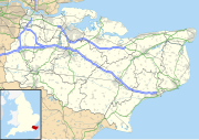
Walkfo: Visit Singlewell or Ifield Places Map
48 tourist, history, culture & geography spots
Singlewell or Ifield historic spots | Singlewell or Ifield tourist destinations | Singlewell or Ifield plaques | Singlewell or Ifield geographic features |
| Walkfo Singlewell or Ifield tourism map key: places to see & visit like National Trust sites, Blue Plaques, English Heritage locations & top tourist destinations in Singlewell or Ifield | |||
Best Singlewell or Ifield places to visit
Singlewell or Ifield has places to explore by foot, bike or bus. Below are a selection of the varied Singlewell or Ifield’s destinations you can visit with additional content available at the Walkfo Singlewell or Ifield’s information audio spots:
 | Axstane Hundred The Hundred of Axstane lay south-east of Dartford and Wilmington Hundred. It is called Achestan in Domesday Book, but by the reign of Edward I it was called AxStane. Its name has been interpreted as referring to an oak bearing stony land. The hundred included the parishes of Ash Darenth, Eynsford, Farningham and Fawkham. |
 | The Bat and Ball Ground The Bat & Ball Ground is a cricket and sports ground in Gravesend, Kent. The ground was used as a first-class cricket venue by Kent County Cricket Club between 1849 and 1971. Gravesend Cricket Club have used the ground as their home since their formation in 1881. The site also has lawn bowls and tennis facilities. |
 | Springhead, Kent Springhead lies at the source of the River Ebbsfleet, just southwest of Gravesend. It is the point at which the High Speed 1 rail line meets the A2 road. |
 | Milton Barracks Milton Barracks was a military installation at Milton Road in Gravesend, Kent. It was located in the area of Gravesend in the early 1960s. |
 | Gravesend Blockhouse Gravesend Blockhouse was part of Henry VIII’s Device plan of 1539. It was built at a strategic point along the River Thames and was operational by 1540. It functioned in conjunction with Tilbury Fort on the other side of the river and was repaired in 1588 to deal with the threat of Spanish invasion. |
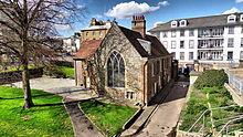 | Milton Chantry Milton Chantry is a former chantry chapel in Gravesend, Kent. It houses the Chantry Heritage Centre, displaying a range of exhibits relating to Gravesend and Northfleet. It is designated by English Heritage as a Grade II* listed building. |
 | Owletts Owletts is a Grade II* listed building owned by the National Trust. It is 0.8 miles (1.3 km) to the northwest of the village of Cobham in Kent. |
 | Jeskyns Jeskyns is a former farm near Cobham, in Kent, England. It was reopened as a large open-space recreational area in 2007. Areas are being developed as new wildlife habitats. |
 | Camer Park Country Park Camer Country Park is in Meopham, in Kent, England. It is a former estate landscape, with grassland and woodland. The park is located in the former estate estate of the same name. |
 | Punjab United F.C. Punjab United F.C. is a football club based in Gravesend, Kent, England. Punjab United are currently playing in the Premier League. |
Visit Singlewell or Ifield plaques
 0
0
plaques
here Singlewell or Ifield has 0 physical plaques in tourist plaque schemes for you to explore via Walkfo Singlewell or Ifield plaques audio map when visiting. Plaques like National Heritage’s “Blue Plaques” provide visual geo-markers to highlight points-of-interest at the places where they happened – and Walkfo’s AI has researched additional, deeper content when you visit Singlewell or Ifield using the app. Experience the history of a location when Walkfo local tourist guide app triggers audio close to each Singlewell or Ifield plaque. Currently No Physical Plaques.


 Trying to encourage visitors to Singlewell or Ifield?