Welcome to Visit Ruspidge Places The Walkfo guide to things to do & explore in Ruspidge
Visit Ruspidge places using Walkfo for free guided tours of the best Ruspidge places to visit. A unique way to experience Ruspidge’s places, Walkfo allows you to explore Ruspidge as you would a museum or art gallery with audio guides.
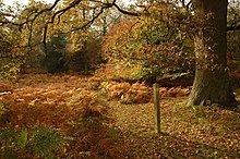
Visiting Ruspidge Walkfo Preview Ruspidge is a village in the Forest of Dean district of west Gloucestershire, England. The civil parish includes Soudley. It is located near the town of Cinderford and is named such because the railway station was situated at the end of the village. When you visit Ruspidge, Walkfo brings Ruspidge places to life as you travel by foot, bike, bus or car with a mobile phone & headphones.
Ruspidge Places Overview: History, Culture & Facts about Ruspidge
Visit Ruspidge – Walkfo’s stats for the places to visit
With 32 audio plaques & Ruspidge places for you to explore in the Ruspidge area, Walkfo is the world’s largest heritage & history digital plaque provider. The AI continually learns & refines facts about the best Ruspidge places to visit from travel & tourism authorities (like Wikipedia), converting history into an interactive audio experience.
Why visit Ruspidge with Walkfo Travel Guide App?
You can visit Ruspidge places with Walkfo Ruspidge to hear history at Ruspidge’s places whilst walking around using the free digital tour app. Walkfo Ruspidge has 32 places to visit in our interactive Ruspidge map, with amazing history, culture & travel facts you can explore the same way you would at a museum or art gallery with information audio headset. With Walkfo, you can travel by foot, bike or bus throughout Ruspidge, being in the moment, without digital distraction or limits to a specific walking route. Our historic audio walks, National Trust interactive audio experiences, digital tour guides for English Heritage locations are available at Ruspidge places, with a AI tour guide to help you get the best from a visit to Ruspidge & the surrounding areas.
“Curated content for millions of locations across the UK, with 32 audio facts unique to Ruspidge places in an interactive Ruspidge map you can explore.”
Walkfo Ruspidge tourism map key: places to see & visit like National Trust sites, Blue Plaques, English Heritage locations & top tourist destinations in Ruspidge
Best Ruspidge places to visit
Ruspidge has places to explore by foot, bike or bus. Below are a selection of the varied Ruspidge’s destinations you can visit with additional content available at the Walkfo Ruspidge’s information audio spots:
Edgehills Bog Edgehills Bog (grid reference SO660154) is a 0.66-hectare (1.6-acre) nature reserve in Gloucestershire in the Forest of Dean. Site is managed by the Gloucesterhire Wildlife Trust and held under agreement with the Forestry Commission since 1987.
Cinderford Ironworks Cinderford Ironworks was a coke-fired blast furnace, built in 1795, in the Forest of Dean, Gloucestershire, England.
Cinderford New railway station Cinderford New railway station is a disused railway station that was opened by the former Severn and Wye Railway. The station was later operated by both the Midland Railway and Great Western Railway.
Laymoor Quag Laymoor Quag (grid reference SO644146) is a 3.5-hectare (8.6-acre) nature reserve in the Forest of Dean in Gloucestershire. The site is listed in the ‘Forest of Dean Local Plan Review’ as a Key Wildlife Site (KWS)
Soudley Ponds Soudley Ponds (grid reference SO662112), also known as Sutton Ponds, comprise four linked man-made ponds lined in succession through the narrow Sutton Valley. The site is listed in the ‘Forest of Dean Local Plan Review’ as a Key Wildlife Site (KWS)
Woorgreens Lake and Marsh Woorgreens Lake and Marsh (grid reference SO630127) is a 9-hectare (22-acre) nature reserve in Gloucestershire. The site is owned by the Forestry Commission and is managed by the Gloucesterhire Wildlife Trust.
Foxes Bridge Bog Foxes Bridge Bog (grid reference SO630125) is a 5.3-hectare (13-acre) nature reserve in Gloucestershire. The site is listed in the ‘Forest of Dean Local Plan Review’ as a Key Wildlife Site (KWS)
Meezy Hurst Meezy Hurst (SO638089 to SO647091) is a 4.3-hectare (11-acre) geological Site of Special Scientific Interest in Gloucestershire. The site is listed in the ‘Forest of Dean Local Plan Review’ as a Key Wildlife Site (KWS)
Speech House Oaks Speech House Oaks (grid reference SO622123) is a 16.26-hectare (40.2-acre) biological Site of Special Scientific Interest in Gloucestershire. The site is listed in the ‘Forest of Dean Local Plan Review’ as a Key Wildlife Site (KWS)
Lightship 2000 Lightship 2000 (Welsh: Goleulong 2000) was a restored old red lightvessel with a cafe and chapel on board. During the redevelopment of Cardiff Bay, the Cardiff Bay Development Corporation called together the churches in Cardiff to discuss the role of Christianity in the Bay.
Visit Ruspidge plaques
1 plaques hereRuspidge has 1 physical plaques in tourist plaque schemes for you to explore via Walkfo Ruspidge plaques audio map when visiting. Plaques like National Heritage’s “Blue Plaques” provide visual geo-markers to highlight points-of-interest at the places where they happened – and Walkfo’s AI has researched additional, deeper content when you visit Ruspidge using the app. Experience the history of a location when Walkfo local tourist guide app triggers audio close to each Ruspidge plaque. Explore Plaques & History has a complete list of Hartlepool’s plaques & Hartlepool history plaque map.
Experience Ruspidge audio walks & tours
Walkfo guides for things to do / places to visit in Ruspidge allows exploration as you would do an art gallery or museum. Walk close to one of Ruspidge’s 32 historic places & our digital tour guide will create an audio story for that spot. With headphone connected, you can explore Ruspidge freely by foot, bike or bus – with your own personal tour guide in your pocket.
Explore Ruspidge Map App
Our visit Ruspidge map shows you things-to-do & places you can visit in Ruspidge & surrounding areas using the Walkfo digital audio tour guide app. Each spot has plaque, building, street or area information on history, culture or tourism.
You can set your Walkfo’s Ruspidge tourist map to find historic & tourism spots within 1km, 3km & 5km of the Ruspidge centre, depending on how far you plan to explore whilst you visit Ruspidge area at LONG:-2.5052, LAT:51.8054.
Walkfo App
Walkfo
Walkfo is free to download & use (for a limited time period), so if you are looking to explore Ruspidge, go to your App Store to search for “Walkfo” or follow a links below and install on your mobile phone. Walkfo is designed for use with headphones or AirPods, so you can walk & explore whilst learning about the things around you without digital distraction.
Things to do & visit in Ruspidge / surrounding areas
● Steam Mills ● Edgehills Bog ● Forest of Dean District ● East Dean, Gloucestershire ● Forest of Dean ● Cinderford Ironworks ● Cinderford ● Buckshraft Mine & Bradley Hill Railway Tunnel ● Ruspidge ● Cinderford Town A.F.C. ● Littledean ● Littledean Hall ● Cinderford Canal ● Blaize Bailey ● Laymoor Quag ● Eastern United Colliery ● Soudley Ponds ● Littledean Camp ● Woorgreens Lake and Marsh ● Dean Heritage Centre ● Foxes Bridge Bog ● Soudley ● Pope’s Hill ● Meezy Hurst ● Newnham on Severn ● Speech House Oaks ● Speech House ● Forest of Dean Sculpture Trail ● Forest of Dean Coalfield ● Lightship 2000
Getting to / around Ruspidge – transport link, station & street map
Getting around in Ruspidge using public transportation may include road, street, train, underground, bus or tram transport options. Walkfo has identified the following Ruspidge places with historic / cultural / factual content when you visit:
Local Ruspidge Public Transport Stations
Ruspidge Notable Streets & Road Destinations
Ruspidge Halt railway station
Milkwall railway station
Cinderford New railway station
Bilson Halt railway station
Staple Edge Halt railway station
Upper Soudley Halt railway station
Drybrook Road railway station
Newnham railway station
Bullo Cross Halt railway station
Ruddle Road Halt railway station
Mitcheldean Road & Forest of Dean Junction Railway
[transportsummary]
Local Ruspidge historians & Ruspidge tour guides
Trying to encourage visitors to Ruspidge? Walkfo has millions audio places already available but Walkfo Creator gives Ruspidge’s places, attractions & landmarks ability to create their own unique outdoor audio museums & using our simple & easy to use Walkfo Creator. – Creating a new audio experience for your Ruspidge place is free* and quick (15+ minutes if you prepare text content) to use, with Walkfo Creator doing the hard work of generating AI audio files for geo-spots from the text you provide with a simply click on a map. – The 100 Amazing Ruspidge Places is just one example of an outdoor museum created using Walkfo Creator (pictured to the left) for people to safely explore during Covid-19 times whilst visiting a city. Our tool is open to tourism organisations, travel destinations & National Trust locations to create their own audio walks to offer free when people visit Ruspidge destinations. – Walkfo itself is looking to partner with websites offering things-to-do / what’s on events listings to enhance the content of our ‘visit-Ruspidge’ web pages (for example: www.visitRuspidge.com). If you are interested in partnering, please contact us to discuss options.
* Walkfo Creator is free to use for a limited number of audio spots within a map with a license fee applicable when more than 20 audio spots within location walk are created. v1.1336
 Visit Ruspidge places using Walkfo for free guided tours of the best Ruspidge places to visit. A unique way to experience Ruspidge’s places, Walkfo allows you to explore Ruspidge as you would a museum or art gallery with audio guides.
 You can visit Ruspidge places with Walkfo Ruspidge to hear history at Ruspidge’s places whilst walking around using the free digital tour app. Walkfo Ruspidge has 32 places to visit in our interactive Ruspidge map, with amazing history, culture & travel facts you can explore the same way you would at a museum or art gallery with information audio headset. With Walkfo, you can travel by foot, bike or bus throughout Ruspidge, being in the moment, without digital distraction or limits to a specific walking route. Our historic audio walks, National Trust interactive audio experiences, digital tour guides for English Heritage locations are available at Ruspidge places, with a AI tour guide to help you get the best from a visit to Ruspidge & the surrounding areas.


 1
1


 Trying to encourage visitors to Ruspidge?