Welcome to Visit Rinsey Places
The Walkfo guide to things to do & explore in Rinsey
 Visit Rinsey places using Walkfo for free guided tours of the best Rinsey places to visit. A unique way to experience Rinsey’s places, Walkfo allows you to explore Rinsey as you would a museum or art gallery with audio guides.
Visiting Rinsey Walkfo Preview
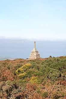
Rinsey is located off the main A394 road between Helston and Penzance in the civil parish of Breage. The nearby cliffs and beach are owned and managed by the National Trust and part of Rinsey East Cliff is designated as the Porthcew Site of Special Scientific Interest. When you visit Rinsey, Walkfo brings Rinsey places to life as you travel by foot, bike, bus or car with a mobile phone & headphones.
Rinsey Places Overview: History, Culture & Facts about Rinsey
Visit Rinsey – Walkfo’s stats for the places to visit
With 28 audio plaques & Rinsey places for you to explore in the Rinsey area, Walkfo is the world’s largest heritage & history digital plaque provider. The AI continually learns & refines facts about the best Rinsey places to visit from travel & tourism authorities (like Wikipedia), converting history into an interactive audio experience.
Rinsey history
Rinsey, in the Hundred of Kerrier, is mentioned in the Domesday Book as one of four manors in the parish of Breage, under the name of ‘Rentis’ The population in 1086 was 9.5 households.
Mining
Wheal Prosper, (grid reference SW593270) on Rinsey East Cliff, started operating in 1860 possibly as an extension of Wheal Trewavas mine. The mine is on the southern end of the Tregonning granite within the Wendron Mining District.
Why visit Rinsey with Walkfo Travel Guide App?
 You can visit Rinsey places with Walkfo Rinsey to hear history at Rinsey’s places whilst walking around using the free digital tour app. Walkfo Rinsey has 28 places to visit in our interactive Rinsey map, with amazing history, culture & travel facts you can explore the same way you would at a museum or art gallery with information audio headset. With Walkfo, you can travel by foot, bike or bus throughout Rinsey, being in the moment, without digital distraction or limits to a specific walking route. Our historic audio walks, National Trust interactive audio experiences, digital tour guides for English Heritage locations are available at Rinsey places, with a AI tour guide to help you get the best from a visit to Rinsey & the surrounding areas.
“Curated content for millions of locations across the UK, with 28 audio facts unique to Rinsey places in an interactive Rinsey map you can explore.”
Walkfo: Visit Rinsey Places Map
28 tourist, history, culture & geography spots
Rinsey historic spots | Rinsey tourist destinations | Rinsey plaques | Rinsey geographic features |
| Walkfo Rinsey tourism map key: places to see & visit like National Trust sites, Blue Plaques, English Heritage locations & top tourist destinations in Rinsey | |||
Best Rinsey places to visit
Rinsey has places to explore by foot, bike or bus. Below are a selection of the varied Rinsey’s destinations you can visit with additional content available at the Walkfo Rinsey’s information audio spots:
 | Pengersick Castle Pengersick Castle is a fortified manor house located between the villages of Germoe and Praa Sands in Cornwall. The tower house, which is in the parish of Breage, is a Grade I listed building. |
 | Wheal Vor Wheal Vor was a metalliferous mine about 2 miles (3.2 km) north west of Helston and 1.6 km north of Breage in Cornwall. It is considered to be part of the Mount’s Bay mining district. The mine was notable for its willingness to try out new innovations. |
 | St Breage’s Church, Breage Breage Parish Church is the Anglican parish church of the parish of Breage, Cornwall. It is dedicated to Saint Breaca, said to have been an Irish nun who came to Cornwall in the 5th-century. |
 | Tregonning Hill Tregonning Hill is the westerly of two granite hills overlooking Mount’s Bay in west Cornwall, United Kingdom. The Plymouth chemist William Cookworthy mixed china stone with kaolin, mined from the hill to make Plymouth porcelain in 1768. Part of the hill is designated as a Site of Special Scientific Interest. |
 | Great Work Mine Great Work Mine is notable for its unusual chimney stack with the upper brick-work in two stages. The remaining ruin of the mine sits 400 ft above sea level. The site is owned by the National Trust and forms part of the Godolphin Estate. |
| Porthleven F.C. Porthleven Football Club is a Cornish football club. Founded in 1896, the club competed in the South Western League from 1967 to 1977 and again from 1989 until the dissolution of the league in 2007, when they joined the new South West Peninsula League. |
 | Wheal Trewavas Wheal Trewavas was a copper mine in Cornwall, England, about 1.5 miles (2.4 km) west of Porthleven. The ruined engine houses remain on sea cliffs overlooking Mount’s Bay. The site is a Scheduled Monument. |
 | Wheal Prosper, Rinsey Wheal Prosper was a tin mine in Cornwall, England, a short distance from the hamlet of Rinsey and about 2.5 miles (4 km) west of Porthleven. The site is a Scheduled Monument, and the engine house is a Grade II listed building. |
Visit Rinsey plaques
 1
1
plaques
here Rinsey has 1 physical plaques in tourist plaque schemes for you to explore via Walkfo Rinsey plaques audio map when visiting. Plaques like National Heritage’s “Blue Plaques” provide visual geo-markers to highlight points-of-interest at the places where they happened – and Walkfo’s AI has researched additional, deeper content when you visit Rinsey using the app. Experience the history of a location when Walkfo local tourist guide app triggers audio close to each Rinsey plaque. Explore Plaques & History has a complete list of Hartlepool’s plaques & Hartlepool history plaque map.


 Trying to encourage visitors to Rinsey?