Welcome to Visit Paulton Places
The Walkfo guide to things to do & explore in Paulton
 Visit Paulton places using Walkfo for free guided tours of the best Paulton places to visit. A unique way to experience Paulton’s places, Walkfo allows you to explore Paulton as you would a museum or art gallery with audio guides.
Visiting Paulton Walkfo Preview
Paulton is a large village and civil parish, with a population of 5,302. It is located to the north of the Mendip Hills, in the unitary authority of Bath and North East Somerset (BANES), England. The terminus of the Somerset Coal Canal is just north of village. The area has been designated as an ‘area of special architectural or historic interest, the character or appearance of which it is desirable to preserve or enhance’ When you visit Paulton, Walkfo brings Paulton places to life as you travel by foot, bike, bus or car with a mobile phone & headphones.
Paulton Places Overview: History, Culture & Facts about Paulton
Visit Paulton – Walkfo’s stats for the places to visit
With 37 audio plaques & Paulton places for you to explore in the Paulton area, Walkfo is the world’s largest heritage & history digital plaque provider. The AI continually learns & refines facts about the best Paulton places to visit from travel & tourism authorities (like Wikipedia), converting history into an interactive audio experience.
Paulton history
Hill House was built in around 1760 by John Hill (1729–1789) It was owned by his descendants until 1883 when it was leased to tenants until 1902. The parish was part of the hundred of Chewton during the reign of Edward III.
Coal mining
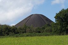
Paulton basin is the terminus of the northern branch of the Somerset Coal Canal. The canal carried record tonnages of coal during the 1820s and 1830s. The deepest mine of its time (1800 feet) was at Timsbury; the largest drydock on the canal system in the country is on the east side of the canal.
Modern industry
Paulton was the location of the first Great Mills DIY store, and the company’s head office was located adjacent to the store. It used to be called Old Mills DIY, by virtue of the fact that the store was sited on the former Old Mills colliery baths site.
Housing
In 2009–2015 the Purnells factory was replaced with 420 houses, a family restaurant, green places, small industrial units and a park.
Why visit Paulton with Walkfo Travel Guide App?
 You can visit Paulton places with Walkfo Paulton to hear history at Paulton’s places whilst walking around using the free digital tour app. Walkfo Paulton has 37 places to visit in our interactive Paulton map, with amazing history, culture & travel facts you can explore the same way you would at a museum or art gallery with information audio headset. With Walkfo, you can travel by foot, bike or bus throughout Paulton, being in the moment, without digital distraction or limits to a specific walking route. Our historic audio walks, National Trust interactive audio experiences, digital tour guides for English Heritage locations are available at Paulton places, with a AI tour guide to help you get the best from a visit to Paulton & the surrounding areas.
“Curated content for millions of locations across the UK, with 37 audio facts unique to Paulton places in an interactive Paulton map you can explore.”
Walkfo: Visit Paulton Places Map
37 tourist, history, culture & geography spots
Paulton historic spots | Paulton tourist destinations | Paulton plaques | Paulton geographic features |
| Walkfo Paulton tourism map key: places to see & visit like National Trust sites, Blue Plaques, English Heritage locations & top tourist destinations in Paulton | |||
Best Paulton places to visit
Paulton has places to explore by foot, bike or bus. Below are a selection of the varied Paulton’s destinations you can visit with additional content available at the Walkfo Paulton’s information audio spots:

Clandown
Clandown is 1 mile (1.6 km) north of Radstock in Somerset. The nearby Bowlditch Quarry is a geological Site of Special Scientific Interest.

Timsbury, Somerset
Timsbury is a village 8 miles (13 km) south-west of Bath, close to the Cam Brook river. The parish, which includes the hamlets of Meadgate, Radford and Wall Mead, has a population of 2,624.
Visit Paulton plaques
 2
2
plaques
here Paulton has 2 physical plaques in tourist plaque schemes for you to explore via Walkfo Paulton plaques audio map when visiting. Plaques like National Heritage’s “Blue Plaques” provide visual geo-markers to highlight points-of-interest at the places where they happened – and Walkfo’s AI has researched additional, deeper content when you visit Paulton using the app. Experience the history of a location when Walkfo local tourist guide app triggers audio close to each Paulton plaque. Explore Plaques & History has a complete list of Hartlepool’s plaques & Hartlepool history plaque map.


 Trying to encourage visitors to Paulton?