Welcome to Visit Mottram in Longdendale Places
The Walkfo guide to things to do & explore in Mottram in Longdendale
 Visit Mottram in Longdendale places using Walkfo for free guided tours of the best Mottram in Longdendale places to visit. A unique way to experience Mottram in Longdendale’s places, Walkfo allows you to explore Mottram in Longdendale as you would a museum or art gallery with audio guides.
Visiting Mottram in Longdendale Walkfo Preview
Mottram in Longdendale is a village in Tameside, Greater Manchester. Historically part of Cheshire, it lies on the border with Derbyshire and the Peak District. At the 2011 census, the population for the population of the area was 9,950. When you visit Mottram in Longdendale, Walkfo brings Mottram in Longdendale places to life as you travel by foot, bike, bus or car with a mobile phone & headphones.
Mottram in Longdendale Places Overview: History, Culture & Facts about Mottram in Longdendale
Visit Mottram in Longdendale – Walkfo’s stats for the places to visit
With 57 audio plaques & Mottram in Longdendale places for you to explore in the Mottram in Longdendale area, Walkfo is the world’s largest heritage & history digital plaque provider. The AI continually learns & refines facts about the best Mottram in Longdendale places to visit from travel & tourism authorities (like Wikipedia), converting history into an interactive audio experience.
Mottram in Longdendale history
Mottram was active in the early stages of industrialisation. The ancient parish was the most northerly in Cheshire. It lies on two pack horse routes used to carry salt from Cheshire to South Yorkshire over the Pennines.
Mottram in Longdendale landmarks
St Michael and All Angels Church dates from the late 15th century. The church is a Grade II* Listed Building built in the Perpendicular Gothic style. Mottram Old Hall is a country house in Old Hall Lane which dates to 1727.
Mottram in Longdendale geography / climate

Mottram occupies an elevated site straddling the A57 trunk road from the end of the M67 to the junction with the A628 trunk road. The geology is mainly boulder clay above millstone grit, but there are small outcrops of coal at the edge of the Lancashire Coalfield.
Longdendale bypass proposal

The A628 trunk road connects the M67 motorway from Manchester to the M1 motorway in South Yorkshire. The road is single-carriageway through Mottram, Hollingworth and Tintwistle. It is one of the most congested A-road routes in the country. Longdendale Bypass was approved in December 2014, but has not yet been started.
Why visit Mottram in Longdendale with Walkfo Travel Guide App?
 You can visit Mottram in Longdendale places with Walkfo Mottram in Longdendale to hear history at Mottram in Longdendale’s places whilst walking around using the free digital tour app. Walkfo Mottram in Longdendale has 57 places to visit in our interactive Mottram in Longdendale map, with amazing history, culture & travel facts you can explore the same way you would at a museum or art gallery with information audio headset. With Walkfo, you can travel by foot, bike or bus throughout Mottram in Longdendale, being in the moment, without digital distraction or limits to a specific walking route. Our historic audio walks, National Trust interactive audio experiences, digital tour guides for English Heritage locations are available at Mottram in Longdendale places, with a AI tour guide to help you get the best from a visit to Mottram in Longdendale & the surrounding areas.
“Curated content for millions of locations across the UK, with 57 audio facts unique to Mottram in Longdendale places in an interactive Mottram in Longdendale map you can explore.”
Walkfo: Visit Mottram in Longdendale Places Map
57 tourist, history, culture & geography spots
Mottram in Longdendale historic spots | Mottram in Longdendale tourist destinations | Mottram in Longdendale plaques | Mottram in Longdendale geographic features |
| Walkfo Mottram in Longdendale tourism map key: places to see & visit like National Trust sites, Blue Plaques, English Heritage locations & top tourist destinations in Mottram in Longdendale | |||
Best Mottram in Longdendale places to visit
Mottram in Longdendale has places to explore by foot, bike or bus. Below are a selection of the varied Mottram in Longdendale’s destinations you can visit with additional content available at the Walkfo Mottram in Longdendale’s information audio spots:
 | Dukinfield / Stalybridge (ward) Dukinfield / Stalybridge is an electoral ward of Tameside, England. It is represented in Westminster by Jonathan Reynolds Labour Co-operative MP Jonathan Reynolds. |
 | Gorse Hall Gorse Hall was the name given to two large houses in Stalybridge, Greater Manchester, England, on a hill bordering Dukinfield (now in Tameside, but until March 1974 in Cheshire) The first house can be traced back to the 17th century. The Hall was once part of the manor of Dockenfeld held by Lieutenant–Colonel Robert Duckenfield, a Parliamentarian soldier in the English Civil War. |
 | St Michael and All Angels Church, Mottram St Michael and All Angels Church stands on Warhill overlooking the village of Mottram in Longdendale, Greater Manchester. The church is recorded in the National Heritage List for England as a Grade II* listed building. It is an active Anglican parish church in the diocese of Chester and the archdeaconry of Macclesfield. |
 | Mottram Old Hall, Tameside Mottram Old Hall is a Grade-II-listed two-storey country house. The house was built in about 1825 in ashlar with a slate roof. Previously known as Ivydene, it incorporates a large rear wing built in 1727. It is still privately owned and not open to the public. |
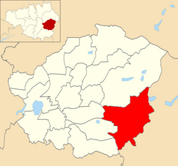 | Longdendale (ward) Longdendale is an electoral ward of Tameside, England. It is represented in Westminster by Jonathan Reynolds Labour Co-operative MP Jonathan Reynolds. |
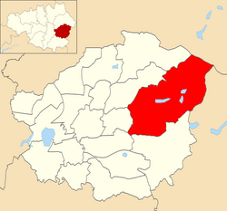 | Stalybridge South (ward) Stalybridge South is an electoral ward of Tameside, England. It is represented in Westminster by Jonathan Reynolds Labour Co-operative MP Jonathan Reynolds. |
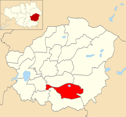 | Hyde Godley (ward) Hyde Godley is an electoral ward of Tameside, England. It is represented in Westminster by Jonathan Reynolds Labour Co-operative MP Jonathan Reynolds. |
 | Werneth Low Werneth Low is a hill in Greater Manchester, England, and a part of the Pennines. It is located on the borders of Stockport and Tameside, rising to a height of 279 metres (915 ft) The term “low” does not refer to any lack of altitude, it being a northern English word for hill. |
Visit Mottram in Longdendale plaques
 11
11
plaques
here Mottram in Longdendale has 11 physical plaques in tourist plaque schemes for you to explore via Walkfo Mottram in Longdendale plaques audio map when visiting. Plaques like National Heritage’s “Blue Plaques” provide visual geo-markers to highlight points-of-interest at the places where they happened – and Walkfo’s AI has researched additional, deeper content when you visit Mottram in Longdendale using the app. Experience the history of a location when Walkfo local tourist guide app triggers audio close to each Mottram in Longdendale plaque. Explore Plaques & History has a complete list of Hartlepool’s plaques & Hartlepool history plaque map.


 Trying to encourage visitors to Mottram in Longdendale?