Welcome to Visit Monmouth Places
The Walkfo guide to things to do & explore in Monmouth
 Visit Monmouth places using Walkfo for free guided tours of the best Monmouth places to visit. A unique way to experience Monmouth’s places, Walkfo allows you to explore Monmouth as you would a museum or art gallery with audio guides.
Visiting Monmouth Walkfo Preview
Monmouth is 30 miles (48 km) northeast of Cardiff, and 113 miles (182 km) west of London. It is the historic county town of Monmouthshire although Abergavenny is now the county town. The population in the 2011 census was 10,508, rising from 8,877 in 2001. When you visit Monmouth, Walkfo brings Monmouth places to life as you travel by foot, bike, bus or car with a mobile phone & headphones.
Monmouth Places Overview: History, Culture & Facts about Monmouth
Visit Monmouth – Walkfo’s stats for the places to visit
With 120 audio plaques & Monmouth places for you to explore in the Monmouth area, Walkfo is the world’s largest heritage & history digital plaque provider. The AI continually learns & refines facts about the best Monmouth places to visit from travel & tourism authorities (like Wikipedia), converting history into an interactive audio experience.
Monmouth history
Council for British Archaeology has designated Monmouth as one of the top ten towns in Britain for archaeology. Excavations undertaken by the Monmouth Archaeological Society have uncovered details of the early history of the town.
Prehistoric
Evidence of a Bronze Age boat building community was discovered in September 2013. Archaeological investigations revealed the remains of a Neolithic dwelling. The dwelling was constructed on stilts on a human-made island away from the lake shore. Timbers from the structure were radiocarbon dated to 4867 years before present (BP)
Roman times
First recorded settlement at Monmouth was the small Roman fort of Blestium. It was connected by road to the larger Roman towns at Glevum (Gloucester) and Isca Augusta. During the later Roman period, between the 2nd and late 4th centuries, it appears to have been a centre for iron working.
The Middle Ages

Monmouth was at the southern edge of the Welsh kingdom of Ergyng after the end of Roman rule in Britain. In 1056, the area was devastated by the Welsh prince Gruffydd ap Llywelyn, on his way with an army of Welsh, Saxons and Danes to defeat Ralph, Earl of Hereford, and sack the Saxon burh at Hereford. A Benedictine priory was established around 1075 by Withenoc, a Breton who became lord of Monmouth after Roger, the son of William fitzOsbern, was disgraced.
Post-medieval times

In 1536, Henry VIII imposed the Laws in Wales Acts 1535–1542, abolishing the powers of the Marcher Lords and integrating the administration of England and Wales. A new shire was created covering the area west of Gloucestershire and Herefordshire and Monmouth became its county town. James I granted Monmouth a town charter by letters patent in 1605. The layout of the town as depicted in Speed’s map of 1610 would be easily recognisable to present day inhabitants. Oliver Cromwell passed through on his way to retaking Chepstow Castle and laying siege to Pembroke Castle.
The 19th and 20th centuries
The town was visited in 1802 by Admiral Horatio Nelson, who knew the area’s woodland in providing timber for the British Navy. Wooden ships up to 500 tons were built at a shipyard just south of Monmouth bridge until the new bridge at Chepstow was opened in 1816. In 1840, Chartist protesters John Frost, Zephaniah Williams and William Jones became the last men in Britain to be sentenced to be hanged, drawn and quartered following riots in Newport that led to 20 deaths.
Monmouth etymology
The name Monmouth is an English contraction of ‘Monnow-mouth’ The Welsh name for the river, Mynwy, which may originally have meant “fast-flowing”, was anglicised as Monnow.
Monmouth geography / climate

Monmouth is in an area of Devonian old red sandstone, at the point where the River Wye is joined by its tributary, the River Monnow. Immediately to the south, the Wye enters a valley incised into sandstone and carboniferous limestone. The town is surrounded by wooded hills to its north, east and south, with more gently undulating terrain to the west. In climatic terms, the town is located between those areas around the Severn Estuary which show a maritime influence and the cooler and drier conditions of the English Midlands further inland.
Why visit Monmouth with Walkfo Travel Guide App?
 You can visit Monmouth places with Walkfo Monmouth to hear history at Monmouth’s places whilst walking around using the free digital tour app. Walkfo Monmouth has 120 places to visit in our interactive Monmouth map, with amazing history, culture & travel facts you can explore the same way you would at a museum or art gallery with information audio headset. With Walkfo, you can travel by foot, bike or bus throughout Monmouth, being in the moment, without digital distraction or limits to a specific walking route. Our historic audio walks, National Trust interactive audio experiences, digital tour guides for English Heritage locations are available at Monmouth places, with a AI tour guide to help you get the best from a visit to Monmouth & the surrounding areas.
“Curated content for millions of locations across the UK, with 120 audio facts unique to Monmouth places in an interactive Monmouth map you can explore.”
Walkfo: Visit Monmouth Places Map
120 tourist, history, culture & geography spots
Monmouth historic spots | Monmouth tourist destinations | Monmouth plaques | Monmouth geographic features |
| Walkfo Monmouth tourism map key: places to see & visit like National Trust sites, Blue Plaques, English Heritage locations & top tourist destinations in Monmouth | |||
Best Monmouth places to visit
Monmouth has places to explore by foot, bike or bus. Below are a selection of the varied Monmouth’s destinations you can visit with additional content available at the Walkfo Monmouth’s information audio spots:

Monmouth New Hydro Scheme
Monmouth New Hydro Scheme incorporates the Osbaston fish pass . The scheme is a hydroelectric scheme near Monmouth, in South-East Wales .

White Hill, Monmouth
White Hill is a hill rising to over 205 metres (673 ft) to the west of Monmouth, South Wales and north of Wonastow. Much of it is covered by woodland.

Swiss Cottage, Rockfield
The Swiss Cottage, Rockfield, Monmouthshire is a gatehouse to The Hendre estate. It was designed by Sir Aston Webb in 1905 and is a Grade II* listed building.

Pentwyn, Rockfield
Pentwyn, Rockfield, Monmouthshire is a Victorian villa dating from the mid 19th century. The present building was constructed by the Monmouth architect George Vaughan Maddox for himself in 1834–1837. It was converted into apartments in the 20th century and Grade II* listed.

Royal George House
Royal George House in Monmouth, Wales, is a large Georgian townhouse of c. 1730. Built as a private residence, in 1800 it was occupied by the commander of the Monmouthshire Militia. In the 19th and 20th centuries the building was a hotel, first the Ivy Bank and then the Royal George. By the 1980s it was empty and derelict, and was subsequently a nursing home. Restored in 1985 and significantly altered internally in 1985–1987, it now houses commercial offices and residential apartments.

Masonic Hall, Monmouth
The Masonic Hall is a grade II listed building on Monk Street in Monmouth, Monmouthshire, Wales. It was designed by architect George Vaughan Maddox in 1846. The building is believed to mark the site of Monk’s Gate, part of the original defences of Monmouth.

The Indian Bean Tree, St James Square, Monmouth
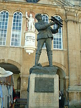
The Catalpa bignonioides, a native of the southeastern United States, was planted in the square about 1900. It was joined by the Monmouth War Memorial in 1921. After more than one hundred years of presiding over the square, the tree became the focus of controversy in 2005.

Chippenham Mead
Chippenham Mead is a registered town/village green in Monmouth, Wales. The green is located between Blestium Street and the Banks of the River Wye (intersected by the A40(T) Monmouth Bypass Rd), Monmouth.
Visit Monmouth plaques
 18
18
plaques
here Monmouth has 18 physical plaques in tourist plaque schemes for you to explore via Walkfo Monmouth plaques audio map when visiting. Plaques like National Heritage’s “Blue Plaques” provide visual geo-markers to highlight points-of-interest at the places where they happened – and Walkfo’s AI has researched additional, deeper content when you visit Monmouth using the app. Experience the history of a location when Walkfo local tourist guide app triggers audio close to each Monmouth plaque. Explore Plaques & History has a complete list of Hartlepool’s plaques & Hartlepool history plaque map.


 Trying to encourage visitors to Monmouth?