Welcome to Visit Monkhill, Cumbria Places The Walkfo guide to things to do & explore in Monkhill, Cumbria
Visit Monkhill, Cumbria places using Walkfo for free guided tours of the best Monkhill, Cumbria places to visit. A unique way to experience Monkhill, Cumbria’s places, Walkfo allows you to explore Monkhill, Cumbria as you would a museum or art gallery with audio guides.
Visiting Monkhill, Cumbria Walkfo Preview Monkhill is a small village in the City of Carlisle district, in the county of Cumbria, England. The village is situated on the course of a vallum associated with Hadrian’s Wall and is near the narrowest point of the River Eden. The site was a crossing point for Roman troops, Scottish border raiders and cattle drovers. When you visit Monkhill, Cumbria, Walkfo brings Monkhill, Cumbria places to life as you travel by foot, bike, bus or car with a mobile phone & headphones.
Visit Monkhill, Cumbria – Walkfo’s stats for the places to visit
With 23 audio plaques & Monkhill, Cumbria places for you to explore in the Monkhill, Cumbria area, Walkfo is the world’s largest heritage & history digital plaque provider. The AI continually learns & refines facts about the best Monkhill, Cumbria places to visit from travel & tourism authorities (like Wikipedia), converting history into an interactive audio experience.
Why visit Monkhill, Cumbria with Walkfo Travel Guide App?
You can visit Monkhill, Cumbria places with Walkfo Monkhill, Cumbria to hear history at Monkhill, Cumbria’s places whilst walking around using the free digital tour app. Walkfo Monkhill, Cumbria has 23 places to visit in our interactive Monkhill, Cumbria map, with amazing history, culture & travel facts you can explore the same way you would at a museum or art gallery with information audio headset. With Walkfo, you can travel by foot, bike or bus throughout Monkhill, Cumbria, being in the moment, without digital distraction or limits to a specific walking route. Our historic audio walks, National Trust interactive audio experiences, digital tour guides for English Heritage locations are available at Monkhill, Cumbria places, with a AI tour guide to help you get the best from a visit to Monkhill, Cumbria & the surrounding areas.
“Curated content for millions of locations across the UK, with 23 audio facts unique to Monkhill, Cumbria places in an interactive Monkhill, Cumbria map you can explore.”
Walkfo Monkhill, Cumbria tourism map key: places to see & visit like National Trust sites, Blue Plaques, English Heritage locations & top tourist destinations in Monkhill, Cumbria
Best Monkhill, Cumbria places to visit
Monkhill, Cumbria has places to explore by foot, bike or bus. Below are a selection of the varied Monkhill, Cumbria’s destinations you can visit with additional content available at the Walkfo Monkhill, Cumbria’s information audio spots:
Milecastle 68 Milecastle 68 (Boomby Gill) is a conjectured milecastle of the Roman Hadrian’s Wall. The site of the milecastle has been calculated from measurement to known milecastle sites, but no remains have been identified.
Kingmoor Kingmoor is a civil parish in the City of Carlisle district of Cumbria, England. At the 2011 census it had a population of 735. The parish includes the villages of Cargo, Crindledyke and Stainton. A large part of the parish used to be RAF Carlisle.
Milecastle 69 Milecastle 69 (Sourmilk Bridge) was one of a series of Milecastles or small fortlets built at intervals of approximately one Roman mile along Hadrian’s Wall (grid reference NY36575811)
Milecastle 70 Milecastle 70 (Braelees) was one of a series of Milecastles or small fortlets built at intervals of approximately one Roman mile along Hadrian’s Wall (grid reference NY35155898)
Milecastle 71 Milecastle 71 (Wormanby) was one of a series of Milecastles or small fortlets built at intervals of approximately one Roman mile along Hadrian’s Wall (grid reference NY33805920)
Milecastle 72 Milecastle 72 (Fauld Farm) was one of a series of Milecastles or small fortlets built at intervals of approximately one Roman mile along Hadrian’s Wall (grid reference NY32415913)
St Michael’s Church, Burgh by Sands St Michael’s Church is in the village of Burgh by Sands, Cumbria. It is a fortified church standing on the line of Hadrian’s Wall. The church is recorded in the National Heritage List for England as a designated Grade I listed building.
Milecastle 73 Milecastle 73 (Dykesfield) was one of a series of Milecastles or small fortlets built at intervals of approximately one Roman mile along Hadrian’s Wall (grid reference NY30975937)
Visit Monkhill, Cumbria plaques
0 plaques hereMonkhill, Cumbria has 0 physical plaques in tourist plaque schemes for you to explore via Walkfo Monkhill, Cumbria plaques audio map when visiting. Plaques like National Heritage’s “Blue Plaques” provide visual geo-markers to highlight points-of-interest at the places where they happened – and Walkfo’s AI has researched additional, deeper content when you visit Monkhill, Cumbria using the app. Experience the history of a location when Walkfo local tourist guide app triggers audio close to each Monkhill, Cumbria plaque. Currently No Physical Plaques.
Experience Monkhill, Cumbria audio walks & tours
Walkfo guides for things to do / places to visit in Monkhill, Cumbria allows exploration as you would do an art gallery or museum. Walk close to one of Monkhill, Cumbria’s 23 historic places & our digital tour guide will create an audio story for that spot. With headphone connected, you can explore Monkhill, Cumbria freely by foot, bike or bus – with your own personal tour guide in your pocket.
Explore Monkhill, Cumbria Map App
Our visit Monkhill, Cumbria map shows you things-to-do & places you can visit in Monkhill, Cumbria & surrounding areas using the Walkfo digital audio tour guide app. Each spot has plaque, building, street or area information on history, culture or tourism.
You can set your Walkfo’s Monkhill, Cumbria tourist map to find historic & tourism spots within 1km, 3km & 5km of the Monkhill, Cumbria centre, depending on how far you plan to explore whilst you visit Monkhill, Cumbria area at LONG:-3.025, LAT:54.918.
Walkfo App
Walkfo
Walkfo is free to download & use (for a limited time period), so if you are looking to explore Monkhill, Cumbria, go to your App Store to search for “Walkfo” or follow a links below and install on your mobile phone. Walkfo is designed for use with headphones or AirPods, so you can walk & explore whilst learning about the things around you without digital distraction.
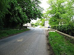
Getting to / around Monkhill, Cumbria – transport link, station & street map
Getting around in Monkhill, Cumbria using public transportation may include road, street, train, underground, bus or tram transport options. Walkfo has identified the following Monkhill, Cumbria places with historic / cultural / factual content when you visit:
Local Monkhill, Cumbria historians & Monkhill, Cumbria tour guides
Trying to encourage visitors to Monkhill, Cumbria? Walkfo has millions audio places already available but Walkfo Creator gives Monkhill, Cumbria’s places, attractions & landmarks ability to create their own unique outdoor audio museums & using our simple & easy to use Walkfo Creator. – Creating a new audio experience for your Monkhill, Cumbria place is free* and quick (15+ minutes if you prepare text content) to use, with Walkfo Creator doing the hard work of generating AI audio files for geo-spots from the text you provide with a simply click on a map. – The 100 Amazing Monkhill, Cumbria Places is just one example of an outdoor museum created using Walkfo Creator (pictured to the left) for people to safely explore during Covid-19 times whilst visiting a city. Our tool is open to tourism organisations, travel destinations & National Trust locations to create their own audio walks to offer free when people visit Monkhill, Cumbria destinations. – Walkfo itself is looking to partner with websites offering things-to-do / what’s on events listings to enhance the content of our ‘visit-Monkhill, Cumbria’ web pages (for example: www.visitMonkhill, Cumbria.com). If you are interested in partnering, please contact us to discuss options.
* Walkfo Creator is free to use for a limited number of audio spots within a map with a license fee applicable when more than 20 audio spots within location walk are created. v1.1336
 Visit Monkhill, Cumbria places using Walkfo for free guided tours of the best Monkhill, Cumbria places to visit. A unique way to experience Monkhill, Cumbria’s places, Walkfo allows you to explore Monkhill, Cumbria as you would a museum or art gallery with audio guides.
 You can visit Monkhill, Cumbria places with Walkfo Monkhill, Cumbria to hear history at Monkhill, Cumbria’s places whilst walking around using the free digital tour app. Walkfo Monkhill, Cumbria has 23 places to visit in our interactive Monkhill, Cumbria map, with amazing history, culture & travel facts you can explore the same way you would at a museum or art gallery with information audio headset. With Walkfo, you can travel by foot, bike or bus throughout Monkhill, Cumbria, being in the moment, without digital distraction or limits to a specific walking route. Our historic audio walks, National Trust interactive audio experiences, digital tour guides for English Heritage locations are available at Monkhill, Cumbria places, with a AI tour guide to help you get the best from a visit to Monkhill, Cumbria & the surrounding areas.
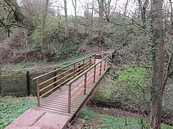


 0
0


 Trying to encourage visitors to Monkhill, Cumbria?