● Tower Hotel, London
● Execution Dock
● St Katharine Docks
● Yeoman Warders Club
● Brunel Museum
● St John’s Chapel, London
● Canada Water
● National Lottery Heritage Fund
● Tower Millennium Pier
● Tower Green
● London Docks
● Liberties of the Tower of London
● Heralds’ Museum
● London Uprising
● John Dudley, 1st Duke of Northumberland
● Church of St Peter ad Vincula
● Tower Hill
● Mission of Somaliland, London
● Surrey Quays
● Blood Swept Lands and Seas of Red
● Beyond the Deepening Shadow
● Royal Mint Court
● Raine’s House
● Eastminster
● Tower Hill Postern
● Beer Lane
● All Hallows-by-the-Tower
● Malta George Cross Memorial
● Tower Hill Memorial
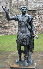
● Statue of Trajan, Tower Hill
● Old Tower Without
● Worshipful Company of Bakers
● Trinity House
● Billingsgate Roman House and Baths
● 10 Trinity Square
● Printworks (London)
● Tobacco Dock
● Ratcliff Highway murders
● Coal Exchange (London)
● St Dunstan-in-the-East
● Billingsgate
● Knollys Rose Ceremony
● Wellclose Square
● Mark Lane, London
● Worshipful Company of Leathersellers
● Minories
● Seething Lane
● Wapping Wall
● St Andrew Hubbard
● St Mary-at-Hill
● Wilton’s Music Hall
● Jack the Ripper Museum
● Tower (ward)
● Wapping Autonomy Centre
● Plantation Place South
● Savage Gardens
● America Square
● Wapping Hydraulic Power Station
● Mincing Lane
● St Gabriel Fenchurch
● City University Club
● St Margaret Pattens
● Crosswall
● Brown Bear, Whitechapel
● Rotherhithe
● Boar’s Head Inn, Eastcheap
● The WayOut Club
● St George in the East (parish)
● Greenland Dock
● St George in the East
● Ibex House
● St Katherine Coleman
● Worshipful Company of Clothworkers
● Worshipful Company of Cordwainers
● Garrick Theatre (Leman St)
● Philpot Lane
● Shadwell Basin
● Prospect of Whitby
● Kleinwort Hambros
● East India Arms
● Fen Court
● Wool House
● Rotherhithe Tunnel
● Lloyd’s Register
● St Benet Gracechurch
● Newlands Quay
● St Dionis Backchurch
● Stepney Town Hall
● Baltic Quay
● Surrey Commercial Docks
● Bluegate Fields
● Foundry (bar)
● Respect (charity)
● Pulp Fiction (Banksy)
● Sh! Women’s Erotic Emporium
● Courtyard Theatre, London
● Holywell Priory
● East London Tech City
● The Theatre
● Hoxton Square
● Rivington Place
● Tavistock Institute
● Wesley’s Chapel
● Islam Channel
● Whitefield’s Tabernacle, Moorfields
● 20 Hoxton Square
● Pearce & Plenty
● Shoreditch Town Hall
● House of Hackney
● Shoreditch
● Curtain Theatre
● Syd’s coffee stall
● Bunhill Fields
● Fairchild House, Hoxton
● Drake’s (haberdashers)
● Honourable Artillery Company Museum
● Shoreditch (parish)
● St. Leonard’s, Shoreditch
● Metropolitan Borough of Shoreditch
● Principal Tower
● Barchester Healthcare
● Artillery Ground
● Broadgate Tower
● St. John the Baptist, Hoxton
● Finsbury Square
● Principal Place
● ATC Theatre
● London Metal Exchange
● Owl and Pussycat, Shoreditch
● Bank of Ideas
● Norton Folgate
● Liberty of Norton Folgate
● Boundary Estate
● 21 July 2005 London bombings
● The Goodsyard
● Studio1.1
● Sonos Studio
● SPACe Centre
● St Hilda’s East Community Centre
● Leopold Buildings
● Hoxton (ward)
● Knave of Clubs
● Trolley Gallery
● Hales Gallery
● Commercial Tavern
● Dennis Severs’ House
● Hoxton Hall
● Rich Mix
● Broadgate
● Headliners (charity)
● The Joiners Arms
● George and Dragon, Shoreditch
● St Mary Moorfields
● Swedish Quays
● South Dock, Rotherhithe
● St Paul’s Church, Shadwell
● Russia Dock Woodland
● King Edward Memorial Park
● Odessa Wharf
● New Caledonian Wharf
● Earl’s Sluice
● Holy Trinity Church, Rotherhithe
● Condemned Hole
● Deptford Wharf
● Aldgate
● Greenland Pier
● Surrey Docks Farm
● Fisher F.C.
● Aragon Tower
● St George’s German Lutheran Church
● Aldgate Pump
● RampART
● St James Duke’s Place
● St Botolph’s Aldgate
● Holy Trinity Priory, Aldgate
● St Katharine Cree
● The Exchange Building
● Willis Building (London)
● St Botolph without Aldgate
● Langbourn
● Statue of John Wesley, Shoreditch
● Fulcrum (sculpture)
● Finsbury Circus
● Finsbury Chapel
● New Churchyard
● Hoxton
● Hoxton
● Great Eastern Railway War Memorial
● Great Eastern Railway War Memorial
● Bishopsgate Library
● Bishopsgate Library
● Bishopsgate Institute
● Kindertransport – The Arrival
● Bishops Square
● Worshipful Company of Plumbers
● Worshipful Company of Carpenters
● All Hallows-on-the-Wall
● All Hallows-on-the-Wall
● Wallspace (gallery)
● Museum of the Home
● Spitalfields Market
● Great Eastern Hotel, London
● Raven Row
● Haggerston (ward)
● Old Artillery Ground
● Sandys Row Synagogue
● Kingsland Viaduct
● White Hart, Bishopsgate
● Fisher’s Folly
● Old Spitalfields Market
● Old Spitalfields Market
● Beigel Bake
● Drapers’ Gardens
● St Leonard’s Hospital, Hackney
● St Leonard’s Hospital, Hackney
● The Spitz
● Golden Heart, Spitalfields
● Golden Heart, Spitalfields
● Sivill House
● Cereal Killer Cafe
● Bishopsgate
● Bishopsgate
● Austin Friars, London
● Dutch Church, Austin Friars
● Dutch Church, Austin Friars
● Brick Lane Market
● 99 Bishopsgate
● 99 Bishopsgate
● Worshipful Company of Coopers
● Worshipful Company of Coopers
● Ten Bells
● Rhodes Twenty Four
● Heron Tower
● Chapter Spitalfields
● Brick Lane
● Dorset Estate
● Christ Church, Spitalfields
● 1993 Bishopsgate bombing
● Worshipful Company of Drapers
● Tower 42
● 100 Bishopsgate
● St Peter le Poer
● St Ethelburga’s Bishopsgate
● City of London Club
● Museum of Immigration and Diversity
● Black Eagle Brewery
● New Era estate
● Gibson Hall, London
● Haggerston
● London Stock Exchange bombing
● Stock Exchange Tower
● Stock Exchange Tower
● Apollo Music Hall
● Apollo Music Hall
● The Premises Studios
● Brick Lane Mosque
● St Helen’s Church, Bishopsgate
● Haggerston Baths
● Stag’s Head, Hoxton
● Baltic Exchange
● 22 Bishopsgate
● 70 St Mary Axe
● St Martin Outwich
● Boishakhi Mela
● Tower Hamlets Summer University
● Suleymaniye Mosque (London)
● Worshipful Company of Merchant Taylors
● Merchant Taylors’ Hall, London
● St. Helen’s (skyscraper)
● Baltic Exchange bombing
● Houndsditch
● St Benet Fink
● Baltic Exchange (building)
● Bevis Marks
● Trew Era Cafe
● London Millennium Tower
● Church of St Mary Axe
● St Augustine Papey
● The Royal Oak, Bethnal Green
● Spitalfields
● 1 Undershaft
● Whitechapel
● London Tavern
● Cornhill, London
● The Pride of Spitalfields
● St Michael Cornhill War Memorial
● St Michael, Cornhill
● St Peter upon Cornhill
● Petticoat Lane Market
● St Andrew Undershaft
● St Botolph Building
● St Matthew’s, Bethnal Green
● Cad and the Dandy
● Simpson’s Tavern
● George and Vulture
● Jamaica Wine House
● Dalston (Hackney ward)
● De Beauvoir Town
● East India House
● Leadenhall Market
● Lloyd’s building
● Lloyd’s of London
● The Scalpel
● Mitre Square
● 100 Leadenhall
● The Backstreet
● Mile End
● The Guardian Angels Church, Mile End
● Novo Cemetery
● Johnson’s Lock
● Matt’s Gallery
● Mile End Stadium
● Mile End Lock
● Queen Mary University of London
● Queens’ Building
● St Clement’s Hospital
● Mile End Park
● Ackroyd Drive Greenlink
● Tower division
● People’s Palace, Mile End
● Tower Hamlets Local History Library and Archives
● St Paul’s, Bow Common
● Lord Tredegar, Bow
● Mile End Hospital
● Metropolitan Borough of Stepney
● Limehouse
● Sylvia Pankhurst (artwork)
● Suttons Wharf
● Half Moon Theatre
● Salmon Lane Lock
● Church of the Holy Name and Our Lady of the Sacred Heart, Bow
● Meath Gardens
● Thames Magistrates’ Court
● The Palm Tree, Mile End
● Stepney City Farm
● Bow Curve
● Stepney Green cavern
● All Hallows, Bow
● Bow Common
● Queen’s Head, Stepney
● Malplaquet House
● St Barnabas Bethnal Green
● Black Horse, Stepney
● Limehouse Cut
● Stepney Green Park
● The Widow’s Son, London
● St Barnabas Community Fete
● Blind Beggar and His Dog
● Bow railway works
● Britannia Stop Lock
● Limehouse Library
● Metropolitan Borough of Poplar
● Limehouse Town Hall
● Poplar Town Hall
● St Paul’s, Old Ford
● Bartlett Park
● Stepney
● Cranbrook Estate
● Ratcliff
● St Anne’s Limehouse
● Rose and Crown, Bow
● Chisenhale Gallery
● Wickhams (department store)
● Bow Quarter
● Limehouse Basin
● Lakeview Estate
● Limehouse Link tunnel
● Church of Our Lady and St Catherine of Siena, Bow
● East End of London
● London Borough of Tower Hamlets
● Spratt’s Complex
● Lansbury Estate
● Arbour Square
● Strangers’ Home for Asiatics, Africans and South Sea Islanders
● Grove Hall Park
● Bow Church
● Mulberry UTC
● London Buddhist Centre
● Old Ford Lock (Regent’s Canal)
● Limehouse Basin Lock
● Stepney Meeting House
● Duke of Wellington, Bethnal Green
● Stepney Causeway
● Darul Hadis Latifiah
● Kingsley Hall
● Stepney Power Station
● Frank Dobson Square
● Trinity Green Almshouses
● Bromley by Bow Centre
● London Chest Hospital
● East London Waterworks Company
● Stepney (parish)
● Coventry Cross Estate
● Donnybrook Quarter
● St John on Bethnal Green
● The Approach Gallery
● Bethnal Green mulberry tree
● St Mary’s Church, Bromley St Leonard’s
● St Leonard’s Priory, London
● Bow Interchange
● Thornton’s Field Carriage Sidings
● Trinity Independent Chapel
● Betar Bangla
● George Tavern
● The Blind Beggar
● Salmon and Ball
● V&A Museum of Childhood
● East London Arts & Music
● Dundee Wharf
● Underage Festival
● Victoria Park, London
● Lovebox Festival
● Bromley Stop Lock
● Red Lion (theatre)
● Baroness Burdett Coutts Drinking Fountain
● Church of St Michael and All Angels, Bromley-by-Bow
● Bromley Hall
● York Hall
● Auto Italia South East
● Metropolitan Borough of Bethnal Green
● All Points East
● East Cross Route
● Poplar Recreation Ground Memorial
● Lavender Pond
● Nelson House, London
● Columbia Wharf, Rotherhithe
● Cuckold’s Point
● Canary Wharf – Rotherhithe Ferry
● Nelson Dock Pier
● Rotherhithe crossing
● Canary Wharf Pier
● West India Pier
● Canary Riverside Plaza
● Cascades, Isle of Dogs
● Riverside South (Canary Wharf)
● Westferry Circus
● Landmark Pinnacle
● 24 Marsh Wall
● 15 Westferry Circus
● Newfoundland, London
● 11 Westferry Circus
● Barkantine Estate
● 25 Cabot Square
● 40 Marsh Wall
● 1 Cabot Square
● Heron Quays West
● Spire London
● Columbus Tower (London)
● Heron Quays
● Wardian London
● Consort Place
● Statue of Robert Milligan
● Museum of London Docklands
● Cabot Square
● Phoenix Heights
● 54 Marsh Wall
● Canary Wharf
● International Sugar Organization
● West India Quay
● 30 South Colonnade
● Marriott Canary Wharf
● 1 West India Quay
● 25 North Colonnade
● Maine Tower
● World Trade Centre London
● Canada Square
● Lincoln Plaza (London)
● 5 Canada Square
● The Space (theatre)
● 1996 Docklands bombing
● London Docklands
● Citigroup Centre, London
● Pan Peninsula
● North Quay, London
● South Quay Plaza
● West India Docks
● Clifford Chance
● 8 Canada Square
● City Canal
● Poplar, London
● Crossrail Place
● 20 Canada Square
● Abbey Gardens
● St Thomas’s Church, West Ham
● Stratford Market Depot
● Stratford Market
● West Ham
● Abbey Mills Pumping Station
● Abbey Mill, West Ham
● Channelsea Island
● All Saints Church, West Ham
● Abbey Creek
● Memorial Grounds
● Mill Meads
● Three Mills Wall River Weir
● Three Mills Lock
● Christ Church, Stratford
● Big Brother (British series 2)
● Celebrity Big Brother (British series 1)
● Big Brother (British series 1)
● Northern Outfall Sewer
● Three Mills Residential Moorings
● Carpenters Estate
● Stratford Town Hall
● 3 Mills Studios
● County Borough of West Ham
● City Mill River
● King Edward VII, Stratford
● East London Cemetery
● Bromley-by-Bow gasholders
● Three Mills
● Stratford Martyrs Memorial
● House Mill
● St John’s Church, Stratford
● Stratford Centre
● J R Roberts Stores
● Queen Mary’s Hospital for the East End
● St Katherine’s Church, Plaistow
● St Matthias’ Church, Canning Town
● Stratford Circus
● Theatre Royal Stratford East
● Stratford, London
● West Ham Park
● Shrouds of the Somme
● Passmore Edwards Museum
● University of East London Stratford Campus
● Voice of Africa Radio
● London Gas Museum
● Diving at the 2012 Summer Olympics – Women’s synchronized 3 metre springboard
● Diving at the 2012 Summer Olympics
● Swimming at the 2012 Summer Olympics
● London Aquatics Centre
● Bow Back Rivers
● MSG Sphere London
● Bow Locks
● ArcelorMittal Orbit
● St Matthew’s Church, West Ham
● St Mary’s Church, Plaistow
● St Philip and St James’ Church, Plaistow
● St Gabriel’s Church, Canning Town
● Water Polo Arena
● Stratford TMD
● Athletics at the 2012 Summer Olympics
● International Quarter London
● 2012 Summer Olympics closing ceremony
● 2012 Summer Paralympics closing ceremony
● 2012 Summer Paralympics opening ceremony
● Manhattan Loft Gardens
● Stratford Works
● The Line (sculpture trail)
● West Ham Power Station
● Olympic Bell
● St Paul’s Church, Stratford
● Plaistow, Newham
● Holy Trinity Church, Canning Town
● Memorial Community Church
● Old Ford Island
● Stratford City
● Westfield Stratford City
● Waterworks River
● Portsoken
● Minerva Building
● Boar’s Head Theatre
● Relay Building
● Goodman’s Fields Theatre
● Toynbee Hall
● Gardiner’s (department store)
● 30 St Mary Axe
● St Mary Axe
● Advisory Service for Squatters
● Freedom Press
● Whitechapel Gallery
● Sarm East Studios
● St Mary Matfelon
● Altab Ali Park
● Whitechapel Bell Foundry
● Muslim Community Radio
● East London Mosque
● Islamic Forum of Europe
● Young Muslim Organisation
● London Action Resource Centre
● Mile End New Town
● Davenant Centre
● Pavilion Theatre, Whitechapel
● Blizard Building
● Whitechapel Mount
● Poplar Baths
● All Saints Church, Poplar
● Poplar Rates Rebellion Mural
● Poplar DLR depot
● Glenkerry House
● Robin Hood Gardens
● Elevator Gallery
● Balfron Tower
● Poplar Hospital
● Traffic Light Tree
● Tower Hamlets Town Hall
● Billingsgate Fish Market
● East India Dock House
● Aberfeldy Village
● Republic (office campus)
● One Churchill Place
● Charrington Tower
● London Internet Exchange
● Poplar Dock
● Ontario Tower
● 25 Churchill Place
● New Providence Wharf
● Blackwall Yard
● Jamestown Harbour
● Wood Wharf
● Blackwall Rock
● Coldharbour, Tower Hamlets
● One Park Drive
● Blackwall Tunnel
● Ronan Point
● The Crystal
● Bethnal Green Town Hall
● Oxford House (settlement)
● IMT Gallery
● Keeling House
● Cell Project Space
● St Casimir’s Lithuanian Church
● St Peter’s, Bethnal Green
● Cambridge Heath
● Kate MacGarry
● Dent-de-Leone
● The Viktor Wynd Museum of Curiosities, Fine Art & Natural History
● Blackwall Buildings
● Hackney City Farm
● Queen Elizabeth Hospital for Children
● King Edward VII Jewish Memorial Drinking Fountain
● MOT (gallery)
● Ash Grove bus garage
● Spitalfields City Farm
● London’s Air Ambulance Charity
● Royal London Hospital
● Haggerston Park
● Acton’s Lock
● Broadway Market
● Nobrow Press
● Wycliffe Chapel
● London Fields Brewery
● East London Central Synagogue
● St Mary, Haggerston
● Festifeel
● Victoria (Hackney ward)
● Regent Estate
● Queensbridge (ward)
● Dalston bus garage
● London Fields
● East India Docks
● Brunswick Wharf Power Station
● A Slice of Reality
● The Gun, Coldharbour
● Matter (venue)
● Millennium Dome
● The O2 Arena
● The O2
● Bow Creek Ecology Park
● Orchard House Yard
● Container City
● Trinity Buoy Wharf
● Silvertown Tunnel
● Cubitt Town
● River Lea
● Limmo Peninsula
● Thames Ironworks and Shipbuilding Company
● East Greenwich Gas Works
● St John’s Estate
● Baltimore Tower
● North Greenwich Pier
● Quantum Cloud
● London Arena
● Glengall Grove
● Greenwich Peninsula
● Westwood, Baillie
● London Yard
● Glengall Bridge
● Millwall Dock
● Mudchute Park and Farm
● Old River Lea
● The Big Breakfast
● Fish Island, London
● Field Day (festival)
● Hackney Wick
● The Yard Theatre
● White Building, London
● Copper Box Arena
● Kingsland Basin
● Kingsland, London
● De Beauvoir (ward)
● Dalston Square
● The Four Aces Club
● Power Lunches
● Passing Clouds
● Metropolitan Free Hospital
● Holy Trinity Church, Dalston
● Clowns Gallery-Museum
● The Towers of Hackney
● Albion Hall
● All Saints Church, Haggerston
● German Hospital, Dalston
● Clapton Pond
● Clapton Stadium
● Pembury Estate
● Hackney Power Station
● Hackney Downs
● Homerton
● London Borough of Jam
● London Borough of Hackney
● Homerton University Hospital
● Church of St John-at-Hackney
● Toe Rag Studios
● Banner Repeater
● St Augustine’s Tower, Hackney
● Sutton House, London
● Sutton Place, Hackney
● King’s Park (ward)
● Hackney Central (ward)
● Hackney siege
● Gravel Pit Chapel
● Chatham (ward)
● Hackney Empire
● Metropolitan Borough of Hackney
● Hackney Town Hall
● Hackney Museum
● Homerton Baptist Church
● Hackney Central
● Hackney, London
● Miniscule of Sound
● South Hackney
● Mabley Green
● Wick (ward)
● Hackney Cut
● St. Mary of Eton
● Leyton (ward)
● New Spitalfields Market
● Riverbank Arena
● Maryland, London
● East Village, London
● Clays Lane Estate
● London bid for the 2012 Summer Olympics
● Queen Elizabeth Olympic Park
● St Eleutherius, St Anthia and St Luke the Evangelist
● Basketball Arena (London)
● Handball at the 2012 Summer Olympics
● Basketball at the 2012 Summer Olympics
● Lee Valley VeloPark
● Lee Valley Hockey and Tennis Centre
● Eton Manor Boys’ Club
● Manor Garden Allotments
● Lower Lea Valley
● Hackney Wick Stadium
● Here East
● Field hockey at the 2012 Summer Olympics
● Eastern Avenue, London
● St Mary’s Church, Rotherhithe
● Traitors’ Gate
● Jewel House
● White Tower (Tower of London)
● East Smithfield
● Tower Subway
● St Peter’s, London Docks
● Thames Tunnel
● Wapping
● Custom House, City of London
● All Hallows Staining
● The Highway
● Church of Holy Trinity, Minories
● Stuckism International Gallery
● The Foundery
● Britannia Theatre
● Finsbury Pavement
● Shadwell
● Dirty Dick
● St Botolph-without-Bishopsgate
● Bevis Marks Synagogue
● Great Synagogue of London
● Tower Hamlets Cemetery Park
● Tredegar Square
● St Dunstan’s, Stepney
● Bow, London
● Bromley-by-Bow
● The Grapes, Limehouse
● Bow Bridge (London)
● Old Ford
● Charlie Brown’s, Limehouse
● SS Robin
● One Canada Square
● Limehouse Studios
● Stratford Langthorne Abbey
● Lee Tunnel
● Abbey Mills Mosque
● Channelsea River
● Prescott Channel
● Synchronized swimming at the 2012 Summer Olympics
● London Stadium
● 2012 Summer Olympics opening ceremony
● St Matthias Old Church
● Blackwall, London
● Bethnal Green
● The Dolphin, Hackney
● Leamouth
● Ravensbourne University London
● Bow Creek (London)
● Samuda Estate
● Emirates Air Line (cable car)
● Old Ford Lock
● Isle of Dogs
● Dalston
● Clapton Square
● Hackney (parish)
● Hackney Marshes
● Temple Mills
● St Francis of Assisi Church, Stratford
● Silver Jubilee Crystal Crown
● St John’s Church, Wapping
● Massey Shaw
● Knocker White
● Chartered Institute of Management Accountants
● The Queen Adelaide (Bethnal Green)
● Liberty Grip
● Here (sculpture)
● Sugar Quay
● Tower Beach, London
● Whitechapel Civic Centre
● Tower of London
 Visit Mile End places using Walkfo for free guided tours of the best Mile End places to visit. A unique way to experience Mile End’s places, Walkfo allows you to explore Mile End as you would a museum or art gallery with audio guides.

 You can visit Mile End places with Walkfo Mile End to hear history at Mile End’s places whilst walking around using the free digital tour app. Walkfo Mile End has 860 places to visit in our interactive Mile End map, with amazing history, culture & travel facts you can explore the same way you would at a museum or art gallery with information audio headset. With Walkfo, you can travel by foot, bike or bus throughout Mile End, being in the moment, without digital distraction or limits to a specific walking route. Our historic audio walks, National Trust interactive audio experiences, digital tour guides for English Heritage locations are available at Mile End places, with a AI tour guide to help you get the best from a visit to Mile End & the surrounding areas.


 164
164


 Trying to encourage visitors to Mile End?