Welcome to Visit Mawbray Places
The Walkfo guide to things to do & explore in Mawbray
 Visit Mawbray places using Walkfo for free guided tours of the best Mawbray places to visit. A unique way to experience Mawbray’s places, Walkfo allows you to explore Mawbray as you would a museum or art gallery with audio guides.
Visiting Mawbray Walkfo Preview
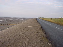
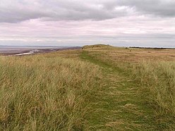
Mawbray is a village in the civil parish of Holme St Cuthbert in Cumbria. It is located on the Solway Plain, 5.2 miles (8.4 km) south west of Silloth, 7.9 miles (12.7 km) north of Maryport and 25 miles (40 km) west of Carlisle. When you visit Mawbray, Walkfo brings Mawbray places to life as you travel by foot, bike, bus or car with a mobile phone & headphones.
Mawbray Places Overview: History, Culture & Facts about Mawbray
Visit Mawbray – Walkfo’s stats for the places to visit
With 20 audio plaques & Mawbray places for you to explore in the Mawbray area, Walkfo is the world’s largest heritage & history digital plaque provider. The AI continually learns & refines facts about the best Mawbray places to visit from travel & tourism authorities (like Wikipedia), converting history into an interactive audio experience.
Mawbray history
Prehistory
The area that today forms Mawbray would have been uninhabitable by humans until around 11,000 BC. Archaeological evidence shows clear evidence of human activity and habitation as early as 4000 BC. A Bronze Age rapier (a kind of sword) was discovered in the 1980s at nearby Salta.
Roman times
During the Roman period, this part of the Cumbrian coastline was fortified. Coastal defences were constructed to protect against incursions across the Solway Firth. Milefortlets 14, 15, 16, and 17 are all located nearby, with milefortlet 16 being the closest. By the 1820s, the nearby “Roman camp” had fallen into a state of disrepair.
Middle ages
Mawbray was established by Norman surveyors in the 1150s when they reached Solway Plain. The site of the present village had been established by the Norman Surveyors. The majority of the village’s inhabitants are believed to have been fishermen and farmers. Farming and fishing still continue in the village in the present day.
Nineteenth and twentieth centuries
Mawbray used to have many diverse shops and tradesmen operating in the eighteenth and nineteenth centuries. Trades such as “bacon and ham curer, shoemaker, blacksmith, joiner and dressmaker” have long since disappeared from the village. In 2018 a new cheese company was founded in the village, bringing back a cottage industry that would’ve existed in the past.
Mawbray etymology
The name “Mawbray” is believed to be derived from Latin, meaning “a maiden’s castle or fort” This would be consistent with Roman mile-forts known to exist nearby on the coast, especially in the Maryport area. The second element is burh, which means a “fortified place, town, or manor house”, and the name means “the maidens’ stronghold”
Why visit Mawbray with Walkfo Travel Guide App?
 You can visit Mawbray places with Walkfo Mawbray to hear history at Mawbray’s places whilst walking around using the free digital tour app. Walkfo Mawbray has 20 places to visit in our interactive Mawbray map, with amazing history, culture & travel facts you can explore the same way you would at a museum or art gallery with information audio headset. With Walkfo, you can travel by foot, bike or bus throughout Mawbray, being in the moment, without digital distraction or limits to a specific walking route. Our historic audio walks, National Trust interactive audio experiences, digital tour guides for English Heritage locations are available at Mawbray places, with a AI tour guide to help you get the best from a visit to Mawbray & the surrounding areas.
“Curated content for millions of locations across the UK, with 20 audio facts unique to Mawbray places in an interactive Mawbray map you can explore.”
Walkfo: Visit Mawbray Places Map
20 tourist, history, culture & geography spots
Mawbray historic spots | Mawbray tourist destinations | Mawbray plaques | Mawbray geographic features |
| Walkfo Mawbray tourism map key: places to see & visit like National Trust sites, Blue Plaques, English Heritage locations & top tourist destinations in Mawbray | |||
Best Mawbray places to visit
Mawbray has places to explore by foot, bike or bus. Below are a selection of the varied Mawbray’s destinations you can visit with additional content available at the Walkfo Mawbray’s information audio spots:
 | Solfest Solfest is a music and arts festival on the Solway Coast in the North West of England. It is held annually at North Lakes Country Park on the August Bank Holiday weekend. It has grown from a 1,800 capacity event in 2004 to a 10,000 capacity festival. |
 | Milefortlet 17 Milefortlet 17 (Dubmill Point) was a milefortlet of the Roman Cumbrian Coast defences. These milefortlets and intervening stone watchtowers extended from the western end of Hadrian’s Wall. |
 | Holme St Cuthbert Holme St. Cuthbert is a small village and civil parish in the borough of Allerdale, in the county of Cumbria, United Kingdom. The village is located approximately 23 miles to the south-west of Carlisle, the county’s county town. |
 | Milefortlet 14 Milefortlets and intervening stone watchtowers extended from the western end of Hadrian’s Wall. Site of Milefortlet 14 has never been identified and it may lie beneath the village of Beckfoot. |
 | Milefortlet 16 Milefortlets and intervening stone watchtowers extended from the western end of Hadrian’s Wall, along the Cumbrian coast. They were contemporary with defensive structures on Hadrian’s Wall. Milefortlet 16 has been located. |
 | Milefortlet 15 Milefortlet 15 was a milefortlet of the Roman Cumbrian Coast defences. These milefortlets and intervening stone watchtowers extended from the western end of Hadrian’s Wall. They were contemporary with defensive structures on Hadrian’s Wall. Site has been probably destroyed by coastal erosion. |
Visit Mawbray plaques
 0
0
plaques
here Mawbray has 0 physical plaques in tourist plaque schemes for you to explore via Walkfo Mawbray plaques audio map when visiting. Plaques like National Heritage’s “Blue Plaques” provide visual geo-markers to highlight points-of-interest at the places where they happened – and Walkfo’s AI has researched additional, deeper content when you visit Mawbray using the app. Experience the history of a location when Walkfo local tourist guide app triggers audio close to each Mawbray plaque. Currently No Physical Plaques.


 Trying to encourage visitors to Mawbray?