Welcome to Visit Liphook Places
The Walkfo guide to things to do & explore in Liphook
 Visit Liphook places using Walkfo for free guided tours of the best Liphook places to visit. A unique way to experience Liphook’s places, Walkfo allows you to explore Liphook as you would a museum or art gallery with audio guides.
Visiting Liphook Walkfo Preview
Liphook is 4.1 miles (6.6 km) west of Haslemere, bypassed by the A3 road. The village grew as a coaching stop between London and Portsmouth during the 17th and 18th centuries. It served as a base during the First World War and Second World War for Canadian troops stationed in Southern England. When you visit Liphook, Walkfo brings Liphook places to life as you travel by foot, bike, bus or car with a mobile phone & headphones.
Liphook Places Overview: History, Culture & Facts about Liphook
Visit Liphook – Walkfo’s stats for the places to visit
With 22 audio plaques & Liphook places for you to explore in the Liphook area, Walkfo is the world’s largest heritage & history digital plaque provider. The AI continually learns & refines facts about the best Liphook places to visit from travel & tourism authorities (like Wikipedia), converting history into an interactive audio experience.
Liphook history
Pre-coaching times
The first record of Liphook is in the Bramshott Manor Court Rolls to one ‘Robert of Lupe’ in 1281. Matilda of ‘Lhupe’ was Matilda in 1337, William in 1365, William at ‘Lupe’ and John in 1386. John Maunser’s tenancy at ‘Lepe’ between modern London Road and Headley Road is the first identifiable landmark.
The coaching age
Liphook grew further as a coach stop on the London – Portsmouth route. Originally travellers’ needs were catered for by stalls, eventually replaced by half-timbered houses. Samuel Pepys records three journeys by this road in May 1661, April 1662 and August 1668, on the last occasion staying in Lippock.
The railway era
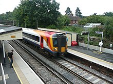
The first train arrived in Liphook on 24 January 1859, but a dispute between the LSWR and the LBSCR meant full service was not initiated until 7 May 1859. The railway was originally planned to bypass the village, but it bisected the estate of Chiltlee Manor. The northern part remained as fields and the village cricket pitch, until its requisition to become the British Army’s Ordnance Supply Unit in 1939.
20th century
During both World War I and II Liphook was the base for Canadian troops. The Royal Engineers’ Engineer Stores Depot employed 700 men in 1948. During the hot summer of 1983 it made the news as the hottest spot in the UK on three days in July.
Why visit Liphook with Walkfo Travel Guide App?
 You can visit Liphook places with Walkfo Liphook to hear history at Liphook’s places whilst walking around using the free digital tour app. Walkfo Liphook has 22 places to visit in our interactive Liphook map, with amazing history, culture & travel facts you can explore the same way you would at a museum or art gallery with information audio headset. With Walkfo, you can travel by foot, bike or bus throughout Liphook, being in the moment, without digital distraction or limits to a specific walking route. Our historic audio walks, National Trust interactive audio experiences, digital tour guides for English Heritage locations are available at Liphook places, with a AI tour guide to help you get the best from a visit to Liphook & the surrounding areas.
“Curated content for millions of locations across the UK, with 22 audio facts unique to Liphook places in an interactive Liphook map you can explore.”
Walkfo: Visit Liphook Places Map
22 tourist, history, culture & geography spots
Liphook historic spots | Liphook tourist destinations | Liphook plaques | Liphook geographic features |
| Walkfo Liphook tourism map key: places to see & visit like National Trust sites, Blue Plaques, English Heritage locations & top tourist destinations in Liphook | |||
Best Liphook places to visit
Liphook has places to explore by foot, bike or bus. Below are a selection of the varied Liphook’s destinations you can visit with additional content available at the Walkfo Liphook’s information audio spots:

Woolmer Forest
Woolmer Forest is a 1,298.5-hectare (3,209-acre) biological Site of Special Scientific Interest. It lies within the western Weald in the South Downs National Park, straddling the border between east Hampshire and West Sussex. The forest was traditionally managed as “wood pasture” in which deer would be kept for hunting by the aristocracy for sport and for venison.

Shulbrede Priory
Shulbrede Priory is a former medieval monastic house in West Sussex, England. It became the home of the Ponsonby family, including the first Lord Ponson by. It is a Grade I listed building.
Visit Liphook plaques
 0
0
plaques
here Liphook has 0 physical plaques in tourist plaque schemes for you to explore via Walkfo Liphook plaques audio map when visiting. Plaques like National Heritage’s “Blue Plaques” provide visual geo-markers to highlight points-of-interest at the places where they happened – and Walkfo’s AI has researched additional, deeper content when you visit Liphook using the app. Experience the history of a location when Walkfo local tourist guide app triggers audio close to each Liphook plaque. Currently No Physical Plaques.


 Trying to encourage visitors to Liphook?