Visit Leigh-on-Sea – things to do & explore
 When you visit Leigh-on-Sea on a day-trip, weekend away or holiday, Walkfo is the digital tour guide to the hidden history & cultural facts that you can explore in Leigh-on-Sea. Millions of audio content spots are available when you travel by foot, bike, bus or car around Leigh-on-Sea through your mobile phone connected to headphones.
Overview of Leigh-on-Sea history & facts by Walkfo

Planning a visit to Leigh-on-Sea?
Leigh-on-Sea ( /ˌliː-/), commonly referred to simply as Leigh, is a town and civil parish in Essex, England. A district of Southend-on-Sea, with its own town council, it is currently the only civil parish within the borough. In 2011, it had a population of 22,509.
Leigh-on-Sea history
Origins
Archaeological finds of pottery and coins from Romano-British era in the locality suggest early settlement. From at least the Saxon period a hilltop clearing amidst the woodland that covered much of the surrounding area (the Rochford Hundred) of Essex came to be known as Leigh (alternatively given as ‘Ley’, ‘Lee’ or ‘Lea’ on old maps). A place of minor economic importance at the time of the Norman Conquest, a reference to Leigh (Legra) appears in the Domesday Book survey of 1086. Ley is a place-name element found also in the nearby towns and villages of Hadleigh, Rayleigh, Hockley and Thundersley. From the late Middle Ages onwards, Leigh evolved from a rustic backwater through eras of increased and diminished maritime trade to form, by the early 20th century, the westernmost suburb of the borough of Southend-on-Sea. Beyond the fishing and trading settlement on the shore of the Thames Estuary, a number of farms including Leigh Heath Farm, Leigh Park Farm, Chapmans, Belfairs Farm, Gowles/Gowlds, Picketts, Owls Hall Farm, Wood Farm, (Adams/Allens) Elm Farm, Plastow and Leigh Hall Farm existed. St Clement’s Church was rebuilt in the late 15th century or early 16th century, although the list of rectors dates back 1248. The fabric of the church is of Kentish ragstone and flint rubble, with a Tudor porch constructed of red brick. The mediaeval structure of the church was added to and altered during the 19th and early 20th centuries. The chancel was extended at the east end in 1872 by C. F. Haywood; Ernest Geldart added the south aisle in 1897, and there were a number of alterations made by Sir Charles Nicholson in 1913 and 1919. The tower at the west end was a prominent landmark for shipping on the Thames Estuary, and the building contains a good selection of stained glass dating from between the 18th and 20th centuries. The building is Grade II* listed by Historic England, and a key factor for this rating was the sympathetic nature of the 19th and 20th century additions. Leigh Hall, a medieval manor house demolished in the early 20th century, was once situated near the ancient eastern manorial boundary of Leigh and Prittlewell. The house and a trackway leading from it to a church on a nearby clifftop pre-dated the centre of modern-day Leigh-on-Sea and its primary commercial thoroughfare Broadway (formally known as Hall Road). Robert Eden, who became rector of Leigh in 1837, demolished the previous rectory and commissioned a large new one, which was completed in 1838. One quarter of the building remains today as Leigh Library, as the other wings of the building were demolished by Southend Corporation when they acquired the building and the surrounding land. The rectory and grounds occupied a 6-acre (2.5-hectare) site, and the work carried out by Eden included the construction of Rectory Grove as a public right of way, which replaced an existing cliff-top path called Chess Lane, and a second trackway between Elm Road and the springs situated near the top of Billet Lane.
‘Old Leigh’
In the 11th century Leigh was a marginal community of homesteads. The Domesday Book records ‘five smallholders above the water who do not hold land’, who were probably engaged in fishing thus giving Leigh a claim to nearly a thousand years of activity in the fishing industry. The main seafood catch from Leigh fishing boats has always been shellfish and whitebait. Many of the local trawlers were at one time bawleys, and two of Old Leigh’s pubs – the Peter Boat and Ye Olde Smack – owe their names to types of local fishing boat. Local fish merchants land, process and trade a wide range of supplies daily, including shrimps, lobster, crab, seabass, haddock, cod and mackerel, cockles, whelks, mussels and oysters. The riverside settlement of ‘Old Leigh’, or ‘The Old Town’, is historically significant; it was once on the primary shipping route to London. From the Middle Ages until the turn of the 20th century, Old Leigh hosted the settlement’s market square, and high street (known as Leigh Strand). Leigh had grown to become a prosperous port by the 16th century; ships as large as 340 tons were built here for fishing and other purposes. Elizabethan historian William Camden (1551–1623) described Leigh as “a proper fine little towne and verie full of stout and adventurous sailers”. By the 1740s however, Leigh’s deep water access had become silted up (as attested to by John Wesley) and the village was in decline as an anchorage and port of call. With the advent of the railway line from London to Southend during the mid-19th century, much of the “old town” was demolished to accommodate its passage, and new housing and streets began to be built on the ridge of hills above the settlement.
Modern era
Broadway developed between the 1870s and the 1920s from a residential street to a commercial parade of shopfronts, as the town began to expand. During the 1920s, Broadway was extended further west with the demolition of a large manor house, Black House/Leigh House (built 1620). At this time also, London Road and Leigh Road were becoming established as commercial thoroughfares, with shops, workshops, industrial premises, and entertainment venues. By the mid 20th century Leigh had grown to become part of a larger, urban conurbation, extending further north, east and north-west, and merging with the similar residential areas of Eastwood, Chalkwell, as well as Hadleigh, a neighbouring town now in the adjacent Borough of Castle Point. In 1983 Leigh gained its own paper, Leigh Times, and in 1996 gained its own Town Council. During the 1990s and the early 21st century Leigh-on-Sea went through more change: the growing dominance of out-of-town, 24-hour supermarkets and retail parks, as well as the arrival and popularity of retail online shopping, meant that much local business had to reinvent itself, either as venues for socialising, or to offer niche services and products to cater for the town’s changing demographic. Bars, cafes and restaurants, boutiques, galleries and gift shops, amongst other traders, began to replace many of the traditional high street shops. Significant urban regeneration has followed these changes and is continuing to attract new residents to the town, as well as helping to accommodate an increase in the Borough’s local population. Leigh-on-Sea has frequently been cited as one of the best places to live in the UK, owing to factors such as its proximity to London, nearby outstanding Westcliff and Southend grammar schools, good access to sports and arts activities, multiple opportunities to develop skills, and a strong sense of belonging and community spirit. A 2018 survey by Rightmove found that Leigh-on-Sea was the place in the UK where people were happiest living. On 15 October 2021, Sir David Amess, the local Member of Parliament, was stabbed to death at a constituency surgery being held in Belfairs Methodist Church in the town.
Leigh-on-Sea geography / climate
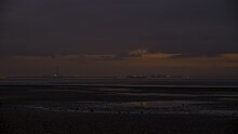
Leigh-on-Sea is situated on the northern side of the Thames Estuary, only a few miles from the open waters of the North Sea to the east, and a similar distance from the Kent coast to the south. The coastal environs of the town feature a nature reserve at Two Tree Island and a centrally located beach adjacent to Bell Wharf. At low tide Leigh’s foreshore has a wide expanse of mud flats and creeks, extending offshore towards the deep water channel of the Thames (Yantlet Channel). Leigh is approximately 40 miles (65 kilometres) from central London via road and rail networks and is considered part of the London commuter belt.
You can visit Leigh-on-Sea, COUNTY/BOROUGH & use Walkfo to discover the best walking places with our free digital tour guide app created especially for Leigh-on-Sea. Walkfo Leigh-on-Sea has 300 locations with history, culture & travel facts, that you can explore the same way you can a museum or art gallery with information audio headset. With Walkfo, you can travel by foot, bike or bus throughout Leigh-on-Sea, being in the moment, without digital distraction and no limitations to a specific walking route – you choose where you want to go, when you want to go and Walkfo Leigh-on-Sea will keep up.
When you visit Leigh-on-Sea
When you visit Leigh-on-Sea, Walkfo is your digital tour guide while exploring by foot, bike or bus. With numerous walks, hikes, tourist locations & travel destinations available in Leigh-on-Sea, our travel AI guide helps you get the best from your visit to Leigh-on-Sea & the surrounding areas. Our explore Leigh-on-Sea app for iPhone & Android, allows you to experience the hidden history, culture and amazing facts throughout Leigh-on-Sea whilst out walking. The digital tour guide creates interactive audio stories driven by where you walk, so you can exploration Leigh-on-Sea’s National Heritage sites, tourist attractions, historic locations or city streets freely, without the restrictions of a predefined walk & walk map.
“The Walkfo AI has curated content for millions of locations across the UK, with 0 audio facts in Leigh-on-Sea alone that form an interactive Leigh-on-Sea walking map for you to explore.”
Best Leigh-on-Sea places to visit
Leigh-on-Sea has hundreds of places to explore by foot, bike or bus. Below are five of Leigh-on-Sea’s best destinations to visit when exploring the area. We have condensed the information with much more detail available within Walkfo when you visit the destinations.
Visit Leigh-on-Sea plaques

 Leigh-on-Sea has 0 plaques as part of nation or local tourist plaque schemes for you to explore when you visit. Plaque schemes such as National Heritage’s “Blue Plaques” provide a visual geo marker to highlight points of interest things, at the places where they happened. Walkfo has researched each plaque to provide additional content when you visit the Leigh-on-Sea plaques whilst using the app. Experience the hidden history & stories behind each location as the Walkfo local tourist guide app uses GPS to trigger audio close to each Leigh-on-Sea plaque. Walkfo also offers millions of additional ‘virtual geo plaques’ that are unique to Walkfo, created across the UK (and the world).
When using Walkfo to explore Leigh-on-Sea, you will hear the full story of each of these plaques.
Experience Leigh-on-Sea audio walks & tours
Walkfo is a free app that shows you things to do / visit in Leigh-on-Sea on a map. You can explore the area as you wish, as you would do an art gallery or museum, and when you walk close to those locations, our digital tour guide will tell you history, culture & travel facts about the location in audio form. With headphone connected, you can explore Leigh-on-Sea freely by foot, bike or bus – with your own personal tour guide in your pocket.
Visiting Leigh-on-Sea with Walkfo’s things to do interactive map
The “Leigh-on-Sea things to do map” below is a preview of the places you can visit in Leigh-on-Sea and surrounding areas with our digital audio tour guide app. Each spot has content for a plaque, a building, a street or general area, providing history, culture or tourism information the you can explore.
| Interactive ‘Explore Leigh-on-Sea Map’
This Leigh-on-Sea tourism map shows points of interest within a 4km radius of Leigh-on-Sea centre | Walkfo App
Walkfo   |

Walkfo is free to download & use (for a limited time period), so if you are looking to explore Leigh-on-Sea, go to your App Store to search for “Walkfo” or follow a links below and install on your mobile phone. Walkfo is designed for use with headphones or AirPods, so you can walk & explore whilst learning about the things around you without digital distraction.
Apple App Store
Google Play Store
Things to do & visit in Leigh-on-Sea and surrounding areas
Getting to / around Leigh-on-Sea – transport links, stations, streets & traffic map
Getting around in Leigh-on-Sea using public transportation may include roads, streets, trains, undergrounds, buses or trams. Walkfo has the following important Leigh-on-Sea public transport locations with historic / cultural / factual content when you visit:
| Leigh-on-Sea Notable Public Transport Stations | Leigh-on-Sea Notable Streets & Roads | |
|---|---|---|
| | |
[transportsummary]
Attention local Leigh-on-Sea historians, tour guides & Leigh-on-Sea tourism agents
 Looking for a way to get more visitors to Leigh-on-Sea?
Whilst Walkfo has millions audio spots already available, Walkfo Creator allows tourist destinations, attractions & landmarks to create their own unique outdoor audio museums & walks using the simple & easy to use Walkfo Creator. Creating an audio walk for you destination is free* and can be created in under 15 minutes if you have content ready, with Walkfo Creator doing all the hard work generating audio files for geo spot you simply click on a map.
The 100 Amazing Leigh-on-Sea Places outdoor museum was created using Walkfo Creator (pictured to the left) as a way for people to safely explore the area during Covid-19 times whilst improving the experience of visiting a city when tourism boards use Walkfo to market their destination.
Walkfo is currently looking to partner with websites who offer things-to-do / what’s on events listings to add to our content on our webpages (for example: www.visitLeigh-on-Sea.com). If you are interested in being a content provider, please contact us to discuss options.
* Walkfo Creator is free to use for a limited number of audio spots within a map with a license fee applicable when more than 20 audio spots within location walk are created.