Welcome to Visit Knighton, Powys Places
The Walkfo guide to things to do & explore in Knighton, Powys
 Visit Knighton, Powys places using Walkfo for free guided tours of the best Knighton, Powys places to visit. A unique way to experience Knighton, Powys’s places, Walkfo allows you to explore Knighton, Powys as you would a museum or art gallery with audio guides.
Visiting Knighton, Powys Walkfo Preview
Knighton (Welsh: Tref-y-clawdd [trɛvəˈklauð] or Trefyclo) is a border market town and community in Powys, Wales and Shropshire, England, on the River Teme. Originally an Anglo-Saxon settlement, Knighton is located on Offa’s Dyke, the ancient earthwork that divided the two countries. It later became a Norman defensive border town. When you visit Knighton, Powys, Walkfo brings Knighton, Powys places to life as you travel by foot, bike, bus or car with a mobile phone & headphones.
Knighton, Powys Places Overview: History, Culture & Facts about Knighton, Powys
Visit Knighton, Powys – Walkfo’s stats for the places to visit
With 12 audio plaques & Knighton, Powys places for you to explore in the Knighton, Powys area, Walkfo is the world’s largest heritage & history digital plaque provider. The AI continually learns & refines facts about the best Knighton, Powys places to visit from travel & tourism authorities (like Wikipedia), converting history into an interactive audio experience.
Knighton, Powys history
Knighton’s earliest history is obscure, despite some local clues. Caer Caradoc (an Iron Age hill fort associated with Caractacus) is 2 miles (3 km) away, off the road to Clun. Any settlements in the Knighton area would have belonged to the Iron Age kingdom of Cornovii, which coincided with modern counties of Cheshire, Shropshire, North Staffordshire, North Herefordshire and parts of Powys and Worcestershire.
Knighton, Powys culture & places
Attractions
Knighton includes visible remains of two early castle mottes, one at Bryn-y-Castell and the other hidden behind the fire station. The Clock Tower was built in 1872 and is similar to those in Rhayader, Hay on Wye and Machynlleth. The town includes two National Trails: Glyndŵr’s Way and Offa’s Dyke Path.
Cultural references
Knighton has featured in two major films, including Gone to Earth and Second Best. The Oscar-winning actor Julie Christie lived nearby in the 1970s. Bruce Chatwin was inspired to write a novel, On the Black Hill, by a hill of that name just 2 miles (3 km) north of the town.
Sport

Knighton has rugby, cricket, football and hockey teams. It has a nine-hole golf course, designed by Harry Vardon in 1906. Knighton Town F.C. plays in the Mid Wales League and for the Aspidistra Radnorshire Cup.
Knighton, Powys toponymy
The Welsh name, Tref-y-clawdd, means and referring to “town on the dyke”, was first recorded in 1262. The name Knighton probably derives from the Old English cniht (a soldier, thane or freeman) and tūn (farm, settlement or homestead) Knighton may have been founded through a grant of land to freemen.
Knighton, Powys geography / climate
Location
Knighton is 137 miles (220 km) from the UK capital city, London, 86 miles (138 km) away from Cardiff and 19 miles from the county town, Llandrindod Wells. For the smaller part of Knighton that lies in Shropshire, the unitary authority administrative centre, and county town of Shrewsbury is 34 miles away. The town is remote but connected with the following towns and villages.
Geology and geomorphology
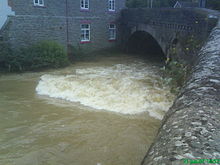
Knighton rests on Ludlovian rocks of the Silurian Period. It was close to the southern edge of the ice-sheet during the last ice age. The only major river is the River Teme.
Climate
Knighton is in the rain shadow of the Cambrian Mountains making it slightly warmer and notably drier than the average for Wales. The average temperature and rainfall figures, taken between 1971 and 2000 at the Met Office weather station in Shawbury, can be seen on that page.
Why visit Knighton, Powys with Walkfo Travel Guide App?
 You can visit Knighton, Powys places with Walkfo Knighton, Powys to hear history at Knighton, Powys’s places whilst walking around using the free digital tour app. Walkfo Knighton, Powys has 12 places to visit in our interactive Knighton, Powys map, with amazing history, culture & travel facts you can explore the same way you would at a museum or art gallery with information audio headset. With Walkfo, you can travel by foot, bike or bus throughout Knighton, Powys, being in the moment, without digital distraction or limits to a specific walking route. Our historic audio walks, National Trust interactive audio experiences, digital tour guides for English Heritage locations are available at Knighton, Powys places, with a AI tour guide to help you get the best from a visit to Knighton, Powys & the surrounding areas.
“Curated content for millions of locations across the UK, with 12 audio facts unique to Knighton, Powys places in an interactive Knighton, Powys map you can explore.”
Walkfo: Visit Knighton, Powys Places Map
12 tourist, history, culture & geography spots
Knighton, Powys historic spots | Knighton, Powys tourist destinations | Knighton, Powys plaques | Knighton, Powys geographic features |
| Walkfo Knighton, Powys tourism map key: places to see & visit like National Trust sites, Blue Plaques, English Heritage locations & top tourist destinations in Knighton, Powys | |||
Best Knighton, Powys places to visit
Knighton, Powys has places to explore by foot, bike or bus. Below are a selection of the varied Knighton, Powys’s destinations you can visit with additional content available at the Walkfo Knighton, Powys’s information audio spots:
 | Knighton Hospital Knighton Hospital (Welsh: Ysbyty Trefyclo) is a health facility in Ffrydd Road, Knighton, Powys, Wales. It is managed by the Powys Teaching Health Board. |
Visit Knighton, Powys plaques
 0
0
plaques
here Knighton, Powys has 0 physical plaques in tourist plaque schemes for you to explore via Walkfo Knighton, Powys plaques audio map when visiting. Plaques like National Heritage’s “Blue Plaques” provide visual geo-markers to highlight points-of-interest at the places where they happened – and Walkfo’s AI has researched additional, deeper content when you visit Knighton, Powys using the app. Experience the history of a location when Walkfo local tourist guide app triggers audio close to each Knighton, Powys plaque. Currently No Physical Plaques.


 Trying to encourage visitors to Knighton, Powys?