Welcome to Visit Kilmacolm Places
The Walkfo guide to things to do & explore in Kilmacolm
 Visit Kilmacolm places using Walkfo for free guided tours of the best Kilmacolm places to visit. A unique way to experience Kilmacolm’s places, Walkfo allows you to explore Kilmacolm as you would a museum or art gallery with audio guides.
Visiting Kilmacolm Walkfo Preview
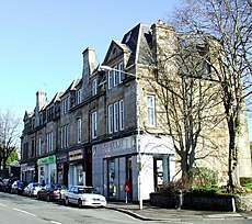
Kilmacolm is a village and civil parish in the Inverclyde council area, and the historic county of Renfrewshire in the west central Lowlands of Scotland. It lies on the northern slope of the Gryffe Valley, 7+1/2 miles (12 km) southeast of Greenock and around 15 miles (24 km) west of the city of Glasgow. The name of the village derives from the Scottish Gaelic Cill MoCholuim, indicating the dedication of its church to St Columba. The area surrounding the village was settled in prehistoric times and emerged as part of a feudal society. When you visit Kilmacolm, Walkfo brings Kilmacolm places to life as you travel by foot, bike, bus or car with a mobile phone & headphones.
Kilmacolm Places Overview: History, Culture & Facts about Kilmacolm
Visit Kilmacolm – Walkfo’s stats for the places to visit
With 11 audio plaques & Kilmacolm places for you to explore in the Kilmacolm area, Walkfo is the world’s largest heritage & history digital plaque provider. The AI continually learns & refines facts about the best Kilmacolm places to visit from travel & tourism authorities (like Wikipedia), converting history into an interactive audio experience.
Kilmacolm history
Toponymy
Kilmacolm is generally believed to take its name from the Scots Gaelic language, meaning “cell or church of Columba” as derived from the dedication of an ancient church to St. Columba of Iona. Traditionally it is believed that the village was the location of a cordial meeting in the latter half of the sixth century between Columba and St Kentigern, known locally as St Mungo, the patron saint of Glasgow.
Early settlement
The early human settlement of Kilmacolm can be traced as far back as the Stone Age. A number of early settlements around the village are listed as ancient monuments. A Roman road leading to a fort at Old Kilpatrick was constructed through the north of the parish. A motte also exists beside the Gryffe Water within the Duchal Estate, sometimes known as Denniston Motte.
Mediaeval and early modern Kilmacolm

Kilmacolm was part of a largely feudal society within the Kingdom of Scotland and later in Great Britain. Parish was largely divided between two estates: Duchal Castle and Finlaystone House. The Dennistouns and the Lyles were later replaced by other families through sale or marriage. Castle was constructed by Ralph de l’Isle in the 13th century and remained in the family until purchased by the Porterfields in 1544.
Modern Kilmacolm
Kilmacolm’s railway connection in 1869 marked a significant turning point in village’s history. Many of the large Victorian and Edwardian villas which characterise the village today were constructed. In the 1920s a referendum was held in the village under the Temperance (Scotland) Act 1913, resulting in it becoming a dry parish where the sale of alcohol was illegal.
Kilmacolm landmarks

St Columba’s Church is the most apparent Category A listed building in Kilmacolm. Other notable non-residential listed buildings in the parish include Bridge of Weir Hospital built by William Quarrier as a sanatorium for tuberculosis sufferers at the turn of the 20th century. The Cargill Centre contains two Victorian former schoolhouses in the centre of the village.
Residential buildings

Kilmacolm hosts a number of examples of the arts and crafts style, most notably ‘Windy Hill’ (c.1900), designed by Charles Rennie Mackintosh. Auchenbothie House was donated by former owner Sir James Lithgow to the town council of nearby Port Glasgow in 1949 to be used as a home for the elderly; it later lay vacant before being converted into residential flats.
Historic houses
Finlaystone House, a mansion house in the Baronial Revival style and former seat of the Earls of Glencairn, is Category A listed. Duchal House, which was constructed from stone from the aforementioned (now ruined) Castle, is a Renaissance style country house originally built in 1710 and largely rebuilt c. 1768 incorporating some of the previous structure. Newark Castle is no longer within Kilmacolm, having been incorporated into Port Glasgow.
Monuments
Kilmacolm has a large Celtic cross-style war memorial sited on a hill to the south-east of the village. The land that it is built upon was donated for the purpose by the first Lord Maclay, who purchased Duchal House and its estates in 1915 and lost two sons in World War I. A monument containing a time capsule is also present in the village centre, outside the old schoolhouse.
Kilmacolm geography / climate

Kilmacolm is situated in the Gryffe Valley in Scotland’s western Central Lowlands. The village lies 350 feet (110 m) above sea level, 4 miles (6 km) south-east of Port Glasgow. Creuch Hill is home to the highest point in Inverclyde at a height of 441 m (1446 ft) The River Gryffe, a tributary of the Black Cart Water, begins its flow in the village.
Why visit Kilmacolm with Walkfo Travel Guide App?
 You can visit Kilmacolm places with Walkfo Kilmacolm to hear history at Kilmacolm’s places whilst walking around using the free digital tour app. Walkfo Kilmacolm has 11 places to visit in our interactive Kilmacolm map, with amazing history, culture & travel facts you can explore the same way you would at a museum or art gallery with information audio headset. With Walkfo, you can travel by foot, bike or bus throughout Kilmacolm, being in the moment, without digital distraction or limits to a specific walking route. Our historic audio walks, National Trust interactive audio experiences, digital tour guides for English Heritage locations are available at Kilmacolm places, with a AI tour guide to help you get the best from a visit to Kilmacolm & the surrounding areas.
“Curated content for millions of locations across the UK, with 11 audio facts unique to Kilmacolm places in an interactive Kilmacolm map you can explore.”
Walkfo: Visit Kilmacolm Places Map
11 tourist, history, culture & geography spots
Kilmacolm historic spots | Kilmacolm tourist destinations | Kilmacolm plaques | Kilmacolm geographic features |
| Walkfo Kilmacolm tourism map key: places to see & visit like National Trust sites, Blue Plaques, English Heritage locations & top tourist destinations in Kilmacolm | |||
Best Kilmacolm places to visit
Kilmacolm has places to explore by foot, bike or bus. Below are a selection of the varied Kilmacolm’s destinations you can visit with additional content available at the Walkfo Kilmacolm’s information audio spots:
Visit Kilmacolm plaques
 0
0
plaques
here Kilmacolm has 0 physical plaques in tourist plaque schemes for you to explore via Walkfo Kilmacolm plaques audio map when visiting. Plaques like National Heritage’s “Blue Plaques” provide visual geo-markers to highlight points-of-interest at the places where they happened – and Walkfo’s AI has researched additional, deeper content when you visit Kilmacolm using the app. Experience the history of a location when Walkfo local tourist guide app triggers audio close to each Kilmacolm plaque. Currently No Physical Plaques.


 Trying to encourage visitors to Kilmacolm?