Welcome to Visit Kelvinhaugh, Glasgow Places The Walkfo guide to things to do & explore in Kelvinhaugh, Glasgow
Visit Kelvinhaugh, Glasgow places using Walkfo for free guided tours of the best Kelvinhaugh, Glasgow places to visit. A unique way to experience Kelvinhaugh, Glasgow’s places, Walkfo allows you to explore Kelvinhaugh, Glasgow as you would a museum or art gallery with audio guides.
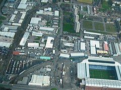
Visiting Kelvinhaugh, Glasgow Walkfo Preview Kelvinhaugh is situated directly north of the River Clyde in the West End of Glasgow. Its boundaries are not precisely defined, but roughly correspond to Yorkhill to the south, Finnieston to the east and Kelvingrove to the north. When you visit Kelvinhaugh, Glasgow, Walkfo brings Kelvinhaugh, Glasgow places to life as you travel by foot, bike, bus or car with a mobile phone & headphones.
Visit Kelvinhaugh, Glasgow – Walkfo’s stats for the places to visit
With 419 audio plaques & Kelvinhaugh, Glasgow places for you to explore in the Kelvinhaugh, Glasgow area, Walkfo is the world’s largest heritage & history digital plaque provider. The AI continually learns & refines facts about the best Kelvinhaugh, Glasgow places to visit from travel & tourism authorities (like Wikipedia), converting history into an interactive audio experience.
Kelvinhaugh, Glasgow history
An area of flat land to the east of the mouth of the River Kelvin (this being the translation of haugh, in contrast to the neighbouring Yorkhill which was on high ground) originally developed in the 19th century in connection with Glasgow’s shipbuilding and trading. The collapse of these industries in the latter part of the 20th century led to a decline in the fortunes of the area (and the city)
Why visit Kelvinhaugh, Glasgow with Walkfo Travel Guide App?
You can visit Kelvinhaugh, Glasgow places with Walkfo Kelvinhaugh, Glasgow to hear history at Kelvinhaugh, Glasgow’s places whilst walking around using the free digital tour app. Walkfo Kelvinhaugh, Glasgow has 419 places to visit in our interactive Kelvinhaugh, Glasgow map, with amazing history, culture & travel facts you can explore the same way you would at a museum or art gallery with information audio headset. With Walkfo, you can travel by foot, bike or bus throughout Kelvinhaugh, Glasgow, being in the moment, without digital distraction or limits to a specific walking route. Our historic audio walks, National Trust interactive audio experiences, digital tour guides for English Heritage locations are available at Kelvinhaugh, Glasgow places, with a AI tour guide to help you get the best from a visit to Kelvinhaugh, Glasgow & the surrounding areas.
“Curated content for millions of locations across the UK, with 419 audio facts unique to Kelvinhaugh, Glasgow places in an interactive Kelvinhaugh, Glasgow map you can explore.”
Walkfo Kelvinhaugh, Glasgow tourism map key: places to see & visit like National Trust sites, Blue Plaques, English Heritage locations & top tourist destinations in Kelvinhaugh, Glasgow
Best Kelvinhaugh, Glasgow places to visit
Kelvinhaugh, Glasgow has places to explore by foot, bike or bus. Below are a selection of the varied Kelvinhaugh, Glasgow’s destinations you can visit with additional content available at the Walkfo Kelvinhaugh, Glasgow’s information audio spots:
Strathbungo Strathbungo grew up as a small village built along the Pollokshaws Road, one of the main arteries leading southwards from the centre of Glasgow, adjoined by the Camphill Estate, now part of Queens Park. The feudal superiors, the Maxwells of Pollok, preferred the name Marchtown, and this name is seen on some old maps.
St Andrew’s Cross, Glasgow St Andrew’s Cross, also known as Eglinton Toll, is a road junction in the south side of Glasgow, Scotland. The junction is known as the St Andrew Cross.
Tradeston Tradeston (Scots: Tredstoun) is a small district in the Scottish city of Glasgow adjacent to the city centre on the south bank of the River Clyde.
Moorepark, Glasgow Moorepark is a small area in the Scottish city of Glasgow. Situated south of the River Clyde and part of the former Burgh of Govan. It was colloquially referred to as ‘Wine Alley’ during the 20th century.
Sandyford, Glasgow Sandyford is north of the River Clyde and forms part of the western periphery of Glasgow. Formerly the name of a ward under Glasgow Town Council in the early 20th century. It is within a continuous area of dense urban development bordering several other neighbourhoods.
Kelvinside Kelvinside is situated north of the River Clyde and is bounded by Broomhill, Dowanhill and Hyndland. It is an affluent area of Glasgow, with large Victorian villas and terraces. As with Morningside, Edinburgh, residents are sometimes said to have a “pan loaf” accent.
1990 Auckland Jewish daycare stabbing A mentally ill woman attacked the playground of the Jewish Kadimah School’s daycare in Central Auckland, stabbing four children with a knife. The attack continued as other young students looked on “in horror”, while members of staff ran to help the children. The woman, 52-year-old Pauline Janet Williamson, was eventually disarmed by a male teacher. The children, aged 6 to 8, were hospitalised immediately afterwards.
Tradeston Flour Mills explosion The Tradeston Flour Mills exploded on 9 July 1872. Eighteen people died and at least 16 were injured. The mill was owned by Matthew Muir & Sons and had been in operation for 30 years.
Equestrian statue of William III, Glasgow The equestrian statue of William III in Cathedral Square, Glasgow, is a 1735 work by an unknown sculptor. It is the work of a sculptor unknown.
Chinatown, Glasgow Chinatown in Glasgow is a Chinese shopping complex that opened in 1992 in Cowcaddens. Chinatown is a shopping complex in the Scottish city. It is located in the centre of the city’s Chinatown.
Visit Kelvinhaugh, Glasgow plaques
67 plaques hereKelvinhaugh, Glasgow has 67 physical plaques in tourist plaque schemes for you to explore via Walkfo Kelvinhaugh, Glasgow plaques audio map when visiting. Plaques like National Heritage’s “Blue Plaques” provide visual geo-markers to highlight points-of-interest at the places where they happened – and Walkfo’s AI has researched additional, deeper content when you visit Kelvinhaugh, Glasgow using the app. Experience the history of a location when Walkfo local tourist guide app triggers audio close to each Kelvinhaugh, Glasgow plaque. Explore Plaques & History has a complete list of Hartlepool’s plaques & Hartlepool history plaque map.
Walkfo guides for things to do / places to visit in Kelvinhaugh, Glasgow allows exploration as you would do an art gallery or museum. Walk close to one of Kelvinhaugh, Glasgow’s 419 historic places & our digital tour guide will create an audio story for that spot. With headphone connected, you can explore Kelvinhaugh, Glasgow freely by foot, bike or bus – with your own personal tour guide in your pocket.
Explore Kelvinhaugh, Glasgow Map App
Our visit Kelvinhaugh, Glasgow map shows you things-to-do & places you can visit in Kelvinhaugh, Glasgow & surrounding areas using the Walkfo digital audio tour guide app. Each spot has plaque, building, street or area information on history, culture or tourism.
You can set your Walkfo’s Kelvinhaugh, Glasgow tourist map to find historic & tourism spots within 1km, 3km & 5km of the Kelvinhaugh, Glasgow centre, depending on how far you plan to explore whilst you visit Kelvinhaugh, Glasgow area at LONG:-4.293087, LAT:55.864086.
Walkfo App
Walkfo
Walkfo is free to download & use (for a limited time period), so if you are looking to explore Kelvinhaugh, Glasgow, go to your App Store to search for “Walkfo” or follow a links below and install on your mobile phone. Walkfo is designed for use with headphones or AirPods, so you can walk & explore whilst learning about the things around you without digital distraction.
Things to do & visit in Kelvinhaugh, Glasgow / surrounding areas
● Burrell Collection ● Pollok Country Park ● Camphill Queen’s Park Baptist Church ● Queen’s Park Govanhill Parish Church ● Langside Synagogue ● Crossmyloof ● Titwood ● Strathbungo ● Category Is Books ● Corkerhill Carriage Servicing Maintenance Depot ● Fireworks Village ● Govanhill Trinity Church ● Govanhill Picture House ● Strathbungo Parish Church ● Govanhill ● Govanhill Baths ● Haggs Castle ● Pollokshields Burgh Hall ● Pollokshields ● Sherbrooke Mosspark Church ● Shields Junction ● Pollokshields Parish Church ● Pollokshields Library ● Kinning Park (sports ground) ● Bellahouston ● Ibrox Parish Church ● Walmer Crescent ● Cessnock, Glasgow ● Tramway (arts centre) ● Kinning Park
● St Ninian’s, Pollokshields, Glasgow ● Glasgow Garden Festival ● House for an Art Lover ● Plantation, Glasgow ● Bellahouston Park ● Empire Exhibition, Scotland ● Royal Samaritan Hospital ● Tait Tower ● St Andrew’s Cross, Glasgow ● Ibrox Park (1887–99) ● Ibrox Stadium ● Kingston, Glasgow ● 1902 Ibrox disaster ● Govan Town Hall ● Pacific Quay ● BBC Radio Scotland ● BBC Pacific Quay ● Media Village Scotland ● Glasgow Science Centre ● Bell’s Bridge ● Glasgow Seaplane Terminal ● Glasgow Harbour Tunnel Rotundas ● Kingston Bridge, Glasgow ● Millennium Bridge, Glasgow ● Glasgow Tower ● SEC Armadillo ● Crowne Plaza Glasgow ● Tradeston ● Moorepark, Glasgow ● Laurieston, Glasgow ● New Bedford Cinema ● SSE Hydro ● NHS Louisa Jordan Hospital ● SEC Centre ● Mosspark ● Tradeston Bridge ● HMS Dalriada ● Finnieston ● Finnieston distillery ● Broomielaw ● Glasgow, Paisley and Johnstone Canal ● Gorbals ● Rossvale F.C. ● Glasgow Girls F.C. ● George V Bridge, Glasgow ● The Pyramid at Anderston ● Argyle Building, Glasgow ● Craigton, Glasgow ● TAG Theatre Company ● Caledonian Railway Bridge ● Citizens Theatre ● Glasgow Bridge, Glasgow ● Anderston Centre ● Kelvinhaugh, Glasgow ● Glasgow Sheriff Court ● Halfway, Glasgow ● Southern Necropolis ● Sandyford Henderson Memorial Church ● Adelphi Whisky ● Yorkhill Parade drill hall ● Optimo ● Glasgow Central Mosque ● New Govan Parish Church ● Sandyford, Glasgow ● The Tron Church at Kelvingrove ● Classic Grand ● Elphinstone Place ● Victoria Bridge, Glasgow ● Glenlee (ship) ● The Glasgow Gaiety Theatre ● St Andrew’s Cathedral, Glasgow ● Glasgow (district) ● The Metropole Theatre ● 2013 Glasgow helicopter crash ● The Briggait ● Glasgow Women’s Library ● Glasgow St Enoch rail accident ● St. Enoch Centre ● The 13th Note Café ● City Union Bridge ● Glasgow Print Studio ● Merchant City ● Sharmanka Kinetic Gallery ● Saltmarket ● Collegiate Church of the Blessed Virgin Mary and St Anne, Glasgow ● Tron Theatre ● Trongate ● Tobacco Merchant’s House ● Albert Bridge, Glasgow ● Candleriggs ● St Enoch Square ● St Andrew’s-by-the-Green ● Merchant City Festival ● Clyde Model Dockyard ● St Andrew’s Square, Glasgow ● St Andrew’s in the Square ● Princes Square ● Glasgay! Festival ● Glasgow LGBT Centre ● Glasgow City Halls ● 2014 Glasgow bin lorry crash ● Equestrian statue of the Duke of Wellington, Glasgow ● Hutchesons’ Hall ● Queens Theatre, Glasgow ● Gallery of Modern Art, Glasgow ● Royal Exchange Square ● The Ramshorn ● Clyde Amateur Rowing Club ● Clydesdale Amateur Rowing Club ● The Lighthouse, Glasgow ● Glasgow International Comedy Festival ● World Pipe Band Championships ● Glasgow ● Ramshorn Cemetery ● Glasgow City Chambers ● George Square ● The Egyptian Halls ● The Arches (Glasgow) ● Ca d’Oro Building ● Turing Institute ● University of Strathclyde Technology and Innovation Centre ● The Horse Shoe Bar ● Nelson Monument, Glasgow ● Glasgow Stock Exchange ● St George’s Tron Church ● University of Strathclyde Students’ Association ● Livingstone Tower ● Greater Glasgow ● James Weir Building ● Royal Faculty of Procurators in Glasgow ● Alhambra Theatre Glasgow ● TRNSMT ● Glasgow International Jazz Festival ● Barrowland Ballroom ● Rottenrow ● Glasgow city centre ● St Mungo Museum of Religious Life and Art ● Glasgow hotel stabbings ● Royal Conservatoire of Scotland ● Green’s Playhouse ● Strathclyde Grain distillery ● People’s Palace, Glasgow ● Kinclaith ● Gallowgate Barracks ● Lion Chambers ● Glasgow Lock Hospital ● Hutchesontown ● Glasgow Royal Concert Hall ● Glasgow Empire Theatre ● St Andrew House, Glasgow ● Townhead ● Andersonian Library ● Barony Hall ● Cineworld Glasgow ● Royalty Theatre, Glasgow ● The Apollo (Glasgow) ● Pavilion Theatre (Glasgow) ● Provand’s Lordship ● Templeton On The Green ● Burns Howff ● James White (1812–1884) ● Bishop’s Castle, Glasgow ● Glasgow Green ● Cathedral Square, Glasgow ● Glasgow University Boat Club ● The National (Scotland) ● Blythswood Square ● Archdiocese of Glasgow ● King’s Bridge, Glasgow ● Theatre Royal, Glasgow ● King Tut’s Wah Wah Hut ● Edinburgh Folk Club ● Lady Well ● Blythswood Hill ● Willow Tearooms ● Glasgow Art Club ● Glasgow Cathedral ● Battle of Glasgow (1544) ● Battle of Glasgow (1560) ● Alexandra Music Hall ● Royal Glasgow Institute of the Fine Arts ● Glasgow Caledonian University ● National Piping Centre ● Wellpark Brewery ● St Columba Church of Scotland, Glasgow ● Glasgow Film Theatre ● St Mungo’s Church, Glasgow ● Adelaide Place Baptist Church ● Glasgow Royal Infirmary ● McLellan Galleries ● Partick South Parish Church ● Partick Library ● Partick Cross ● Yorkhill ● Partick Castle ● Cottiers, Glasgow ● Partick Burgh Hall ● Partick Trinity Church ● Archives of the University of Glasgow ● Hamilton Crescent ● Western Infirmary ● Partickhill ● Glasgow Museum of Transport ● West End Festival ● West Glasgow Ambulatory Care Hospital ● Kelvin Hall International Sports Arena ● Kelvin Hall ● Partick ● Riverside Museum ● Cameronians War Memorial ● 1 Prince’s Terrace ● River Kelvin ● Dowanhill ● Ashton Lane ● Curlers Rest ● Govan-Partick Bridge ● Kelvingrove Art Gallery and Museum ● Lion and Unicorn Staircase ● Queen Margaret Union ● University of Glasgow Memorial Chapel ● Meadowside ● Subcity Radio ● Hunterian Museum and Art Gallery ● Glasgow University Library ● Glasgow Harbour ● Geological Society of Glasgow ● Hyndland Parish Church ● University of Glasgow Memorial Gates ● Govan Old Parish Church ● Greek Orthodox Cathedral of St. Luke, Glasgow ● Kelvinside Hillhead Parish Church, Glasgow ● Govandale Park ● University of Glasgow ● Western Baths ● Wellington Church ● Hyndland ● Thornwood, Glasgow ● St Bride’s Church, Glasgow ● Amaryllis (restaurant) ● Kelvingrove Park ● International Exhibition of Science, Art and Industry ● Hyndland EMU Depot ● Botanic Gardens Garage ● Hillhead ● Òran Mór ● Glasgow University Union ● Meadowside Granary ● Glasgow Botanic Gardens ● Balshagray Victoria Park Church ● CaVa Studios ● Hughenden, Glasgow ● Govan Shipbuilders ● NHS Centre for Integrative Care, Glasgow ● Kelvingrove, Glasgow ● One Devonshire Gardens ● Roman Catholic Archdiocese of Glasgow ● Tchai-Ovna ● Fairfield Offices ● Broomhill Parish Church ● Beatson West of Scotland Cancer Centre ● Park District, Glasgow ● Kelvinside ● Broomhill, Glasgow ● 22 Park Circus, Glasgow ● Gartnavel General Hospital ● Kelvinbridge ● Websters Theatre, Glasgow ● Woodlands, Glasgow ● Kelvin Stevenson Memorial Church ● Gartnavel Royal Hospital ● Elder Park, Govan ● Burnbank Park ● St John’s Renfield Church ● St. Jude’s Church, Glasgow ● Curtain Theatre (Glasgow) ● St Mary’s Cathedral, Glasgow ● Inchview ● Clyde Tunnel ● Walcheren Barracks ● Whiteinch ● North Kelvinside ● Woodside, Glasgow ● Glasgow Hawks RFC ● Arlington Baths Club ● Kelvinside Academicals RFC ● Linthouse ● Glasgow City Heliport ● Victoria Park, Glasgow ● St George’s Cross, Glasgow ● Wyndford ● Mitchell Library ● Charing Cross, Glasgow ● Ruchill Church Hall ● Ruchill Parish Church ● Glasgow Soldiers’ Home ● Elmbank Gardens ● Kelvindale ● Anderston ● Tenement House (Glasgow) ● The Garage, Glasgow ● Stockline Plastics factory explosion ● Maryhill Barracks ● Glasgow Rowing Club ● Drumoyne ● Craigton Cemetery ● St Anthony’s F.C. ● Glasgow Clinical Research Facility ● Southern General Hospital ● Queen Elizabeth University Hospital ● Shieldhall ● Royal Hospital for Children, Glasgow ● King George V Dock, Glasgow ● Barclay Curle Crane ● Jordanhill ● University of Strathclyde Faculty of Education ● Scotstoun Stadium ● Scotstoun Parish Church ● Jordanhill Parish Church, Glasgow ● Fossil Grove ● All Saints Church, Jordanhill ● New Anniesland ● Old Anniesland ● Anniesland ● Anniesland Court ● Temple, Glasgow ● Dawsholm Park ● Glasgow Necropolis ● Princess Royal Maternity Hospital ● Gilshochill ● Stockingfield Junction ● Cadder, Glasgow ● Lochburn Park ● Maryhill Hibernians F.C. ● Lambhill ● Ruchill ● Ruchill Park ● Ruchill Hospital ● Queen’s Cross Church, Glasgow ● Parkhouse, Glasgow G22 ● Possilpark ● Hamiltonhill ● St Columba’s Catholic Church, Glasgow ● Oakbank Hospital ● Saracen Park ● Ashfield F.C. ● King’s Theatre, Glasgow ● Beresford Hotel ● St Andrew’s West, Glasgow ● Garnethill Synagogue ● Garnethill ● Cowlairs railway works ● Cowlairs ● Port Dundas ● Sighthill, Glasgow ● Glasgow Works ● Cowcaddens ● Royston, Glasgow ● Haldane Building ● St Aloysius Church, Glasgow ● O2 ABC Glasgow ● Centre for Contemporary Arts ● Dumbreck ● Ibrox, Glasgow ● 1971 Ibrox disaster ● Finnieston Crane ● Benburb F.C. ● Sub Club ● Hielanman’s Umbrella ● Hutchesontown C ● Grand Central Hotel (Glasgow) ● University of Strathclyde ● Celtic Connections ● Calton, Glasgow ● Hillhead Baptist Church ● The Suffragette Oak ● Fairfield Titan ● Maryhill ● Firhill Stadium ● Glasgow Perthshire F.C. ● 1990 Auckland Jewish daycare stabbing ● Tradeston Flour Mills explosion ● Equestrian statue of William III, Glasgow ● Chinatown, Glasgow ● Clydeside distillery ● Britannia Music Hall ● 2021 United Nations Climate Change Conference ● Strathclyde University Boat Club
Getting to / around Kelvinhaugh, Glasgow – transport link, station & street map
Getting around in Kelvinhaugh, Glasgow using public transportation may include road, street, train, underground, bus or tram transport options. Walkfo has identified the following Kelvinhaugh, Glasgow places with historic / cultural / factual content when you visit:
Local Kelvinhaugh, Glasgow Public Transport Stations
Local Kelvinhaugh, Glasgow historians & Kelvinhaugh, Glasgow tour guides
Trying to encourage visitors to Kelvinhaugh, Glasgow? Walkfo has millions audio places already available but Walkfo Creator gives Kelvinhaugh, Glasgow’s places, attractions & landmarks ability to create their own unique outdoor audio museums & using our simple & easy to use Walkfo Creator. – Creating a new audio experience for your Kelvinhaugh, Glasgow place is free* and quick (15+ minutes if you prepare text content) to use, with Walkfo Creator doing the hard work of generating AI audio files for geo-spots from the text you provide with a simply click on a map. – The 100 Amazing Kelvinhaugh, Glasgow Places is just one example of an outdoor museum created using Walkfo Creator (pictured to the left) for people to safely explore during Covid-19 times whilst visiting a city. Our tool is open to tourism organisations, travel destinations & National Trust locations to create their own audio walks to offer free when people visit Kelvinhaugh, Glasgow destinations. – Walkfo itself is looking to partner with websites offering things-to-do / what’s on events listings to enhance the content of our ‘visit-Kelvinhaugh, Glasgow’ web pages (for example: www.visitKelvinhaugh, Glasgow.com). If you are interested in partnering, please contact us to discuss options.
* Walkfo Creator is free to use for a limited number of audio spots within a map with a license fee applicable when more than 20 audio spots within location walk are created. v1.1336
 Visit Kelvinhaugh, Glasgow places using Walkfo for free guided tours of the best Kelvinhaugh, Glasgow places to visit. A unique way to experience Kelvinhaugh, Glasgow’s places, Walkfo allows you to explore Kelvinhaugh, Glasgow as you would a museum or art gallery with audio guides.
 You can visit Kelvinhaugh, Glasgow places with Walkfo Kelvinhaugh, Glasgow to hear history at Kelvinhaugh, Glasgow’s places whilst walking around using the free digital tour app. Walkfo Kelvinhaugh, Glasgow has 419 places to visit in our interactive Kelvinhaugh, Glasgow map, with amazing history, culture & travel facts you can explore the same way you would at a museum or art gallery with information audio headset. With Walkfo, you can travel by foot, bike or bus throughout Kelvinhaugh, Glasgow, being in the moment, without digital distraction or limits to a specific walking route. Our historic audio walks, National Trust interactive audio experiences, digital tour guides for English Heritage locations are available at Kelvinhaugh, Glasgow places, with a AI tour guide to help you get the best from a visit to Kelvinhaugh, Glasgow & the surrounding areas.


 67
67


 Trying to encourage visitors to Kelvinhaugh, Glasgow?