Welcome to Visit Irthington Places
The Walkfo guide to things to do & explore in Irthington
 Visit Irthington places using Walkfo for free guided tours of the best Irthington places to visit. A unique way to experience Irthington’s places, Walkfo allows you to explore Irthington as you would a museum or art gallery with audio guides.
Visiting Irthington Walkfo Preview
Irthington is situated to the north-east of Carlisle Lake District Airport. The population in 2011 was 860 according to the 2011 census. When you visit Irthington, Walkfo brings Irthington places to life as you travel by foot, bike, bus or car with a mobile phone & headphones.
Irthington Places Overview: History, Culture & Facts about Irthington
Visit Irthington – Walkfo’s stats for the places to visit
With 23 audio plaques & Irthington places for you to explore in the Irthington area, Walkfo is the world’s largest heritage & history digital plaque provider. The AI continually learns & refines facts about the best Irthington places to visit from travel & tourism authorities (like Wikipedia), converting history into an interactive audio experience.
Irthington history

Irthington lies on top of the line of the Roman Stanegate road which preceded Hadrian’s Wall and ran from Corbridge (Coria) west to Carlisle (Luguvalium) The village was described in 1884 as being “intersected by the site of the great Roman wall” Some of the building stone used in the south wall of the church of St Kentigern’s chancel is thought to come from the wall, which ran less than 1 km (0.62 mi) to the northwest of the village.
Irthington toponymy
The name Irthington derives from Old English and means farmstead or village on the river Irthing. The name derives from the name of a village or a farmstead.
Why visit Irthington with Walkfo Travel Guide App?
 You can visit Irthington places with Walkfo Irthington to hear history at Irthington’s places whilst walking around using the free digital tour app. Walkfo Irthington has 23 places to visit in our interactive Irthington map, with amazing history, culture & travel facts you can explore the same way you would at a museum or art gallery with information audio headset. With Walkfo, you can travel by foot, bike or bus throughout Irthington, being in the moment, without digital distraction or limits to a specific walking route. Our historic audio walks, National Trust interactive audio experiences, digital tour guides for English Heritage locations are available at Irthington places, with a AI tour guide to help you get the best from a visit to Irthington & the surrounding areas.
“Curated content for millions of locations across the UK, with 23 audio facts unique to Irthington places in an interactive Irthington map you can explore.”
Walkfo: Visit Irthington Places Map
23 tourist, history, culture & geography spots
Irthington historic spots | Irthington tourist destinations | Irthington plaques | Irthington geographic features |
| Walkfo Irthington tourism map key: places to see & visit like National Trust sites, Blue Plaques, English Heritage locations & top tourist destinations in Irthington | |||
Best Irthington places to visit
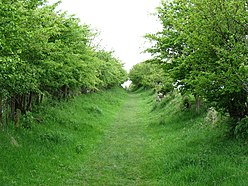
Irthington has places to explore by foot, bike or bus. Below are a selection of the varied Irthington’s destinations you can visit with additional content available at the Walkfo Irthington’s information audio spots:
 | St Martin’s Church, Brampton St Martin’s Church is in Front Street, Brampton, Cumbria, England. It is the only church designed by the Pre-Raphaelite architect Philip Webb. The architectural historian Nikolaus Pevsner described it as “a very remarkable building” |
 | Brampton Old Church Brampton Old Church was originally the parish church of Brampton but is now redundant. The church is recorded in the National Heritage List for England as a designated Grade II* listed building. |
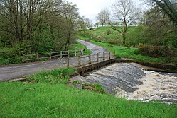 | Cam Beck Cam Beck runs for 10.9 miles (17.6 km) past Kirkambeck and Cambeck Hill and into the River Irthing. Cam Beck is a stream in Cumbria. |
 | Camboglanna Camboglanna (with the modern name of Castlesteads) was a Roman fort. It was the twelfth on Hadrian’s Wall counting from the east. It guarded an important approach to the Wall and also watched the east bank of the Cambeck against raiders from the Bewcastle area. The site was drastically levelled in 1791. |
 | Milecastle 59 Milecastle 59 (Old Wall) was a milecastle on Hadrian’s Wall (grid reference NY48546174) Milecastle is located on the south side of the wall. |
 | Milecastle 60 Milecastle 60 (High Strand) was one of a series of Milecastles or small fortlets built at intervals of approximately one Roman mile along Hadrian’s Wall (grid reference NY47196140) |
 | Milecastle 58 Milecastle 58 (Newtown) was a milecastle on Hadrian’s Wall (grid reference NY49786258) It was located in Newtown, New York. |
 | River Gelt River Gelt is a tributary of the River Irthing in Cumbria. The source of the river is close to the border with Northumberland. In 1570 it saw the Battle of Gelt Bridge, when Leonard Dacre was defeated by Henry Carey, 1st Baron Hunsdon. |
 | Milecastle 56 Milecastle 56 (Walton) was a milecastle on Hadrian’s Wall (grid reference NY522643) Milecastle was located in the middle of the Roman era. |
 | Milecastle 57 Milecastle 57 (Cambeckhill) was a milecastle on Hadrian’s Wall (grid reference NY50816368) Milecastle was located in Cambeckhill. |
Visit Irthington plaques
 1
1
plaques
here Irthington has 1 physical plaques in tourist plaque schemes for you to explore via Walkfo Irthington plaques audio map when visiting. Plaques like National Heritage’s “Blue Plaques” provide visual geo-markers to highlight points-of-interest at the places where they happened – and Walkfo’s AI has researched additional, deeper content when you visit Irthington using the app. Experience the history of a location when Walkfo local tourist guide app triggers audio close to each Irthington plaque. Explore Plaques & History has a complete list of Hartlepool’s plaques & Hartlepool history plaque map.


 Trying to encourage visitors to Irthington?