Welcome to Visit Hulme Places
The Walkfo guide to things to do & explore in Hulme
 Visit Hulme places using Walkfo for free guided tours of the best Hulme places to visit. A unique way to experience Hulme’s places, Walkfo allows you to explore Hulme as you would a museum or art gallery with audio guides.
Visiting Hulme Walkfo Preview
When you visit Hulme, Walkfo brings Hulme places to life as you travel by foot, bike, bus or car with a mobile phone & headphones.
Hulme Places Overview: History, Culture & Facts about Hulme
Visit Hulme – Walkfo’s stats for the places to visit
With 474 audio plaques & Hulme places for you to explore in the Hulme area, Walkfo is the world’s largest heritage & history digital plaque provider. The AI continually learns & refines facts about the best Hulme places to visit from travel & tourism authorities (like Wikipedia), converting history into an interactive audio experience.
Hulme history
Toponymy
Hulme derives its name from the Old Norse holmr, holmi, through Old Danish hulm or hulme meaning small islands or land surrounded by streams, fen or marsh . The area may have fitted this description as it is surrounded by water on three sides by the rivers Irwell, Medlock and Corn Brook .
Early history
Ouerholm and Noranholm were recorded in 1226 and Norholm in 1227 . These are thought to be variations of Overhulm and Netherhoulm, although recorded earlier .
Industrial Revolution

Industrial Revolution brought development to the area, and jobs to the poor . Coal from ‘starvationers’ (very narrow canal boats) to be carted off along Deansgate .
Post War Housing
Hulme in the 1960s was an era of “socialist, post-war spirit – reflected across health, education and worker rights” The modernist and brutalist architectural style of the period led to building what became known as the “cities in the sky”
Hulme geography / climate
Hulme is south of Manchester city centre, beyond the River Medlock. The area nearest to Old Trafford is known as Cornbrook from the Corn Brook, a tributary of the River Irwell.
Why visit Hulme with Walkfo Travel Guide App?
 You can visit Hulme places with Walkfo Hulme to hear history at Hulme’s places whilst walking around using the free digital tour app. Walkfo Hulme has 474 places to visit in our interactive Hulme map, with amazing history, culture & travel facts you can explore the same way you would at a museum or art gallery with information audio headset. With Walkfo, you can travel by foot, bike or bus throughout Hulme, being in the moment, without digital distraction or limits to a specific walking route. Our historic audio walks, National Trust interactive audio experiences, digital tour guides for English Heritage locations are available at Hulme places, with a AI tour guide to help you get the best from a visit to Hulme & the surrounding areas.
“Curated content for millions of locations across the UK, with 474 audio facts unique to Hulme places in an interactive Hulme map you can explore.”
Walkfo: Visit Hulme Places Map
474 tourist, history, culture & geography spots
Hulme historic spots | Hulme tourist destinations | Hulme plaques | Hulme geographic features |
| Walkfo Hulme tourism map key: places to see & visit like National Trust sites, Blue Plaques, English Heritage locations & top tourist destinations in Hulme | |||
Best Hulme places to visit
Hulme has places to explore by foot, bike or bus. Below are a selection of the varied Hulme’s destinations you can visit with additional content available at the Walkfo Hulme’s information audio spots:

Hough End Hall
Hough End Hall is a historic house now in Chorlton-cum-Hardy, (originally in Withington), Manchester . It was built in 1596 during the reign of Queen Elizabeth I by Sir Nicholas Mosley . The Mosleys were an influential Mancunian family from the 16th century onwards .

Chorlton Poor Law Union
Chorlton Poor Law Union was founded in January 1837 in response to the Poor Law Amendment Act 1834 . It was overseen by an elected board of 19 guardians representing the 12 parishes in the area it served .

Southern Cemetery, Manchester
Southern Cemetery is a large municipal cemetery in Chorlton-cum-Hardy, Manchester, England . It opened in 1879 and is owned and administered by Manchester City Council . It is the second largest cemetery in Europe and the largest in the UK .

St Ann’s, Stretford
St Ann’s Church, Stretford is a Grade II listed Roman Catholic church . It was constructed between 1862 and 1863, on the east side of the A56 Chester Road . The parish functions under the jurisdiction of the Roman Catholic Diocese of Salford .

Longsight Electric TMD
Longsight Electric TMD is an AC electric railway locomotive traction maintenance depot situated in Longsight, Manchester, England . The depot code is LG (9A 1950 – 1973). It is one of the largest train depots in the United Kingdom and can hold 179 carriages at one time .

Victoria Baths
Victoria Baths opened to the public in 1906 and cost £59,144 to build . Manchester City Council closed the baths in 1993 and the building was left empty . A multimillion-pound restoration project began in 2007 and is on English Heritage’s Heritage at Risk Register .

Edgar Wood Centre
Edgar Wood Centre was designed by Edgar Wood in 1903 . Nikolaus Pevsner considered it “the only religious building in Lancashire that would be indispensable in a survey of twentieth century church design in all England” Grade I listed building is on Heritage at Risk Register .

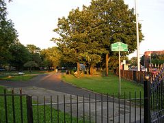
Victoria Park, Manchester
Victoria Park is a suburban area of Manchester, England . Victoria Park lies approximately two miles south of Manchester city centre . It is located between Rusholme and Longsight .

Dalton-Ellis Hall
Dalton-Ellis Hall is a hall of residence complex at the University of Manchester . It is situated in the south of the city on Conyngham Road in Victoria Park, next to St Chrysostom’s Church . It has 279 male and female residents in catered accommodation .
Ardwick
Ardwick is a district of Manchester in North West England, one mile south east of the city centre . The population of the Ardwick Ward at the 2011 census was 19,250 . Historically in Lancashire, by the mid-nineteenth century Ardwick had grown from being a village into a wealthy suburb of Manchester . By the end of that century it had become heavily industrialised .
Visit Hulme plaques
 189
189
plaques
here Hulme has 189 physical plaques in tourist plaque schemes for you to explore via Walkfo Hulme plaques audio map when visiting. Plaques like National Heritage’s “Blue Plaques” provide visual geo-markers to highlight points-of-interest at the places where they happened – and Walkfo’s AI has researched additional, deeper content when you visit Hulme using the app. Experience the history of a location when Walkfo local tourist guide app triggers audio close to each Hulme plaque. Explore Plaques & History has a complete list of Hartlepool’s plaques & Hartlepool history plaque map.


 Trying to encourage visitors to Hulme?