Welcome to Visit High Lane, Greater Manchester Places
The Walkfo guide to things to do & explore in High Lane, Greater Manchester
 Visit High Lane, Greater Manchester places using Walkfo for free guided tours of the best High Lane, Greater Manchester places to visit. A unique way to experience High Lane, Greater Manchester’s places, Walkfo allows you to explore High Lane, Greater Manchester as you would a museum or art gallery with audio guides.
Visiting High Lane, Greater Manchester Walkfo Preview
High Lane (population 5,853) is a village in the Metropolitan Borough of Stockport, Greater Manchester. It is on the Macclesfield Canal, 5 miles (8 km) from Stockport. When you visit High Lane, Greater Manchester, Walkfo brings High Lane, Greater Manchester places to life as you travel by foot, bike, bus or car with a mobile phone & headphones.
High Lane, Greater Manchester Places Overview: History, Culture & Facts about High Lane, Greater Manchester
Visit High Lane, Greater Manchester – Walkfo’s stats for the places to visit
With 23 audio plaques & High Lane, Greater Manchester places for you to explore in the High Lane, Greater Manchester area, Walkfo is the world’s largest heritage & history digital plaque provider. The AI continually learns & refines facts about the best High Lane, Greater Manchester places to visit from travel & tourism authorities (like Wikipedia), converting history into an interactive audio experience.
High Lane, Greater Manchester landmarks
There is a Grade II listed war memorial in the centre of the village, close to the church of St Thomas. The Old Court House (dated 1772) is one of a few older houses along the main road. Wybersley Hall sits within High Lane Park overlooking two junior football pitches.
High Lane, Greater Manchester geography / climate
High Lane is 5 miles (8 km) south-east of Stockport. It is bordered by the villages of Marple to the north; Hazel Grove to the west; Disley to the east and Poynton to the south. Most of the village is spread along the A6 road, which connects Luton and Carlisle.
Why visit High Lane, Greater Manchester with Walkfo Travel Guide App?
 You can visit High Lane, Greater Manchester places with Walkfo High Lane, Greater Manchester to hear history at High Lane, Greater Manchester’s places whilst walking around using the free digital tour app. Walkfo High Lane, Greater Manchester has 23 places to visit in our interactive High Lane, Greater Manchester map, with amazing history, culture & travel facts you can explore the same way you would at a museum or art gallery with information audio headset. With Walkfo, you can travel by foot, bike or bus throughout High Lane, Greater Manchester, being in the moment, without digital distraction or limits to a specific walking route. Our historic audio walks, National Trust interactive audio experiences, digital tour guides for English Heritage locations are available at High Lane, Greater Manchester places, with a AI tour guide to help you get the best from a visit to High Lane, Greater Manchester & the surrounding areas.
“Curated content for millions of locations across the UK, with 23 audio facts unique to High Lane, Greater Manchester places in an interactive High Lane, Greater Manchester map you can explore.”
Walkfo: Visit High Lane, Greater Manchester Places Map
23 tourist, history, culture & geography spots
High Lane, Greater Manchester historic spots | High Lane, Greater Manchester tourist destinations | High Lane, Greater Manchester plaques | High Lane, Greater Manchester geographic features |
| Walkfo High Lane, Greater Manchester tourism map key: places to see & visit like National Trust sites, Blue Plaques, English Heritage locations & top tourist destinations in High Lane, Greater Manchester | |||
Best High Lane, Greater Manchester places to visit
High Lane, Greater Manchester has places to explore by foot, bike or bus. Below are a selection of the varied High Lane, Greater Manchester’s destinations you can visit with additional content available at the Walkfo High Lane, Greater Manchester’s information audio spots:

Mellor Mill
Mellor Mill, also known as Bottom’s Mill, was a cotton mill in Marple, Greater Manchester built by Samuel Oldknow in 1793. It was a six-storey, 42-foot wide and 210-foot (64 m) long mill. It reached its peak production in 1804, when 10,080 spindles were operating.

Torkington
Torkington in Greater Manchester is part of the Metropolitan Borough of Stockport. It is located in the Metropolitan borough of the city, Stockport, and is situated in the North East of the South East of Manchester.
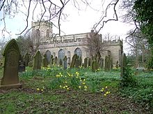
St Mary’s Church, Disley
St Mary’s Church is on a hill overlooking Disley, Cheshire, England. It is recorded in the National Heritage List for England as a designated Grade II* listed building. Its benefice is combined with that of St John, Furness Vale.
Visit High Lane, Greater Manchester plaques
 1
1
plaques
here High Lane, Greater Manchester has 1 physical plaques in tourist plaque schemes for you to explore via Walkfo High Lane, Greater Manchester plaques audio map when visiting. Plaques like National Heritage’s “Blue Plaques” provide visual geo-markers to highlight points-of-interest at the places where they happened – and Walkfo’s AI has researched additional, deeper content when you visit High Lane, Greater Manchester using the app. Experience the history of a location when Walkfo local tourist guide app triggers audio close to each High Lane, Greater Manchester plaque. Explore Plaques & History has a complete list of Hartlepool’s plaques & Hartlepool history plaque map.


 Trying to encourage visitors to High Lane, Greater Manchester?