Welcome to Visit Hethersett Places
The Walkfo guide to things to do & explore in Hethersett
 Visit Hethersett places using Walkfo for free guided tours of the best Hethersett places to visit. A unique way to experience Hethersett’s places, Walkfo allows you to explore Hethersett as you would a museum or art gallery with audio guides.
Visiting Hethersett Walkfo Preview
Hethersett is a large village and electoral ward in the county of Norfolk, England. It covers an area of 4.22 sq mi (10.9 km) and had a population of 5,441 in 2,321 households at the 2001 census, increasing to 5,691 at the 2011 census. It became the first village or town to receive a Prime Minister’s Big Society Award for its outstanding contribution to the Olympic legacy and sport and fitness in general. When you visit Hethersett, Walkfo brings Hethersett places to life as you travel by foot, bike, bus or car with a mobile phone & headphones.
Hethersett Places Overview: History, Culture & Facts about Hethersett
Visit Hethersett – Walkfo’s stats for the places to visit
With 17 audio plaques & Hethersett places for you to explore in the Hethersett area, Walkfo is the world’s largest heritage & history digital plaque provider. The AI continually learns & refines facts about the best Hethersett places to visit from travel & tourism authorities (like Wikipedia), converting history into an interactive audio experience.
Hethersett history
The Parish of Hethersett is, by Norfolk standards, a large one, covering 2,695 acres; it was the main settlement in the ancient Hundred of Humbleyard; it lies in the Deanery of Humbleyard and in the South Norfolk district. Hethersett stretched three miles from east to west along the line of the B1172 (the old Norwich to London road) and two miles from northwest to southeast. The road cuts it into slightly larger northern and smaller southern divisions; the Norwich to Cambridge railway follows its southern boundary but otherwise the parish has no obvious physical limits and presumably represents the land needed to feed the Saxon settlements that grew up in the area. Residential developments to the North of the village, toward little Melton has given rise to the discovery of a Roman settlement, possibly including a Roman Villa. Residential development to the north west of the village had been put on hold as a result of the discovery of this Roman find. Trial excavations in late 2020 established that further investigations are needed. From the west, moving in a clockwise direction, the parishes contiguous with this are those of Wymondham, Great Melton, Little Melton, Colney, Cringleford, Intwood (now part of Keswick) and Ketteringham. The meaning of the name of Hethersett is not clear; the guide to the church suggests the enclosure for the deer: ‘heedra’ is an Old English word for heather or heath, and ‘set’ is Old English for a dwelling place, camp, stable or fold. This would give the meaning as being that of a camp or enclosure on the heath. Although the name is Saxon, we have evidence of earlier settlers; a New Stone Age long barrow (burial mound) lies in Cantley and two areas of Roman pottery have been found in the northern part of the parish; in view of the existence of a great Roman centre at Caistor St Edmund, the latter finds are nor surprising. The earliest description of Hethersett comes to us in the Domesday Book account of 1086; it would seem that there were perhaps 400 people in the parish by that time. The Lord of the Manor had 87 sheep and seven hives of bees, perhaps gathering nectar from the heather, among his possessions. The Domesday Book also mentions the church with its 60 acres of land, a handsome endowment: no Saxon or Norman work remains to be seen because of later rebuilding. There is also mention of a second church and this presumably applies to the church of Cantley, then a separate parish, of which nothing now remains except some mounds in a pasture to the north of Cantley Farm. This small parish was amalgamated with its larger neighbour in 1397 although the church was used as a chapel until the 16th century. During medieval times, the parish seems to have had an uneventful history. The present parish church was begun in 1320 and the tower and nave arcades and windows are in the decorated style (1290–1330). It is dedicated to St Remigius (438–533), the great Bishop of Rheims. Remigius de Hethersete, a priest who also participated in the building of Hingham Church, may have suggested the dedication in honour of his name-saint. The clerestory of the nave and the lovely north porch were added in the 15th century. The Domesday village had become three manors or at least was part of three manors by the 13th century. These became known as Hethersett Cromwells, Hethersett Hacons and Hethersett Woodhall. Cromwells was the chief manor and its manor house was probably in the meadows immediately to the south of Church Farm. Hacons and Woodhall sites are less certain and the lands of these manors lay in the neighbouring parishes as well as Hethersett. Thickthorn seems to have had a separate hamlet with its own moated house near to the present Hall. As the community grew during the 16th century, the commons became especially important to those who had little other land. Hethersett with its open green, Lynch Green, would have had cottages and farm buildings around the edge. Lynch Green opened out westwards to the great common where Wymondham, Great Melton and Hethersett parishes met. The most famous event in Hethersett’s history took place in 1549 when Robert Kett and his men tore down John Flowerdew’s hedges on Hethersett common. Kett’s Oak is said to commemorate the spot where rebels gathered before marching to Mousehold Heath in Norwich. In the 17th and 18th centuries, several fine houses were built or added to in the village. Access was improved by the turnpiking of the main road in the middle of the 17th century. Farmhouses of some style were built at Hill Farm, Whitehouse Farm, Cedar Grange and Beech Grove as yeomen bought up land and some of the common fields disappeared. Woodhall, the Priory and the Old Hall were modernised and extended by Norwich merchants such as John Buckle, Mayor of Norwich in 1793, who lived in the Priory. In the early 19th century, Hethersett Hall was built and its attractive park and ornamental lake laid out by the Back family. The Hill House estate was laid out in the 1780s by a Mr Brown. Perhaps the greatest change of all came as a result of the enclosure award of 1799 when Lynch Green was divided up and disappeared as an open space, although the tithe map shows that there were still only a few houses along Mill Road and Great Melton Road in 1844. In Victorian Miniature, Owen Chadwick gives us a detailed account of life in the area in the middle of the 19th century. The Rev William Waite Andrew, the Vicar of Ketteringham and one of the two central characters in the book, lived at Woodhall which he bought for £3,600 in 1841, and to which he added a new western extension. In the 19th century, village crafts and small industries employed a number of men locally; two windmills existed, one giving the name to Mill Road. Three smithies existed in the village in the 1880s and carriages were built at Harveys. There was a brickyard in Queen’s Road. The railway lasted 120 years; it arrived as the Norwich & Brandon Railway in 1846, but was closed to passengers in 1966. Hethersett lies so close to Norwich that many think of it as just another of its suburbs. It is, however, a separate community with its own vitality and quite a marked community spirit. This shows itself in a range of activities in the village but also in more permanent ways in items provided for the village through the efforts of villagers. These include a learner swimming pool in the Middle School, a bench in the memory of Zita James sited at the church, a cassette library, the conversion of School House in the Middle School to provide a Music Room, the erection of a village sign, village street plans, the Jubilee Youth Club and the Scout and Guide Hut. Trees have been planted in various parts of the village and a memorial plaque has been erected on the site of the old School (No 3 Queen’s Road). The Parish Council have provided litter bins, salt and grit bins for use in icy weather and “Fido” bins. The village also has a thriving football team, Hethersett Athletic, that caters for boys and girls football from around 5 years old to men’s and women’s football teams. In September 1994 the new village hall was opened in Back Lane, funded mostly by Wilcon Homes under a Section 106 Planning Gain agreement. The hall has a purpose built stage with seating for 250 and also provides a committee room for 50 people. In 1801 Hethersett had a population of 696 (in 90 houses), by 1851 this number had nearly doubled, but it never reached this total again until 1931; since then and especially in the last 20 years or so, Hethersett’s population has risen to over 5,000. It is now as large as some of Norfolk’s market towns. During the past seven years the Steepletower site near the parish church has expanded rapidly; by 1995 about 360 dwellings had been completed out of a projected figure of 520. Water supply, mains drains, a new surface water drainage system, street lights, branch library, new first school and high school, reflect the demands of a rapidly growing population for improved services. The village has its own post office, surgery, pharmacy and dentist and the square in Great Melton Road (known to locals as Oak Square) has is the centre of the shopping works fir the village. Here you can find a national chain supermarket, two independent take away food outlets, the post office, a hairdressers, an independent gift shop and an estate agent. Other shops on the same road consist of two charity shops, a butchers and a chemist. One other independent shop selling food, alcohol and newspapers is adjacent to the recreation field on Recreation Road. The village has two pubs, the Queens Head and the Kings Head which will reopen in April 2021 under the tenure of landlord JustinHarvey, also the landlord of the Green Dragon in nearby wymondham. The village also has a social club that is home to a bowls club and has a popular clubhouse bar and function room. In 2020 Norfolk Police bought the former Old Hall School and this will become a police training centre, for Norfolk police and other constabularies around the UK. The construction of the A11 dual carriageway from Cringleford to Wymondham initially reduced the traffic using the old A11 (now B1172), but with the growth of nearby Wymondham in terms of residential development along the Norwich Road corridor since 2018, the amount of traffic using the B1172 continues to increase. The effects of the opening of the Norwich Southern Bypass are less direct, but already land nearby has come under pressure for development. Hethersett’s situation so close to Norwich with its excellent facilities and transport links means pressures for growth and development (both desirable and undesirable) will continue in the foreseeable future. Despite the substantial growth of housing over the last 40 years, the Parish of Hethersett still has much wildlife interest. The built up area covers less than 25% of this large parish, leaving a considerable acreage of arable land and open spaces. Two areas of much interest are the Kissing and Suckling Lanes, both public footpaths. From the former the walker has excellent views of the park with its remaining large trees and lake. Members of the thrush family regularly feed here; sometimes in early spring these include large gatherings of fieldfares and redwings before they depart for their eastern breeding grounds. Both Canada and Barnacle geese breed in the vicinity of the lake where mallards, moorhens and coots are regularly seen. Commorants also visit these waters with a variety of other ducks dropping in from time to time. The careful observer can often see a patient heron or even a kingfisher waiting for a catch. There are many interesting walks in the parish including footpaths to the Village Pit and from New Road to Great Melton church. They contain old hedges and mature trees providing suitable homes for various birds. Hethersett continues to grow but it remains a village with much natural beauty for those with the eyes and ears willing to seek it.
Why visit Hethersett with Walkfo Travel Guide App?
 You can visit Hethersett places with Walkfo Hethersett to hear history at Hethersett’s places whilst walking around using the free digital tour app. Walkfo Hethersett has 17 places to visit in our interactive Hethersett map, with amazing history, culture & travel facts you can explore the same way you would at a museum or art gallery with information audio headset. With Walkfo, you can travel by foot, bike or bus throughout Hethersett, being in the moment, without digital distraction or limits to a specific walking route. Our historic audio walks, National Trust interactive audio experiences, digital tour guides for English Heritage locations are available at Hethersett places, with a AI tour guide to help you get the best from a visit to Hethersett & the surrounding areas.
“Curated content for millions of locations across the UK, with 17 audio facts unique to Hethersett places in an interactive Hethersett map you can explore.”
Walkfo: Visit Hethersett Places Map
17 tourist, history, culture & geography spots
Hethersett historic spots | Hethersett tourist destinations | Hethersett plaques | Hethersett geographic features |
| Walkfo Hethersett tourism map key: places to see & visit like National Trust sites, Blue Plaques, English Heritage locations & top tourist destinations in Hethersett | |||
Best Hethersett places to visit
Hethersett has places to explore by foot, bike or bus. Below are a selection of the varied Hethersett’s destinations you can visit with additional content available at the Walkfo Hethersett’s information audio spots:
 | Quadram Institute The Quadram Institute is a centre for food and health research. It is located on the outskirts of Norwich, England, United Kingdom. The Institute is housed in a purpose-built facility on the Norwich Research Park that opened in 2018. |
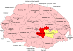 | Forehoe and Henstead Rural District Forehoe and Henstead Rural Districts were formed under the Local Government Act 1894 based on rural sanitary districts of the same names. They lay generally south of Norwich. In 1935 the Wymondham parish of Forehoe RD was created a new Wymondsham Urban District. The remainder of Henstead RD apart from an island in the River Yare were merged. In 1974 the merged district was abolished and became part of the South Norfolk district. |
Visit Hethersett plaques
 0
0
plaques
here Hethersett has 0 physical plaques in tourist plaque schemes for you to explore via Walkfo Hethersett plaques audio map when visiting. Plaques like National Heritage’s “Blue Plaques” provide visual geo-markers to highlight points-of-interest at the places where they happened – and Walkfo’s AI has researched additional, deeper content when you visit Hethersett using the app. Experience the history of a location when Walkfo local tourist guide app triggers audio close to each Hethersett plaque. Currently No Physical Plaques.


 Trying to encourage visitors to Hethersett?