Welcome to Visit Hackbridge Places
The Walkfo guide to things to do & explore in Hackbridge
 Visit Hackbridge places using Walkfo for free guided tours of the best Hackbridge places to visit. A unique way to experience Hackbridge’s places, Walkfo allows you to explore Hackbridge as you would a museum or art gallery with audio guides.
Visiting Hackbridge Walkfo Preview
Hackbridge is 8.8 miles (15 km) south-west of Charing Cross. It is just over two miles north-east of the town of Sutton itself. When you visit Hackbridge, Walkfo brings Hackbridge places to life as you travel by foot, bike, bus or car with a mobile phone & headphones.
Hackbridge Places Overview: History, Culture & Facts about Hackbridge
Visit Hackbridge – Walkfo’s stats for the places to visit
With 156 audio plaques & Hackbridge places for you to explore in the Hackbridge area, Walkfo is the world’s largest heritage & history digital plaque provider. The AI continually learns & refines facts about the best Hackbridge places to visit from travel & tourism authorities (like Wikipedia), converting history into an interactive audio experience.
Hackbridge toponymy
The district takes its name from Hack Bridge, a bridge over the River Wandle. The origin of the name is obscure; it may mean “Haka’s bridge”, or “bridge of the hogs”. Early versions include Hakebridge, Hagbridge and Hogbridge.
Hackbridge geography / climate

Hackbridge is located on the River Wandle in the London Borough of Sutton, about two miles north east of the town of Sutton itself. It is mainly Edwardian and early 20th century in the central shopping area with surrounding suburbs in Tudorbethan semi-detached style. The parish church of Hackbridge and Beddington Corner was built in 1931.
Why visit Hackbridge with Walkfo Travel Guide App?
 You can visit Hackbridge places with Walkfo Hackbridge to hear history at Hackbridge’s places whilst walking around using the free digital tour app. Walkfo Hackbridge has 156 places to visit in our interactive Hackbridge map, with amazing history, culture & travel facts you can explore the same way you would at a museum or art gallery with information audio headset. With Walkfo, you can travel by foot, bike or bus throughout Hackbridge, being in the moment, without digital distraction or limits to a specific walking route. Our historic audio walks, National Trust interactive audio experiences, digital tour guides for English Heritage locations are available at Hackbridge places, with a AI tour guide to help you get the best from a visit to Hackbridge & the surrounding areas.
“Curated content for millions of locations across the UK, with 156 audio facts unique to Hackbridge places in an interactive Hackbridge map you can explore.”
Walkfo: Visit Hackbridge Places Map
156 tourist, history, culture & geography spots
Hackbridge historic spots | Hackbridge tourist destinations | Hackbridge plaques | Hackbridge geographic features |
| Walkfo Hackbridge tourism map key: places to see & visit like National Trust sites, Blue Plaques, English Heritage locations & top tourist destinations in Hackbridge | |||
Best Hackbridge places to visit
Hackbridge has places to explore by foot, bike or bus. Below are a selection of the varied Hackbridge’s destinations you can visit with additional content available at the Walkfo Hackbridge’s information audio spots:
 | Old Town, Croydon Old Town is a small neighbourhood and main road next to Croydon in the London Borough of Croyden . It is located on the main road and is located in Old Town, a small part of the London borough, and is named Old Town . |
 | Wandle Park, Croydon Wandle Park is an 8.5-hectare (21-acre) park located in the Broad Green Ward of Croydon, south London, England . It was opened in 1890 by the Mayor of the city . The site is protected by Fields in Trust through a legal “Deed of Dedication” safeguarding the future of the space . |
 | David Lean Cinema David Lean Cinema is a small cinema established in Croydon, London . It is accessed from the Clocktower arts complex on Katharine Street . |
 | Wettern House Wettern House was built in 1963, two years before the County Borough of Croydon disbanded . It was demolished in November 2005 to make way for Ruskin Square . The building had 12 floors and a structural height of 38 metres . |
 | Ruskin Square Ruskin Square is a project to redevelop a parcel of land between East Croydon railway station and the existing town centre . It is part of the major regeneration scheme which has been subject to substantial public debate . |
 | Mitcham Road Cemetery Mitcham Road Cemetery, previously called Croydon Cemetery, is a cemetery located next to Mitcham Common . It is part of the London Borough of Croyden, London, and is located in the centre of the city . There is also a chapel located inside the cemetery . |
 | Norbury Estate The Norbury Estate originated as a London County Council cottage estate . It was built between 1901 and 1920 in what is now the north of the London Borough of Croydon . The estate was declared a conservation area in 2008 . |
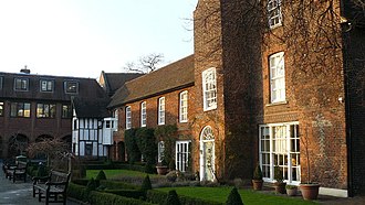 | Croydon Palace Croydon Palace was the summer residence of the Archbishop of Canterbury for over 500 years. Regular visitors included Henry III and Queen Elizabeth I. Now known as “Old Palace”, the buildings are still in use as the Old Palace School. |
Visit Hackbridge plaques
 26
26
plaques
here Hackbridge has 26 physical plaques in tourist plaque schemes for you to explore via Walkfo Hackbridge plaques audio map when visiting. Plaques like National Heritage’s “Blue Plaques” provide visual geo-markers to highlight points-of-interest at the places where they happened – and Walkfo’s AI has researched additional, deeper content when you visit Hackbridge using the app. Experience the history of a location when Walkfo local tourist guide app triggers audio close to each Hackbridge plaque. Explore Plaques & History has a complete list of Hartlepool’s plaques & Hartlepool history plaque map.


 Trying to encourage visitors to Hackbridge?