Visit Gwynedd Place – things to do & explore
 Visit Gwynedd places on a day-trip, weekend away or holiday – and Walkfo becomes your personal digital tour guide to Gwynedd things to do.
Visiting Gwynedd Overview
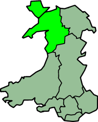
The Llŷn Peninsula and most of Snowdonia National Park are in Gwynedd . The current area is 2,548 square kilometres (984 square miles) with a population of 121,874 as measured in the 2011 Census . As a local government area, it is the second largest in Wales in terms of land area .
When you visit Gwynedd, Gwynedd history becomes available at the places you travel to by foot, bike, bus or car with a mobile phone & headphones.
Gwynedd places overview by Walkfo
Visit to Gwynedd stats
With 627 tourism audio plaques & places for you to explore in Gwynedd, Walkfo is the world’s largest heritage & history digital plaque provider in the world. Our AI continually learns & refines content about the best Gwynedd places to visit from online information authorities like Wikipedia for current & history, and converts it into an audio experience.
Gwynedd history
Gwynedd was an independent kingdom from the end of the Roman period until the 13th century, when it was conquered by England. It was one of eight Welsh counties created on 1 April 1974 under the Local Government Act 1972. The county was divided into five districts: Aberconwy, Arfon, Dwyfor, Meirionnydd and Anglesey. The Local Government (Wales) Act 1994 abolished the 1974 county (and the five districts) and its area was divided. As a unitary authority, the modern entity no longer has any districts.
Gwynedd etymology
In the past, historians assumed that the Celtic source of the word “Gwynedd” meant “collection of tribes” – the same root as the Irish fine, meaning “tribe” The Irish settled in NW Wales, and in Dyfed, at the end of the Roman era. The name was revived when the new county was formed in 1974.
When you visit Gwynedd
You can visit Gwynedd places and use Walkfo Gwynedd to discover the history & things to do in Gwynedd whilst walking with our free digital tour app. Walkfo Gwynedd has 627 places on our Gwynedd map with history, culture & travel facts that you explore the same way you would at a museum or art gallery with information audio headset. With Walkfo, you can travel by foot, bike or bus throughout Gwynedd, being in the moment, without digital distraction or limits to a specific walking route – you choose where you want to go, when you want to go and Walkfo Gwynedd will keep up.
–
With millions of places including tourist walks, Gwynedd travel destinations, National Trust locations converted to audio experiences, our Gwynedd places AI guide will help you get the best from your visit to Gwynedd & the surrounding areas. The Gwynedd places app for iPhone & Android delivers hidden history, interesting culture and amazing facts in interactive audio stories in response to where you walk at National Heritage sites, tourist attractions, historic locations or city streets, with no predefined walk map requirements.
“The Walkfo AI has curated content for millions of locations across the UK, with 627 audio facts unique to Gwynedd places forming an interactive Gwynedd map for you to explore.”
Walkfo’s Visit Gwynedd Places Map
627 tourist, history, culture & geography spots
Gwynedd historic spot | Gwynedd tourist destination | Gwynedd plaque | Gwynedd geographic feature |
| Walkfo Gwynedd tourism map key: places to see & visit like National Trust sites, Blue Plaques, English Heritage locations & top tourist destinations in Gwynedd | |||
Best Gwynedd places to visit
Gwynedd has many places to explore by foot, bike or bus. Below are a selection of the varied Gwynedd’s destinations you can visit with additional content available at the Walkfo Gwynedd’s information audio spots:
 | Peniel Chapel Peniel Chapel (Welsh: Capel Peniel) is a former Calvinistic Methodist chapel in Tremadog, Gwynedd . It is one of five Grade I-listed nonconformist chapels in Wales . |
 | Ysbyty Alltwen Ysbyty Alltwen is a health facility in Tremadog, Gwynedd, Wales . It is managed by the Betsi Cadwaladr University Health Board . |
 | Moel y Gest Moel y Gest is a 263 m (863 ft) hill to the west of Porthmadog in North Wales . It is a very rocky hill with high topographic prominence because of the lower land that surrounds it on all sides . The views from the top are far ranging and include the Llŷn Peninsula, the Rhinogydd, Moelwynion, and Snowdon . |
 | Pen-yr-Orsedd quarry Pen-yr-Orsedd quarry was a slate quarry in the Nantlle Valley in North Wales . It was one of the last slate quarries operating in the area, finally closing in 1979 . |
 | Yr Eifl Yr Eifl is a group of hills on the north coast of the Llŷn Peninsula in Gwynedd, Wales. The OS Maps show a height of 564 metres, but a recent survey gives the height at 561 metres (1,841 feet) The views from the top summit reach as far as the Isle of Man, the Wicklow Mountains in Ireland and the Lake District. |
 | Pantperthog Pantperthog is 2 miles north of Machynlleth and 14 miles southeast of Dolgellau. The Afon Dulas forms the border between Gwynedd and Powys. Nearby is the former Llwyngwern quarry, now the Centre for Alternative Technology. |
 | Corris Craft Centre Corris Craft Centre is a craft and leisure complex in Corris on the A487 near Machynlleth, mid-Wales. It is sometimes referred to as King Arthur’s Labyrinth, one of the attractions on the site. |
 | Broad Vein Mudstone Formation The Broad Vein Mudstone Formation is an Ordovician lithostratigraphic group (a sequence of rock strata) in Mid Wales. The formation is between 400 metres (1,300 ft) and 560 metres thick and runs from Dinas Mawddwy south-west to Cardigan Bay at Tywyn. |
 | Ceiswyn Formation The Ceiswyn Formation is an Ordovician lithostratigraphic group (a sequence of rock strata) in Mid Wales. It is made up of interleaved beds of silty mudstones and siltstones. The formation runs diagonally across Mid Wales from close by Bala Lake to Cardigan Bay near Tywyn. |
 | Narrow Vein Mudstone Formation The Narrow Vein Mudstone Formation is an Ordovician lithostratigraphic group. It runs from Dinas Mawddwy south-west to Cardigan Bay at Tywyn. The formation is between 400 metres (1,300 ft) and 560 metres thick. |
Visit Gwynedd plaques
 30
30
plaques
here Gwynedd has 30 physical plaques within tourist plaque schemes for you to explore via Walkfo Gwynedd plaques when visiting. Plaque schemes such as National Heritage’s “Blue Plaques” provide visual geo-markers to highlight points-of-interest at the places where they happened. Where a plaque is available, Walkfo AI has done research to provide additional, deeper content when you visit Gwynedd using the app. Experience hidden history & stories at each location as the Walkfo local tourist guide app uses trigger audio close to each Gwynedd plaque. Explore Gwynedd Plaques & History has a complete list of Hartlepool’s plaques & Hartlepool history plaque map.


 Trying to encourage visitors to Gwynedd?