Welcome to Visit Grumbla Places
The Walkfo guide to things to do & explore in Grumbla
 Visit Grumbla places using Walkfo for free guided tours of the best Grumbla places to visit. A unique way to experience Grumbla’s places, Walkfo allows you to explore Grumbla as you would a museum or art gallery with audio guides.
Visiting Grumbla Walkfo Preview
Grumbla (Cornish: An Gromlegh, meaning the cromlech) is a hamlet in the parish of Sancreed, Cornwall, England, UK. When you visit Grumbla, Walkfo brings Grumbla places to life as you travel by foot, bike, bus or car with a mobile phone & headphones.
Grumbla Places Overview: History, Culture & Facts about Grumbla
Visit Grumbla – Walkfo’s stats for the places to visit
With 29 audio plaques & Grumbla places for you to explore in the Grumbla area, Walkfo is the world’s largest heritage & history digital plaque provider. The AI continually learns & refines facts about the best Grumbla places to visit from travel & tourism authorities (like Wikipedia), converting history into an interactive audio experience.
Grumbla history
The remains of a possible prehistoric tomb, or cromlech, can be found at grid reference SW40492948. It consists of a circular earth bank lined with big stones, but its identification is uncertain. A slab of rock, 50 metres (160 ft) north of this, set on edge and apparently artificially erected, could be the support of a dolmen, or the retaining circle of a barrow.
Grumbla toponymy
Recorded as Gromleigh in 1504, meaning cromlech or prehistoric tomb. Referred to as Grumbler in an advertisement on the front page of The Cornishman in 1880.
Grumbla geography / climate
Grumbla is a small area within the parish of Sancreed, Cornwall. The hamlet lies within the Cornwall Area of Outstanding Natural Beauty.
Why visit Grumbla with Walkfo Travel Guide App?
 You can visit Grumbla places with Walkfo Grumbla to hear history at Grumbla’s places whilst walking around using the free digital tour app. Walkfo Grumbla has 29 places to visit in our interactive Grumbla map, with amazing history, culture & travel facts you can explore the same way you would at a museum or art gallery with information audio headset. With Walkfo, you can travel by foot, bike or bus throughout Grumbla, being in the moment, without digital distraction or limits to a specific walking route. Our historic audio walks, National Trust interactive audio experiences, digital tour guides for English Heritage locations are available at Grumbla places, with a AI tour guide to help you get the best from a visit to Grumbla & the surrounding areas.
“Curated content for millions of locations across the UK, with 29 audio facts unique to Grumbla places in an interactive Grumbla map you can explore.”
Walkfo: Visit Grumbla Places Map
29 tourist, history, culture & geography spots
Grumbla historic spots | Grumbla tourist destinations | Grumbla plaques | Grumbla geographic features |
| Walkfo Grumbla tourism map key: places to see & visit like National Trust sites, Blue Plaques, English Heritage locations & top tourist destinations in Grumbla | |||
Best Grumbla places to visit
Grumbla has places to explore by foot, bike or bus. Below are a selection of the varied Grumbla’s destinations you can visit with additional content available at the Walkfo Grumbla’s information audio spots:

Brane Barrow
Brane Barrow is a Neolithic entrance grave located near the hamlet of Brane, Cornwall, England, UK. It is considered to be one of the smallest and best preserved burial monuments in Britain.

Caer Bran
Caer Bran Hill Fort is an archaeological site near Sancreed and Carn Euny Iron Age village, on the Penwith peninsula in Cornwall.
![]()
Sancreed Beacon
Sancreed Beacon is a Bronze Age archaeological site on the Penwith peninsula of Cornwall. On top of the hill are several stone cists and Bronze Age remains comprising burial mounds and the remains of the Bronze Age hut.

Lower Bostraze and Leswidden SSSI
Lower Bostraze And Leswidden SSSI is a biological Site of Special Scientific Interest. It is located on the Penwith Peninsula, Cornwall, England, a little to the east of St Just, approximately 8 km west of Penzance.

Tregeseal East stone circle
Tregeseal East (Cornish: Meyn an Dons, meaning “Stones of the Dance”; grid reference SW386323) is a heavily restored prehistoric stone circle. It is one surviving circle of three that once stood aligned along an east–west axis on the hillside to the south of Carn Kenidjack.
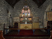
St Just in Penwith Parish Church
St Just in Penwith Parish Church is a parish church in the Church of England. It is located in St Just Penwith, Cornwall, UK.

St Just in Penwith
St Just (Cornish: Lan(n)ust), known as St Just in Penwith, is a town and civil parish in the Penwith district of Cornwall. It lies along the B3306 road which connects St Ives to the A30 road. The town of St Just is the most westerly town in mainland Britain and is situated approximately 8 miles (13 km) west of Penzance.

Drift Reservoir
Drift Reservoir is 1,200 yards (1,100 m) long and covers 65 acres (26 ha) The dam is at the southern end of the reservoir and the northern end splits into north-western and north-eastern shallow arms.
Visit Grumbla plaques
 0
0
plaques
here Grumbla has 0 physical plaques in tourist plaque schemes for you to explore via Walkfo Grumbla plaques audio map when visiting. Plaques like National Heritage’s “Blue Plaques” provide visual geo-markers to highlight points-of-interest at the places where they happened – and Walkfo’s AI has researched additional, deeper content when you visit Grumbla using the app. Experience the history of a location when Walkfo local tourist guide app triggers audio close to each Grumbla plaque. Currently No Physical Plaques.


 Trying to encourage visitors to Grumbla?