Welcome to Visit Grayshott Places
The Walkfo guide to things to do & explore in Grayshott
 Visit Grayshott places using Walkfo for free guided tours of the best Grayshott places to visit. A unique way to experience Grayshott’s places, Walkfo allows you to explore Grayshott as you would a museum or art gallery with audio guides.
Visiting Grayshott Walkfo Preview
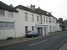
Grayshott is 4 miles (6.4 km) northwest of Haslemere by road, and 46 miles (74 km) southwest of central London. The name originally referred to a hamlet a mile west of the present village. The present civil parish is part of East Hampshire District. When you visit Grayshott, Walkfo brings Grayshott places to life as you travel by foot, bike, bus or car with a mobile phone & headphones.
Grayshott Places Overview: History, Culture & Facts about Grayshott
Visit Grayshott – Walkfo’s stats for the places to visit
With 24 audio plaques & Grayshott places for you to explore in the Grayshott area, Walkfo is the world’s largest heritage & history digital plaque provider. The AI continually learns & refines facts about the best Grayshott places to visit from travel & tourism authorities (like Wikipedia), converting history into an interactive audio experience.
Grayshott history
The earliest reference to Grayshott is in Winchester Bishopric records as Gravesetta (1185) and Graveschete (1200) In 1533 it was called Graveshotte, and the named changed to its current spelling probably in the 18th century. The name applied to a hamlet about a mile to the west of the present village. The village is mentioned in the Headley Parish Register of 1564 as Grashott. At the earliest census, 1841, the village had 114 inhabitants, increasing gradually.
Why visit Grayshott with Walkfo Travel Guide App?
 You can visit Grayshott places with Walkfo Grayshott to hear history at Grayshott’s places whilst walking around using the free digital tour app. Walkfo Grayshott has 24 places to visit in our interactive Grayshott map, with amazing history, culture & travel facts you can explore the same way you would at a museum or art gallery with information audio headset. With Walkfo, you can travel by foot, bike or bus throughout Grayshott, being in the moment, without digital distraction or limits to a specific walking route. Our historic audio walks, National Trust interactive audio experiences, digital tour guides for English Heritage locations are available at Grayshott places, with a AI tour guide to help you get the best from a visit to Grayshott & the surrounding areas.
“Curated content for millions of locations across the UK, with 24 audio facts unique to Grayshott places in an interactive Grayshott map you can explore.”
Walkfo: Visit Grayshott Places Map
24 tourist, history, culture & geography spots
Grayshott historic spots | Grayshott tourist destinations | Grayshott plaques | Grayshott geographic features |
| Walkfo Grayshott tourism map key: places to see & visit like National Trust sites, Blue Plaques, English Heritage locations & top tourist destinations in Grayshott | |||
Best Grayshott places to visit
Grayshott has places to explore by foot, bike or bus. Below are a selection of the varied Grayshott’s destinations you can visit with additional content available at the Walkfo Grayshott’s information audio spots:
![]()
Shottermill & Haslemere F.C.
Shottermill & Haslemere Football Club are currently members of the Surrey Intermediate League Premier Division. They play at the Woolmer Hill Sports Hill in Surrey.
Haslemere Educational Museum
Haslemere Educational Museum was founded in 1888 by the eminent surgeon Sir Jonathan Hutchinson. It contains nearly half a million specimens, artefacts, papers and images. It won a national award in 2012 and is an independent charity.

The Curry Club
The Curry Club was founded by Pat Chapman in 1982 to further the understanding and appreciation of the cuisines of the Indian subcontinent. In 2007 it became known as Pat Chapman’s Curry Club.

Devil’s Punch Bowl
The Devil’s Punch Bowl is a 282.2-hectare (697-acre) visitor attraction and biological Site of Special Scientific Interest. It is part of the Wealden Heaths Phase II Special Protection Area. The highest point of the rim of the bowl is Gibbet Hill, 272 metres (892 ft) above sea level.
Visit Grayshott plaques
 10
10
plaques
here Grayshott has 10 physical plaques in tourist plaque schemes for you to explore via Walkfo Grayshott plaques audio map when visiting. Plaques like National Heritage’s “Blue Plaques” provide visual geo-markers to highlight points-of-interest at the places where they happened – and Walkfo’s AI has researched additional, deeper content when you visit Grayshott using the app. Experience the history of a location when Walkfo local tourist guide app triggers audio close to each Grayshott plaque. Explore Plaques & History has a complete list of Hartlepool’s plaques & Hartlepool history plaque map.


 Trying to encourage visitors to Grayshott?