Welcome to Visit Gravesend Places
The Walkfo guide to things to do & explore in Gravesend
 Visit Gravesend places using Walkfo for free guided tours of the best Gravesend places to visit. A unique way to experience Gravesend’s places, Walkfo allows you to explore Gravesend as you would a museum or art gallery with audio guides.
Visiting Gravesend Walkfo Preview
Gravesend is situated 21 miles (35 km) east-southeast of Charing Cross (central London) on the south bank of the River Thames and opposite Tilbury in Essex. Located in the diocese of Rochester, it is the administrative centre of the Borough of Gravesham. When you visit Gravesend, Walkfo brings Gravesend places to life as you travel by foot, bike, bus or car with a mobile phone & headphones.
Gravesend Places Overview: History, Culture & Facts about Gravesend
Visit Gravesend – Walkfo’s stats for the places to visit
With 48 audio plaques & Gravesend places for you to explore in the Gravesend area, Walkfo is the world’s largest heritage & history digital plaque provider. The AI continually learns & refines facts about the best Gravesend places to visit from travel & tourism authorities (like Wikipedia), converting history into an interactive audio experience.
Gravesend history
Stone Age implements have been found in the locality since the 1900s. Domesday Book recorded mills, hythes, and fisheries here. Milton Chantry is Gravesend’s oldest surviving building and dates from the early 14th century. The current Gravesend Town Hall was completed in 1764 and is now a venue for weddings and civil partnership ceremonies.
Gravesend culture & places
Charles Dickens lived at Gad’s Hill Place, 2 miles (3.2 km) east of Gravesend and specifically mentions the town and its environs in at least three of his novels. Gravesend is briefly mentioned in the 1818 novel Frankenstein by Mary Shelley. The 1952 film “The Long Memory” starring John Mills was filmed in and around Gravesend.
Gravesend toponymy

Gravesham was recorded as Gravesham in the Domesday Book of 1086 when it belonged to Odo, Earl of Kent and Bishop of Bayeux, the half-brother of William the Conqueror. Frank Carr asserts that the name derives from the Saxon Gerevesend, the end of the authority of the Portreeve. In Brooklyn, New York, the neighbourhood of Gravesend is said by some to have been named for ‘s-Gravenzande.
Gravesend landmarks
Gravesend Town Pier

Gravesend has the world’s oldest surviving cast iron pier, built in 1834. It is a unique structure having the first known iron cylinders used in its construction. The pier was completely refurbished in 2004 and now features a bar and restaurant.
Royal Terrace Pier

Royal Terrace Pier is in constant 24-hour use, as part of the Port of London Authority main operations centre. Built in 1844, the initial construction was funded by the Gravesend Freehold Investment Company, at a cost of £9,200. It was where Princess Alexandra of Denmark arrived on her way to marry Edward, Prince of Wales, in 1865.
Gravesend Clock Tower, Milton Road

The clock tower was built in 1887 to commemorate the 50th year of Queen Victoria’s reign. It is based on the design of the Elizabeth Tower in the Palace of Westminster. The centre of the clock is measured at 50 feet (15 m) above ground and the face measures 5 ft 6 in (1.68 m) in diameter.
Pocahontas statue

An American sculptor, William Ordway Partridge, created a life-size statue of Pocahontas in 1922. Queen Elizabeth II viewed this statue in 1957 and again on 4 May 2007, while visiting Jamestown on the 400th anniversary of foundation. On 5 October 1958, an exact replica of Partridge’s statue was dedicated as a memorial at St George’s Parish Church.
Windmill Hill
Windmill Hill, named after its former windmills, offers extensive views across the Thames. The hill was the site of a beacon in 1377, instituted by King Richard II, and still in use 200 years later at the time of the Spanish Armada. The last surviving windmill is reported as having been destroyed by fire during Mafeking Night celebrations in 1900. During World War I an Imperial German Navy airship passed over the hill, dropping bombs on it.
Gravesend Power Station
Gravesend power station was built by the Gravesend Corporation in 1902–03 to supply local demand for electricity. It was built on the south side of the basin at the west end of the Thames and Medway canal. The buildings were demolished in 1995.
Gravesend geography / climate
Gravesend is located at a point where the lowest point of the dip slope of the North Downs reaches the Thames. The settlement was established as it was a good landing place and sheltered by the prominent height of Windmill Hill. From its origins as a landing place, Gravesend gradually extended southwards and eastwards.
Why visit Gravesend with Walkfo Travel Guide App?
 You can visit Gravesend places with Walkfo Gravesend to hear history at Gravesend’s places whilst walking around using the free digital tour app. Walkfo Gravesend has 48 places to visit in our interactive Gravesend map, with amazing history, culture & travel facts you can explore the same way you would at a museum or art gallery with information audio headset. With Walkfo, you can travel by foot, bike or bus throughout Gravesend, being in the moment, without digital distraction or limits to a specific walking route. Our historic audio walks, National Trust interactive audio experiences, digital tour guides for English Heritage locations are available at Gravesend places, with a AI tour guide to help you get the best from a visit to Gravesend & the surrounding areas.
“Curated content for millions of locations across the UK, with 48 audio facts unique to Gravesend places in an interactive Gravesend map you can explore.”
Walkfo: Visit Gravesend Places Map
48 tourist, history, culture & geography spots
Gravesend historic spots | Gravesend tourist destinations | Gravesend plaques | Gravesend geographic features |
| Walkfo Gravesend tourism map key: places to see & visit like National Trust sites, Blue Plaques, English Heritage locations & top tourist destinations in Gravesend | |||
Best Gravesend places to visit
Gravesend has places to explore by foot, bike or bus. Below are a selection of the varied Gravesend’s destinations you can visit with additional content available at the Walkfo Gravesend’s information audio spots:

The Bat and Ball Ground
The Bat & Ball Ground is a cricket and sports ground in Gravesend, Kent. The ground was used as a first-class cricket venue by Kent County Cricket Club between 1849 and 1971. Gravesend Cricket Club have used the ground as their home since their formation in 1881. The site also has lawn bowls and tennis facilities.

Northfleet Urban Country Park
Northfleet Urban Country Park is in Northfleet, in Kent, England. The site is owned by and managed by Gravesham Borough Council. It is land encompassed by Springhead Road, Thames Way and (on its northern boundary) the railway.

Rosherville Gardens
Rosherville Gardens was a 19th-century pleasure garden in a disused chalk pit in Gravesend, Kent, England. It closed after the advent of the railways, when other tourist destinations became easy to reach. Structures still surviving at the gardens include a Grade II-listed bear pit, a hermit cave in a chalk grotto, an Italian garden central feature which also formed part of the Broadwalk.

Springhead, Kent
Springhead lies at the source of the River Ebbsfleet, just southwest of Gravesend. It is the point at which the High Speed 1 rail line meets the A2 road.

Milton Barracks
Milton Barracks was a military installation at Milton Road in Gravesend, Kent. It was located in the area of Gravesend in the early 1960s.

Gravesend Blockhouse
Gravesend Blockhouse was part of Henry VIII’s Device plan of 1539. It was built at a strategic point along the River Thames and was operational by 1540. It functioned in conjunction with Tilbury Fort on the other side of the river and was repaired in 1588 to deal with the threat of Spanish invasion.
Milton Chantry
Milton Chantry is a former chantry chapel in Gravesend, Kent. It houses the Chantry Heritage Centre, displaying a range of exhibits relating to Gravesend and Northfleet. It is designated by English Heritage as a Grade II* listed building.

Tilbury Riverside railway station
Tilbury Riverside railway station is located in the town of Tilbury in the borough and unitary authority of Thurrock in Essex. The station was 22 miles 46 chains (36.33 km) down the line from London Fenchurch Street station via Rainham.

Baker’s Hole
Baker’s Hole is a geological Site of Special Scientific Interest, mostly consisting of a back-filled quarry, adjacent to Ebbsfleet International railway station in Kent. It is a Geological Conservation Review site.

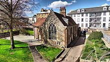
St James’ Church, West Tilbury
The church of St James is a grade II* listed former parish church in West Tilbury. It is constructed from flint and rubble and was restored by W Benton. It contains remnants of Early Norman windows.
Visit Gravesend plaques
 0
0
plaques
here Gravesend has 0 physical plaques in tourist plaque schemes for you to explore via Walkfo Gravesend plaques audio map when visiting. Plaques like National Heritage’s “Blue Plaques” provide visual geo-markers to highlight points-of-interest at the places where they happened – and Walkfo’s AI has researched additional, deeper content when you visit Gravesend using the app. Experience the history of a location when Walkfo local tourist guide app triggers audio close to each Gravesend plaque. Currently No Physical Plaques.


 Trying to encourage visitors to Gravesend?