Welcome to Visit Gorbals Places The Walkfo guide to things to do & explore in Gorbals
Visit Gorbals places using Walkfo for free guided tours of the best Gorbals places to visit. A unique way to experience Gorbals’s places, Walkfo allows you to explore Gorbals as you would a museum or art gallery with audio guides.
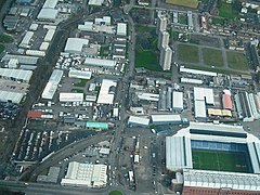
Visiting Gorbals Walkfo Preview By the late 19th century, it had become densely populated; rural migrants and immigrants were attracted by the new industries and employment opportunities of Glasgow. At its peak, during the 1930s, the wider Gorbals district had swollen in population to an estimated 90,000 residents. This gave the area a very high population density of around 40,000/km². When you visit Gorbals, Walkfo brings Gorbals places to life as you travel by foot, bike, bus or car with a mobile phone & headphones.
Gorbals Places Overview: History, Culture & Facts about Gorbals
Visit Gorbals – Walkfo’s stats for the places to visit
With 409 audio plaques & Gorbals places for you to explore in the Gorbals area, Walkfo is the world’s largest heritage & history digital plaque provider. The AI continually learns & refines facts about the best Gorbals places to visit from travel & tourism authorities (like Wikipedia), converting history into an interactive audio experience.
Gorbals history
Govan parish was one of the oldest possessions of the church in the region. The merk land of “Brigend and Gorbaldis” is referred to in several sources. The village of Brigend was named after the bridge which Bishop William Rae had built in 1345 over the River Clyde; it lasted until the 19th century. Lady Marjorie Stewart of Lochow was said to have had a hospital built for lepers and dedicated to St Ninian in 1350, although this year is contested by current historians’ estimates dating her life and activities. The lands on which the hospital was built were named St Ninian’s Croft. They were later incorporated into Hutchesontown. After the Protestant Reformation, in 1579 the church granted the land for ground rents (feued the land) to Sir George Elphinstone, a merchant who was Provost of Glasgow (1600–1606). The barony and regality of the Gorbals was confirmed in 1606 by a charter of King James VI, which vested Elphinstone’s son, also George, and his descendants. These powers descended to Sir Robert Douglas of Blackerstone, who in 1650 disponed (legally transferred) the Gorbals to Glasgow’s magistrates for the benefit of the city, the Trades’ House, and Hutchesons’ Hospital. The magistrates from then on collected the rents and duties and divided them: one fourth to the city, one fourth to the Trades’ House, and the remaining half to Hutchesons’ Hospital. In 1790 the lands were divided into lots for development; the city acquired the old feus of Gorbals and Bridgend, and also the Kingston portion of the Barony of Gorbals. The Trades’ House obtained a western section; and the remaining section lying to the east and south was allocated to Hutchesons’ Hospital. The Hutcheson’s Trust sub-feud a portion of their lands to an ambitious builder, James Laurie. (His grave, along with those of many other builders of Gorbals, is marked with well-carved masons’ implements, indicating his Master status. The gravestones are visible at the Burial Ground, established in 1715 and now called the Gorbals Rose Garden). Laurie built the first house in St Ninian Street in 1794. The districts are now known as the Gorbals, Laurieston, Tradeston, Kingston and Hutchesontown. The Little Govan estate, including a small village of the same name, were replaced by the eastern parts of Hutchesontown and Oatlands. The Gorbals was a successful industrial suburb in the late 19th century, and attracted many Protestant and Catholic immigrants from Ireland, especially from Ulster (in particular from County Donegal), and Italy, as well as Jewish immigrants from the Russian Empire and Eastern Europe. At one time most of the Jews in Scotland resided in this area. Industrial decay and over-population overwhelmed the area, which became a centre of poverty in the early 20th century. Gorbals railway station opened on 1 September 1877. Changes in the area meant a decrease in business, and it closed to passengers permanently on 1 June 1928. In the 1870s, the City Improvement Trust cleared away the old Gorbals village and redeveloped the area to form the new Gorbals Cross, at the same time developing new workers’ tenements around the former Oatlands Square. Much of the early Gorbals village was replaced by modern tenements in the street grid system being adopted in the city centre and notably in the south side including neighbouring Tradeston, Kinning Park and Hutchesontown. Along the riverside the classical terraces of Laurieston had taken shape. By 1914 the population of Gorbals and Hutchesontown was working locally and in commerce in the city centre, factories and warehouses nearby of carpetmaking, garment making, food manufacturing, ironworks, chemical works, railways, docks, shipping, construction and engineering; supporting some 16 schools, 15 churches, three synagogues, swimming baths and libraries, and a range of picture-houses, dance halls and two theatres. One theatre, the Royal Princess’s, is the Citizens Theatre today. Of its 19,000 houses 48% were now classed as overcrowded. To remedy over-crowding and lack of facilities within houses, local authority housing started in the 1920s on new areas being brought in by the city’s expansion of boundaries. Between 1921 and 1951 the population of Gorbals and Hutchesontown fell by 21%. By 1964 there were 12,200 houses. As with London and other major cities, in the post-war planning of the 1950s Glasgow Corporation decided to demolish many inner districts including Gorbals and Huchesontown, with families being dispersed to new outlying housing estates such as Castlemilk, in overspill agreements with New Towns such as East Kilbride, and others rehoused within the area but in huge concrete multi-storey towers. With its grid network of tenements facing directly onto the street, the neighbouring Govanhill district to the south (whose residents observed the demolition/modernisation in nearby areas such as the Gorbals and Pollokshaws with suspicion and successfully opposed the same fate befalling their homes, although they faced other challenges to improve their living conditions) offers some reminder of how the district used to look prior to its redevelopment. From the late 1990s, terraces of tenements in the modern style started to return and in the 21st century most of the concrete tower blocks have been demolished. Glasgow Corporation’s replacement of old, outdated and crowded housing with new high-rise towers of social housing in the 1960s greatly improved conditions but had social consequences. Lack of awareness of the effects of concentrating families resulted in poor design, and the low-quality construction of the concrete, 20-storey flats led to innumerable social and health problems among the residents. Many of the blocks developed mould and structural problems. Their designs prevented residents from visually controlling their internal and external spaces, adding to issues of social dysfunction. The Queen Elizabeth Square flats, designed by Sir Basil Spence, were demolished in 1993 to make way for a new generation of housing development. In 2004, Glasgow Housing Association announced plans to demolish more of the decaying high-rise blocks, and to comprehensively refurbish and re-clad others. Two of the Area D blocks (Caledonia Road), as well as the entire Area E (Sandiefield) and Laurieston (Stirlingfauld / Norfolk Court) high-rise estates, were demolished between 2002 and 2016. The two surviving Area D blocks, and the entire Area B or “Riverside” estate, designed by Robert Matthew, will be the only high-rise flats left in the Gorbals. New housing has been developed at lower density, with design elements to encourage residents’ and public safety. Much of the area, particularly Hutchesontown, was comprehensively redeveloped for a third time, providing a mix of private (market rate) and social housing. Earlier phases of this recent redevelopment tended toward yellow-brick reinterpretations of traditional tenements, in a post-modern style. More recent phases, masterplanned by Piers Gough, have employed noted modern architects such as Page/Park, Elder & Cannon and CZWG, resulting in more bold and radical designs, accompanied by innovative street plans and high-quality landscaping. They incorporated many pieces of public art. The Gorbals Leisure Centre opened in January 2000, and the number of shopping facilities in the area is on the rise. In 2005, fire destroyed the Catholic Church of Blessed John Duns Scotus as a result of a fallen candle. The church was restored and reopened for worship in September 2010. With much of the Hutchesontown area of the Gorbals improved, the urban and social-regeneration program expanded into the neighbouring Laurieston area to the west. In the early 2000s, a local heritage group started a campaign to reinstate the cross fountain, aided by people attracted to their Facebook page, Old Gorbals Pictures (Heritage Group). The group have discovered that a copy of the original cross fountain was installed on the Caribbean island of St Kitts & Nevis. They are working to engage professional help to digitally scan this object to allow for the manufacture of ‘Gorbals Cross, No 3’, to be installed in a new development near to where it originally stood. Since 1945, the Citizens Theatre has been based in the area at the former Royal Princess’s Theatre, an historic Victorian building. The area also has a local newspaper Local News for Southsiders. The area is served by Bridge Street and West Street subway stations and numerous bus routes. A controversial pub in the district is the Brazen Head, located at the northern end of Cathcart Road and one of few buildings to survive the mid-20th century redevelopment. Formerly a railway pub known as the Granite City, much of its clientele is Celtic F.C. supporters and has been associated with Irish Republicanism. Nearby is the architectural masterpiece of the Caledonia Road Church, Category A-listed mid-Victorian structure of remaining walls and tower designed by Alexander “Greek” Thomson.
Why visit Gorbals with Walkfo Travel Guide App?
You can visit Gorbals places with Walkfo Gorbals to hear history at Gorbals’s places whilst walking around using the free digital tour app. Walkfo Gorbals has 409 places to visit in our interactive Gorbals map, with amazing history, culture & travel facts you can explore the same way you would at a museum or art gallery with information audio headset. With Walkfo, you can travel by foot, bike or bus throughout Gorbals, being in the moment, without digital distraction or limits to a specific walking route. Our historic audio walks, National Trust interactive audio experiences, digital tour guides for English Heritage locations are available at Gorbals places, with a AI tour guide to help you get the best from a visit to Gorbals & the surrounding areas.
“Curated content for millions of locations across the UK, with 409 audio facts unique to Gorbals places in an interactive Gorbals map you can explore.”
Walkfo Gorbals tourism map key: places to see & visit like National Trust sites, Blue Plaques, English Heritage locations & top tourist destinations in Gorbals
Best Gorbals places to visit
Gorbals has places to explore by foot, bike or bus. Below are a selection of the varied Gorbals’s destinations you can visit with additional content available at the Walkfo Gorbals’s information audio spots:
Strathbungo Strathbungo grew up as a small village built along the Pollokshaws Road, one of the main arteries leading southwards from the centre of Glasgow, adjoined by the Camphill Estate, now part of Queens Park. The feudal superiors, the Maxwells of Pollok, preferred the name Marchtown, and this name is seen on some old maps.
St Andrew’s Cross, Glasgow St Andrew’s Cross, also known as Eglinton Toll, is a road junction in the south side of Glasgow, Scotland. The junction is known as the St Andrew Cross.
Tradeston Tradeston (Scots: Tredstoun) is a small district in the Scottish city of Glasgow adjacent to the city centre on the south bank of the River Clyde.
Moorepark, Glasgow Moorepark is a small area in the Scottish city of Glasgow. Situated south of the River Clyde and part of the former Burgh of Govan. It was colloquially referred to as ‘Wine Alley’ during the 20th century.
Sandyford, Glasgow Sandyford is north of the River Clyde and forms part of the western periphery of Glasgow. Formerly the name of a ward under Glasgow Town Council in the early 20th century. It is within a continuous area of dense urban development bordering several other neighbourhoods.
Athletes’ Village (Glasgow 2014) The Athletes Village for the 2014 Commonwealth Games was situated on a 35-hectare (86-acre) site, in the east end of Glasgow. The site was used as accommodation for up to 8,000 athletes and officials from all over the Commonwealth nations. After the games, the site was further developed and has up to 1,400 homes, a portion of which are available for social rental.
1990 Auckland Jewish daycare stabbing A mentally ill woman attacked the playground of the Jewish Kadimah School’s daycare in Central Auckland, stabbing four children with a knife. The attack continued as other young students looked on “in horror”, while members of staff ran to help the children. The woman, 52-year-old Pauline Janet Williamson, was eventually disarmed by a male teacher. The children, aged 6 to 8, were hospitalised immediately afterwards.
Tradeston Flour Mills explosion The Tradeston Flour Mills exploded on 9 July 1872. Eighteen people died and at least 16 were injured. The mill was owned by Matthew Muir & Sons and had been in operation for 30 years.
Equestrian statue of William III, Glasgow The equestrian statue of William III in Cathedral Square, Glasgow, is a 1735 work by an unknown sculptor. It is the work of a sculptor unknown.
Chinatown, Glasgow Chinatown in Glasgow is a Chinese shopping complex that opened in 1992 in Cowcaddens. Chinatown is a shopping complex in the Scottish city. It is located in the centre of the city’s Chinatown.
Visit Gorbals plaques
74 plaques hereGorbals has 74 physical plaques in tourist plaque schemes for you to explore via Walkfo Gorbals plaques audio map when visiting. Plaques like National Heritage’s “Blue Plaques” provide visual geo-markers to highlight points-of-interest at the places where they happened – and Walkfo’s AI has researched additional, deeper content when you visit Gorbals using the app. Experience the history of a location when Walkfo local tourist guide app triggers audio close to each Gorbals plaque. Explore Plaques & History has a complete list of Hartlepool’s plaques & Hartlepool history plaque map.
Experience Gorbals audio walks & tours
Walkfo guides for things to do / places to visit in Gorbals allows exploration as you would do an art gallery or museum. Walk close to one of Gorbals’s 409 historic places & our digital tour guide will create an audio story for that spot. With headphone connected, you can explore Gorbals freely by foot, bike or bus – with your own personal tour guide in your pocket.
Explore Gorbals Map App
Our visit Gorbals map shows you things-to-do & places you can visit in Gorbals & surrounding areas using the Walkfo digital audio tour guide app. Each spot has plaque, building, street or area information on history, culture or tourism.
You can set your Walkfo’s Gorbals tourist map to find historic & tourism spots within 1km, 3km & 5km of the Gorbals centre, depending on how far you plan to explore whilst you visit Gorbals area at LONG:-4.25222, LAT:55.84861.
Walkfo App
Walkfo
Walkfo is free to download & use (for a limited time period), so if you are looking to explore Gorbals, go to your App Store to search for “Walkfo” or follow a links below and install on your mobile phone. Walkfo is designed for use with headphones or AirPods, so you can walk & explore whilst learning about the things around you without digital distraction.
Things to do & visit in Gorbals / surrounding areas
● Pollokshaws Burgh Hall ● Pollokshaws ● St Margaret’s, Newlands, Glasgow ● Pollok F.C. ● Burrell Collection ● Pollok Country Park ● Merrylee ● Cathcart Trinity Church ● Millbrae Crescent ● Couper Institute Library ● Cathcart ● Langside ● Cathcart Castle ● Battlefield, Glasgow ● Battle of Langside ● Cathcart Old Church ● Glasgow Victoria Infirmary ● Mount Florida ● Lesser Hampden ● New Victoria Hospital ● Queen’s Park, Glasgow ● Hampden Park ● Scottish Football Hall of Fame ● Hampden Park (1873–83) ● King’s Park, Glasgow ● Crosshill Queen’s Park Church ● Camphill Queen’s Park Baptist Church ● Queen’s Park Govanhill Parish Church ● Langside Synagogue ● Toryglen Regional Football Centre
● Crossmyloof ● Titwood ● Crosshill, Glasgow ● Strathbungo ● Category Is Books ● Toryglen ● Rutherglen Glencairn F.C. ● Cathkin Park (1872–1903) ● Fireworks Village ● Govanhill Trinity Church ● Govanhill Picture House ● Strathbungo Parish Church ● Govanhill ● Govanhill Baths ● Rutherglen Town Hall ● Rutherglen ● Rutherglen Castle ● Shawfield ● CamGlen Radio ● Polmadie TRSMD ● Shawfield Amateurs F.C. ● Haggs Castle ● Rosebery Park ● Pollokshields Burgh Hall ● Pollokshields ● Sherbrooke Mosspark Church ● Shields Junction ● Pollokshields Parish Church ● Pollokshields Library ● Kinning Park (sports ground) ● Bellahouston ● Ibrox Parish Church ● Walmer Crescent ● Cessnock, Glasgow ● Tramway (arts centre) ● Kinning Park ● St Ninian’s, Pollokshields, Glasgow ● Glasgow Garden Festival ● House for an Art Lover ● Plantation, Glasgow ● Empire Exhibition, Scotland ● Royal Samaritan Hospital ● St Andrew’s Cross, Glasgow ● Ibrox Park (1887–99) ● Ibrox Stadium ● Kingston, Glasgow ● 1902 Ibrox disaster ● Govan Town Hall ● Pacific Quay ● BBC Radio Scotland ● BBC Pacific Quay ● Media Village Scotland ● Glasgow Science Centre ● Bell’s Bridge ● Glasgow Seaplane Terminal ● Glasgow Harbour Tunnel Rotundas ● Kingston Bridge, Glasgow ● Millennium Bridge, Glasgow ● Glasgow Tower ● SEC Armadillo ● Crowne Plaza Glasgow ● Tradeston ● Moorepark, Glasgow ● Laurieston, Glasgow ● New Bedford Cinema ● SSE Hydro ● NHS Louisa Jordan Hospital ● SEC Centre ● Tradeston Bridge ● Finnieston ● Finnieston distillery ● Broomielaw ● Glasgow, Paisley and Johnstone Canal ● Gorbals ● George V Bridge, Glasgow ● The Pyramid at Anderston ● Argyle Building, Glasgow ● TAG Theatre Company ● Caledonian Railway Bridge ● Citizens Theatre ● Glasgow Bridge, Glasgow ● Anderston Centre ● Kelvinhaugh, Glasgow ● Glasgow Sheriff Court ● Southern Necropolis ● Sandyford Henderson Memorial Church ● Adelphi Whisky ● Yorkhill Parade drill hall ● Optimo ● Glasgow Central Mosque ● New Govan Parish Church ● Sandyford, Glasgow ● The Tron Church at Kelvingrove ● Classic Grand ● Elphinstone Place ● Victoria Bridge, Glasgow ● Glenlee (ship) ● The Glasgow Gaiety Theatre ● St Andrew’s Cathedral, Glasgow ● Glasgow (district) ● The Metropole Theatre ● 2013 Glasgow helicopter crash ● The Briggait ● Glasgow Women’s Library ● Glasgow St Enoch rail accident ● St. Enoch Centre ● The 13th Note Café ● City Union Bridge ● Glasgow Print Studio ● Merchant City ● Sharmanka Kinetic Gallery ● Saltmarket ● Collegiate Church of the Blessed Virgin Mary and St Anne, Glasgow ● Tron Theatre ● Trongate ● Tobacco Merchant’s House ● Albert Bridge, Glasgow ● Candleriggs ● St Enoch Square ● St Andrew’s-by-the-Green ● Merchant City Festival ● Clyde Model Dockyard ● St Andrew’s Square, Glasgow ● St Andrew’s in the Square ● Princes Square ● Glasgay! Festival ● Glasgow LGBT Centre ● Glasgow City Halls ● 2014 Glasgow bin lorry crash ● Equestrian statue of the Duke of Wellington, Glasgow ● Hutchesons’ Hall ● Queens Theatre, Glasgow ● Gallery of Modern Art, Glasgow ● Royal Exchange Square ● The Ramshorn ● Clyde Amateur Rowing Club ● Clydesdale Amateur Rowing Club ● The Lighthouse, Glasgow ● Glasgow International Comedy Festival ● World Pipe Band Championships ● Glasgow ● Ramshorn Cemetery ● Glasgow City Chambers ● George Square ● The Egyptian Halls ● The Arches (Glasgow) ● Ca d’Oro Building ● Turing Institute ● University of Strathclyde Technology and Innovation Centre ● The Horse Shoe Bar ● Nelson Monument, Glasgow ● Glasgow Stock Exchange ● St George’s Tron Church ● University of Strathclyde Students’ Association ● Livingstone Tower ● Greater Glasgow ● James Weir Building ● Royal Faculty of Procurators in Glasgow ● Alhambra Theatre Glasgow ● TRNSMT ● Glasgow International Jazz Festival ● Barrowland Ballroom ● Rottenrow ● Glasgow city centre ● St Mungo Museum of Religious Life and Art ● Glasgow hotel stabbings ● Royal Conservatoire of Scotland ● Green’s Playhouse ● Strathclyde Grain distillery ● People’s Palace, Glasgow ● Kinclaith ● Gallowgate Barracks ● Lion Chambers ● Glasgow Lock Hospital ● Hutchesontown ● Glasgow Royal Concert Hall ● Glasgow Empire Theatre ● St Andrew House, Glasgow ● Townhead ● Andersonian Library ● Barony Hall ● Cineworld Glasgow ● Royalty Theatre, Glasgow ● The Apollo (Glasgow) ● Pavilion Theatre (Glasgow) ● Provand’s Lordship ● Templeton On The Green ● Burns Howff ● James White (1812–1884) ● Bishop’s Castle, Glasgow ● Glasgow Green ● Cathedral Square, Glasgow ● Glasgow University Boat Club ● The National (Scotland) ● Blythswood Square ● Archdiocese of Glasgow ● King’s Bridge, Glasgow ● Theatre Royal, Glasgow ● King Tut’s Wah Wah Hut ● Edinburgh Folk Club ● Lady Well ● Blythswood Hill ● Willow Tearooms ● Glasgow Art Club ● Glasgow Cathedral ● Battle of Glasgow (1544) ● Battle of Glasgow (1560) ● Alexandra Music Hall ● Royal Glasgow Institute of the Fine Arts ● Glasgow Caledonian University ● National Piping Centre ● Wellpark Brewery ● St Columba Church of Scotland, Glasgow ● Glasgow Film Theatre ● St Mungo’s Church, Glasgow ● Adelaide Place Baptist Church ● Glasgow Royal Infirmary ● McLellan Galleries ● Partick Cross ● Yorkhill ● Partick Castle ● Partick Trinity Church ● Archives of the University of Glasgow ● Western Infirmary ● Glasgow Museum of Transport ● West End Festival ● West Glasgow Ambulatory Care Hospital ● Kelvin Hall International Sports Arena ● Kelvin Hall ● Riverside Museum ● Cameronians War Memorial ● River Kelvin ● Ashton Lane ● Curlers Rest ● Govan-Partick Bridge ● Kelvingrove Art Gallery and Museum ● Lion and Unicorn Staircase ● Queen Margaret Union ● University of Glasgow Memorial Chapel ● Subcity Radio ● Hunterian Museum and Art Gallery ● Glasgow University Library ● Geological Society of Glasgow ● University of Glasgow Memorial Gates ● University of Glasgow ● Western Baths ● Wellington Church ● Kelvingrove Park ● International Exhibition of Science, Art and Industry ● Botanic Gardens Garage ● Hillhead ● Òran Mór ● Glasgow University Union ● CaVa Studios ● Kelvingrove, Glasgow ● Roman Catholic Archdiocese of Glasgow ● Tchai-Ovna ● Park District, Glasgow ● 22 Park Circus, Glasgow ● Kelvinbridge ● Websters Theatre, Glasgow ● Woodlands, Glasgow ● Kelvin Stevenson Memorial Church ● Burnbank Park ● St. Jude’s Church, Glasgow ● Curtain Theatre (Glasgow) ● St Mary’s Cathedral, Glasgow ● North Kelvinside ● Woodside, Glasgow ● Arlington Baths Club ● St George’s Cross, Glasgow ● Mitchell Library ● Charing Cross, Glasgow ● Elmbank Gardens ● Anderston ● Tenement House (Glasgow) ● The Garage, Glasgow ● Stockline Plastics factory explosion ● Oatlands, Glasgow ● Braehead Park ● Rutherglen Bridge ● Polmadie Bridge ● Glasgow Rowing Club ● Barrowfield Park ● Glasgow National Hockey Centre ● Thistle F.C. ● Sacred Heart Church, Glasgow ● Bridgeton, Glasgow ● Dalmarnock ● Saint Mary’s, Calton ● Athletes’ Village (Glasgow 2014) ● Farme Castle ● Bellgrove Hotel ● Commonwealth Arena and Sir Chris Hoy Velodrome ● Gallowgate, Glasgow ● Barrowfield ● Glasgow Necropolis ● Glasgow Bellgrove rail accident ● St. Anne’s Church, Glasgow ● Princess Royal Maternity Hospital ● Our Lady of Good Counsel Church, Glasgow ● Bluevale and Whitevale Towers ● Cuningar Loop ● Murder of Kriss Donald ● Queen’s Cross Church, Glasgow ● Hamiltonhill ● St Columba’s Catholic Church, Glasgow ● Oakbank Hospital ● King’s Theatre, Glasgow ● Beresford Hotel ● St Andrew’s West, Glasgow ● Garnethill Synagogue ● Garnethill ● Cowlairs railway works ● Springvale Park ● Cowlairs ● Hyde Park, Glasgow ● Port Dundas ● Springburn Museum ● Petershill Park ● Clyde Locomotive Company ● Sighthill, Glasgow ● Glasgow Works ● Cowcaddens ● MC Metals ● Royston, Glasgow ● Haldane Building ● St Aloysius Church, Glasgow ● O2 ABC Glasgow ● Centre for Contemporary Arts ● Old Balornock ● Germiston, Glasgow ● Dennistoun ● Nelson Recreation Ground ● Camlachie ● Strathclyde F.C. ● Vinegarhill ● Bridgeton Waverley F.C. ● Alexandra Park, Glasgow ● Parkhead Hospital ● Carntyne Stadium ● The Forge Shopping Centre ● Parkhead ● Celtic Park (1888–92) ● Newbank, Glasgow ● Glasgow East End Regeneration Route ● Lilybank ● Parkhead F.C. ● Greencity Wholefoods ● Haghill ● Scottish Football Museum ● Cathkin Park ● Polmadie ● Dumbreck ● Ibrox, Glasgow ● 1971 Ibrox disaster ● Finnieston Crane ● Sub Club ● Hielanman’s Umbrella ● Hutchesontown C ● Grand Central Hotel (Glasgow) ● University of Strathclyde ● Celtic Connections ● Calton, Glasgow ● Hillhead Baptist Church ● The Suffragette Oak ● Firhill Stadium ● Blochairn ● Celtic Park ● 1990 Auckland Jewish daycare stabbing ● Tradeston Flour Mills explosion ● Equestrian statue of William III, Glasgow ● Chinatown, Glasgow ● Clydeside distillery ● Britannia Music Hall ● 2021 United Nations Climate Change Conference ● Strathclyde University Boat Club
Getting to / around Gorbals – transport link, station & street map
Getting around in Gorbals using public transportation may include road, street, train, underground, bus or tram transport options. Walkfo has identified the following Gorbals places with historic / cultural / factual content when you visit:
Local Gorbals Public Transport Stations
Gorbals Notable Streets & Road Destinations
Pollokshaws East railway station
Langside railway station
Cathcart railway station
Shawlands railway station
Mount Florida railway station
King’s Park railway station
Crossmyloof railway station
Queens Park railway station (Scotland)
Crosshill railway station
Pollokshields West railway station
Croftfoot railway station
Strathbungo railway station
Rutherglen railway station
Maxwell Park railway station
Dumbreck railway station
Bellahouston railway station
Kinning Park subway station
Pollokshields railway station
Shields railway station
Shields Road railway station
Pollokshields East railway station
Cessnock subway station
Shields Road subway station
Ibrox railway station
Ibrox subway station
West Street subway station
Eglinton Street railway station
Southside railway station
Cumberland Street railway station
Bridge Street subway station
Bridge Street railway station
Main Street railway station (Glasgow)
Gorbals railway station
Anderston railway station
Finnieston railway station
Govan railway station
Glasgow Central station
St Enoch subway station
Argyle Street railway station
St Enoch railway station
Gallowgate railway station
Glasgow Queen Street railway station
High Street (Glasgow) railway station
Buchanan Street subway station
Buchanan bus station
Glasgow Green railway station
Gallowgate Central railway station
Buchanan Street railway station
Kelvinhall subway station
Partick Central railway station
Hillhead subway station
Kelvinbridge railway station
Kelvinbridge subway station
St George’s Cross subway station
Charing Cross (Glasgow) railway station
Dalmarnock railway station
Bridgeton railway station
Bridgeton Central railway station
Glasgow Cross railway station
Bellgrove railway station
Cowlairs railway station
Springburn railway station
Barnhill railway station
Cowcaddens subway station
Garngad railway station
Alexandra Parade railway station
Parkhead North railway station
Parkhead Stadium railway station
Duke Street railway station
Exhibition Centre railway station
Gushetfaulds railway station
Glasgow Shields Road TMD
Victoria Road drill hall
Kilbirnie Street fire
Cheapside Street whisky bond fire
James Watt Street fire
South Portland Street Suspension Bridge
Yorkhill Street drill hall
Argyle Street, Glasgow
Dunlop Street
Glassford Street
Wilson Street
Queen Street, Glasgow
Cochrane Street, Glasgow
Buchanan Street
High Street, Glasgow
Parliamentary Road
St Vincent Street Church, Glasgow
Byres Road
West Princes Street drill hall
Duke Street Hospital
Duke Street Prison
A82 road
Sauchiehall Street
Glasgow Inner Ring Road
Ingram Street
A730 road
[transportsummary]
Local Gorbals historians & Gorbals tour guides
Trying to encourage visitors to Gorbals? Walkfo has millions audio places already available but Walkfo Creator gives Gorbals’s places, attractions & landmarks ability to create their own unique outdoor audio museums & using our simple & easy to use Walkfo Creator. – Creating a new audio experience for your Gorbals place is free* and quick (15+ minutes if you prepare text content) to use, with Walkfo Creator doing the hard work of generating AI audio files for geo-spots from the text you provide with a simply click on a map. – The 100 Amazing Gorbals Places is just one example of an outdoor museum created using Walkfo Creator (pictured to the left) for people to safely explore during Covid-19 times whilst visiting a city. Our tool is open to tourism organisations, travel destinations & National Trust locations to create their own audio walks to offer free when people visit Gorbals destinations. – Walkfo itself is looking to partner with websites offering things-to-do / what’s on events listings to enhance the content of our ‘visit-Gorbals’ web pages (for example: www.visitGorbals.com). If you are interested in partnering, please contact us to discuss options.
* Walkfo Creator is free to use for a limited number of audio spots within a map with a license fee applicable when more than 20 audio spots within location walk are created. v1.1336
 Visit Gorbals places using Walkfo for free guided tours of the best Gorbals places to visit. A unique way to experience Gorbals’s places, Walkfo allows you to explore Gorbals as you would a museum or art gallery with audio guides.
 You can visit Gorbals places with Walkfo Gorbals to hear history at Gorbals’s places whilst walking around using the free digital tour app. Walkfo Gorbals has 409 places to visit in our interactive Gorbals map, with amazing history, culture & travel facts you can explore the same way you would at a museum or art gallery with information audio headset. With Walkfo, you can travel by foot, bike or bus throughout Gorbals, being in the moment, without digital distraction or limits to a specific walking route. Our historic audio walks, National Trust interactive audio experiences, digital tour guides for English Heritage locations are available at Gorbals places, with a AI tour guide to help you get the best from a visit to Gorbals & the surrounding areas.


 74
74


 Trying to encourage visitors to Gorbals?