Welcome to Visit Girdle Toll Places
The Walkfo guide to things to do & explore in Girdle Toll
 Visit Girdle Toll places using Walkfo for free guided tours of the best Girdle Toll places to visit. A unique way to experience Girdle Toll’s places, Walkfo allows you to explore Girdle Toll as you would a museum or art gallery with audio guides.
Visiting Girdle Toll Walkfo Preview
When you visit Girdle Toll, Walkfo brings Girdle Toll places to life as you travel by foot, bike, bus or car with a mobile phone & headphones.
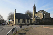
Girdle Toll Places Overview: History, Culture & Facts about Girdle Toll
Visit Girdle Toll – Walkfo’s stats for the places to visit
With 37 audio plaques & Girdle Toll places for you to explore in the Girdle Toll area, Walkfo is the world’s largest heritage & history digital plaque provider. The AI continually learns & refines facts about the best Girdle Toll places to visit from travel & tourism authorities (like Wikipedia), converting history into an interactive audio experience.
Girdle Toll history

Girdle Toll was just a row of houses next to large areas of farmland. In the 1970s and 1980s IDC decided to develop the land into a large housing area. The most recent development was in 2001 when a small development was built next to Bryce Knox court.
Prehistory
The Girdle Mound was completely levelled circa 1860 . This mound gave the name to the toll and then the area . It was about 30 feet in diameter and 3 feet high .
Girdle Toll geography / climate
Girdle Toll is 10 miles (16km) from Prestwick Airport and 23 miles (37 km) from Glasgow. It previously formed part of the A736 route to Glasgow. The A736 now bypasses the area just to the west.
Why visit Girdle Toll with Walkfo Travel Guide App?
 You can visit Girdle Toll places with Walkfo Girdle Toll to hear history at Girdle Toll’s places whilst walking around using the free digital tour app. Walkfo Girdle Toll has 37 places to visit in our interactive Girdle Toll map, with amazing history, culture & travel facts you can explore the same way you would at a museum or art gallery with information audio headset. With Walkfo, you can travel by foot, bike or bus throughout Girdle Toll, being in the moment, without digital distraction or limits to a specific walking route. Our historic audio walks, National Trust interactive audio experiences, digital tour guides for English Heritage locations are available at Girdle Toll places, with a AI tour guide to help you get the best from a visit to Girdle Toll & the surrounding areas.
“Curated content for millions of locations across the UK, with 37 audio facts unique to Girdle Toll places in an interactive Girdle Toll map you can explore.”
Walkfo: Visit Girdle Toll Places Map
37 tourist, history, culture & geography spots
Girdle Toll historic spots | Girdle Toll tourist destinations | Girdle Toll plaques | Girdle Toll geographic features |
| Walkfo Girdle Toll tourism map key: places to see & visit like National Trust sites, Blue Plaques, English Heritage locations & top tourist destinations in Girdle Toll | |||
Best Girdle Toll places to visit
Girdle Toll has places to explore by foot, bike or bus. Below are a selection of the varied Girdle Toll’s destinations you can visit with additional content available at the Walkfo Girdle Toll’s information audio spots:
Dreghorn
Dreghorn is a village in North Ayrshire, Scotland, on the old main road from Irvine to Kilmarnock . It is sited on a ridge between two rivers and is 3.5km east of Irvine town centre . Archaeological excavations have found a significant neolithic settlement dated to around 3500 BC .

Bourtreehill
Bourtreehill is a large housing estate built by the Irvine Development Corporation in the late 1970s . It is part of the Irvine New Town in North Ayrshire, Scotland . Along its southern border runs the Broomlands estate .

Tanzie Well
The Tanzie Well, also known as Saint Anne’s Well, the Washing House Well or the Spoot is located beside the River Irvine . It has been suggested that ‘Tanzie’ may be a corruption of St Inan’s Well . The old Irvine Pouther House of 1801 is located nearby .

Annick Water
The Annick Water (previously also spelled as Annack, Annoch or Annock) is the largest tributary of the River Irvine . The name may derive from the Gaelic for ‘overflowing’ and is prone to flooding .

The Chapel Well
The Chapel Well, sometimes known as Saint Mary’s Well, is located beside the River Irvine at the end of the Chapel Lane path that links to the Kirk Vennel in Irvine, North Ayrshire .

Eglinton Country Park
Eglinton Country Park is located in the grounds of the old EGLinton Castle estate, Kilwinning, North Ayrshire, Scotland. The ruined castle was once home to the family of the Montgomeries, Earls of Eglint, and chiefs of the Clan Montgomery.

Lands of Doura
The Lands of Doura, Dawra, Dowrey Dowray, Dourey or Douray formed a small estate, at one time part of the Barony of Corsehill and Doura. It is situated near the Eglinton Estate in the Parish of Kilwinning, North Ayrshire, Scotland.
Visit Girdle Toll plaques
 5
5
plaques
here Girdle Toll has 5 physical plaques in tourist plaque schemes for you to explore via Walkfo Girdle Toll plaques audio map when visiting. Plaques like National Heritage’s “Blue Plaques” provide visual geo-markers to highlight points-of-interest at the places where they happened – and Walkfo’s AI has researched additional, deeper content when you visit Girdle Toll using the app. Experience the history of a location when Walkfo local tourist guide app triggers audio close to each Girdle Toll plaque. Explore Plaques & History has a complete list of Hartlepool’s plaques & Hartlepool history plaque map.


 Trying to encourage visitors to Girdle Toll?