Welcome to Visit Far Cotton Places
The Walkfo guide to things to do & explore in Far Cotton
 Visit Far Cotton places using Walkfo for free guided tours of the best Far Cotton places to visit. A unique way to experience Far Cotton’s places, Walkfo allows you to explore Far Cotton as you would a museum or art gallery with audio guides.
Visiting Far Cotton Walkfo Preview
Far Cotton is a district in the civil parish of Far Cotton and Delapre, in the town of Northampton, in Northamptonshire. The population is included in Northampton Borough Council Ward. When you visit Far Cotton, Walkfo brings Far Cotton places to life as you travel by foot, bike, bus or car with a mobile phone & headphones.
Far Cotton Places Overview: History, Culture & Facts about Far Cotton
Visit Far Cotton – Walkfo’s stats for the places to visit
With 77 audio plaques & Far Cotton places for you to explore in the Far Cotton area, Walkfo is the world’s largest heritage & history digital plaque provider. The AI continually learns & refines facts about the best Far Cotton places to visit from travel & tourism authorities (like Wikipedia), converting history into an interactive audio experience.
Far Cotton history
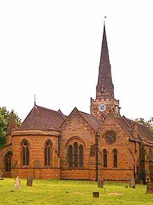
Far Cotton was first recorded in 1196 under the name Cotes. The name derived from the Old English word “Cot” meaning a cottage or hut. It expanded with the arrival of the Northampton and Peterborough Railway in 1845. Far Cotton is in the ecclesiastical parish of St Mary.
Why visit Far Cotton with Walkfo Travel Guide App?
 You can visit Far Cotton places with Walkfo Far Cotton to hear history at Far Cotton’s places whilst walking around using the free digital tour app. Walkfo Far Cotton has 77 places to visit in our interactive Far Cotton map, with amazing history, culture & travel facts you can explore the same way you would at a museum or art gallery with information audio headset. With Walkfo, you can travel by foot, bike or bus throughout Far Cotton, being in the moment, without digital distraction or limits to a specific walking route. Our historic audio walks, National Trust interactive audio experiences, digital tour guides for English Heritage locations are available at Far Cotton places, with a AI tour guide to help you get the best from a visit to Far Cotton & the surrounding areas.
“Curated content for millions of locations across the UK, with 77 audio facts unique to Far Cotton places in an interactive Far Cotton map you can explore.”
Walkfo: Visit Far Cotton Places Map
77 tourist, history, culture & geography spots
Far Cotton historic spots | Far Cotton tourist destinations | Far Cotton plaques | Far Cotton geographic features |
| Walkfo Far Cotton tourism map key: places to see & visit like National Trust sites, Blue Plaques, English Heritage locations & top tourist destinations in Far Cotton | |||
Best Far Cotton places to visit
Far Cotton has places to explore by foot, bike or bus. Below are a selection of the varied Far Cotton’s destinations you can visit with additional content available at the Walkfo Far Cotton’s information audio spots:
| Roman Catholic Diocese of Northampton The Diocese of Northampton is one of the 22 Roman Catholic dioceses in England and Wales. The Cathedral of Our Lady Immaculate and St Thomas of Canterbury is the mother church of the Diocese. |
 | Northampton Cathedral The Cathedral Church of St Mary and St Thomas is a Roman Catholic cathedral in Northampton, England. It is the seat of the Bishop of Northampton and mother church of the Diocese. The cathedral is situated in the north of the town, along the Barrack Road. |
 | Gibraltar Barracks, Northampton Gibraltar Barracks is a former military installation at Northampton in Northamptonshire. It is located in the town of Gibraltar, Northants, and is located on the outskirts of Northampton. |
 | The Holy Sepulchre, Northampton The Holy Sepulchre is a Norman round church in Northampton, England. Dating from circa 1100, it was probably built by Simon de Senlis, Earl of Northampton. There are four medieval round churches still in use in England. |
 | Roadmender (nightclub) Roadmender is a live music venue in Lady’s Lane, Northampton, England. Set in a former school building, the venue has left an indelible print on generations of the town’s teenagers. |
 | Grosvenor Centre Work started in 1972 and the Grosvenor Centre opened in 1976. The two-level centre is located adjacent to Market Square. In 2014 it underwent a £3 million refurbishment. |
 | Northampton Guildhall Northampton Guildhall is a municipal building in St Giles’ Square in Northampton, England. It is a Grade II* listed building. |
 | Weston Favell Shopping Centre Weston Favell shopping centre sits on the outskirts of Northampton, in the East Midlands region of England and comprises 330,000 sq ft of retail space. The scheme is anchored by Tesco which is one of the Top 10 Tesco Extra format stores in the UK in terms of size. |
 | Sessions House, Northampton The Sessions House is a Grade I listed building on George Row in Northampton. The building is adjacent to County Hall, Northamptonshire County Council’s meeting place. It is currently used as a Tourist Information Centre. |
 | All Saints’ Church, Northampton All Saints’ Church, Northampton is a Church of England parish church in the centre of Northampton. The current church was largely built after a fire and was consecrated in 1680. It is a Grade I listed building. |
Visit Far Cotton plaques
 5
5
plaques
here Far Cotton has 5 physical plaques in tourist plaque schemes for you to explore via Walkfo Far Cotton plaques audio map when visiting. Plaques like National Heritage’s “Blue Plaques” provide visual geo-markers to highlight points-of-interest at the places where they happened – and Walkfo’s AI has researched additional, deeper content when you visit Far Cotton using the app. Experience the history of a location when Walkfo local tourist guide app triggers audio close to each Far Cotton plaque. Explore Plaques & History has a complete list of Hartlepool’s plaques & Hartlepool history plaque map.


 Trying to encourage visitors to Far Cotton?