Visit East Dunbartonshire Place – things to do & explore
![]() Visit East Dunbartonshire places on a day-trip, weekend away or holiday – and Walkfo becomes your personal digital tour guide to East Dunbartonshire things to do.
Visit East Dunbartonshire places on a day-trip, weekend away or holiday – and Walkfo becomes your personal digital tour guide to East Dunbartonshire things to do.
Visiting East Dunbartonshire Overview
East Dunbartonshire (Scots: Aest Dunbartanshire) is one of the 32 council areas of Scotland . It borders the north-west of Glasgow and contains many affluent areas to the north of the city . The council area was formed in 1996 as a result of the Local Government etc. (Scotland) Act 1994 .
When you visit East Dunbartonshire, East Dunbartonshire history becomes available at the places you travel to by foot, bike, bus or car with a mobile phone & headphones.
East Dunbartonshire places overview by Walkfo
Visit to East Dunbartonshire stats
With 63 tourism audio plaques & places for you to explore in East Dunbartonshire, Walkfo is the world’s largest heritage & history digital plaque provider in the world. Our AI continually learns & refines content about the best East Dunbartonshire places to visit from online information authorities like Wikipedia for current & history, and converts it into an audio experience.
When you visit East Dunbartonshire
You can visit East Dunbartonshire places and use Walkfo East Dunbartonshire to discover the history & things to do in East Dunbartonshire whilst walking with our free digital tour app. Walkfo East Dunbartonshire has 63 places on our East Dunbartonshire map with history, culture & travel facts that you explore the same way you would at a museum or art gallery with information audio headset. With Walkfo, you can travel by foot, bike or bus throughout East Dunbartonshire, being in the moment, without digital distraction or limits to a specific walking route – you choose where you want to go, when you want to go and Walkfo East Dunbartonshire will keep up.![]()
–
With millions of places including tourist walks, East Dunbartonshire travel destinations, National Trust locations converted to audio experiences, our East Dunbartonshire places AI guide will help you get the best from your visit to East Dunbartonshire & the surrounding areas. The East Dunbartonshire places app for iPhone & Android delivers hidden history, interesting culture and amazing facts in interactive audio stories in response to where you walk at National Heritage sites, tourist attractions, historic locations or city streets, with no predefined walk map requirements.
“The Walkfo AI has curated content for millions of locations across the UK, with 63 audio facts unique to East Dunbartonshire places forming an interactive East Dunbartonshire map for you to explore.”
Walkfo’s Visit East Dunbartonshire Places Map
63 tourist, history, culture & geography spots
East Dunbartonshire historic spot | East Dunbartonshire tourist destination | East Dunbartonshire plaque | East Dunbartonshire geographic feature |
| Walkfo East Dunbartonshire tourism map key: places to see & visit like National Trust sites, Blue Plaques, English Heritage locations & top tourist destinations in East Dunbartonshire | |||
Best East Dunbartonshire places to visit
East Dunbartonshire has many places to explore by foot, bike or bus. Below are a selection of the varied East Dunbartonshire’s destinations you can visit with additional content available at the Walkfo East Dunbartonshire’s information audio spots:
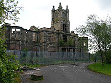
 | Bardowie Castle Bardowie Castle is located 2 kilometres (1.2 mi) east of Milngavie, in East Dunbartonshire, Scotland . The A-Listed building overlooks Bardowy Loch . |
 | Woodilee Hospital Woodilee Hospital was a psychiatric institution situated in Lenzie, East Dunbartonshire, Scotland . It was situated in the area of Lenzie in East Dunbaronshire . |
 | Kirkintilloch Town Hall Kirkintilloch Town Hall is a municipal building in East Dunbartonshire, Scotland . It is a category B listed building . The town hall is located in Union Street in Kirkintiloch, East Dunbaronshire . |
 | Broomhill Hospital Broomhill Hospital was a health facility in Kirkintilloch, East Dunbartonshire, Scotland . It was established in the 1930s and was set up in the mid-1940s . |
 | St Cyprian’s Church, Lenzie St Cyprian’s Church is an episcopal church in Lenzie, East Dunbartonshire, Scotland . It was built in 1873 by Alexander Ross of Inverness and cost around £2600 . |
 | Antonine Wall The Antonine Wall was the second of two “great walls” created by the Romans in Great Britain in the second century AD. It spanned approximately 63 kilometres (39 miles) and was about 3 metres (10 feet) high and 5 metres (16 feet) wide. Construction began in AD 142 at the order of Roman Emperor Antoninus Pius, and took about 12 years to complete. |
 | Milngavie water treatment works The Waterworks is a Scottish Water-operated water treatment facility located in Milngavie, Scotland. It is primary source of the water for the city of Glasgow (and the Greater Glasgow area) in western Scotland. Its primary supply is via two aqueducts that are 56km (32 miles) in length, and can deliver up to 50,000,000 imperial gallons a day. |
Visit East Dunbartonshire plaques
![]() 0
0
plaques
here East Dunbartonshire has 0 physical plaques within tourist plaque schemes for you to explore via Walkfo East Dunbartonshire plaques when visiting. Plaque schemes such as National Heritage’s “Blue Plaques” provide visual geo-markers to highlight points-of-interest at the places where they happened. Where a plaque is available, Walkfo AI has done research to provide additional, deeper content when you visit East Dunbartonshire using the app. Experience hidden history & stories at each location as the Walkfo local tourist guide app uses trigger audio close to each East Dunbartonshire plaque. Currently No Physical Plaques.