Welcome to Visit Crookston, Glasgow Places
The Walkfo guide to things to do & explore in Crookston, Glasgow
 Visit Crookston, Glasgow places using Walkfo for free guided tours of the best Crookston, Glasgow places to visit. A unique way to experience Crookston, Glasgow’s places, Walkfo allows you to explore Crookston, Glasgow as you would a museum or art gallery with audio guides.
Visiting Crookston, Glasgow Walkfo Preview
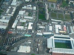
Crookston (Scottish Gaelic: Baile Cruic, Scots: Cruixtoun) is a residential suburb on the southwestern edge of Glasgow, Scotland. Two distinct and geographically separate neighbourhoods about 1 mile (1.6 km) apart on opposite sides of the White Cart Water are known by the name. When you visit Crookston, Glasgow, Walkfo brings Crookston, Glasgow places to life as you travel by foot, bike, bus or car with a mobile phone & headphones.
Crookston, Glasgow Places Overview: History, Culture & Facts about Crookston, Glasgow
Visit Crookston, Glasgow – Walkfo’s stats for the places to visit
With 98 audio plaques & Crookston, Glasgow places for you to explore in the Crookston, Glasgow area, Walkfo is the world’s largest heritage & history digital plaque provider. The AI continually learns & refines facts about the best Crookston, Glasgow places to visit from travel & tourism authorities (like Wikipedia), converting history into an interactive audio experience.
Crookston, Glasgow history
Crookston Estate
The lands of Crookston were named after the feudal Anglo-Norman lord, Robert Croc who was granted the deeds by David I of Scotland, via Walter fitz Alan, in 1170. Crookst Castle was built in the early 1400s and was captured in the mid-1500s and its importance diminished. It was restored in mid-19th century by the Maxwells of Pollok and was donated by the family to the National Trust in 1931.
Crookston Station area

Crookston was chosen as the name of a station on the Glasgow and South Western Railway’s new route between Glasgow and Paisley in 1885. Over the next few decades, a small commuter suburb consisting mostly of large villas was constructed around the station. It was gradually surrounded by other residential neighbourhoods including South Cardonald, Hillington, Penilee and Rosshall within the city.
Crookston Home and Leverndale area
In 1895, a lunatic asylum and hospital (known initially as Govan District Asylum, then as Hawkhead Asylum after the surrounding country estate on the periphery of Paisley) was built on a promentory near the left bank of the White Cart to the west of Crookston Road. It was expanded several times, including the incorporation of the old Hawkhead mansion and a farm for use by inmates, and was re-named Leverndale Hospital in 1964. In that period there was a separate Hawkhead Hospital located across fields to the west of Leverndale, another psychiatric facility south of that at Dykebar Hospital, and another hospital a short distance to the east at Cowglen. New buildings closer to the main road were constructed in the 1990s, and in the 2000s the older units (including the Category A listed Towerview Unit were converted to private housing. In 2011, a station for the Scottish Ambulance Service opened at the new Leverndale site, followed in 2014 by the NHS West of Scotland Mother and Baby Unit (relocated from the Southern General Hospital). In 1906, Renfrewshire Combination Poorhouse was built near Old Crookston Farm to the east of Crookston Road. It was later re-named as Crookston Home Poor Law Institution, before being reconfigured as a nursing home for the elderly in 1934. Four years later, a development of ‘cottage homes’ (an early version of sheltered housing) was built immediately to its south, with additional care provided from the main block of the complex as required. Around the same time, a wide area of land to the east and north of the Home (within Renfrewshire’s Eastwood parish) was purchased by Glasgow from the Pollok Estate for housebuilding, and after its first stage (today’s ‘Old Pollok’) was interrupted by World War II, the large Pollok peripheral housing scheme was constructed along both banks of the Levern Water in the decade after the conflict, surrounding Crookston Castle and also occupying part of the old woodland and farms including Mains of Crookston, Byres, Nether Crookston and Crookston House – the latter, at the confluence of the White Cart and Levern Waters, became the site of Howford Special School in the mid 1960s. In contrast to the preservation work at Leverndale, the Crookston Home facility operated until the 1990s when its functions became obsolete, and the site was then cleared for housebuilding leaving no trace of the original buildings or the cottages. There was already an existing mid-20th century development of houses at Roughmussel at the southern end of Crookston Road (along with a row of shops), and various housebuilders added clusters of suburban villas accessed from the main road from the 1990s until the 2010s, until most of the accessible land forming Glasgow’s western border between Howford Bridge and Barrhead Road, a distance of over a mile, was built upon. Despite the large number of family homes, there are no primary schools in this area itself, the closest being in west Pollok a short distance from each other, and another at a modern campus in Craigbank (Nitshill) – it incorporates the special educational needs base previously at Howford School, the vacated building for which was subjected to arson in 2018. The older local schoolchildren typically attend Rosshall Academy and Lourdes Secondary, although St Paul’s High School is physically closer for many. This southern sector of Crookston has no official recognised centre, the closest equivalent arguably being the crossroads at Bullwood Drive and Dalmellington Road where there is a supermarket and chemist in addition to Crookston Medical Centre (built in 2000) and Crookston Bowling Club, which has its origins in the 1940s as part of the recreational provision for workers at the Rolls-Royce factory in Hillington Industrial Estate. There is a local Crookston Community Group based just east of Crookston Road, but technically this falls under Pollok and is involved with providing support to deprived communities in the south-west of Glasgow, a socio-economic classification into which most of Pollok falls, but Crookston does not – some very large and grand homes have been built, particularly around Leverndale. There is also a natural barrier between the areas for the most part, formed by Haugh Hill and other elevated woodland (labelled as components of the ‘Stirling Maxwell Forest Parks’, a designation for the many green areas in and around the streets of Pollok, including old Crookston Wood). Echoing the area’s past, a new elderly care facility, Meadowburn Home, opened in 2019 close to where Crookston Home had stood but on the Pollok side of these woods; another smaller home at Bonnyholm near Rosshall (replacing a primary school, in a part of north Pollok where most of the residences were rebuilt too) had opened in 2018. Most amenities are located in the centre of Pollok, including the modernised ‘civic realm’ with district library, health centre and sports centre, adjacent to the Silverburn Centre with various retail and dining options and a cinema. The local community council covering this area is Hurlet and Brockburn CC.
Name
‘Crookston’ used by the media in reports referring to events in all of its smaller parts. No clarifying prefixes (Old/New, North/South) have ever been adopted in official contexts in relation to the distinct areas.
Why visit Crookston, Glasgow with Walkfo Travel Guide App?
 You can visit Crookston, Glasgow places with Walkfo Crookston, Glasgow to hear history at Crookston, Glasgow’s places whilst walking around using the free digital tour app. Walkfo Crookston, Glasgow has 98 places to visit in our interactive Crookston, Glasgow map, with amazing history, culture & travel facts you can explore the same way you would at a museum or art gallery with information audio headset. With Walkfo, you can travel by foot, bike or bus throughout Crookston, Glasgow, being in the moment, without digital distraction or limits to a specific walking route. Our historic audio walks, National Trust interactive audio experiences, digital tour guides for English Heritage locations are available at Crookston, Glasgow places, with a AI tour guide to help you get the best from a visit to Crookston, Glasgow & the surrounding areas.
“Curated content for millions of locations across the UK, with 98 audio facts unique to Crookston, Glasgow places in an interactive Crookston, Glasgow map you can explore.”
Walkfo: Visit Crookston, Glasgow Places Map
98 tourist, history, culture & geography spots
Crookston, Glasgow historic spots | Crookston, Glasgow tourist destinations | Crookston, Glasgow plaques | Crookston, Glasgow geographic features |
| Walkfo Crookston, Glasgow tourism map key: places to see & visit like National Trust sites, Blue Plaques, English Heritage locations & top tourist destinations in Crookston, Glasgow | |||
Best Crookston, Glasgow places to visit
Crookston, Glasgow has places to explore by foot, bike or bus. Below are a selection of the varied Crookston, Glasgow’s destinations you can visit with additional content available at the Walkfo Crookston, Glasgow’s information audio spots:

Nitshill
Nitshill (Scottish Gaelic: Cnoc nan Cnòthan) is a district on the south side of Glasgow. It is bordered by Darnley to the east, Crookston and Roughmussel to the north-west. The Victoria Colliery in the area was the scene of one of Scotland’s worst mining disasters.
Moorepark, Glasgow
Moorepark is a small area in the Scottish city of Glasgow. Situated south of the River Clyde and part of the former Burgh of Govan. It was colloquially referred to as ‘Wine Alley’ during the 20th century.

Braehead
Braehead (Scots: Braeheid, Gaelic: Ceann a’ Bhruthaich) is a commercial development located at the former site of a power station in Renfrew. It is particularly notable for its large shopping centre, arena and leisure facilities. The shopping centre was rebranded in 2013 and carried that name until 2020.
Visit Crookston, Glasgow plaques
 6
6
plaques
here Crookston, Glasgow has 6 physical plaques in tourist plaque schemes for you to explore via Walkfo Crookston, Glasgow plaques audio map when visiting. Plaques like National Heritage’s “Blue Plaques” provide visual geo-markers to highlight points-of-interest at the places where they happened – and Walkfo’s AI has researched additional, deeper content when you visit Crookston, Glasgow using the app. Experience the history of a location when Walkfo local tourist guide app triggers audio close to each Crookston, Glasgow plaque. Explore Plaques & History has a complete list of Hartlepool’s plaques & Hartlepool history plaque map.


 Trying to encourage visitors to Crookston, Glasgow?