Welcome to Visit Cringleford Places
The Walkfo guide to things to do & explore in Cringleford
 Visit Cringleford places using Walkfo for free guided tours of the best Cringleford places to visit. A unique way to experience Cringleford’s places, Walkfo allows you to explore Cringleford as you would a museum or art gallery with audio guides.
Visiting Cringleford Walkfo Preview
Cringleford is a village on the banks of the River Yare on the outskirts of Norwich. A village existed here at least as early as Saxon times and there is evidence of human settlement in the area from Roman times and the Bronze Age. The size of the village is 4.04 square kilometres (1.56 sq mi) and the population at the 2011 UK census was 2963. When you visit Cringleford, Walkfo brings Cringleford places to life as you travel by foot, bike, bus or car with a mobile phone & headphones.
Cringleford Places Overview: History, Culture & Facts about Cringleford
Visit Cringleford – Walkfo’s stats for the places to visit
With 44 audio plaques & Cringleford places for you to explore in the Cringleford area, Walkfo is the world’s largest heritage & history digital plaque provider. The AI continually learns & refines facts about the best Cringleford places to visit from travel & tourism authorities (like Wikipedia), converting history into an interactive audio experience.
Why visit Cringleford with Walkfo Travel Guide App?
 You can visit Cringleford places with Walkfo Cringleford to hear history at Cringleford’s places whilst walking around using the free digital tour app. Walkfo Cringleford has 44 places to visit in our interactive Cringleford map, with amazing history, culture & travel facts you can explore the same way you would at a museum or art gallery with information audio headset. With Walkfo, you can travel by foot, bike or bus throughout Cringleford, being in the moment, without digital distraction or limits to a specific walking route. Our historic audio walks, National Trust interactive audio experiences, digital tour guides for English Heritage locations are available at Cringleford places, with a AI tour guide to help you get the best from a visit to Cringleford & the surrounding areas.
“Curated content for millions of locations across the UK, with 44 audio facts unique to Cringleford places in an interactive Cringleford map you can explore.”
Walkfo: Visit Cringleford Places Map
44 tourist, history, culture & geography spots
Cringleford historic spots | Cringleford tourist destinations | Cringleford plaques | Cringleford geographic features |
| Walkfo Cringleford tourism map key: places to see & visit like National Trust sites, Blue Plaques, English Heritage locations & top tourist destinations in Cringleford | |||
Best Cringleford places to visit
Cringleford has places to explore by foot, bike or bus. Below are a selection of the varied Cringleford’s destinations you can visit with additional content available at the Walkfo Cringleford’s information audio spots:
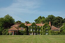
Earlham Hall
Earlham Hall is located just to the west of Norwich, on Earlham Road, on the outskirts of the village of Earlham . For generations it was the home of the Gurney family, known as bankers and social activists . Prison reformer Elizabeth Fry grew up at the hall . When the University of East Anglia was founded in 1963 it became its administrative centre .

Theatre Royal, Norwich
The Theatre Royal is an art-deco theatre in Norwich, Norfolk, England. It celebrated its 250th anniversary on the 31st of January 2008 and is one of the country’s oldest established theatres. The theatre had a £10m refurbishment in 2007, designed by Tim Foster Architects.

Chantry Place
Chantry Place is a shopping centre in Norwich city centre. It was previously occupied by the Caleys (later Rowntree Mackintosh and Nestlé) chocolate factory. As Chapelfield, the centre opened in 2005 and adopted Intu branding in 2013.

St Giles’ Church, Norwich
St Giles’ Church, Norwich is a Grade I listed parish church in the Church of England in Norwich. The church is located in the city centre of Norwich.

Eaton, Norfolk
Eaton lies to the southwest of Norwich on the A11 road, the main route to London/Cambridge. The village has two pubs, The Red Lion and The Cellar House. The population of the Norwich ward of Eaton was 8,781 at the 2011 Census.

Quadram Institute
The Quadram Institute is a centre for food and health research. It is located on the outskirts of Norwich, England, United Kingdom. The Institute is housed in a purpose-built facility on the Norwich Research Park that opened in 2018.

Norwich CEYMS F.C.
Norwich CEYMS are a football club based in Swardeston, near Norwich, in Norfolk, England. They are currently members of the Anglian Combination Premier Division, having previously played in the Eastern Counties League. The club is affiliated to the Norfolk County FA.
Visit Cringleford plaques
 18
18
plaques
here Cringleford has 18 physical plaques in tourist plaque schemes for you to explore via Walkfo Cringleford plaques audio map when visiting. Plaques like National Heritage’s “Blue Plaques” provide visual geo-markers to highlight points-of-interest at the places where they happened – and Walkfo’s AI has researched additional, deeper content when you visit Cringleford using the app. Experience the history of a location when Walkfo local tourist guide app triggers audio close to each Cringleford plaque. Explore Plaques & History has a complete list of Hartlepool’s plaques & Hartlepool history plaque map.


 Trying to encourage visitors to Cringleford?