Welcome to Visit Corby Places
The Walkfo guide to things to do & explore in Corby
 Visit Corby places using Walkfo for free guided tours of the best Corby places to visit. A unique way to experience Corby’s places, Walkfo allows you to explore Corby as you would a museum or art gallery with audio guides.
Visiting Corby Walkfo Preview
When you visit Corby, Walkfo brings Corby places to life as you travel by foot, bike, bus or car with a mobile phone & headphones.
Corby Places Overview: History, Culture & Facts about Corby
Visit Corby – Walkfo’s stats for the places to visit
With 17 audio plaques & Corby places for you to explore in the Corby area, Walkfo is the world’s largest heritage & history digital plaque provider. The AI continually learns & refines facts about the best Corby places to visit from travel & tourism authorities (like Wikipedia), converting history into an interactive audio experience.
Corby history
Early history
Mesolithic and Neolithic artefacts have been found in the area surrounding Corby . Human remains dating to the Bronze Age were found in 1970 at Cowthick . The first evidence of permanent settlement comes from the 8th century when Danish invaders arrived .
From rural village to industrial town
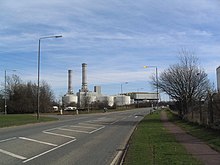
In 1931 Corby was a small village with a population of around 1,500 . By 1939 the population had grown to around 12,000 . The steel works dominated the town for decades .
1940s and 1950s
Corby steelworks were expected to be a target for German bombers during WWII . But only a few bombs were dropped by solitary planes and there were no casualties . This may be because the whole area was blanketed in huge dense black clouds created by burning of oil and latex to hide the glowing Bessemer converter furnaces .
Decline of the steel industry

In 1967 the Stewarts & Lloyds steel tube works at Corby became part of British Steel Corporation . The Government approved a ten-year development strategy with expenditure of £3,000 million from 1973 onwards . Steelmaking was to be concentrated in five main areas: South Wales, Sheffield, Scunthorpe, Teesside and Scotland .
Redevelopment
Corby was designated as a new town in 1950 . Most of the housing in the town has been built since this date . New industry attracted to the town when the Thatcher government designated it as an Enterprise Zone . By 1991 unemployment had returned to the national average .
Corby geography / climate

Corby is 72 miles (116 km) north-northwest of London, 23 miles (37km) north east of Northampton, 28 miles (45 km) southeast of Leicester and 51 miles (82 km) east of Birmingham. Peterborough is its nearest city, 19 miles (31 km) west of Peterborough.
Areas of Corby
The borough of Corby is made up of 11 wards following a boundary change after the 2011 census . Most of the population live in the town itself, however in terms of area it is mostly rural . This list includes the villages within the borough but also districts of the urban area .
Why visit Corby with Walkfo Travel Guide App?
 You can visit Corby places with Walkfo Corby to hear history at Corby’s places whilst walking around using the free digital tour app. Walkfo Corby has 17 places to visit in our interactive Corby map, with amazing history, culture & travel facts you can explore the same way you would at a museum or art gallery with information audio headset. With Walkfo, you can travel by foot, bike or bus throughout Corby, being in the moment, without digital distraction or limits to a specific walking route. Our historic audio walks, National Trust interactive audio experiences, digital tour guides for English Heritage locations are available at Corby places, with a AI tour guide to help you get the best from a visit to Corby & the surrounding areas.
“Curated content for millions of locations across the UK, with 17 audio facts unique to Corby places in an interactive Corby map you can explore.”
Walkfo: Visit Corby Places Map
17 tourist, history, culture & geography spots
Corby historic spots | Corby tourist destinations | Corby plaques | Corby geographic features |
| Walkfo Corby tourism map key: places to see & visit like National Trust sites, Blue Plaques, English Heritage locations & top tourist destinations in Corby | |||
Best Corby places to visit
Corby has places to explore by foot, bike or bus. Below are a selection of the varied Corby’s destinations you can visit with additional content available at the Walkfo Corby’s information audio spots:
 | Great Oakley, Northamptonshire Great Oakley is an outer suburb of Corby situated two miles south west of the town centre and five miles from Kettering, England. It was represented on Corby Borough Council by one councillor. The population of the ward at the 2011 Census was 2,248. |
Visit Corby plaques
 0
0
plaques
here Corby has 0 physical plaques in tourist plaque schemes for you to explore via Walkfo Corby plaques audio map when visiting. Plaques like National Heritage’s “Blue Plaques” provide visual geo-markers to highlight points-of-interest at the places where they happened – and Walkfo’s AI has researched additional, deeper content when you visit Corby using the app. Experience the history of a location when Walkfo local tourist guide app triggers audio close to each Corby plaque. Currently No Physical Plaques.


 Trying to encourage visitors to Corby?