Welcome to Visit Clydach Vale Places
The Walkfo guide to things to do & explore in Clydach Vale
 Visit Clydach Vale places using Walkfo for free guided tours of the best Clydach Vale places to visit. A unique way to experience Clydach Vale’s places, Walkfo allows you to explore Clydach Vale as you would a museum or art gallery with audio guides.
Visiting Clydach Vale Walkfo Preview
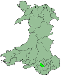
Clydach Vale (Welsh: Cwmclydach) is a village northwest of Tonypandy in Rhondda Cynon Taf. It is named for its situation on the Nant Clydch, a tributary of the River Rhonddach. When you visit Clydach Vale, Walkfo brings Clydach Vale places to life as you travel by foot, bike, bus or car with a mobile phone & headphones.
Clydach Vale Places Overview: History, Culture & Facts about Clydach Vale
Visit Clydach Vale – Walkfo’s stats for the places to visit
With 43 audio plaques & Clydach Vale places for you to explore in the Clydach Vale area, Walkfo is the world’s largest heritage & history digital plaque provider. The AI continually learns & refines facts about the best Clydach Vale places to visit from travel & tourism authorities (like Wikipedia), converting history into an interactive audio experience.
Clydach Vale history
In the 1840s coal mining began in the valley, but this was on a small scale and no pits were sunk at this time. Towards the end of the century there was a marked increase in mining activity, with several collieries being opened.
Industrial conflict
Clydach Vale colleries became synonymous with worker activism within the South Wales coalfield. Opened in 1872, the Cambrian colliery No. 1 was originally sunk by Osbourne Riches and Samuel Thomas. The Cambrian Collieries were a focus for disputation between active trade unions and business networks. A bitter clash between them resulted in the 1910 Tonypandy Riot.
Colliery disasters
On 10 March 1905, an explosion occurred at the Cambrian Colliery No.1. The explosion was heard for miles around the valleys and resulted in the loss of 33 lives and serious injury to 14 others. On 25 November 1941, seven men were killed and 53 were injured when a trolley transporting miners down a sharply sloping shaft ran out of control.
1910 flood disaster

One adult and five children died when pent-up water from an abandoned coal mine burst through into the village. The mountainside seemed to give way, ‘as though from a volcanic eruption’ and a torrent of water swept down the hillside. Rushing down to the valley floor, the torrent inundated the Clydach Vale School and trapped hundreds of children. The time coincided with the homecoming of many miners at the end of a shift and an immediate rescue effort by them and the school’s staff saved all but three of over 950 children.
Why visit Clydach Vale with Walkfo Travel Guide App?
 You can visit Clydach Vale places with Walkfo Clydach Vale to hear history at Clydach Vale’s places whilst walking around using the free digital tour app. Walkfo Clydach Vale has 43 places to visit in our interactive Clydach Vale map, with amazing history, culture & travel facts you can explore the same way you would at a museum or art gallery with information audio headset. With Walkfo, you can travel by foot, bike or bus throughout Clydach Vale, being in the moment, without digital distraction or limits to a specific walking route. Our historic audio walks, National Trust interactive audio experiences, digital tour guides for English Heritage locations are available at Clydach Vale places, with a AI tour guide to help you get the best from a visit to Clydach Vale & the surrounding areas.
“Curated content for millions of locations across the UK, with 43 audio facts unique to Clydach Vale places in an interactive Clydach Vale map you can explore.”
Walkfo: Visit Clydach Vale Places Map
43 tourist, history, culture & geography spots
Clydach Vale historic spots | Clydach Vale tourist destinations | Clydach Vale plaques | Clydach Vale geographic features |
| Walkfo Clydach Vale tourism map key: places to see & visit like National Trust sites, Blue Plaques, English Heritage locations & top tourist destinations in Clydach Vale | |||
Best Clydach Vale places to visit
Clydach Vale has places to explore by foot, bike or bus. Below are a selection of the varied Clydach Vale’s destinations you can visit with additional content available at the Walkfo Clydach Vale’s information audio spots:
 | Ton Pentre F.C. Ton Pentre Football Club plays in the Ardal Leagues South West, the third level of Welsh league football. Nicknamed the “Rhondda Bulldogs”, the team plays at Ynys Park, Ton Pente, Rhondda Cynon Taff. |
 | Ystradyfodwg Ystradyfodwg was an ancient upland parish in Glamorgan, Wales. It is believed to have been named after a 6th-century saint or chieftain. The Parish included most of the area which would later be known as Rhondda. |
 | River Cynon River Cynon (Welsh: Afon Cynon) in South Wales is a main tributary of the Taff. Its source is the rising of Llygad Cynon at Penderyn, Rhondda Cynon Taf and flows roughly southeast. The water emerging at the Cynon is traced back to the sink of the Nant Cadlan at Ogof Fawr. |
 | District of Rhondda Rhondda was one of six local government districts of Mid Glamorgan from 1974 to 1996. The district was created from parts of Ystradyfodwg, Llanwonno and Llantrisant parishes in 1877. It was renamed Rhondada Urban District in 1897 after the River Rhonda. |
 | Ysbyty George Thomas Ysbyty George Thomas is a health facility on Cwmparc Road, Treorchy, Rhondda Cynon Taf, Wales. It is managed by the Cwm Taf Morgannwg University Health Board. |
 | Cambrian Colliery Cambrian Colliery was a large coal mine that operated between 1872 and 1967. It is notable for its huge production and for two infamous explosion disasters, in 1905 and 1965, in which a total of 64 miners were killed. |
 | Ysbyty Cwm Rhondda Ysbyty Cwm Rhondda is a health facility on Partridge Road, Llwynypia. It is managed by the Cwm Taf Morgannwg University Health Board. |
 | Llwynypia Hospital Llwynypia Hospital was a health facility in Rhondda Cynon Taf, Wales. It was managed by the Cwm Taf Morgannwg University Health Board. |
 | Cambrian & Clydach Vale B.&G.C. Cambrian & Clydach Vale Boys & Girls Club is a Welsh football club. The club was founded in 1965 as Cambrian United and joined the Welsh Football League in 2005. The side finished in promotion positions in Divisions Three and Two in successive seasons. |
 | Mynydd William Meyrick Mynydd William Meyrick is a 535-metre-high hill straddling the boundary of Bridgend and Rhondda Cynon Taf county boroughs in South Wales. It takes the form of a broad northwest-southeast ridge with numerous broad shoulders extending to the east, south and west. |
Visit Clydach Vale plaques
 4
4
plaques
here Clydach Vale has 4 physical plaques in tourist plaque schemes for you to explore via Walkfo Clydach Vale plaques audio map when visiting. Plaques like National Heritage’s “Blue Plaques” provide visual geo-markers to highlight points-of-interest at the places where they happened – and Walkfo’s AI has researched additional, deeper content when you visit Clydach Vale using the app. Experience the history of a location when Walkfo local tourist guide app triggers audio close to each Clydach Vale plaque. Explore Plaques & History has a complete list of Hartlepool’s plaques & Hartlepool history plaque map.


 Trying to encourage visitors to Clydach Vale?