Welcome to Visit Chislehurst Places
The Walkfo guide to things to do & explore in Chislehurst
 Visit Chislehurst places using Walkfo for free guided tours of the best Chislehurst places to visit. A unique way to experience Chislehurst’s places, Walkfo allows you to explore Chislehurst as you would a museum or art gallery with audio guides.
Visiting Chislehurst Walkfo Preview
When you visit Chislehurst, Walkfo brings Chislehurst places to life as you travel by foot, bike, bus or car with a mobile phone & headphones.
Chislehurst Places Overview: History, Culture & Facts about Chislehurst
Visit Chislehurst – Walkfo’s stats for the places to visit
With 57 audio plaques & Chislehurst places for you to explore in the Chislehurst area, Walkfo is the world’s largest heritage & history digital plaque provider. The AI continually learns & refines facts about the best Chislehurst places to visit from travel & tourism authorities (like Wikipedia), converting history into an interactive audio experience.
Chislehurst history
The name “Chislehurst” is derived from the Saxon words cisel, “gravel”, and hyrst, “wooded hill”
Chislehurst landmarks
Chislehurst Caves
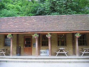
Chislehurst Caves were originally used to mine flint and chalk . During World War II, they were used nightly as an air-raid shelter . Jimi Hendrix, the Who, the Rolling Stones, David Bowie, Pink Floyd and Led Zeppelin have all played there .
Camden Place

Camden Place (now Chislehurst Golf Club, 51° 24′ 40.05″N 0° 3′ 55.69″E ) takes its name from the antiquary William Camden, who lived in the former house on the site from 1609 until his death in 1623 . The present house was built shortly before 1717, and it was given a number of additions in the late 18th and very early 19th centuries by the architect George Dance the younger .
Chislehurst geography / climate
Chislehurst West, previously known as “Pricking”, includes the biggest of the ponds and the High Street. The area is largely a residential area.
Chislehurst Conservation Area
A 2017 list shows there have been 596.4 hectares (1,474 acres) in Chislehurst designated as conservation areas since 1971 . The destruction of many trees and Victorian style buildings caused by bombing during WWII made protection even more critical .
Nearby areas
Chislehurst borders New Eltham to the north, Sidcup to the east and east, St Paul’s Cray to the south east, Petts Wood and Bickley .
Why visit Chislehurst with Walkfo Travel Guide App?
 You can visit Chislehurst places with Walkfo Chislehurst to hear history at Chislehurst’s places whilst walking around using the free digital tour app. Walkfo Chislehurst has 57 places to visit in our interactive Chislehurst map, with amazing history, culture & travel facts you can explore the same way you would at a museum or art gallery with information audio headset. With Walkfo, you can travel by foot, bike or bus throughout Chislehurst, being in the moment, without digital distraction or limits to a specific walking route. Our historic audio walks, National Trust interactive audio experiences, digital tour guides for English Heritage locations are available at Chislehurst places, with a AI tour guide to help you get the best from a visit to Chislehurst & the surrounding areas.
“Curated content for millions of locations across the UK, with 57 audio facts unique to Chislehurst places in an interactive Chislehurst map you can explore.”
Walkfo: Visit Chislehurst Places Map
57 tourist, history, culture & geography spots
Chislehurst historic spots | Chislehurst tourist destinations | Chislehurst plaques | Chislehurst geographic features |
| Walkfo Chislehurst tourism map key: places to see & visit like National Trust sites, Blue Plaques, English Heritage locations & top tourist destinations in Chislehurst | |||
Best Chislehurst places to visit
Chislehurst has places to explore by foot, bike or bus. Below are a selection of the varied Chislehurst’s destinations you can visit with additional content available at the Walkfo Chislehurst’s information audio spots:
 | Foots Cray Place Foots Cray Place was one of the four country houses built in England in the 18th century to a design inspired by Palladio’s Villa Capra near Vicenza . Built in 1754 near Sidcup, Kent, it was demolished in 1950 after a fire in 1949 . |
 | Foots Cray Meadows Foots Cray Meadows is 97 hectares (240 acres) in size within the London Borough of Bexley . It borders the suburbs of Albany Park, Sidcup, North Cray and Ruxley . The River Cray runs through it in a north-easterly direction . |
 | Kemnal Park Cemetery & Memorial Gardens Kemnal Park Cemetery & Memorial Gardens was opened in October 2013 by the Mayor of Bromley, Cllr Ernest Noad . It comprises 55 acres in total and has 30,000 burial plots . The cemetery is also listed as a ‘site of special interest’ due to its ancient woodland and diverse bird life . |
Visit Chislehurst plaques
 9
9
plaques
here Chislehurst has 9 physical plaques in tourist plaque schemes for you to explore via Walkfo Chislehurst plaques audio map when visiting. Plaques like National Heritage’s “Blue Plaques” provide visual geo-markers to highlight points-of-interest at the places where they happened – and Walkfo’s AI has researched additional, deeper content when you visit Chislehurst using the app. Experience the history of a location when Walkfo local tourist guide app triggers audio close to each Chislehurst plaque. Explore Plaques & History has a complete list of Hartlepool’s plaques & Hartlepool history plaque map.


 Trying to encourage visitors to Chislehurst?