Welcome to Visit Burnage Places
The Walkfo guide to things to do & explore in Burnage
 Visit Burnage places using Walkfo for free guided tours of the best Burnage places to visit. A unique way to experience Burnage’s places, Walkfo allows you to explore Burnage as you would a museum or art gallery with audio guides.
Visiting Burnage Walkfo Preview
Burnage is 4 miles (6.4 km) south of Manchester city centre and bisected by the dual carriageway of Kingsway. It lies between Withington to the west, Levenshulme to the north, Heaton Chapel to the east and Didsbury to the south. When you visit Burnage, Walkfo brings Burnage places to life as you travel by foot, bike, bus or car with a mobile phone & headphones.
Burnage Places Overview: History, Culture & Facts about Burnage
Visit Burnage – Walkfo’s stats for the places to visit
With 135 audio plaques & Burnage places for you to explore in the Burnage area, Walkfo is the world’s largest heritage & history digital plaque provider. The AI continually learns & refines facts about the best Burnage places to visit from travel & tourism authorities (like Wikipedia), converting history into an interactive audio experience.
Burnage history
Toponymy
The name Burnage is thought to have stemmed from “Brown Hedge”, from the old brown stone walls or “hedges” which were common in medieval times. In a survey of 1320, the district is referred to as “Bronadge”
Middle Ages
During the Middle Ages, Burnage was an area of common pasture and marsh land. Burnage did not have its own manor but the land was shared between the farmers from the Manors of Withington and Heaton Norris as it was a border district between two neighbouring lordships. Named arable farmers of this time included Thomas Grelley, Sir John de Byron, and Dame Joan de Longford.
17th—19th centuries
By 1655, Burnage had become a township. The Egerton family were major landowners in Burnage. In 1894, the Irish writer George Bernard Shaw described Burnage as the prettiest village in Manchester.
20th century

1906 saw plans to build a “garden suburb” in the district. Burnage Garden Village was created by building many new semi-detached houses as well as open recreational spaces. Construction of Kingsway (the A34) began in 1928 and was named after King George V. A cinema, the Lido, was built in the 1920s on Kingsway and later became the Concorde cinema.
Present day
Burnage is a mainly residential area, mostly semi-detached houses built in the 1930s and 1940s. The area is known as Burnage, Burnage.
Burnage geography / climate
Burnage is a suburb of South Manchester, approximately 4.2 miles (6.8 km) from Manchester City Centre. Burnage, a suburb, is located just over 4 miles from the city centre.
Why visit Burnage with Walkfo Travel Guide App?
 You can visit Burnage places with Walkfo Burnage to hear history at Burnage’s places whilst walking around using the free digital tour app. Walkfo Burnage has 135 places to visit in our interactive Burnage map, with amazing history, culture & travel facts you can explore the same way you would at a museum or art gallery with information audio headset. With Walkfo, you can travel by foot, bike or bus throughout Burnage, being in the moment, without digital distraction or limits to a specific walking route. Our historic audio walks, National Trust interactive audio experiences, digital tour guides for English Heritage locations are available at Burnage places, with a AI tour guide to help you get the best from a visit to Burnage & the surrounding areas.
“Curated content for millions of locations across the UK, with 135 audio facts unique to Burnage places in an interactive Burnage map you can explore.”
Walkfo: Visit Burnage Places Map
135 tourist, history, culture & geography spots
Burnage historic spots | Burnage tourist destinations | Burnage plaques | Burnage geographic features |
| Walkfo Burnage tourism map key: places to see & visit like National Trust sites, Blue Plaques, English Heritage locations & top tourist destinations in Burnage | |||
Best Burnage places to visit
Burnage has places to explore by foot, bike or bus. Below are a selection of the varied Burnage’s destinations you can visit with additional content available at the Walkfo Burnage’s information audio spots:
 | Hough End Hall Hough End Hall is a historic house now in Chorlton-cum-Hardy, (originally in Withington), Manchester . It was built in 1596 during the reign of Queen Elizabeth I by Sir Nicholas Mosley . The Mosleys were an influential Mancunian family from the 16th century onwards . |
 | Southern Cemetery, Manchester Southern Cemetery is a large municipal cemetery in Chorlton-cum-Hardy, Manchester, England . It opened in 1879 and is owned and administered by Manchester City Council . It is the second largest cemetery in Europe and the largest in the UK . |
 | Victoria Baths Victoria Baths opened to the public in 1906 and cost £59,144 to build . Manchester City Council closed the baths in 1993 and the building was left empty . A multimillion-pound restoration project began in 2007 and is on English Heritage’s Heritage at Risk Register . |
 | Edgar Wood Centre Edgar Wood Centre was designed by Edgar Wood in 1903 . Nikolaus Pevsner considered it “the only religious building in Lancashire that would be indispensable in a survey of twentieth century church design in all England” Grade I listed building is on Heritage at Risk Register . |
 | Victoria Park, Manchester Victoria Park is a suburban area of Manchester, England . Victoria Park lies approximately two miles south of Manchester city centre . It is located between Rusholme and Longsight . |
 | Dalton-Ellis Hall Dalton-Ellis Hall is a hall of residence complex at the University of Manchester . It is situated in the south of the city on Conyngham Road in Victoria Park, next to St Chrysostom’s Church . It has 279 male and female residents in catered accommodation . |
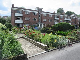 | Appleby Lodge Appleby Lodge is a set of three-storey 1930s blocks of flats with eight entrance doors . The blocks are in a U-shape around a central garden in Rusholme, Manchester . |
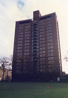 | Owens Park Owens Park is a large hall of residence located in the Fallowfield district of the city of Manchester . The hall is owned by the University of Manchester and houses 1,056 students . The terms ‘Owens Park’ and ‘Fallowfield Campus’ are sometimes used interchangeably . |
 | Fallowfield Campus Fallowfield Campus is the main residential campus of the University of Manchester . It is located 2 miles (3 km) south of the main university site . The campus is connected by Wilmslow Road and the A34 . |
 | St Joseph’s Church, Stockport St Joseph’s Church is a Roman Catholic Parish church in Stockport. It was built from 1861 to 1862 and designed by Matthew Ellison Hadfield. It is the only church in England administered by the Priests of the Sacred Heart. |
Visit Burnage plaques
 37
37
plaques
here Burnage has 37 physical plaques in tourist plaque schemes for you to explore via Walkfo Burnage plaques audio map when visiting. Plaques like National Heritage’s “Blue Plaques” provide visual geo-markers to highlight points-of-interest at the places where they happened – and Walkfo’s AI has researched additional, deeper content when you visit Burnage using the app. Experience the history of a location when Walkfo local tourist guide app triggers audio close to each Burnage plaque. Explore Plaques & History has a complete list of Hartlepool’s plaques & Hartlepool history plaque map.


 Trying to encourage visitors to Burnage?