Welcome to Visit Brimington Places
The Walkfo guide to things to do & explore in Brimington
 Visit Brimington places using Walkfo for free guided tours of the best Brimington places to visit. A unique way to experience Brimington’s places, Walkfo allows you to explore Brimington as you would a museum or art gallery with audio guides.
Visiting Brimington Walkfo Preview
Brimington is a large village and civil parish in Chesterfield in Derbyshire. The population of the parish taken at the 2011 census was 8,788. The town of Staveley is to the east, and Hollingwood is nearby. When you visit Brimington, Walkfo brings Brimington places to life as you travel by foot, bike, bus or car with a mobile phone & headphones.
Brimington Places Overview: History, Culture & Facts about Brimington
Visit Brimington – Walkfo’s stats for the places to visit
With 52 audio plaques & Brimington places for you to explore in the Brimington area, Walkfo is the world’s largest heritage & history digital plaque provider. The AI continually learns & refines facts about the best Brimington places to visit from travel & tourism authorities (like Wikipedia), converting history into an interactive audio experience.
Brimington history
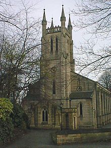
Brimington appears in the Domesday Book of 1086 as Brimintune. At that time, the manor was the property of King William I and the population was recorded as being sixteen villagers, two smallholders and one slave. In the autumn of 1603, there was an outbreak of bubonic plague in the village. The present church was rebuilt in 1847 and contains a war memorial.
Why visit Brimington with Walkfo Travel Guide App?
 You can visit Brimington places with Walkfo Brimington to hear history at Brimington’s places whilst walking around using the free digital tour app. Walkfo Brimington has 52 places to visit in our interactive Brimington map, with amazing history, culture & travel facts you can explore the same way you would at a museum or art gallery with information audio headset. With Walkfo, you can travel by foot, bike or bus throughout Brimington, being in the moment, without digital distraction or limits to a specific walking route. Our historic audio walks, National Trust interactive audio experiences, digital tour guides for English Heritage locations are available at Brimington places, with a AI tour guide to help you get the best from a visit to Brimington & the surrounding areas.
“Curated content for millions of locations across the UK, with 52 audio facts unique to Brimington places in an interactive Brimington map you can explore.”
Walkfo: Visit Brimington Places Map
52 tourist, history, culture & geography spots
Brimington historic spots | Brimington tourist destinations | Brimington plaques | Brimington geographic features |
| Walkfo Brimington tourism map key: places to see & visit like National Trust sites, Blue Plaques, English Heritage locations & top tourist destinations in Brimington | |||
Best Brimington places to visit
Brimington has places to explore by foot, bike or bus. Below are a selection of the varied Brimington’s destinations you can visit with additional content available at the Walkfo Brimington’s information audio spots:
 | Tapton House George Stephenson built the first public railway line in the world to use steam locomotives. In its time Tapton has been a gentleman’s residence, a ladies’ boarding school and a co-educational school. The House is now rented out as offices by Chesterfield Borough Council. |
 | Christ Church, Chesterfield Christ Church, Chesterfield is a parish church in Chesterfield, Derbyshire. It is located in the centre of Chesterfield in the area. |
 | Holy Trinity Church, Chesterfield Holy Trinity Church, Chesterfield is a Grade II listed parish church in Chesterfield, Derbyshire. It is located in the centre of Chesterfield in the north of the county. |
 | Battle of Chesterfield The Battle of Chesterfield was a minor skirmish in the 13th-century England’s Second Barons’ War. The battle was fought in the latter stages of the Second Barons’ war. |
 | Chesterfield Town Hall Chesterfield Town Hall is a municipal building on Rose Hill, Chesterfield, Derbyshire, England. It is a Grade II listed building. |
 | Chesterfield Royal Hospital Chesterfield Royal Hospital is an acute general hospital in Chesterfield, Derbyshire. It is managed by the Chesterfield Hospital NHS Foundation Trust. |
 | Poolsbrook Country Park Poolsbrook Country Park is a park in North East Derbyshire, England. It is a country park in the north-east of the county. |
 | Barrow Hill and New Whittington Barrow Hill and New Whittington is one of the nineteen wards that make up the borough of Chesterfield, Derbyshire. The population of the ward was 5,903 at the 2011 Census. |
 | Peak FM (North Derbyshire) Peak FM was a local radio station serving north Derbyshire. It was folded into Greatest Hits Radio Yorkshire, as part of a rebrand, on 1 September 2020. |
Visit Brimington plaques
 5
5
plaques
here Brimington has 5 physical plaques in tourist plaque schemes for you to explore via Walkfo Brimington plaques audio map when visiting. Plaques like National Heritage’s “Blue Plaques” provide visual geo-markers to highlight points-of-interest at the places where they happened – and Walkfo’s AI has researched additional, deeper content when you visit Brimington using the app. Experience the history of a location when Walkfo local tourist guide app triggers audio close to each Brimington plaque. Explore Plaques & History has a complete list of Hartlepool’s plaques & Hartlepool history plaque map.


 Trying to encourage visitors to Brimington?