Welcome to Visit Breage, Cornwall Places
The Walkfo guide to things to do & explore in Breage, Cornwall
 Visit Breage, Cornwall places using Walkfo for free guided tours of the best Breage, Cornwall places to visit. A unique way to experience Breage, Cornwall’s places, Walkfo allows you to explore Breage, Cornwall as you would a museum or art gallery with audio guides.
Visiting Breage, Cornwall Walkfo Preview
Breage is named after Saint Breaca, a missionary from Ireland. The village is three miles (5 km) west of Helston. The ward population at the Census 2011 had increased to 4,757. When you visit Breage, Cornwall, Walkfo brings Breage, Cornwall places to life as you travel by foot, bike, bus or car with a mobile phone & headphones.
Breage, Cornwall Places Overview: History, Culture & Facts about Breage, Cornwall
Visit Breage, Cornwall – Walkfo’s stats for the places to visit
With 40 audio plaques & Breage, Cornwall places for you to explore in the Breage, Cornwall area, Walkfo is the world’s largest heritage & history digital plaque provider. The AI continually learns & refines facts about the best Breage, Cornwall places to visit from travel & tourism authorities (like Wikipedia), converting history into an interactive audio experience.
Breage, Cornwall history
The parish was at the time of Domesday Book within the manor of Binnerton. There were 32 villagers and 25 smallholders with 15 ploughs between them. Livestock were 45 mares, 13 cattle, 5 pigs and 60 sheep.
Breage, Cornwall geography / climate
The geological formation known as the Tregonning-Godolphin Granite underlies the parish and the area was formerly an important source of tin and copper ore. The area has evidence of habitation and mining for the past two millennia.
Protected areas
Tregonning Hill, to the west of the parish, was designated a Site of Special Scientific Interest (SSSI) in 1994 for its biological interest. Tremearne Par and Porthcew SSSI were designated for their geological interest and are also Geological Conservation Review (GCR) sites. Great Wheal Fortune was a small mine in operation between 1855 and 1880 and produced 2992 tons of tin, 322 tons of copper and some arsenic and tungsten.
Why visit Breage, Cornwall with Walkfo Travel Guide App?
 You can visit Breage, Cornwall places with Walkfo Breage, Cornwall to hear history at Breage, Cornwall’s places whilst walking around using the free digital tour app. Walkfo Breage, Cornwall has 40 places to visit in our interactive Breage, Cornwall map, with amazing history, culture & travel facts you can explore the same way you would at a museum or art gallery with information audio headset. With Walkfo, you can travel by foot, bike or bus throughout Breage, Cornwall, being in the moment, without digital distraction or limits to a specific walking route. Our historic audio walks, National Trust interactive audio experiences, digital tour guides for English Heritage locations are available at Breage, Cornwall places, with a AI tour guide to help you get the best from a visit to Breage, Cornwall & the surrounding areas.
“Curated content for millions of locations across the UK, with 40 audio facts unique to Breage, Cornwall places in an interactive Breage, Cornwall map you can explore.”
Walkfo: Visit Breage, Cornwall Places Map
40 tourist, history, culture & geography spots
Breage, Cornwall historic spots | Breage, Cornwall tourist destinations | Breage, Cornwall plaques | Breage, Cornwall geographic features |
| Walkfo Breage, Cornwall tourism map key: places to see & visit like National Trust sites, Blue Plaques, English Heritage locations & top tourist destinations in Breage, Cornwall | |||
Best Breage, Cornwall places to visit
Breage, Cornwall has places to explore by foot, bike or bus. Below are a selection of the varied Breage, Cornwall’s destinations you can visit with additional content available at the Walkfo Breage, Cornwall’s information audio spots:
 | Pengersick Castle Pengersick Castle is a fortified manor house located between the villages of Germoe and Praa Sands in Cornwall. The tower house, which is in the parish of Breage, is a Grade I listed building. |
 | Wheal Vor Wheal Vor was a metalliferous mine about 2 miles (3.2 km) north west of Helston and 1.6 km north of Breage in Cornwall. It is considered to be part of the Mount’s Bay mining district. The mine was notable for its willingness to try out new innovations. |
| Wheal Metal Wheal Metal is a tin-mining sett in west Cornwall, England, UK. It was described by the Mining Journal in July 1885 as the richest tin mine in the world. It also hosts a remarkable engine house of the mid-19th century. |
 | St Breage’s Church, Breage Breage Parish Church is the Anglican parish church of the parish of Breage, Cornwall. It is dedicated to Saint Breaca, said to have been an Irish nun who came to Cornwall in the 5th-century. |
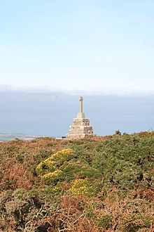 | Tregonning Hill Tregonning Hill is the westerly of two granite hills overlooking Mount’s Bay in west Cornwall, United Kingdom. The Plymouth chemist William Cookworthy mixed china stone with kaolin, mined from the hill to make Plymouth porcelain in 1768. Part of the hill is designated as a Site of Special Scientific Interest. |
 | Trevarno, Cornwall Trevarno is a private country estate in south-west Cornwall, England, UK, near the village of Crowntown, 2 miles (3.2 km) north-east of Helston. First developed in the 13th century, the estate was owned by a succession of families until 1994 when it was sold for development as a tourist attraction based around its extensive gardens. |
 | Great Work Mine Great Work Mine is notable for its unusual chimney stack with the upper brick-work in two stages. The remaining ruin of the mine sits 400 ft above sea level. The site is owned by the National Trust and forms part of the Godolphin Estate. |
 | Helston Castle Helston Castle was a medieval castle built for Edmund, 2nd Earl of Cornwall in the 13th century. The castle was ruined by the end of the 15th-century, and sat at the bottom of Coinagehall Street. |
 | Penrose, Cornwall Penrose (Cornish: Penros) is a house (in private ownership) and National Trust estate amounting to 1536 acres, east of Porthleven and in the civil parish of Sithney, Cornwall. The estate was owned by the Penrose family for several hundred years before 1771 when it was bought by the Rogers family. |
| Porthleven F.C. Porthleven Football Club is a Cornish football club. Founded in 1896, the club competed in the South Western League from 1967 to 1977 and again from 1989 until the dissolution of the league in 2007, when they joined the new South West Peninsula League. |
Visit Breage, Cornwall plaques
 1
1
plaques
here Breage, Cornwall has 1 physical plaques in tourist plaque schemes for you to explore via Walkfo Breage, Cornwall plaques audio map when visiting. Plaques like National Heritage’s “Blue Plaques” provide visual geo-markers to highlight points-of-interest at the places where they happened – and Walkfo’s AI has researched additional, deeper content when you visit Breage, Cornwall using the app. Experience the history of a location when Walkfo local tourist guide app triggers audio close to each Breage, Cornwall plaque. Explore Plaques & History has a complete list of Hartlepool’s plaques & Hartlepool history plaque map.


 Trying to encourage visitors to Breage, Cornwall?