Welcome to Visit Bramcote Places The Walkfo guide to things to do & explore in Bramcote
Visit Bramcote places using Walkfo for free guided tours of the best Bramcote places to visit. A unique way to experience Bramcote’s places, Walkfo allows you to explore Bramcote as you would a museum or art gallery with audio guides.
Visiting Bramcote Walkfo Preview Bramcote is a suburban village in the Broxtowe district of Nottinghamshire. The main Nottingham–Derby road today is the A52, Brian Clough Way. Nearby are Beeston, Wollaton, Chilwell and Stapleford. When you visit Bramcote, Walkfo brings Bramcote places to life as you travel by foot, bike, bus or car with a mobile phone & headphones.
Bramcote Places Overview: History, Culture & Facts about Bramcote
Visit Bramcote – Walkfo’s stats for the places to visit
With 73 audio plaques & Bramcote places for you to explore in the Bramcote area, Walkfo is the world’s largest heritage & history digital plaque provider. The AI continually learns & refines facts about the best Bramcote places to visit from travel & tourism authorities (like Wikipedia), converting history into an interactive audio experience.
Why visit Bramcote with Walkfo Travel Guide App?
You can visit Bramcote places with Walkfo Bramcote to hear history at Bramcote’s places whilst walking around using the free digital tour app. Walkfo Bramcote has 73 places to visit in our interactive Bramcote map, with amazing history, culture & travel facts you can explore the same way you would at a museum or art gallery with information audio headset. With Walkfo, you can travel by foot, bike or bus throughout Bramcote, being in the moment, without digital distraction or limits to a specific walking route. Our historic audio walks, National Trust interactive audio experiences, digital tour guides for English Heritage locations are available at Bramcote places, with a AI tour guide to help you get the best from a visit to Bramcote & the surrounding areas.
“Curated content for millions of locations across the UK, with 73 audio facts unique to Bramcote places in an interactive Bramcote map you can explore.”
Walkfo Bramcote tourism map key: places to see & visit like National Trust sites, Blue Plaques, English Heritage locations & top tourist destinations in Bramcote
Best Bramcote places to visit
Bramcote has places to explore by foot, bike or bus. Below are a selection of the varied Bramcote’s destinations you can visit with additional content available at the Walkfo Bramcote’s information audio spots:
Nuthall Temple Nuthall Temple in Nottinghamshire was one of five houses said to have been inspired by Palladio’s Villa Capra in Vicenza. Only two 18th century examples remain: Mereworth Castle and Chiswick House. Foots Cray Place was demolished in 1950 after a fire in 1949.
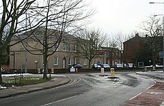
Chetwynd Barracks Chetwynd Barracks is a military installation at Chilwell in Nottinghamshire. It is located on the outskirts of Nottinghamshire and is located in the town of Chilworth. It was built in the 1960s and is now a military base in the area.
Bramcote Bramcote is a suburban village in the Broxtowe district of Nottinghamshire. The main Nottingham–Derby road today is the A52, Brian Clough Way. Nearby are Beeston, Wollaton, Chilwell and Stapleford.
Attenborough Nature Reserve Attenborough Nature Reserve is located 4.3 mi (7 km) south west of Nottingham city centre. It is owned and managed by Nottinghamshire Wildlife Trust, supported by Broxtowe Borough Council.
The Grange, Beeston The Grange is a Grade II listed building in Beeston, Nottinghamshire. It formerly served as the area police station and is currently in use as apartments.
War Memorial Cross, Beeston War Memorial Cross, Beeston is a Grade II listed structure in Beeston, Nottinghamshire. It was built in the 1930s and is located in the area of Beeston. It is located on the outskirts of Nottinghamshire and is on the edge of the Nottinghamshire town centre.
Wollaton Road, Beeston Wollaton Road, Beeston runs north from junction with High Road to Derby Road. Beeston Road is one of the main roads in the Beeston area of Beeston.
St Giles’ Church, Sandiacre St Giles’ Church, Sandiacre is a Grade I listed parish church in Derbyshire. It was built in the 1930s and is now a Grade II listed parish.
Essoldo Cinema, Beeston Essoldo Cinema, Beeston is a cinema open from 1938 to 1968 in Beeston, Nottinghamshire, England. It was open between 1938 and 1968.
Beeston Brewery Company The Beeston Brewery Company was a brewery based in Beeston, Nottinghamshire, England that opened in 1880 and closed in 1922. The company was also known as the Beeston Brewery and Malting Company.
Visit Bramcote plaques
36 plaques hereBramcote has 36 physical plaques in tourist plaque schemes for you to explore via Walkfo Bramcote plaques audio map when visiting. Plaques like National Heritage’s “Blue Plaques” provide visual geo-markers to highlight points-of-interest at the places where they happened – and Walkfo’s AI has researched additional, deeper content when you visit Bramcote using the app. Experience the history of a location when Walkfo local tourist guide app triggers audio close to each Bramcote plaque. Explore Plaques & History has a complete list of Hartlepool’s plaques & Hartlepool history plaque map.
Experience Bramcote audio walks & tours
Walkfo guides for things to do / places to visit in Bramcote allows exploration as you would do an art gallery or museum. Walk close to one of Bramcote’s 73 historic places & our digital tour guide will create an audio story for that spot. With headphone connected, you can explore Bramcote freely by foot, bike or bus – with your own personal tour guide in your pocket.
Explore Bramcote Map App
Our visit Bramcote map shows you things-to-do & places you can visit in Bramcote & surrounding areas using the Walkfo digital audio tour guide app. Each spot has plaque, building, street or area information on history, culture or tourism.
You can set your Walkfo’s Bramcote tourist map to find historic & tourism spots within 1km, 3km & 5km of the Bramcote centre, depending on how far you plan to explore whilst you visit Bramcote area at LONG:-1.242, LAT:52.934.
Walkfo App
Walkfo
Walkfo is free to download & use (for a limited time period), so if you are looking to explore Bramcote, go to your App Store to search for “Walkfo” or follow a links below and install on your mobile phone. Walkfo is designed for use with headphones or AirPods, so you can walk & explore whilst learning about the things around you without digital distraction.
Things to do & visit in Bramcote / surrounding areas
● Queen’s Medical Centre ● Cripps Health Centre ● Dunkirk, Nottingham ● Splendour in Nottingham ● Wollaton Hall ● Wollaton Park ● University of Nottingham tram stop ● University of Nottingham ● University Radio Nottingham ● Nottingham New Theatre ● Nottingham Industrial Museum ● East Midlands Conference Centre ● Nottingham Tennis Centre ● St Leonard’s Church, Wollaton ● Wollaton ● Bilborough ● Trowell MSA ● St Barnabas’ Church, Lenton Abbey ● Bramcote Hills ● The White Hills Park Federation Trust ● Nuthall Temple ● Stapleford Rural District ● Eskdale Drive tram stop ● Toton Lane tram stop ● Bramcote Lane tram stop ● Chetwynd Barracks ● Chilwell ● Cator Lane tram stop ● Chilwell Olympia ● Beeston and Stapleford Urban District
● Frances Longden Almshouses ● Christ Church, Chilwell ● Bramcote ● Church of St Michael and All Angels, Bramcote ● Stapleford, Nottinghamshire ● St Barnabas Church, Inham Nook ● Toton TMD ● Attenborough, Nottinghamshire ● Stapleford Cross ● Beeston Fields Drive ● St Helen’s Church, Stapleford ● Beeston Methodist Church ● St John’s Grove, Beeston ● Attenborough Nature Reserve ● The Grange, Beeston ● St John the Baptist Church, Beeston ● War Memorial Cross, Beeston ● Beeston transport interchange ● Anglo Scotian Mills ● Beeston, Nottinghamshire ● Sandiacre ● St Giles’ Church, Sandiacre ● Hemlock Stone ● Essoldo Cinema, Beeston ● Beeston Brewery Company ● Beeston Urban District ● Sandiacre Town F.C. ● Borough of Broxtowe ● Lenton Abbey ● Nottingham Canal ● University of Nottingham Halls of Residence ● St Luke’s Church, Stapleford ● Trowell ● St Helen’s Church, Trowell ● University Boulevard tram stop ● Broadgate Park ● Beeston Hydro ● Highfields Park, Nottingham ● National Shell Filling Factory, Chilwell ● St Mary’s Church, Attenborough ● HMS Sherwood (shore establishment)
Getting to / around Bramcote – transport link, station & street map
Getting around in Bramcote using public transportation may include road, street, train, underground, bus or tram transport options. Walkfo has identified the following Bramcote places with historic / cultural / factual content when you visit:
Local Bramcote Public Transport Stations
Bramcote Notable Streets & Road Destinations
Attenborough railway station
East Midlands Hub railway station
Stapleford and Sandiacre railway station
Beeston bus station
Beeston railway station
Stanton Gate railway station
Inham Road tram stop
Chilwell Road tram stop
Chilwell Road, Beeston
Wollaton Road, Beeston
High Road, Beeston
Station Road, Beeston
Meadow Road, Beeston
Queen’s Road Methodist Church
Middle Street tram stop
[transportsummary]
Local Bramcote historians & Bramcote tour guides
Trying to encourage visitors to Bramcote? Walkfo has millions audio places already available but Walkfo Creator gives Bramcote’s places, attractions & landmarks ability to create their own unique outdoor audio museums & using our simple & easy to use Walkfo Creator. – Creating a new audio experience for your Bramcote place is free* and quick (15+ minutes if you prepare text content) to use, with Walkfo Creator doing the hard work of generating AI audio files for geo-spots from the text you provide with a simply click on a map. – The 100 Amazing Bramcote Places is just one example of an outdoor museum created using Walkfo Creator (pictured to the left) for people to safely explore during Covid-19 times whilst visiting a city. Our tool is open to tourism organisations, travel destinations & National Trust locations to create their own audio walks to offer free when people visit Bramcote destinations. – Walkfo itself is looking to partner with websites offering things-to-do / what’s on events listings to enhance the content of our ‘visit-Bramcote’ web pages (for example: www.visitBramcote.com). If you are interested in partnering, please contact us to discuss options.
* Walkfo Creator is free to use for a limited number of audio spots within a map with a license fee applicable when more than 20 audio spots within location walk are created. v1.1336
 Visit Bramcote places using Walkfo for free guided tours of the best Bramcote places to visit. A unique way to experience Bramcote’s places, Walkfo allows you to explore Bramcote as you would a museum or art gallery with audio guides.
 With 73 audio plaques & Bramcote places for you to explore in the Bramcote area, Walkfo is the world’s largest heritage & history digital plaque provider. The AI continually learns & refines facts about the best Bramcote places to visit from travel & tourism authorities (like Wikipedia), converting history into an interactive audio experience.
 You can visit Bramcote places with Walkfo Bramcote to hear history at Bramcote’s places whilst walking around using the free digital tour app. Walkfo Bramcote has 73 places to visit in our interactive Bramcote map, with amazing history, culture & travel facts you can explore the same way you would at a museum or art gallery with information audio headset. With Walkfo, you can travel by foot, bike or bus throughout Bramcote, being in the moment, without digital distraction or limits to a specific walking route. Our historic audio walks, National Trust interactive audio experiences, digital tour guides for English Heritage locations are available at Bramcote places, with a AI tour guide to help you get the best from a visit to Bramcote & the surrounding areas.


 36
36


 Trying to encourage visitors to Bramcote?