Welcome to Visit Bolenowe Places
The Walkfo guide to things to do & explore in Bolenowe
 Visit Bolenowe places using Walkfo for free guided tours of the best Bolenowe places to visit. A unique way to experience Bolenowe’s places, Walkfo allows you to explore Bolenowe as you would a museum or art gallery with audio guides.
Visiting Bolenowe Walkfo Preview
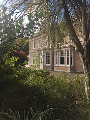
Bolenowe (Cornish: Boslenow, meaning dwelling of strip-fields) is a village in west Cornwall. It is approximately one-and-a-half miles (2 km) southeast of Camborne. It consists of cottages that are spread apart by large gardens. When you visit Bolenowe, Walkfo brings Bolenowe places to life as you travel by foot, bike, bus or car with a mobile phone & headphones.
Bolenowe Places Overview: History, Culture & Facts about Bolenowe
Visit Bolenowe – Walkfo’s stats for the places to visit
With 61 audio plaques & Bolenowe places for you to explore in the Bolenowe area, Walkfo is the world’s largest heritage & history digital plaque provider. The AI continually learns & refines facts about the best Bolenowe places to visit from travel & tourism authorities (like Wikipedia), converting history into an interactive audio experience.
Bolenowe history
The first record of the name was Boslaynou in 1321. A Hamelinus Bolyneu was named as one of three taxatores for the parish of Camborne in a Lay Subsidy roll of 1327. In the 19th and 20th centuries Bolenowe had two shops, an unlicensed pub, called a kidleywink.
Why visit Bolenowe with Walkfo Travel Guide App?
 You can visit Bolenowe places with Walkfo Bolenowe to hear history at Bolenowe’s places whilst walking around using the free digital tour app. Walkfo Bolenowe has 61 places to visit in our interactive Bolenowe map, with amazing history, culture & travel facts you can explore the same way you would at a museum or art gallery with information audio headset. With Walkfo, you can travel by foot, bike or bus throughout Bolenowe, being in the moment, without digital distraction or limits to a specific walking route. Our historic audio walks, National Trust interactive audio experiences, digital tour guides for English Heritage locations are available at Bolenowe places, with a AI tour guide to help you get the best from a visit to Bolenowe & the surrounding areas.
“Curated content for millions of locations across the UK, with 61 audio facts unique to Bolenowe places in an interactive Bolenowe map you can explore.”
Walkfo: Visit Bolenowe Places Map
61 tourist, history, culture & geography spots
Bolenowe historic spots | Bolenowe tourist destinations | Bolenowe plaques | Bolenowe geographic features |
| Walkfo Bolenowe tourism map key: places to see & visit like National Trust sites, Blue Plaques, English Heritage locations & top tourist destinations in Bolenowe | |||
Best Bolenowe places to visit
Bolenowe has places to explore by foot, bike or bus. Below are a selection of the varied Bolenowe’s destinations you can visit with additional content available at the Walkfo Bolenowe’s information audio spots:
 | Trevenson Trevenson (Cornish: Trevensyn) is in the parish of Carn Brea, between the towns of Camborne and Redruth in Cornwall, United Kingdom. |
 | South Crofty South Crofty is a metalliferous tin and copper mine located in Pool, Cornwall, United Kingdom. It has seen production for over 400 years, and extends almost two and a half miles across and 3,000 feet (910 m) down and has mined over 40 lodes. |
 | Dolcoath mine Dolcoath mine (Cornish: Bal Dorkoth) was a copper and tin mine in Camborne, Cornwall, England, United Kingdom. Its name derives from the Cornish for ‘Old Ground’, and it was also affectionately known as The Queen of Cornish Mines. |
 | East Pool mine East Pool mine (later known as East Pool and Agar mine), was a metalliferous mine in the Camborne and Redruth mining area, just east of the village of Pool in Cornwall. Worked from the early 18th century until 1945, first for copper and later tin, it was very profitable for much of its life. |
 | Carn Brea Castle Carn Brea Castle is a 14th-century grade II listed granite stone building. It was extensively remodelled in the 18th century as a hunting lodge in the style of a castle for the Basset family. The building is in private use as a restaurant. |
 | South Wheal Frances Mine South Wheal Frances is a former mine accessing the copper and tin of the Great Flat Lode south of Camborne in Cornwall, England. |
 | King Edward Mine The King Edward Mine at Camborne, Cornwall, in the United Kingdom is a mine wholly owned by Cornwall Council. At the end of the 19th century students at the Camborne School of Mines spent much of their time doing practical mining and tin dressing work. |
 | Nine Maidens Downs Nine Maidens Downs is a moorland southwest of Four Lanes in Cornwall, England, UK. It is located southwest of the Cornish Moorland. |
 | Carwynnen Quoit Carwynnen Quoit (grid reference SW650372) is a dolmen belonging to the Neolithic period. It collapsed in 1966 and was re-erected in 2014. |
 | Holy Trinity Church, Penponds Holy Trinity Church is a Grade II listed parish church in Penponds, Cornwall. It was built in the 1930s and is located in the area of Cornwall. |
Visit Bolenowe plaques
 0
0
plaques
here Bolenowe has 0 physical plaques in tourist plaque schemes for you to explore via Walkfo Bolenowe plaques audio map when visiting. Plaques like National Heritage’s “Blue Plaques” provide visual geo-markers to highlight points-of-interest at the places where they happened – and Walkfo’s AI has researched additional, deeper content when you visit Bolenowe using the app. Experience the history of a location when Walkfo local tourist guide app triggers audio close to each Bolenowe plaque. Currently No Physical Plaques.


 Trying to encourage visitors to Bolenowe?