Welcome to Visit Bedford, Greater Manchester Places
The Walkfo guide to things to do & explore in Bedford, Greater Manchester
![]() Visit Bedford, Greater Manchester places using Walkfo for free guided tours of the best Bedford, Greater Manchester places to visit. A unique way to experience Bedford, Greater Manchester’s places, Walkfo allows you to explore Bedford, Greater Manchester as you would a museum or art gallery with audio guides.
Visit Bedford, Greater Manchester places using Walkfo for free guided tours of the best Bedford, Greater Manchester places to visit. A unique way to experience Bedford, Greater Manchester’s places, Walkfo allows you to explore Bedford, Greater Manchester as you would a museum or art gallery with audio guides.
Visiting Bedford, Greater Manchester Walkfo Preview
When you visit Bedford, Greater Manchester, Walkfo brings Bedford, Greater Manchester places to life as you travel by foot, bike, bus or car with a mobile phone & headphones.
Bedford, Greater Manchester Places Overview: History, Culture & Facts about Bedford, Greater Manchester
Visit Bedford, Greater Manchester – Walkfo’s stats for the places to visit
With 66 audio plaques & Bedford, Greater Manchester places for you to explore in the Bedford, Greater Manchester area, Walkfo is the world’s largest heritage & history digital plaque provider. The AI continually learns & refines facts about the best Bedford, Greater Manchester places to visit from travel & tourism authorities (like Wikipedia), converting history into an interactive audio experience.
Bedford, Greater Manchester history
Toponymy
Bedford means the “ford of Beda”, which crossed the Pennington Brook, probably near Beaston Bridge on Warrington Road . It was recorded as Beneford in 1200–21 and Bedeford in 1200 and 1296 .
Manor
Bedford Hall never assumed the role of a manor house and was occupied by tenants of the Kighleys who were absentee landlords . The manor, held of the Botelers of Warrington, was divided before the time from which records survive .
Industry
Bedford Brewery was founded in 1823 . Corn mills powered by steam were built at the canal basin by Butts Bridge in 1831 . Bickham and Pownall built a silk mill in Duke Street in 1833 . After 1845 the Bedford Foundry made agricultural machinery and fire ranges in premises near the canal .
Bedford, Greater Manchester geography / climate
Astley and Bedford Mosses are a surviving part of Chat Moss where the elevation of the land is barely 50 feet above mean sea-level. The township was crossed by four brooks from the north, west and east which united to the south of Bedford Hall to form the Glaze Brook forming part of the township’s south western boundary.
Why visit Bedford, Greater Manchester with Walkfo Travel Guide App?
![]() You can visit Bedford, Greater Manchester places with Walkfo Bedford, Greater Manchester to hear history at Bedford, Greater Manchester’s places whilst walking around using the free digital tour app. Walkfo Bedford, Greater Manchester has 66 places to visit in our interactive Bedford, Greater Manchester map, with amazing history, culture & travel facts you can explore the same way you would at a museum or art gallery with information audio headset. With Walkfo, you can travel by foot, bike or bus throughout Bedford, Greater Manchester, being in the moment, without digital distraction or limits to a specific walking route. Our historic audio walks, National Trust interactive audio experiences, digital tour guides for English Heritage locations are available at Bedford, Greater Manchester places, with a AI tour guide to help you get the best from a visit to Bedford, Greater Manchester & the surrounding areas.
You can visit Bedford, Greater Manchester places with Walkfo Bedford, Greater Manchester to hear history at Bedford, Greater Manchester’s places whilst walking around using the free digital tour app. Walkfo Bedford, Greater Manchester has 66 places to visit in our interactive Bedford, Greater Manchester map, with amazing history, culture & travel facts you can explore the same way you would at a museum or art gallery with information audio headset. With Walkfo, you can travel by foot, bike or bus throughout Bedford, Greater Manchester, being in the moment, without digital distraction or limits to a specific walking route. Our historic audio walks, National Trust interactive audio experiences, digital tour guides for English Heritage locations are available at Bedford, Greater Manchester places, with a AI tour guide to help you get the best from a visit to Bedford, Greater Manchester & the surrounding areas.
“Curated content for millions of locations across the UK, with 66 audio facts unique to Bedford, Greater Manchester places in an interactive Bedford, Greater Manchester map you can explore.”
Walkfo: Visit Bedford, Greater Manchester Places Map
66 tourist, history, culture & geography spots
Bedford, Greater Manchester historic spots | Bedford, Greater Manchester tourist destinations | Bedford, Greater Manchester plaques | Bedford, Greater Manchester geographic features |
| Walkfo Bedford, Greater Manchester tourism map key: places to see & visit like National Trust sites, Blue Plaques, English Heritage locations & top tourist destinations in Bedford, Greater Manchester | |||
Best Bedford, Greater Manchester places to visit
Bedford, Greater Manchester has places to explore by foot, bike or bus. Below are a selection of the varied Bedford, Greater Manchester’s destinations you can visit with additional content available at the Walkfo Bedford, Greater Manchester’s information audio spots:

Parsonage Colliery
Parsonage Colliery was a coal mine operating on the Lancashire Coalfield . It was sunk between 1913 and 1920 by the Wigan Coal and Iron Company . For many years its shafts to the Arley mine were the deepest in the country .

Mather Lane Mill
Mather Lane Mills was a complex of cotton mills built by the Bridgewater Canal in Bedford, Leigh in Lancashire . The No 2 mill and its former warehouse are grade II listed buildings .

Pennington Flash Country Park
Pennington Flash Country Park is a 200-hectare (490-acre) country park located between Lowton and Leigh in Greater Manchester .
Howe Bridge Colliery
Howe Bridge Colliery was part of Fletcher, Burrows and Company’s collieries at Howe Bridge in Atherton, Greater Manchester, then in the historic county of Lancashire .

Leigh Spinners
Leigh Spinners or Leigh Mill is a Grade II* listed double cotton spinning mill in Bedford, Leigh, Greater Manchester . The mill was built in the 1930s .
Damhouse
Damhouse or Astley Hall is a Grade II* Listed building in Astley, Greater Manchester. It has served as a manor house, sanatorium and sanatorium. Since restoration in 2000, it houses offices, a clinic, nursery and tearooms.
St Stephen’s Church, Astley
St Stephen’s Church is an active Anglican church in Astley, Greater Manchester. It was built in 1968 and part of Leigh deanery in the archdeaconry of Salford and diocese of Manchester.

Higher Folds
Higher Folds is 10 miles from Manchester in the unparished area of Leigh, in the Wigan district. In 2018 it had an estimated population of 2,770. Shaun Keaveny grew up in the town and grew up there.

Tyldesley Top Chapel
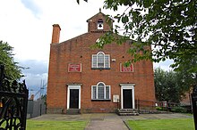
Top Chapel was built in 1789 on a site of 1,300 square yards at the top of Tyldesley Banks opposite the Square. The site and building materials were all provided by Thomas Johnson. It was properly known as “The Lady Huntingdon Chapel” but became known as Top Chapel because of its position.

Tyldesley Urban District
Tyldesley cum Shakerley Urban District was, from 1894 to 1974, a local government district in Lancashire, England.
Visit Bedford, Greater Manchester plaques
![]() 0
0
plaques
here Bedford, Greater Manchester has 0 physical plaques in tourist plaque schemes for you to explore via Walkfo Bedford, Greater Manchester plaques audio map when visiting. Plaques like National Heritage’s “Blue Plaques” provide visual geo-markers to highlight points-of-interest at the places where they happened – and Walkfo’s AI has researched additional, deeper content when you visit Bedford, Greater Manchester using the app. Experience the history of a location when Walkfo local tourist guide app triggers audio close to each Bedford, Greater Manchester plaque. Currently No Physical Plaques.


