Welcome to Visit Anthorn Places The Walkfo guide to things to do & explore in Anthorn
Visit Anthorn places using Walkfo for free guided tours of the best Anthorn places to visit. A unique way to experience Anthorn’s places, Walkfo allows you to explore Anthorn as you would a museum or art gallery with audio guides.
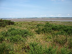
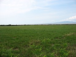
Visiting Anthorn Walkfo Preview Anthorn is situated on the south side of the Solway Firth, on the Wampool estuary, about 21km west of Carlisle. It is the location of the Anthorn radio station, broadcasting low frequency signals for timekeeping and navigation. When you visit Anthorn, Walkfo brings Anthorn places to life as you travel by foot, bike, bus or car with a mobile phone & headphones.
Anthorn Places Overview: History, Culture & Facts about Anthorn
Visit Anthorn – Walkfo’s stats for the places to visit
With 16 audio plaques & Anthorn places for you to explore in the Anthorn area, Walkfo is the world’s largest heritage & history digital plaque provider. The AI continually learns & refines facts about the best Anthorn places to visit from travel & tourism authorities (like Wikipedia), converting history into an interactive audio experience.
Anthorn history
Anthorn Radio Station is now the site of a large mast field for the NATO VLF transmitter, the NPL time signal and an eLoran timing signal. The Admiralty housing development, larger than the original village itself, remains.
Why visit Anthorn with Walkfo Travel Guide App?
You can visit Anthorn places with Walkfo Anthorn to hear history at Anthorn’s places whilst walking around using the free digital tour app. Walkfo Anthorn has 16 places to visit in our interactive Anthorn map, with amazing history, culture & travel facts you can explore the same way you would at a museum or art gallery with information audio headset. With Walkfo, you can travel by foot, bike or bus throughout Anthorn, being in the moment, without digital distraction or limits to a specific walking route. Our historic audio walks, National Trust interactive audio experiences, digital tour guides for English Heritage locations are available at Anthorn places, with a AI tour guide to help you get the best from a visit to Anthorn & the surrounding areas.
“Curated content for millions of locations across the UK, with 16 audio facts unique to Anthorn places in an interactive Anthorn map you can explore.”
Walkfo Anthorn tourism map key: places to see & visit like National Trust sites, Blue Plaques, English Heritage locations & top tourist destinations in Anthorn
Best Anthorn places to visit
Anthorn has places to explore by foot, bike or bus. Below are a selection of the varied Anthorn’s destinations you can visit with additional content available at the Walkfo Anthorn’s information audio spots:
Milefortlet 1 Milefortlet 1 (Biglands House) was a milefortlet of the Roman Cumbrian Coast defences. These milefortlets and intervening stone watchtowers extended from the western end of Hadrian’s Wall.
Milefortlet 2 Milefortlets and intervening stone watchtowers extended from the western end of Hadrian’s Wall, along the Cumbrian coast. The exact location of Milefortlet 2 is unknown, although one of the nearby turrets (Tower 2B) has been located and excavated.
Anthorn Anthorn is situated on the south side of the Solway Firth, on the Wampool estuary, about 21km west of Carlisle. It is the location of the Anthorn radio station, broadcasting low frequency signals for timekeeping and navigation.
Time from NPL (MSF) The Time from NPL is a radio signal broadcast from Anthorn Radio Station near Anthorn, Cumbria. It is based on time standards maintained by the UK’s National Physical Laboratory. The signal’s carrier frequency is maintained at 60 kHz to within 2 parts in 10.
Milefortlet 3 Milefortlets and intervening stone watchtowers extended from the western end of Hadrian’s Wall, along the Cumbrian coast and were linked by a wooden palisade. Milefortlet 3 has been located on aerial photographs.
Milefortlet 4 Milefortlets and intervening stone watchtowers extended from the western end of Hadrian’s Wall, along the Cumbrian coast. Milefortlet 4 (Herd Hill) has been located by archaeologists.
Milefortlet 5 Milefortlets and intervening stone watchtowers extended from the western end of Hadrian’s Wall, along the Cumbrian coast and were linked by a wooden palisade. Milefortlet 5 was excavated in 1943-4 prior to its destruction in 1944.
Newton Arlosh Newton Arlosh is a village in the civil parish of Holme East Waver in Cumbria, United Kingdom. It is located in the village of Newburgh in the north-west of the county.
St John the Evangelist’s Church, Newton Arlosh St John the Evangelist’s Church is in Newton Arlosh, Cumbria, England. It was built as a fortified church, one of a number of such buildings near the Scottish border. The church is recorded in the National Heritage List for England as a designated Grade I listed building.
Visit Anthorn plaques
0 plaques hereAnthorn has 0 physical plaques in tourist plaque schemes for you to explore via Walkfo Anthorn plaques audio map when visiting. Plaques like National Heritage’s “Blue Plaques” provide visual geo-markers to highlight points-of-interest at the places where they happened – and Walkfo’s AI has researched additional, deeper content when you visit Anthorn using the app. Experience the history of a location when Walkfo local tourist guide app triggers audio close to each Anthorn plaque. Currently No Physical Plaques.
Experience Anthorn audio walks & tours
Walkfo guides for things to do / places to visit in Anthorn allows exploration as you would do an art gallery or museum. Walk close to one of Anthorn’s 16 historic places & our digital tour guide will create an audio story for that spot. With headphone connected, you can explore Anthorn freely by foot, bike or bus – with your own personal tour guide in your pocket.
Explore Anthorn Map App
Our visit Anthorn map shows you things-to-do & places you can visit in Anthorn & surrounding areas using the Walkfo digital audio tour guide app. Each spot has plaque, building, street or area information on history, culture or tourism.
You can set your Walkfo’s Anthorn tourist map to find historic & tourism spots within 1km, 3km & 5km of the Anthorn centre, depending on how far you plan to explore whilst you visit Anthorn area at LONG:-3.257294, LAT:54.914689.
Walkfo App
Walkfo
Walkfo is free to download & use (for a limited time period), so if you are looking to explore Anthorn, go to your App Store to search for “Walkfo” or follow a links below and install on your mobile phone. Walkfo is designed for use with headphones or AirPods, so you can walk & explore whilst learning about the things around you without digital distraction.
Things to do & visit in Anthorn / surrounding areas
● Milefortlet 1 ● Milefortlet 2 ● Anthorn ● Longcroft, Cumbria ● Anthorn Radio Station ● Time from NPL (MSF) ● Milefortlet 3 ● Cardurnock ● Milefortlet 4 ● Milefortlet 5 ● Kirkbride, Cumbria ● Angerton, Allerdale ● Newton Arlosh ● St John the Evangelist’s Church, Newton Arlosh ● Moricambe Bay ● Holme East Waver
Getting to / around Anthorn – transport link, station & street map
Getting around in Anthorn using public transportation may include road, street, train, underground, bus or tram transport options. Walkfo has identified the following Anthorn places with historic / cultural / factual content when you visit:
Local Anthorn Public Transport Stations
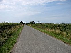
Anthorn Notable Streets & Road Destinations
Whitrigg railway station
Kirkbride railway station
[transportsummary]
Local Anthorn historians & Anthorn tour guides
Trying to encourage visitors to Anthorn? Walkfo has millions audio places already available but Walkfo Creator gives Anthorn’s places, attractions & landmarks ability to create their own unique outdoor audio museums & using our simple & easy to use Walkfo Creator. – Creating a new audio experience for your Anthorn place is free* and quick (15+ minutes if you prepare text content) to use, with Walkfo Creator doing the hard work of generating AI audio files for geo-spots from the text you provide with a simply click on a map. – The 100 Amazing Anthorn Places is just one example of an outdoor museum created using Walkfo Creator (pictured to the left) for people to safely explore during Covid-19 times whilst visiting a city. Our tool is open to tourism organisations, travel destinations & National Trust locations to create their own audio walks to offer free when people visit Anthorn destinations. – Walkfo itself is looking to partner with websites offering things-to-do / what’s on events listings to enhance the content of our ‘visit-Anthorn’ web pages (for example: www.visitAnthorn.com). If you are interested in partnering, please contact us to discuss options.
* Walkfo Creator is free to use for a limited number of audio spots within a map with a license fee applicable when more than 20 audio spots within location walk are created. v1.1336
 Visit Anthorn places using Walkfo for free guided tours of the best Anthorn places to visit. A unique way to experience Anthorn’s places, Walkfo allows you to explore Anthorn as you would a museum or art gallery with audio guides.
 With 16 audio plaques & Anthorn places for you to explore in the Anthorn area, Walkfo is the world’s largest heritage & history digital plaque provider. The AI continually learns & refines facts about the best Anthorn places to visit from travel & tourism authorities (like Wikipedia), converting history into an interactive audio experience.
 You can visit Anthorn places with Walkfo Anthorn to hear history at Anthorn’s places whilst walking around using the free digital tour app. Walkfo Anthorn has 16 places to visit in our interactive Anthorn map, with amazing history, culture & travel facts you can explore the same way you would at a museum or art gallery with information audio headset. With Walkfo, you can travel by foot, bike or bus throughout Anthorn, being in the moment, without digital distraction or limits to a specific walking route. Our historic audio walks, National Trust interactive audio experiences, digital tour guides for English Heritage locations are available at Anthorn places, with a AI tour guide to help you get the best from a visit to Anthorn & the surrounding areas.


 0
0


 Trying to encourage visitors to Anthorn?