Welcome to Visit Watendlath Places The Walkfo guide to things to do & explore in Watendlath
Visit Watendlath places using Walkfo for free guided tours of the best Watendlath places to visit. A unique way to experience Watendlath’s places, Walkfo allows you to explore Watendlath as you would a museum or art gallery with audio guides.
Visiting Watendlath Walkfo Preview Watendlath is a hamlet and tarn (a small lake) in the Lake District in the English county of Cumbria. It is owned by the National Trust and sits high between Borrowdale and Thirlmere valleys at 863 feet (263 m) above sea level. When you visit Watendlath, Walkfo brings Watendlath places to life as you travel by foot, bike, bus or car with a mobile phone & headphones.
Watendlath Places Overview: History, Culture & Facts about Watendlath
Visit Watendlath – Walkfo’s stats for the places to visit
With 23 audio plaques & Watendlath places for you to explore in the Watendlath area, Walkfo is the world’s largest heritage & history digital plaque provider. The AI continually learns & refines facts about the best Watendlath places to visit from travel & tourism authorities (like Wikipedia), converting history into an interactive audio experience.
Watendlath etymology
The name came from Old Norse vatn-endi-hlaða = “water-end-barn” The name was originally used as a reference to the end of a barn.
Why visit Watendlath with Walkfo Travel Guide App?
You can visit Watendlath places with Walkfo Watendlath to hear history at Watendlath’s places whilst walking around using the free digital tour app. Walkfo Watendlath has 23 places to visit in our interactive Watendlath map, with amazing history, culture & travel facts you can explore the same way you would at a museum or art gallery with information audio headset. With Walkfo, you can travel by foot, bike or bus throughout Watendlath, being in the moment, without digital distraction or limits to a specific walking route. Our historic audio walks, National Trust interactive audio experiences, digital tour guides for English Heritage locations are available at Watendlath places, with a AI tour guide to help you get the best from a visit to Watendlath & the surrounding areas.
“Curated content for millions of locations across the UK, with 23 audio facts unique to Watendlath places in an interactive Watendlath map you can explore.”
Walkfo Watendlath tourism map key: places to see & visit like National Trust sites, Blue Plaques, English Heritage locations & top tourist destinations in Watendlath
Best Watendlath places to visit
Watendlath has places to explore by foot, bike or bus. Below are a selection of the varied Watendlath’s destinations you can visit with additional content available at the Walkfo Watendlath’s information audio spots:
Great Crag Great Crag is a fell in the English Lake District. It is located near Rosthwaite and Stonethwaite in Borrowdale.
High Tove High Tove is a fell in the English Lake District, close to the geographical centre of the Cumbrian hills. It forms part of the watershed between the Derwentwater and Thirlmere catchments.
Lodore Falls Lodore Falls is a waterfall in Cumbria, close to Derwentwater and downstream from Watendlath Tarn. The falls tumble more than 100 feet (30 m) over a steep cascade into the Borrowdale Valley.
Cataract of Lodore “The Cataract of Lodore” is a poem written in 1820 by the English poet Robert Southey. It describes the Lodore Falls on the Watendlath.
High Seat (Lake District) High Seat is a fell in the centre of the English Lake District. Despite being below 2,000 ft it is the highest point for about 5 miles in any direction.
Bleaberry Fell Bleaberry Fell is a fell in the Lake District in Cumbria, England, with a height of 590 metres (1,936 feet) It stands on the main watershed between Borrowdale and Thirlmere and can be climbed from either flank. Walla Crag is a subsidiary top of the fell.
Barrow House, Cumbria Barrow House is a late 18th-century mansion situated on the eastern shore of Derwentwater in Borrowdale within the Lake District National Park. It was originally a private dwelling and has since served as a hotel, youth hostel run by the YHA and is now an independent hostel.
Grange Fell Grange Fell is a small fell in the English Lake District in the county of Cumbria. It is situated in the Borrowdale valley overlooking the villages of Grange and Rosthwaite.
Raven Crag Raven Crag is a fell in the Lake District that overlooks Thirlmere reservoir. It has subsidiary summits The Benn and Castle Crag.
Bowder Stone The Bowder Stone is a large andesite lava boulder that fell 200 metres (660 ft) from Bowder Crag on Kings How between 13,500 and 10,000 years ago. It is estimated to weigh around 2000 tons and is about 30 feet (9.1 m) high, 50 feet (15 m) across and 90 feet (27 m) in circumference.
Visit Watendlath plaques
1 plaques hereWatendlath has 1 physical plaques in tourist plaque schemes for you to explore via Walkfo Watendlath plaques audio map when visiting. Plaques like National Heritage’s “Blue Plaques” provide visual geo-markers to highlight points-of-interest at the places where they happened – and Walkfo’s AI has researched additional, deeper content when you visit Watendlath using the app. Experience the history of a location when Walkfo local tourist guide app triggers audio close to each Watendlath plaque. Explore Plaques & History has a complete list of Hartlepool’s plaques & Hartlepool history plaque map.
Experience Watendlath audio walks & tours
Walkfo guides for things to do / places to visit in Watendlath allows exploration as you would do an art gallery or museum. Walk close to one of Watendlath’s 23 historic places & our digital tour guide will create an audio story for that spot. With headphone connected, you can explore Watendlath freely by foot, bike or bus – with your own personal tour guide in your pocket.
Explore Watendlath Map App
Our visit Watendlath map shows you things-to-do & places you can visit in Watendlath & surrounding areas using the Walkfo digital audio tour guide app. Each spot has plaque, building, street or area information on history, culture or tourism.
You can set your Walkfo’s Watendlath tourist map to find historic & tourism spots within 1km, 3km & 5km of the Watendlath centre, depending on how far you plan to explore whilst you visit Watendlath area at LONG:-3.121389, LAT:54.537222.
Walkfo App
Walkfo
Walkfo is free to download & use (for a limited time period), so if you are looking to explore Watendlath, go to your App Store to search for “Walkfo” or follow a links below and install on your mobile phone. Walkfo is designed for use with headphones or AirPods, so you can walk & explore whilst learning about the things around you without digital distraction.
Things to do & visit in Watendlath / surrounding areas
● Dock Tarn ● Stonethwaite ● Great Crag ● Rosthwaite, Allerdale ● Borrowdale ● Seatoller ● Armboth Fell ● High Tove ● Watendlath ● Thirlmere ● Bell Crags ● Lodore Falls ● Cataract of Lodore ● Ashness Bridge ● High Seat (Lake District) ● Bleaberry Fell ● Barrow House, Cumbria ● Grange Fell ● Grange in Borrowdale ● Raven Crag ● Bowder Stone ● Castle Crag ● Stonethwaite Beck
Getting to / around Watendlath – transport link, station & street map
Getting around in Watendlath using public transportation may include road, street, train, underground, bus or tram transport options. Walkfo has identified the following Watendlath places with historic / cultural / factual content when you visit:
Local Watendlath Public Transport Stations
Watendlath Notable Streets & Road Destinations
[transportsummary]
Local Watendlath historians & Watendlath tour guides
Trying to encourage visitors to Watendlath? Walkfo has millions audio places already available but Walkfo Creator gives Watendlath’s places, attractions & landmarks ability to create their own unique outdoor audio museums & using our simple & easy to use Walkfo Creator. – Creating a new audio experience for your Watendlath place is free* and quick (15+ minutes if you prepare text content) to use, with Walkfo Creator doing the hard work of generating AI audio files for geo-spots from the text you provide with a simply click on a map. – The 100 Amazing Watendlath Places is just one example of an outdoor museum created using Walkfo Creator (pictured to the left) for people to safely explore during Covid-19 times whilst visiting a city. Our tool is open to tourism organisations, travel destinations & National Trust locations to create their own audio walks to offer free when people visit Watendlath destinations. – Walkfo itself is looking to partner with websites offering things-to-do / what’s on events listings to enhance the content of our ‘visit-Watendlath’ web pages (for example: www.visitWatendlath.com). If you are interested in partnering, please contact us to discuss options.
* Walkfo Creator is free to use for a limited number of audio spots within a map with a license fee applicable when more than 20 audio spots within location walk are created. v1.1336
 Visit Watendlath places using Walkfo for free guided tours of the best Watendlath places to visit. A unique way to experience Watendlath’s places, Walkfo allows you to explore Watendlath as you would a museum or art gallery with audio guides.
 You can visit Watendlath places with Walkfo Watendlath to hear history at Watendlath’s places whilst walking around using the free digital tour app. Walkfo Watendlath has 23 places to visit in our interactive Watendlath map, with amazing history, culture & travel facts you can explore the same way you would at a museum or art gallery with information audio headset. With Walkfo, you can travel by foot, bike or bus throughout Watendlath, being in the moment, without digital distraction or limits to a specific walking route. Our historic audio walks, National Trust interactive audio experiences, digital tour guides for English Heritage locations are available at Watendlath places, with a AI tour guide to help you get the best from a visit to Watendlath & the surrounding areas.
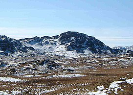


 1
1


 Trying to encourage visitors to Watendlath?